
Beginner Off-Road Trails
Near Conejo, New Mexico
Explore All Beginner Trails Near Conejo, New Mexico
Beginner Off-Road Trails Near Conejo, New Mexico
Discover the best beginner-friendly off-road trails near you. These easier, lower-rated trails are a great place to start — browse trail maps, check difficulty ratings, and find your next adventure.
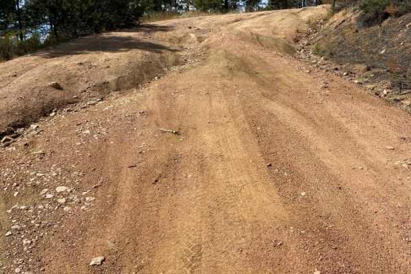
Arroyo Hondo Forest Service 79
Forest Service road that climbs a wide loose and rutted road. There are many shallow ruts and a few deep ruts that must be navigated around if clearance is an issue. There is a very steep descent about 2.5 miles past the Santa Fe National Forest signs or about 0.25 miles past the rough parking lot. ...
Learn more about Arroyo Hondo Forest Service 79
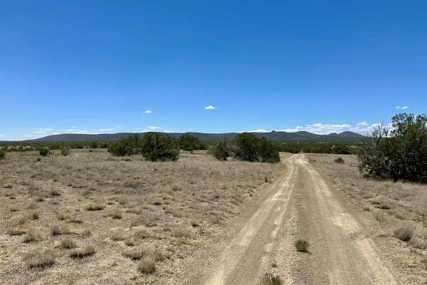
Dispersed Camping Loop
This is a simple and smooth dirt trail leading to dispersed camping. There is one small steep hill drop, where you will need to take it slow. Most of this is smooth and leads to a few other trails, such as Powerline and Dead Dog Trail Offshoot.
Learn more about Dispersed Camping Loop
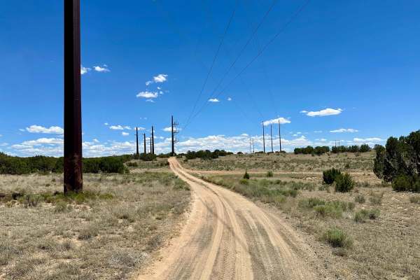
Dead Dog Trail Offshoot
This is a mostly smooth dirt trail with some off-camber areas and ruts at the beginning. There is one deeply rutted area with no bypass. There is a gate you will need to open and close, but it will be unlocked. This trail also leads to the Powerline Trail. This trail also leads to dispersed camping.
Learn more about Dead Dog Trail Offshoot
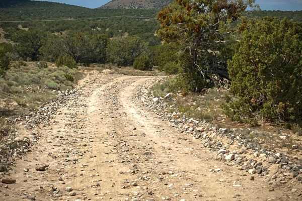
Caja del Rio to La Bajada Mesa-USFS 24
The Caja del Rio Road (#24) is a 23-mile drive across the Caja del Rio Plateau to La Bajada Mesa. It ends with a large escarpment dropping 1000 feet to the valley below with the Pueblo de Cochiti and Pueblo of Santa Domingo reservations. The views for miles from here on a clear day are tremendous wi...
Learn more about Caja del Rio to La Bajada Mesa-USFS 24
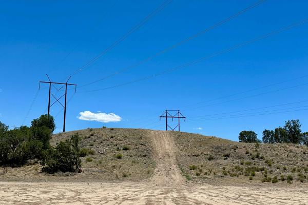
Little Hill
This is a little hill at the intersection of a variety of different trails. It is a fun little hill to climb up on. No loose rocks, no obstacles, no ledges. Loose dirt, but it's something to play on in the area. The top of the hill is somewhat flat.
Learn more about Little Hill
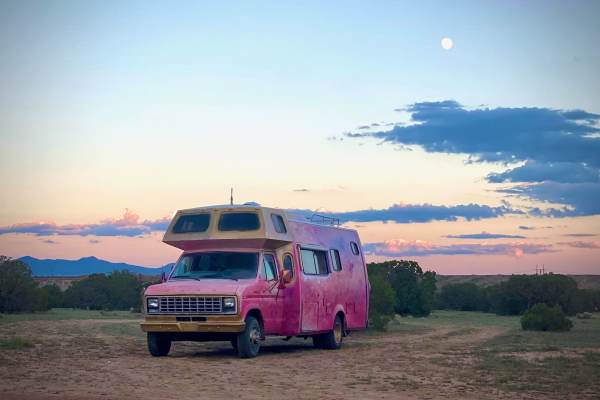
BLM-SFNF Connector & Camping
This short unnamed road is part of the Caja del Rio area of the Santa Fe National Forest. It provides access to the large BLM area with Diablo Canyon and the Camino Real trail adjoining the National Forest lands. There are several side roads and areas to pull off and primitive camp. Cellular service...
Learn more about BLM-SFNF Connector & Camping
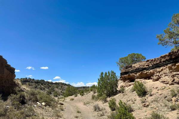
FS 24BB
This is a scenic drive in the National Forest, Trail 24BB. Smooth dirt, with some rutted areas and a few simple hills. This does dead-end at the end, so it is out-and-back, but the views along the way are nice, with lava rocks along the mountains. Watch out for cows. There is an offshoot trail which...
Learn more about FS 24BB
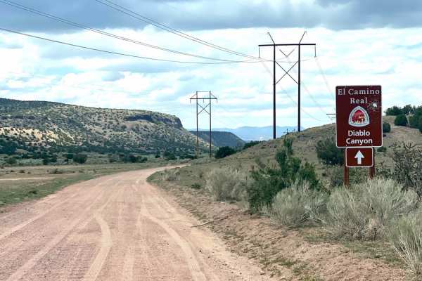
El Camino Real y Diablo Canyon Trail
The El Camino Trail road will take you to Diablo Canyon and to the Rio Grande River. It is almost an extension of the Camino la Tierra road off of Hwy 599. It changes in name to Old Buckman road as it forks to the right after 6.7 miles. The road is well marked with signage at the fork and a wide, wh...
Learn more about El Camino Real y Diablo Canyon Trail
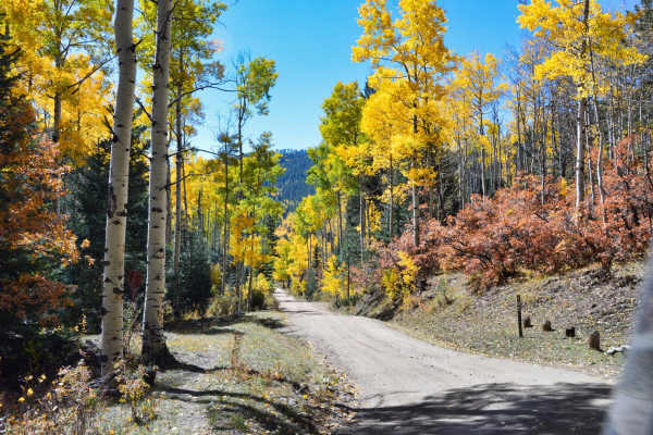
Pacheco Canyon
Pacheco Canyon is a great easy trail near the Santa Fe Ski area, just outside Santa Fe, NM. The trail can be run in either direction, but the views heading downhill into Tesuque Village are amazing. There are several great places to camp along the side roads for this trail, so take extra time to exp...
Learn more about Pacheco Canyon
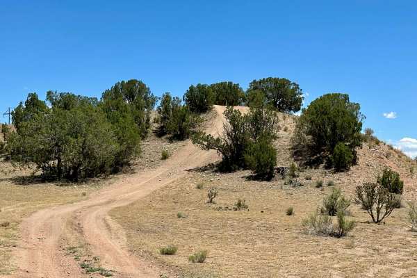
Hill Obstacle
This is a fun little obstacle: a steep hill off the El Camino Real main trail. There are no rocks, no loose rocks, and the top of it is flat. Going back down on the other side is steep, but doable. Nothing intense, simply a fun hill to hit.
Learn more about Hill Obstacle
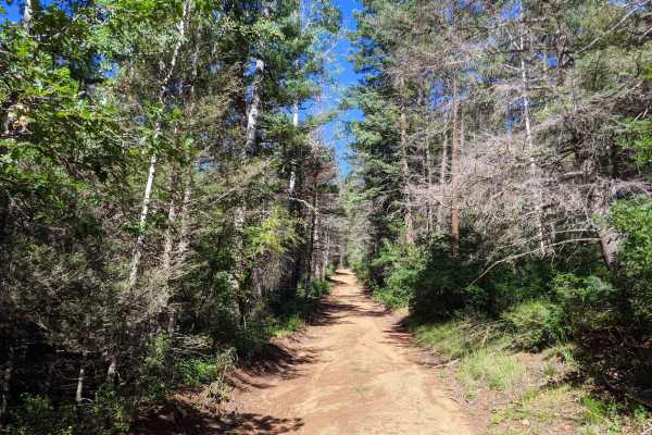
Glorieta Baldy
Glorieta Baldy is a trail on the South end of the Pecos Mountain area featuring numerous camp sites and an expansive view of the Pecos/Glorieta area. The trail starts at the back of a neighborhood on La Cueva road, and ascends Glorieta Baldy from there. The first half of the trail is open, with wide...
Learn more about Glorieta Baldy
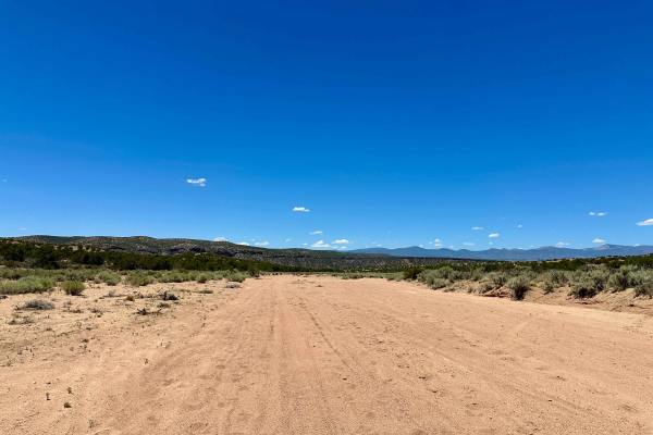
Sand Drag Strip
This is a fun, open sandy wash to drive down. There are a couple of different routes to take within the sandy area that all lead back to the same sandy trail. The sandy wash is wide enough for multiple vehicles side by side. Be careful for cows in the road. There are one to two areas where the sandy...
Learn more about Sand Drag Strip
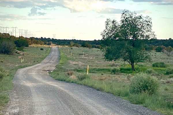
Dead Dog Trail & Santa Fe Ranch
This road off of the Camino Real Road is an easy drive, except for a dip with soft sand early on crossing Alamo Creek. There are a couple of mud puddles that had bypasses. For the first 3 miles, it parallels the El Camino Real hiking trail. The road towards the SE end becomes part of the Santa Fe Ra...
Learn more about Dead Dog Trail & Santa Fe Ranch
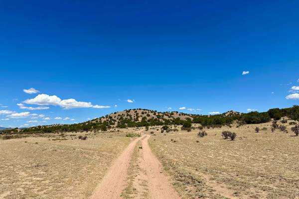
Dispersed Camping Trail
This dirt trail leads from Estrada Calabasas to El Camino Real and offers dispersed camping sites throughout the trail. There are no off-camber areas, but it is not flat and smooth. It is capable for a 2WD to do; no lockers needed. Near the Estrada Calabasas entrance, there are some hills that are u...
Learn more about Dispersed Camping Trail
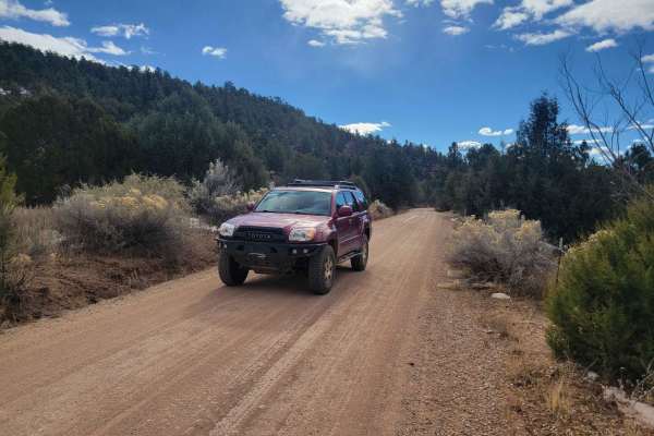
Molino Meadows
This is an easy trail across some open meadows on NM State Land. Unfortunately, despite maps of the trail showing National Forest access, the trail currently dead ends at a gate preventing access to FSR 50A to the North. Just before the gate, there is a fork in the road. Note that the route to the l...
Learn more about Molino Meadows
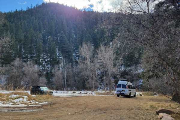
Dalton Canyon
This trail is one of the more accessible routes into the Pecos Mountains. Navigable by most cross-overs, this trail is a local favorite for camping and riding. The trail is mostly well-maintained gravel, with some sections of dirt that can be prone to rutting in the rainy season. Most of the road ha...
Learn more about Dalton Canyon
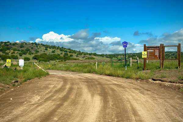
Shortcut to Caja del Rio - Santa Fe County Road 56C
This Santa Fe county road 56C will take you 4.7 miles connecting to the Caja del Rio to La Bajada Mesa-USFS 24 trail. It goes through the Santa Fe Ranch Cienega Recreation area which is managed by the BLM. When you get to the USFS 24 trail, turn left and take the drive to the Caja del Rio Plateau & ...
Learn more about Shortcut to Caja del Rio - Santa Fe County Road 56C
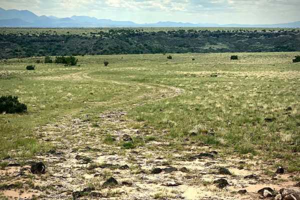
Close to the Southern Edge
This is a short side road off of Caja Del Rio Road USFS 24, which takes you to a Southern escarpment of the plateau overlooking the Santa Fe River basin below. There are a few disturbed primitive campsites with great views to the South over the Pueblo de Santo Domingo reservation and ranch lands. Co...
Learn more about Close to the Southern Edge
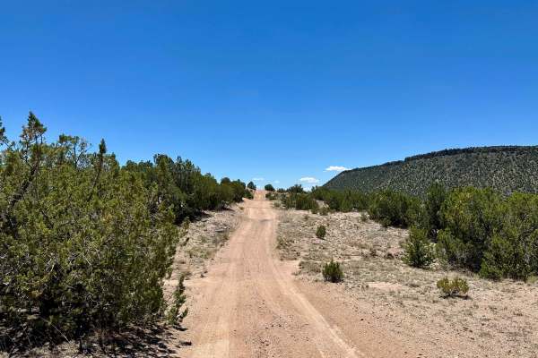
El Camino Real Alternate Pass
This is a dirt trail with some light up-and-down hills and no off-camber areas. It is an alternate route to El Camino Real from or to Diablo Canyon that is a bit more exciting than the main road. There is dispersed camping on the sides of this trail. There are no bypasses, but there is nothing to re...
Learn more about El Camino Real Alternate Pass
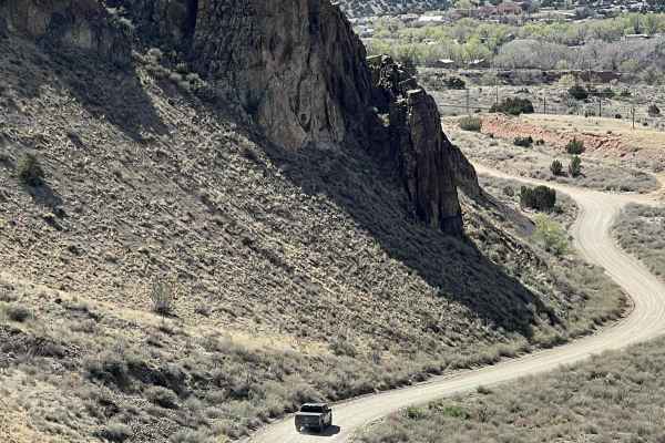
Where is Waldo?
This is an easy route that connects I-25 at the top of La Bajada Hill with Highway 14 at the Village of Cerrillos. For many years, there was a well-marked turnoff to Waldo on I-25. But where is Waldo and what is Waldo? All that remains of the ghost town is a cement foundation along the railroad trac...
Learn more about Where is Waldo?
Beginner ATV trails near Conejo, New Mexico
Explore ATV-friendly trails near you. These trails are accessible for vehicles up to 50 inches wide, perfect for ATVs and smaller off-road machines.
Arroyo Hondo Forest Service 79
Forest Service road that climbs a wide loose and rutted road. There are many shallow ruts and a few deep ruts that must be navigated around if clearance is an issue. There is a very steep descent about 2.5 miles past the Santa Fe National Forest signs or about 0.25 miles past the rough parking lot. ...
Learn more about Arroyo Hondo Forest Service 79
Dispersed Camping Loop
This is a simple and smooth dirt trail leading to dispersed camping. There is one small steep hill drop, where you will need to take it slow. Most of this is smooth and leads to a few other trails, such as Powerline and Dead Dog Trail Offshoot.
Learn more about Dispersed Camping Loop
Dead Dog Trail Offshoot
This is a mostly smooth dirt trail with some off-camber areas and ruts at the beginning. There is one deeply rutted area with no bypass. There is a gate you will need to open and close, but it will be unlocked. This trail also leads to the Powerline Trail. This trail also leads to dispersed camping.
Learn more about Dead Dog Trail Offshoot
Caja del Rio to La Bajada Mesa-USFS 24
The Caja del Rio Road (#24) is a 23-mile drive across the Caja del Rio Plateau to La Bajada Mesa. It ends with a large escarpment dropping 1000 feet to the valley below with the Pueblo de Cochiti and Pueblo of Santa Domingo reservations. The views for miles from here on a clear day are tremendous wi...
Learn more about Caja del Rio to La Bajada Mesa-USFS 24
Beginner UTV/side-by-side trails near Conejo, New Mexico
Find UTV and side-by-side trails near you. These trails accommodate vehicles up to 60 inches wide, ideal for UTVs, side-by-sides, and wider off-road rigs.
Arroyo Hondo Forest Service 79
Forest Service road that climbs a wide loose and rutted road. There are many shallow ruts and a few deep ruts that must be navigated around if clearance is an issue. There is a very steep descent about 2.5 miles past the Santa Fe National Forest signs or about 0.25 miles past the rough parking lot. ...
Learn more about Arroyo Hondo Forest Service 79
Dispersed Camping Loop
This is a simple and smooth dirt trail leading to dispersed camping. There is one small steep hill drop, where you will need to take it slow. Most of this is smooth and leads to a few other trails, such as Powerline and Dead Dog Trail Offshoot.
Learn more about Dispersed Camping Loop
Dead Dog Trail Offshoot
This is a mostly smooth dirt trail with some off-camber areas and ruts at the beginning. There is one deeply rutted area with no bypass. There is a gate you will need to open and close, but it will be unlocked. This trail also leads to the Powerline Trail. This trail also leads to dispersed camping.
Learn more about Dead Dog Trail Offshoot
Caja del Rio to La Bajada Mesa-USFS 24
The Caja del Rio Road (#24) is a 23-mile drive across the Caja del Rio Plateau to La Bajada Mesa. It ends with a large escarpment dropping 1000 feet to the valley below with the Pueblo de Cochiti and Pueblo of Santa Domingo reservations. The views for miles from here on a clear day are tremendous wi...
Learn more about Caja del Rio to La Bajada Mesa-USFS 24
The onX Offroad Difference
onX Offroad combines trail photos, descriptions, difficulty ratings, width restrictions, seasonality, and more in a user-friendly interface. Available on all devices, with offline access and full compatibility with CarPlay and Android Auto. Discover what you're missing today!
Open Trail Map