
Beginner Off-Road Trails
Near Centennial Park, Arizona
Explore All Beginner Trails Near Centennial Park, Arizona
Beginner Off-Road Trails Near Centennial Park, Arizona
Discover the best beginner-friendly off-road trails near you. These easier, lower-rated trails are a great place to start — browse trail maps, check difficulty ratings, and find your next adventure.
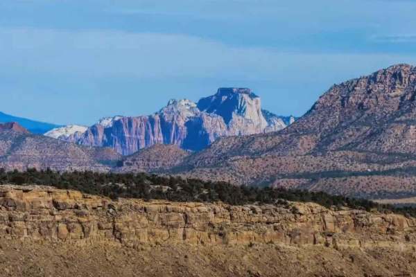
Lost Spring Mesa BLM 2100
Lost Spring Mesa BLM 2100 is a 16.3-mile (one-way) out-and-back trail across the mesa to Lost Spring Mountain at 5,700 feet. This is a 3 of 10 rated dirt and rock trail that consists of flat plains dirt track and a single wide rocky shelf road climb to the top of the mesa, with a sand and dirt flat ...
Learn more about Lost Spring Mesa BLM 2100
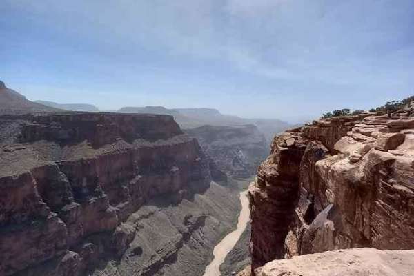
County Highway 5
This trail is class 2 sand, dirt, and gravel trail traveling south from Colorado City, AZ to Grand Canyon, Toroweap Overlook. A two-dollar permit is required to enter the last six miles of the trail. The last six miles will be a class 3. Tuweep campground is at the end of the trail with ten primitiv...
Learn more about County Highway 5
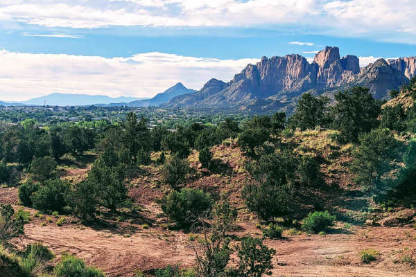
Cottonwood Point
This beautiful trail winds through the trees, and offers wonderful views of the red rock faces of Cottonwood Point above. There are many options throughout this BLM area, ranging from fairly packed dirt to deep loose sand. The area allows you to connect the town of Colorado City to the Coral Pink Sa...
Learn more about Cottonwood Point
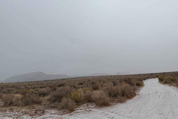
BLM M0000-M4186
This red dirt road is a great entry point into a much larger trail system. Starting right off the highway, it's a fun, sandy route with gentle curves and a few small dips. As you work your way in, you'll find numerous side trails branching off, offering plenty of opportunities for further exploratio...
Learn more about BLM M0000-M4186
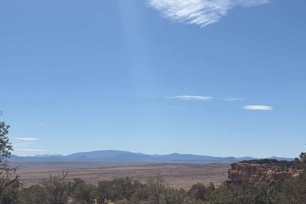
Yellowstone Mesa
Yellowstone Mesa is a remote volcanic mesa located on the Arizona Strip north of the Grand Canyon, within the rugged high-desert landscape between the Uinkaret Mountains and the Toroweap Valley. Formed from ancient lava flows associated with the Uinkaret volcanic field, the mesa rises above surround...
Learn more about Yellowstone Mesa
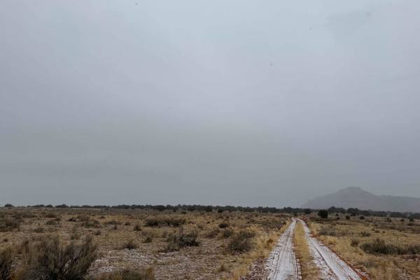
BLM M4187
This scenic BLM trail in Arizona offers a fun and sandy loop with ever-changing terrain. Expect soft sections that can challenge traction, plus a few banked corners that add to the ride. Along the way, you'll pass through two gates- be sure to close them if they are found open- and may encounter gra...
Learn more about BLM M4187
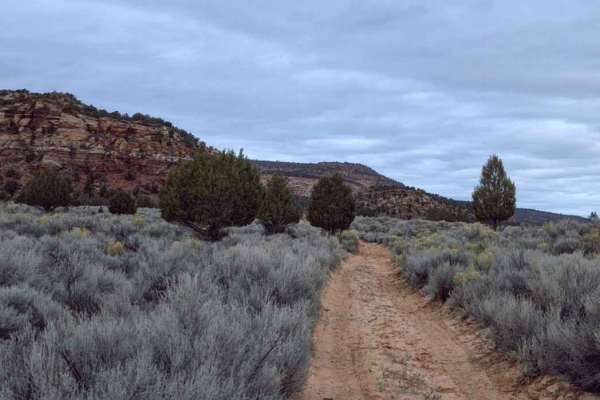
Rose Canyon - BLM M4156
Rose Canyon (also known as Rosy Canyon) is a destination trail located along the northernmost border of Arizona, in Mohave County. BLM M4156- Rose Canyon is a 1.9-mile point-to-point sand and dirt trail rated 3 of 10. This dirt trail runs along the edge of BLM managed land between two points on the ...
Learn more about Rose Canyon - BLM M4156
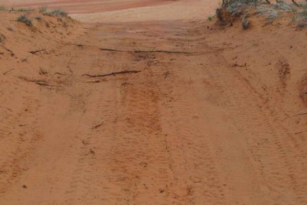
Dinosaur Tracks Loop
This is a fun excursion that will depart from the Elephant Cove Trailhead near Coral Pink Sand Dunes State Park. It starts with a short climb up a slick rock face. From there you will follow some very sandy trails with two relatively steep, deep sand drops that will add a little spice to the adventu...
Learn more about Dinosaur Tracks Loop
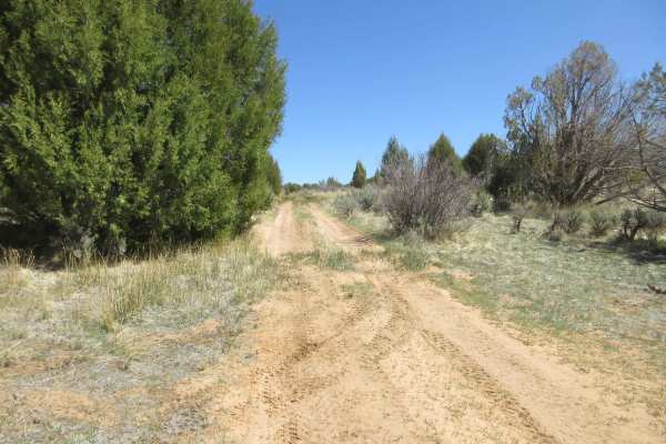
Elephant Gap - Poverty Gulch Overlook
This is a sandy but somewhat easy trail with great views of the surrounding area. You will see mountains, rocky valleys, and large areas of sand-based flats. There are also interesting small areas with grass and a nearby spring. If you want a ride to get to know your vehicle or to train a newer driv...
Learn more about Elephant Gap - Poverty Gulch Overlook
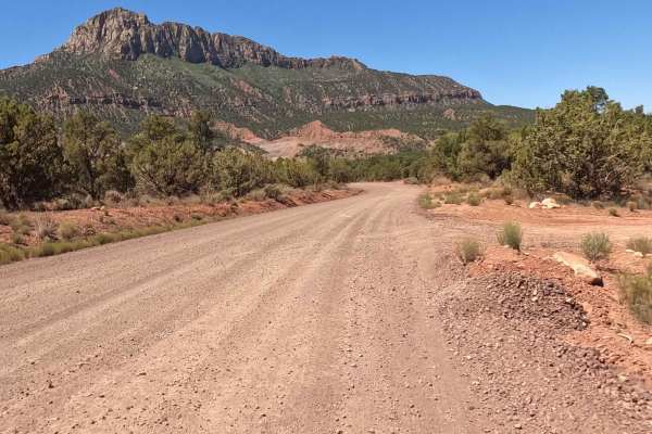
The Smithsonian Butte Backcountry Byway
The Smithsonian Butte Backcountry Byway is a scenic, beginner-friendly corridor that offers four-wheel-drive vehicles, SxSs, and standard passenger cars a stunning shortcut between Highway 59 and Rockville near Zion National Park. Spanning 7.7 miles, this well-maintained gravel road winds through so...
Learn more about The Smithsonian Butte Backcountry Byway
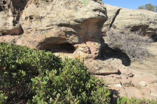
Little Creek Mesa
Little Creek Mesa is a hidden gem for anyone looking for fantastic views, widely varying terrain, history or something for the entire family. There are large areas of flat, slick rock that people use for biking, numerous areas with historic pit houses and other remnants from the early culture and pe...
Learn more about Little Creek Mesa
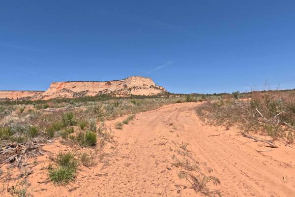
BLM 15
Marked clearly at its southern entrance by a weathered brown Carsonite Forest Service post indicating the junction with BLM 20, BLM 15 is a highly enjoyable, 2.3-mile point-to-point connector trail. This beautifully scenic backcountry route offers off-road explorers a wonderfully fun, distinctly twi...
Learn more about BLM 15
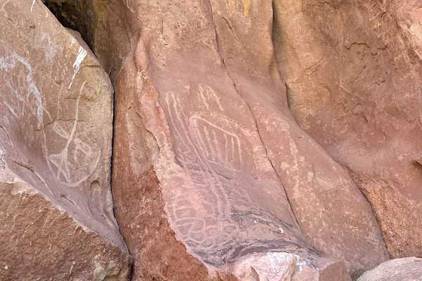
Yellowman/Gooseberry Mesa
Yellowman is a unique pictograph that when coupled with the nearby petroglyphs would allow you to come up with some great stories. This track goes through private land and there is a gate that should be closed. This route can be very challenging after rain or snow. The final approximately 0.5 miles ...
Learn more about Yellowman/Gooseberry Mesa
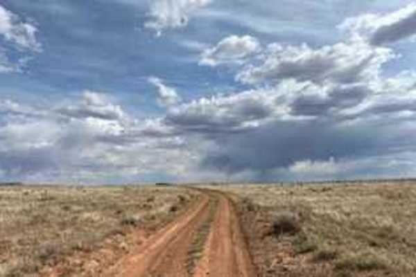
BLM 2086A
This trail connects you from Antelope Trail 1015 to Around Little Creek Mountain and vice versa. This is a hard-packed dirt trail that is easy to navigate. There are little to no obstacles on this route and it is a relatively smooth trip. The area offers great views of the surrounding mountains whi...
Learn more about BLM 2086A
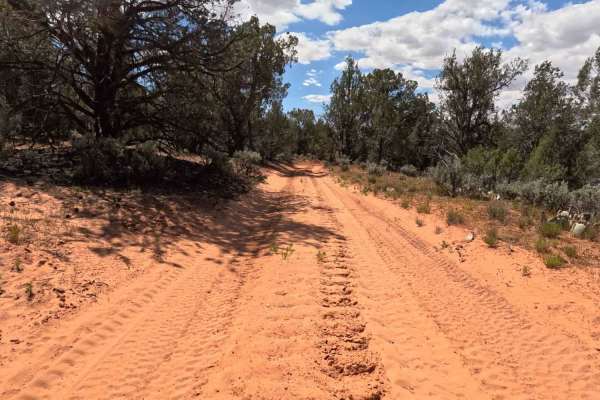
BLM 32
BLM 32 offers a beautifully scenic, highly engaging 3.5-mile point-to-point journey through the high desert. Presenting as a wide, well-traveled dirt and sand two-track, this prominent route meanders under expansive blue skies dotted with fluffy clouds, flanked by vibrant green junipers and desert s...
Learn more about BLM 32
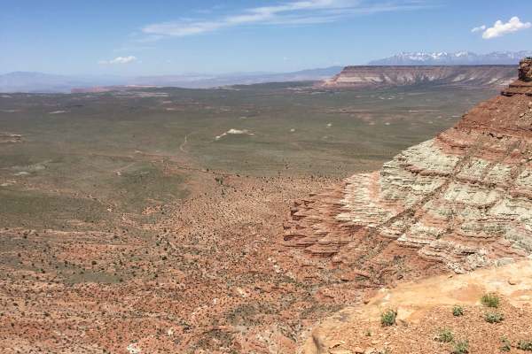
Little Creek Lookout Loop
This is a short loop where you’ll get a bird’s eye view of Southern Utah’s "geological staircase," including Fort Pierce, the Arizona Strip, and the towering heights of Zion National Park, Gooseberry, and Kolob. Accessible directly off Highway 59 via M4071 and BLM 2100, the terrain is a classic mix ...
Learn more about Little Creek Lookout Loop
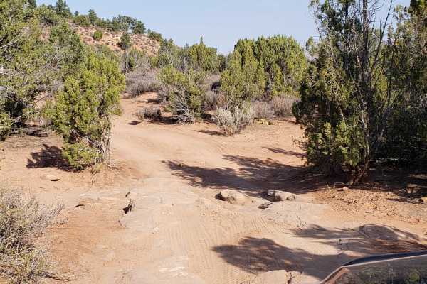
Wire Mesa
Wire Mesa is a scenic, 1.4-mile dirt route traversing a high desert plateau near Rockville, Utah, offering exceptional views of the surrounding red rock landscape near Zion National Park. While the area is well-known as a premier mountain biking destination, this off-road trail continues past the ma...
Learn more about Wire Mesa
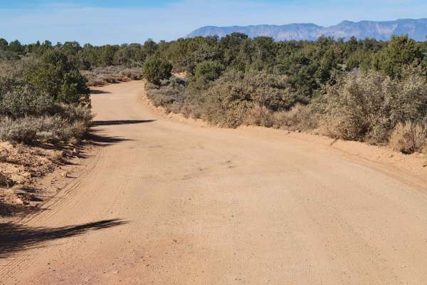
Gooseberry Mesa
Gooseberry Mesa and the surrounding area are a mecca for all things dirt biking and hiking. There is an endless network of trails in this region. Off this particular road, you'll find the Gooseberry Mesa trailhead and Windmill trailhead. The trail is easy enough for 2WD vehicles, but note that the t...
Learn more about Gooseberry Mesa
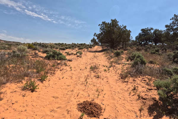
BLM 33A
Marked at its entrance by a brown Carsonite forest service post, BLM 33A is a brief, 0.9-mile point-to-point journey that provides a relaxing escape into the high desert. This easy-going, sandy two-track playfully bobs and weaves through a vibrant landscape dotted with fragrant, green juniper trees ...
Learn more about BLM 33A
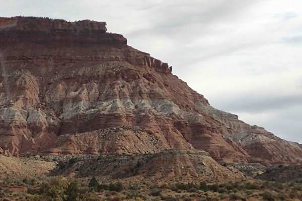
Rocky Top Little Creek Mesa
From the Little Creek Mesa Trail, this 4.5-mile track loops around to the rocky outcropping on top of the Mesa. It's great fun for dirt bikes, quads, 4x4s, and SXSs. The views of the valley from the top of the Mesa are beautiful. The views of Zion National Park are stunning. If it's snowed or rained...
Learn more about Rocky Top Little Creek Mesa
Beginner ATV trails near Centennial Park, Arizona
Explore ATV-friendly trails near you. These trails are accessible for vehicles up to 50 inches wide, perfect for ATVs and smaller off-road machines.
Lost Spring Mesa BLM 2100
Lost Spring Mesa BLM 2100 is a 16.3-mile (one-way) out-and-back trail across the mesa to Lost Spring Mountain at 5,700 feet. This is a 3 of 10 rated dirt and rock trail that consists of flat plains dirt track and a single wide rocky shelf road climb to the top of the mesa, with a sand and dirt flat ...
Learn more about Lost Spring Mesa BLM 2100
County Highway 5
This trail is class 2 sand, dirt, and gravel trail traveling south from Colorado City, AZ to Grand Canyon, Toroweap Overlook. A two-dollar permit is required to enter the last six miles of the trail. The last six miles will be a class 3. Tuweep campground is at the end of the trail with ten primitiv...
Learn more about County Highway 5
Cottonwood Point
This beautiful trail winds through the trees, and offers wonderful views of the red rock faces of Cottonwood Point above. There are many options throughout this BLM area, ranging from fairly packed dirt to deep loose sand. The area allows you to connect the town of Colorado City to the Coral Pink Sa...
Learn more about Cottonwood Point
BLM M0000-M4186
This red dirt road is a great entry point into a much larger trail system. Starting right off the highway, it's a fun, sandy route with gentle curves and a few small dips. As you work your way in, you'll find numerous side trails branching off, offering plenty of opportunities for further exploratio...
Learn more about BLM M0000-M4186
Beginner UTV/side-by-side trails near Centennial Park, Arizona
Find UTV and side-by-side trails near you. These trails accommodate vehicles up to 60 inches wide, ideal for UTVs, side-by-sides, and wider off-road rigs.
Lost Spring Mesa BLM 2100
Lost Spring Mesa BLM 2100 is a 16.3-mile (one-way) out-and-back trail across the mesa to Lost Spring Mountain at 5,700 feet. This is a 3 of 10 rated dirt and rock trail that consists of flat plains dirt track and a single wide rocky shelf road climb to the top of the mesa, with a sand and dirt flat ...
Learn more about Lost Spring Mesa BLM 2100
County Highway 5
This trail is class 2 sand, dirt, and gravel trail traveling south from Colorado City, AZ to Grand Canyon, Toroweap Overlook. A two-dollar permit is required to enter the last six miles of the trail. The last six miles will be a class 3. Tuweep campground is at the end of the trail with ten primitiv...
Learn more about County Highway 5
Cottonwood Point
This beautiful trail winds through the trees, and offers wonderful views of the red rock faces of Cottonwood Point above. There are many options throughout this BLM area, ranging from fairly packed dirt to deep loose sand. The area allows you to connect the town of Colorado City to the Coral Pink Sa...
Learn more about Cottonwood Point
BLM M0000-M4186
This red dirt road is a great entry point into a much larger trail system. Starting right off the highway, it's a fun, sandy route with gentle curves and a few small dips. As you work your way in, you'll find numerous side trails branching off, offering plenty of opportunities for further exploratio...
Learn more about BLM M0000-M4186
The onX Offroad Difference
onX Offroad combines trail photos, descriptions, difficulty ratings, width restrictions, seasonality, and more in a user-friendly interface. Available on all devices, with offline access and full compatibility with CarPlay and Android Auto. Discover what you're missing today!
Open Trail Map