
Beginner Off-Road Trails
Near Callender, California
Explore All Beginner Trails Near Callender, California
Beginner Off-Road Trails Near Callender, California
Discover the best beginner-friendly off-road trails near you. These easier, lower-rated trails are a great place to start — browse trail maps, check difficulty ratings, and find your next adventure.
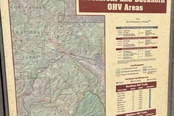
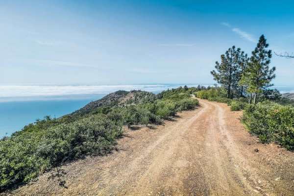
Ride around Rockfront
Fun loop around Rockfront OHV. This loop shows you everything Rockfront has to offer the Central Coast of California;steep climbs, jumpy fast double track, and lots of dust! This loop also brings you to Baja Campground. Enjoy the double track with anything from a moto to a full-sized 4x4.
Learn more about Ride around Rockfront
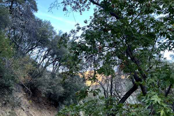
Bates Canyon
Surrounded by chaparral in the Los Padres National Forest. This trail can be closed due to weather. Please check the LPNF website. The best time to go is in the spring to see the flowers and green hills. There is a first come first serve campground at the base of the mountains.
Learn more about Bates Canyon
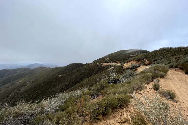
McPherson Peak - FS 32S13
Located in the Los Padres National Forest. This road follows a ridge line to McPherson Peak that has a telecommunication tower ending up over 5,700 ft. From there, you can continue on foot to backpacking trails. This is mostly untouched land, surrounded by chaparral shrubs with oak trees. There are...
Learn more about McPherson Peak - FS 32S13
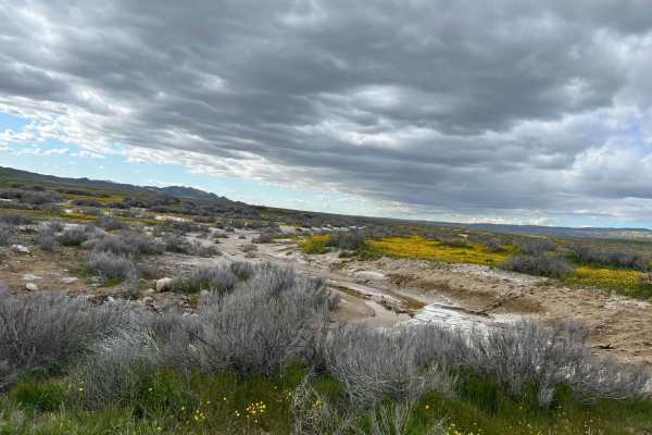
Elkhorn Road
The majority of the road is smooth and graded. However, there are sections that can have sticky mud, washed out from seasonal creeks that have a potential for high clearance. Carrizo Plain can get very hot in the summer and very cold in the winter. The best time to go in the spring to check out the ...
Learn more about Elkhorn Road
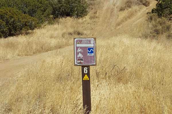
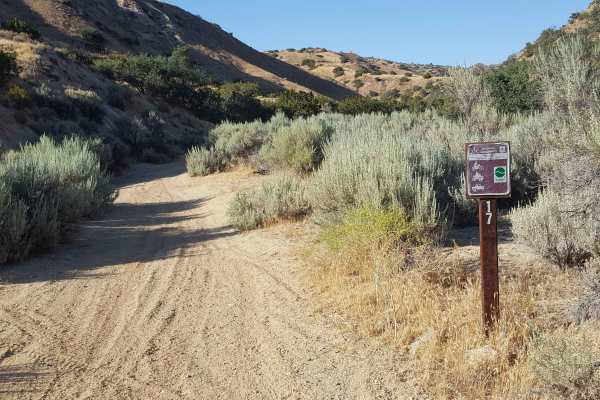
Trail 6
This is a fast and flowy 50" trail through open fields on the northern edge of the Ballinger riding area. It starts near the Day Use parking area and adjacent campground and will provide a good warm-up ride before heading out to more difficult trails. There are several short, steep, and rutted hill ...
Learn more about Trail 6
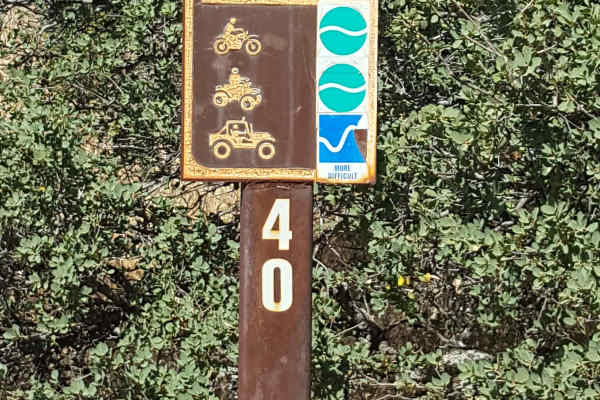
Trail 40
This is a point-to-point trail running from the southwest corner to the center of the Ballinger OHV area. The track is generally a little wider than a single vehicle, with frequent places to pull aside to let other vehicles pass. The trail surface is predominantly packed dirt with small embedded roc...
Learn more about Trail 40
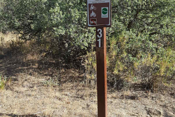
Trail 31
This is a short, fun singletrack trail for dirt bikes and ATVs only that connects Trail 24 with Trail 40. From Trail 24, it runs up a hillside through a tree section over a couple short climbs. It then transitions to a shelf trail along an open hillside area before finishing with a fast and flowy st...
Learn more about Trail 31
Trail 17
This is a loop trail that climbs to the top of a ridge and then circles back. The start of the trail begins in a sandy wash and then quickly climbs up an adjacent rutted hillside using a series of narrow switchbacks. At the top, the trail flattens out and has occasional whoops, loose rocks, and rut...
Learn more about Trail 17
San Martin
San Martin is a short trail dotted with many campsites along the San Martin Ridgeline. The trail stays mostly above the fog line, offering beautiful views of the Pacific Ocean. The trail dead-ends at a High Clearance 4x4 trail leading to the cliffside. There are also plenty of places to turn around ...
Learn more about San Martin
Beginner ATV trails near Callender, California
Explore ATV-friendly trails near you. These trails are accessible for vehicles up to 50 inches wide, perfect for ATVs and smaller off-road machines.
Ride around Rockfront
Fun loop around Rockfront OHV. This loop shows you everything Rockfront has to offer the Central Coast of California;steep climbs, jumpy fast double track, and lots of dust! This loop also brings you to Baja Campground. Enjoy the double track with anything from a moto to a full-sized 4x4.
Learn more about Ride around Rockfront
Trail 6
This is a fast and flowy 50" trail through open fields on the northern edge of the Ballinger riding area. It starts near the Day Use parking area and adjacent campground and will provide a good warm-up ride before heading out to more difficult trails. There are several short, steep, and rutted hill ...
Learn more about Trail 6
Trail 40
This is a point-to-point trail running from the southwest corner to the center of the Ballinger OHV area. The track is generally a little wider than a single vehicle, with frequent places to pull aside to let other vehicles pass. The trail surface is predominantly packed dirt with small embedded roc...
Learn more about Trail 40
Trail 31
This is a short, fun singletrack trail for dirt bikes and ATVs only that connects Trail 24 with Trail 40. From Trail 24, it runs up a hillside through a tree section over a couple short climbs. It then transitions to a shelf trail along an open hillside area before finishing with a fast and flowy st...
Learn more about Trail 31
Beginner UTV/side-by-side trails near Callender, California
Find UTV and side-by-side trails near you. These trails accommodate vehicles up to 60 inches wide, ideal for UTVs, side-by-sides, and wider off-road rigs.
Ride around Rockfront
Fun loop around Rockfront OHV. This loop shows you everything Rockfront has to offer the Central Coast of California;steep climbs, jumpy fast double track, and lots of dust! This loop also brings you to Baja Campground. Enjoy the double track with anything from a moto to a full-sized 4x4.
Learn more about Ride around Rockfront
Trail 40
This is a point-to-point trail running from the southwest corner to the center of the Ballinger OHV area. The track is generally a little wider than a single vehicle, with frequent places to pull aside to let other vehicles pass. The trail surface is predominantly packed dirt with small embedded roc...
Learn more about Trail 40
Trail 17
This is a loop trail that climbs to the top of a ridge and then circles back. The start of the trail begins in a sandy wash and then quickly climbs up an adjacent rutted hillside using a series of narrow switchbacks. At the top, the trail flattens out and has occasional whoops, loose rocks, and rut...
Learn more about Trail 17
San Martin
San Martin is a short trail dotted with many campsites along the San Martin Ridgeline. The trail stays mostly above the fog line, offering beautiful views of the Pacific Ocean. The trail dead-ends at a High Clearance 4x4 trail leading to the cliffside. There are also plenty of places to turn around ...
Learn more about San Martin
The onX Offroad Difference
onX Offroad combines trail photos, descriptions, difficulty ratings, width restrictions, seasonality, and more in a user-friendly interface. Available on all devices, with offline access and full compatibility with CarPlay and Android Auto. Discover what you're missing today!
Open Trail Map