
Beginner Off-Road Trails
Near Boise City, Idaho
Explore All Beginner Trails Near Boise City, Idaho
Beginner Off-Road Trails Near Boise City, Idaho
Discover the best beginner-friendly off-road trails near you. These easier, lower-rated trails are a great place to start — browse trail maps, check difficulty ratings, and find your next adventure.

Oregon Trail
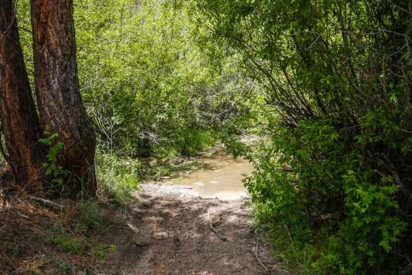
This trail packs a lot into a short distance, blending various terrain challenges with deep Idaho history. As you parallel the original Oregon Trail, you’ll encounter 4-foot cement pillars around the one-mile mark that officially designate the historic route. The first mile features deep ruts that o...
Learn more about Oregon Trail
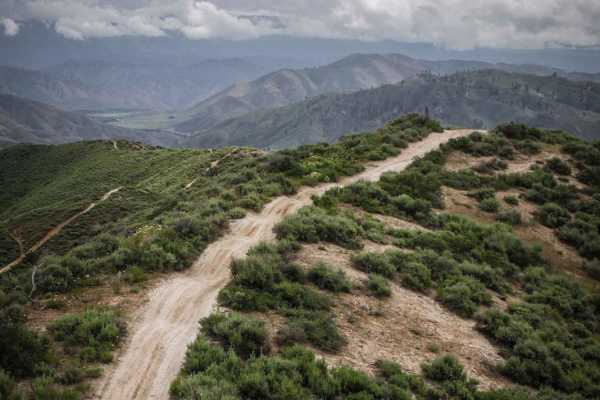
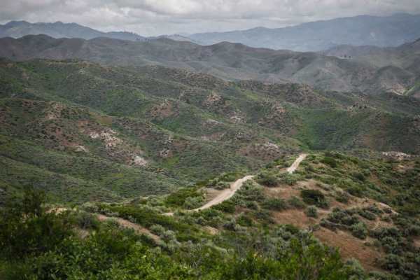
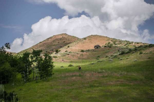
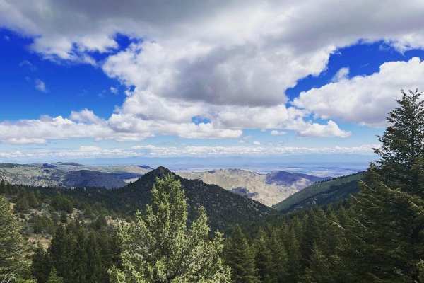
Boise Ridge Road
Boise Ridge Road is a scenic, moderate forest service route ideal for high-clearance 4x4s, side-by-sides, and dirt bikes looking for expansive ridgeline views overlooking Boise, Idaho. Stretching over 11 miles and reaching a peak elevation of 6,509 feet, this unpaved route connects the high-country ...
Learn more about Boise Ridge Road
Rocky Canyon Road
Pretty simple road during the summer months that cuts over to Robbie Creek. A nice alternate route to Hwy 21, or a good road to access the ridge road. The winter months can vary depending on snowpack. It is not maintained east of the summit. Full size vehicles would be a handful in spots, and the ea...
Learn more about Rocky Canyon Road

North Fork River Road
Do you like long drives on a dirt road, river views, and hot springs? This road is for you! Enjoy a dirt road that follows along the Boise River. It is possible to do this in any vehicle as long as there is no snow or heavy rainstorms. During heavy rainstorms, this road could become dangerous with f...
Learn more about North Fork River Road
Prairie Dog Lane
This area of BLM is a spiderweb of trails. This particular one is fairly short but wild and rugged in terrain. The trail is less visible in some places but it is still defined enough to follow. There are some rocky patches scattered throughout. Wide-open views of the surrounding area in every direct...
Learn more about Prairie Dog Lane
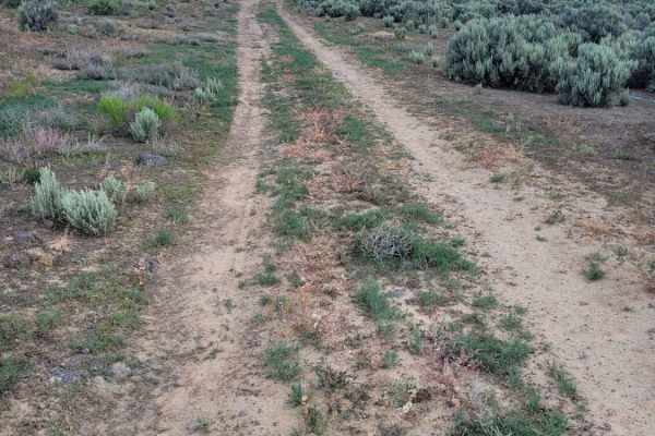
West Nicholson Road
This dirt and gravel trail will take you from Swan Falls Road to Robinson Boulevard and vice versa. It's an easy road with rolling hills to overland across two major roads. Along this trail, there are multiple offshoots to take smaller, unnamed trails. The smaller side trails appear to have decent-s...
Learn more about West Nicholson Road
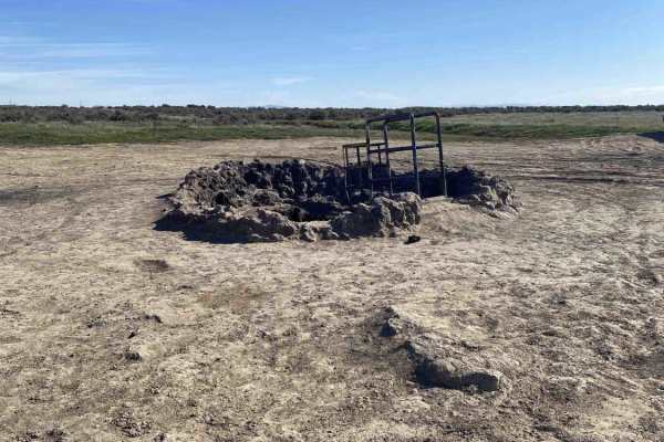
Kuna Cave
This short but versatile trail offers plenty of opportunities to test your suspension or choose a more conservative line, depending on your build. The primary draw is the quick access to Kuna Cave, a unique subterranean cavern formed by an ancient lava tube. While the main track features extreme rut...
Learn more about Kuna Cave
501
501 is an easy 50" trail for dirt bikes and ATVs but is slightly harder for ATVs due to steep climbs and lots of whoops. The trail is a wide ridge line path across a series of green rolling hills in the Boise National Forest. It's two-track width the whole way on a dirt surface, and the dirt is a li...
Learn more about 501
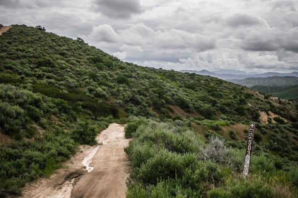
503
This short ATV trail is in the Danskin Trail System just southeast of Boise, Idaho. It's a wide and shelfy ATV trail that is two-track wide, with a steady decline and meanders by a creek. In the beginning, it looks like an old road, with a lot of overgrowth of shrubs lining the trail and grass on th...
Learn more about 503
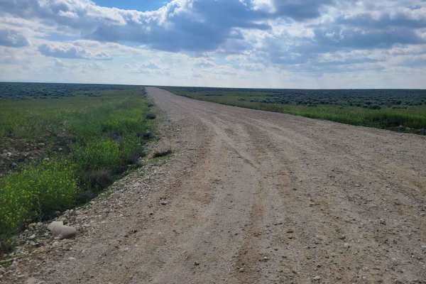
Standifer Road
This wide-open, easy dirt road connects to many of the side trails in the area. The Southern end of the trail brings you near and to the National Guard Training Area. Please respect all posted signs on both sides of the trail. Wide-open views of the surrounding terrain in every direction.
Learn more about Standifer Road
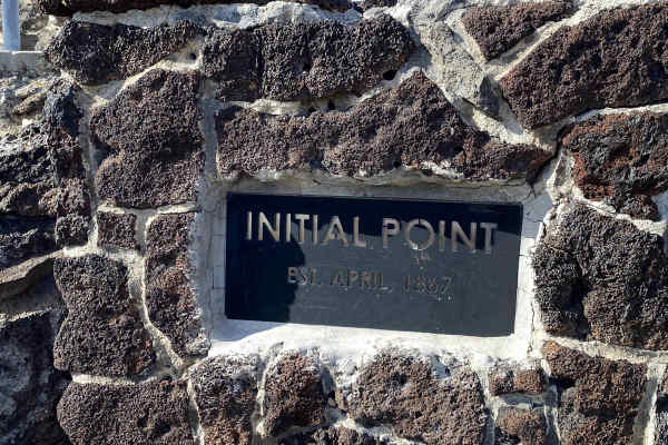
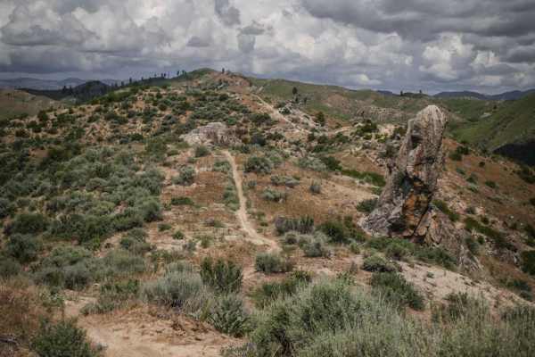
Initial Point
This 1.25-mile trek begins with an easy drive to the historic 1867 Idaho mapping baseline. The first mile is wide and flat with some ruts, but nothing more than a couple of inches deep. The intensity spikes in the last 0.25 miles as the trail narrows to a single-vehicle track, climbing steeply on a ...
Learn more about Initial Point
502
This short ATV trail connects ATV trails 500 and 501. It's mostly easy but has two sections where the trail is rutted out right down the center of the trail. On a dirt bike, it's easy to get troughed out here, but it may be easier on an ATV because you can straddle the rut. It also has several secti...
Learn more about 502
512
Danskin #512 is a ridge line single track in the Boise National Forest. It's on a wider ridge line atop a series of rolling green hills, and the trail itself is a decently wide single track, thus the exposure is not too bad. It goes along a fence line for much of it, with wide open views and not man...
Learn more about 512
521
ATV #521 is a wide ridge line two-track with wide open views of the surrounding Danskin Mountains. It starts at a 5 way intersection with trails #531, #530, and #532 at the bottom of a valley under some pine trees, and climbs up about 900 feet over 2 miles up to ATV #520. It has several steep hill c...
Learn more about 521
531
This is one of several easy ATV trails in the Danskin Trail System of the Boise National Forest. On the north end, this one starts in a pine tree forest with a big creek crossing that is deep in parts, as it leaves ATV trail #300. It climbs up to a ridge line with several steep hill climbs. The trai...
Learn more about 531
533
This is a short ridge line trail in the Danskin Trail System that spurs off of #532 on the north end and connects to ATV #531 on the south end. Unlike many of the other ridge line trails in the area, this one doesn't have much elevation change, thus this trail is mostly flat and doesn't have any of ...
Learn more about 533
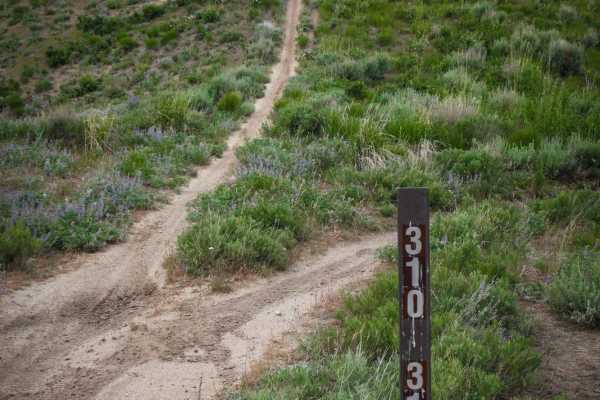
311
Danskin #311 is a ridge line single track in the Danskin Trail System in the Boise National Forest. It hill climbs the entire way from ATV #300 to the #310 single track, gaining almost 900 feet in 1.6 miles. The trail will have a steep hill climb that crests over a hill, continues flat for a minute,...
Learn more about 311
Along The Edge
Another connecting trail to many of the others in the area, this one leads right along the fence line and, at one point, along the edge of the railroad tracks. At times the trail becomes not as defined, assuming it doesn't get much traffic. It is uneven, rutted/eroded in places, and has some rocky p...
Learn more about Along The Edge
312
This short single track in the Danskin Trail System is a ridge line trail that goes over a series of rolling hills in this mountain range with lots of steep hill climbs and descents. It departs from #310 with a steep hill climb up to the top of a hill, then it downhills the rest of the way to #300. ...
Learn more about 312
Harris Creek Trail
This 13.9-mile point-to-point trail connects the Bogus Basin area to the Harris Creek area. Stop at 3.5 miles from Bogus Basin and hike out to Coyote Rock, or stop at 7.4 miles from Bogus Basin and check out Sugarloaf Rock. There are several other hiking trails to explore along this route. There is ...
Learn more about Harris Creek Trail
Beginner ATV trails near Boise City, Idaho
Explore ATV-friendly trails near you. These trails are accessible for vehicles up to 50 inches wide, perfect for ATVs and smaller off-road machines.
Oregon Trail
This trail packs a lot into a short distance, blending various terrain challenges with deep Idaho history. As you parallel the original Oregon Trail, you’ll encounter 4-foot cement pillars around the one-mile mark that officially designate the historic route. The first mile features deep ruts that o...
Learn more about Oregon Trail
Boise Ridge Road
Boise Ridge Road is a scenic, moderate forest service route ideal for high-clearance 4x4s, side-by-sides, and dirt bikes looking for expansive ridgeline views overlooking Boise, Idaho. Stretching over 11 miles and reaching a peak elevation of 6,509 feet, this unpaved route connects the high-country ...
Learn more about Boise Ridge Road
Rocky Canyon Road
Pretty simple road during the summer months that cuts over to Robbie Creek. A nice alternate route to Hwy 21, or a good road to access the ridge road. The winter months can vary depending on snowpack. It is not maintained east of the summit. Full size vehicles would be a handful in spots, and the ea...
Learn more about Rocky Canyon Road
North Fork River Road
Do you like long drives on a dirt road, river views, and hot springs? This road is for you! Enjoy a dirt road that follows along the Boise River. It is possible to do this in any vehicle as long as there is no snow or heavy rainstorms. During heavy rainstorms, this road could become dangerous with f...
Learn more about North Fork River Road
Beginner UTV/side-by-side trails near Boise City, Idaho
Find UTV and side-by-side trails near you. These trails accommodate vehicles up to 60 inches wide, ideal for UTVs, side-by-sides, and wider off-road rigs.
Oregon Trail
This trail packs a lot into a short distance, blending various terrain challenges with deep Idaho history. As you parallel the original Oregon Trail, you’ll encounter 4-foot cement pillars around the one-mile mark that officially designate the historic route. The first mile features deep ruts that o...
Learn more about Oregon Trail
Boise Ridge Road
Boise Ridge Road is a scenic, moderate forest service route ideal for high-clearance 4x4s, side-by-sides, and dirt bikes looking for expansive ridgeline views overlooking Boise, Idaho. Stretching over 11 miles and reaching a peak elevation of 6,509 feet, this unpaved route connects the high-country ...
Learn more about Boise Ridge Road
North Fork River Road
Do you like long drives on a dirt road, river views, and hot springs? This road is for you! Enjoy a dirt road that follows along the Boise River. It is possible to do this in any vehicle as long as there is no snow or heavy rainstorms. During heavy rainstorms, this road could become dangerous with f...
Learn more about North Fork River Road
Prairie Dog Lane
This area of BLM is a spiderweb of trails. This particular one is fairly short but wild and rugged in terrain. The trail is less visible in some places but it is still defined enough to follow. There are some rocky patches scattered throughout. Wide-open views of the surrounding area in every direct...
Learn more about Prairie Dog Lane
The onX Offroad Difference
onX Offroad combines trail photos, descriptions, difficulty ratings, width restrictions, seasonality, and more in a user-friendly interface. Available on all devices, with offline access and full compatibility with CarPlay and Android Auto. Discover what you're missing today!
Open Trail Map