Trail Overview
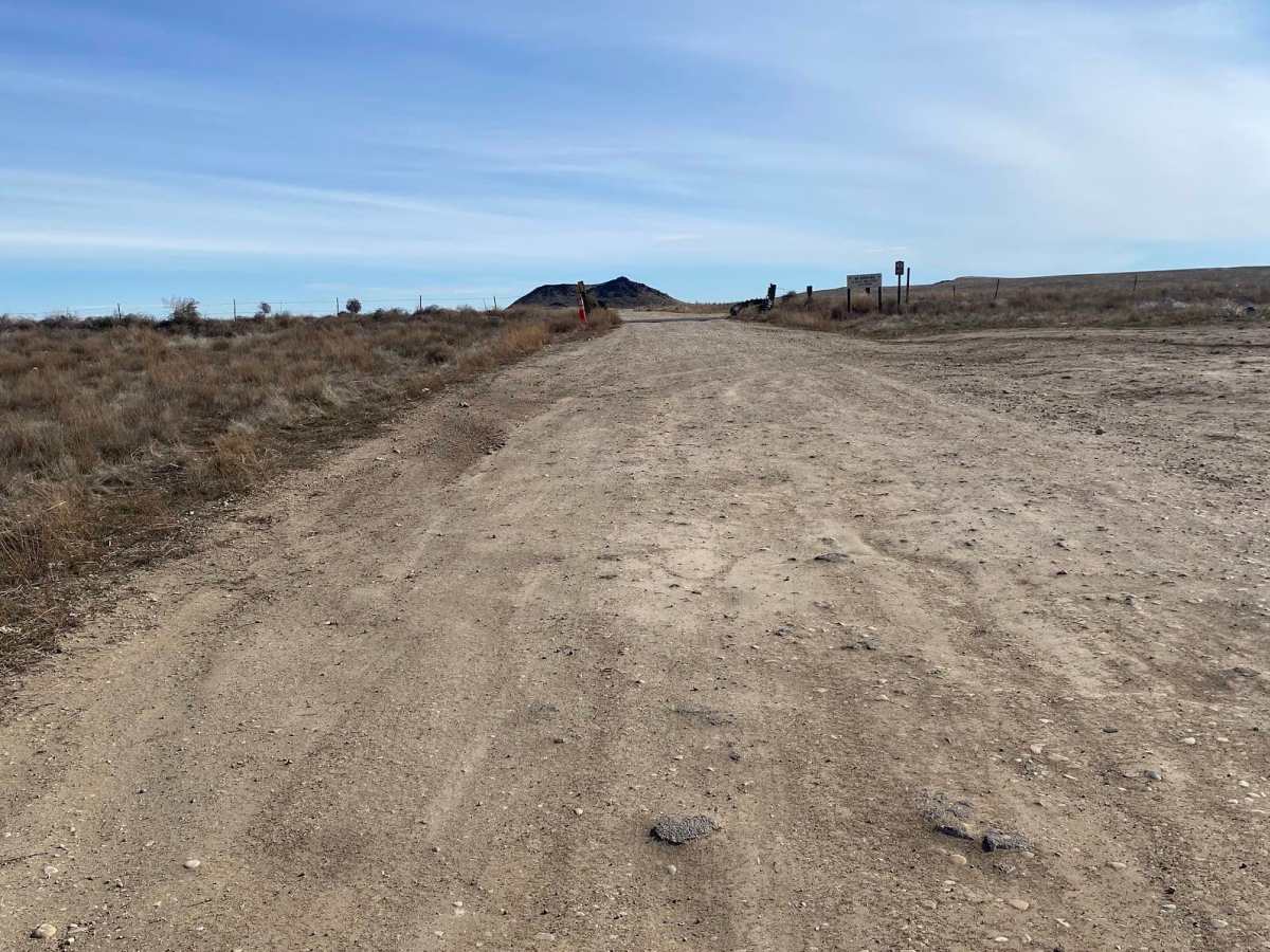
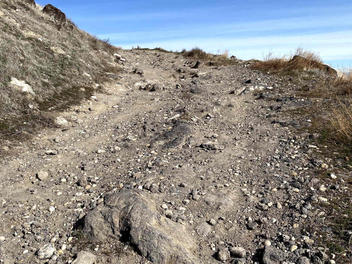
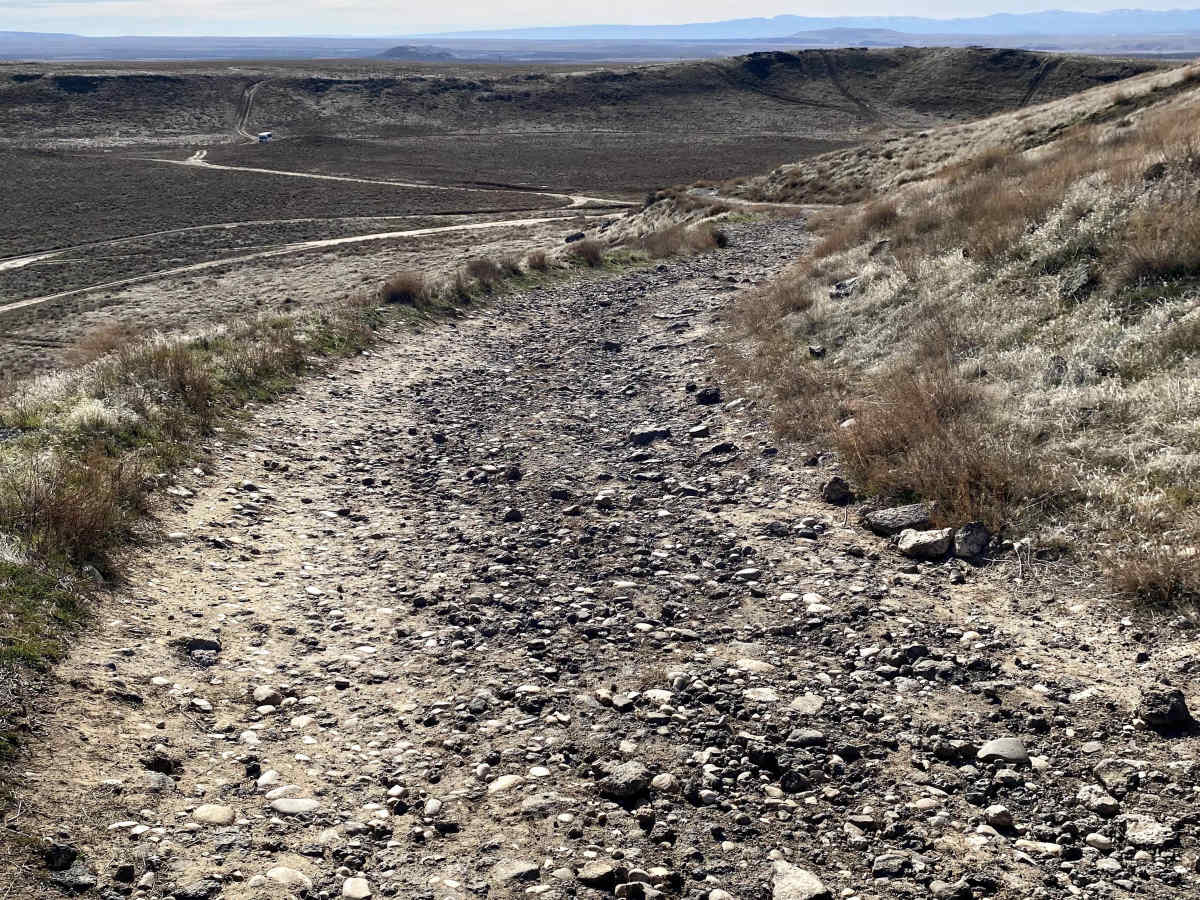
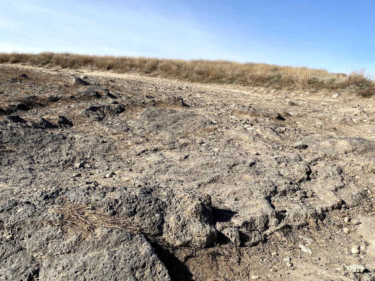
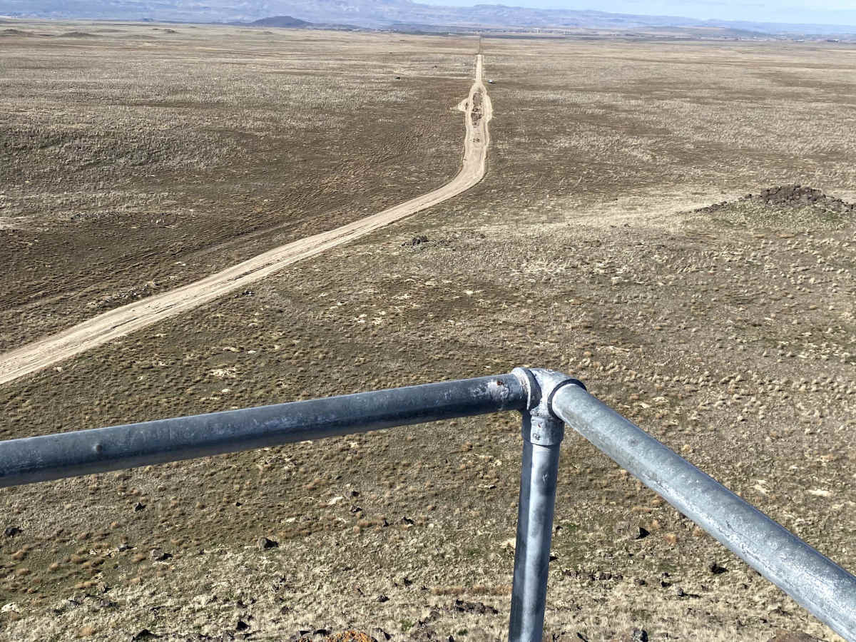
This 1.25-mile trek begins with an easy drive to the historic 1867 Idaho mapping baseline. The first mile is wide and flat with some ruts, but nothing more than a couple of inches deep. The intensity spikes in the last 0.25 miles as the trail narrows to a single-vehicle track, climbing steeply on a jagged volcanic rock trail. It is very bumpy. Navigate carefully over 6 to 10-inch volcanic rocks sticking out during the final quarter-mile ascent. Your reward is a breathtaking summit panorama featuring unobstructed views of the Owyhee Mountains and the surrounding desert.
Difficulty
The first mile of this is easy with some rutted areas. The last quarter of a mile is completely different, as you have a narrow trail with a steep climb. The hill is a volcanic outcropping, and the trail is cut into the side of the hill, so it is extremely rocky.
History
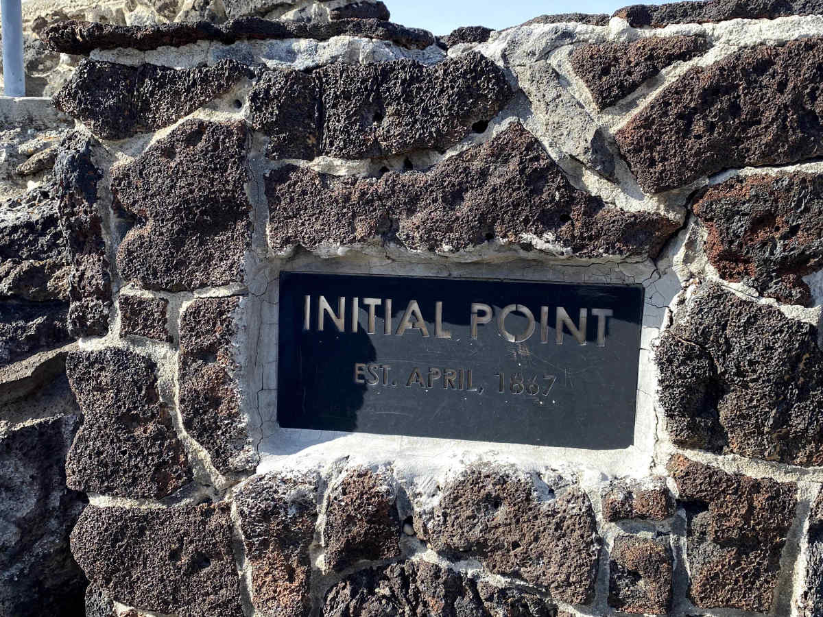
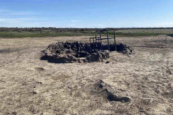
Located about 8 miles south of Kuna, Initial Point is the most significant geographic landmark in Idaho. While it may look like just another volcanic butte, it serves as the literal "anchor" for the state’s history and development.
Established in 1867, Initial Point is the official point of origin for all land surveys in the state of Idaho. Every property line, farm boundary, and town layout in Idaho's 53 million acres is calculated based on its distance and direction from this single marker.