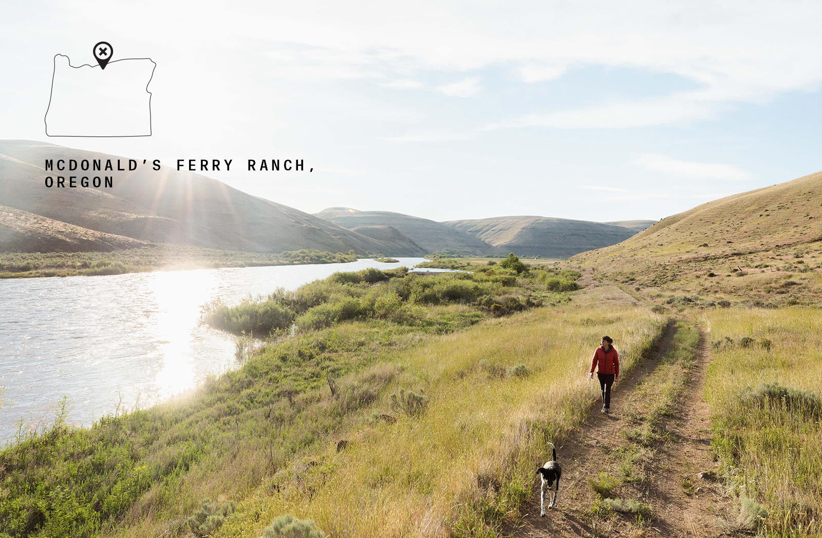
Passing the Baton: Chronicling the McDonald’s Ferry Ranch
The Last Takeout
The John Day River is the longest undammed river West of the Rockies and is designated Wild and Scenic. From its headwaters in the Strawberry Mountains near Prairie City, the river runs, unencumbered, nearly 284 miles through archaeological sites, historical areas, and canyons. The varied sections of habitat provide life both above and below the water line. It hosts runs of Chinook salmon, steelhead, and other game fish including great bass fishing in the heat of summer. The riparian areas are filled with bighorn sheep, deer, game birds, rattlesnakes, coyotes, and countless other species.
The river is an exceptional float and attracts rafters from all around the Pacific Northwest to its tranquil waters. That is until, the notorious Tumwater Falls—a class-five waterfall that is surrounded by private land. So where are rafters, boaters, and floaters supposed to take out? That’d be McDonald’s Ferry Ranch. This 4,054-acre parcel near Wasco, Oregon is a place where recreationists have taken out from their multi-day float, hiked along the Oregon trail, and chased chukar through the rugged John Day valley.
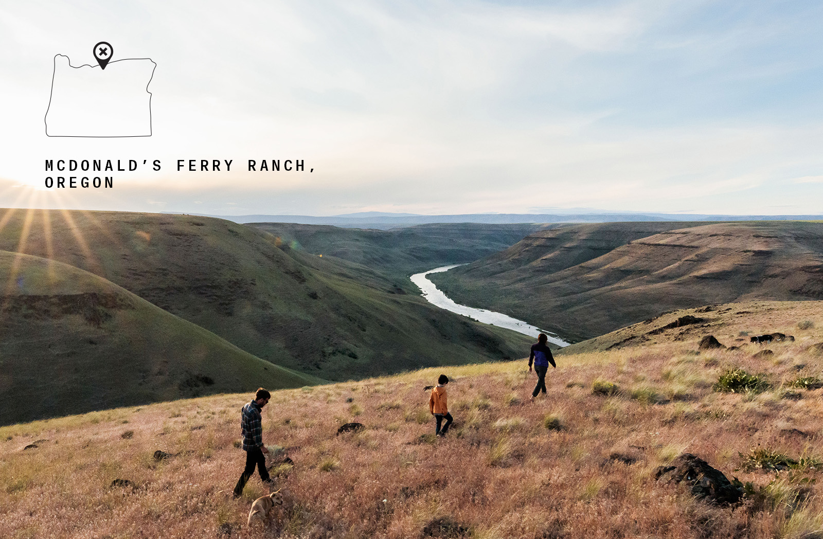
Photo credit: Sage Brown
Western Rivers Conservancy (WRC), a conservation group dedicated to protecting rivers in the West, first purchased land along the John Day in September of 2008. Their strategy is to acquire, and then convey these properties to federal, tribal, local, or state land management agencies. In the case of the now-named Cottonwood Canyon State Park, upstream of McDonald’s Ferry, they purchased that property to turn it over to the Oregon Parks and Recreation Department (OPRD).
Since then, local businesses such as the Wasco House Bed and Breakfast have seen an uptick in visitation to the area. “When they (WRC and OPRD) first developed Cottonwood Canyon State Park, we weren’t expecting to get much business from it. However, we have several guests come out every year to fish the John Day and one or two groups that float it,” share Dave Bergmann and Lisa D’Arcy, who own the hospitality business. They remember a time when they used to be the only two hiking the area, yet now, there are 20 or 30 people out there on the trails. Not to worry, “It’s a huge park and it’s not crowded,” they say. For them, Wasco seems to be a stopover town for folks heading out to the Painted Hills, Cottonwood Canyon State Park, or even the farther reaches of places like Smith Rock, however, the hope is that the recreational gem of McDonald’s Ferry Ranch might just slow them down a little bit and adventurers might stay a while.
McDonald’s Ferry Ranch Walk-In Program
While under the management of WRC, which has been about three years, the McDonald’s Ferry Ranch has provided recreational access to hikers, boaters, and hunters. WRC’s dedication to hunting access propelled them to seek out Brandon Dyches of the Oregon Department of Fish and Wildlife, who manages the state’s Hunt By Reservation program. WRC enrolled the ranch into the program which granted Dyches administrative oversight of the property’s hunting access. This ensures rich hunting experiences and empowers landowners to allow access and manage their property the way they want to. “They were a small landowner willing to allow hunting access, but didn’t have the time or resources to do so,” says Dyches. In the first year, they had 85 reservations and 155 hunters. Harvest was mostly chukar. “Access is the biggest problem. There’s Bureau of Land Management peppered through there that got locked up by little ranchettes or old homesteads. We were able to handle that access and keep hunt quality really high,” reflects Dyches.
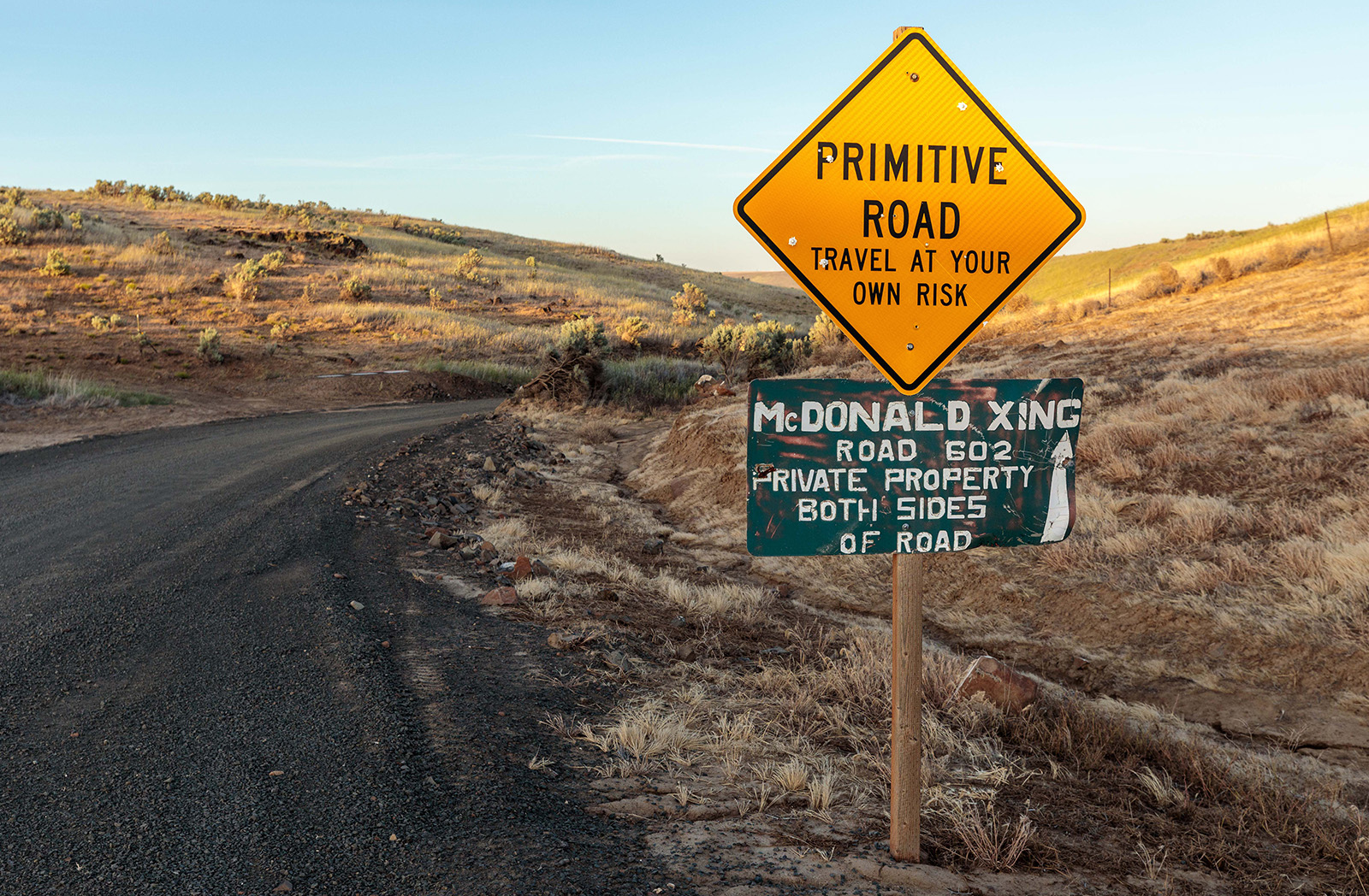
Photo credit: Sage Brown
Opening up these parcels, including McDonald’s Ferry Ranch and Cottonwood Canyon, allows people to break up their explorations into smaller chunks, “The spirit is now that the average recreationist doesn’t have to commit six days to the John Day.” Day trippers from Portland, Hood River, and nearby areas can experience this valley. This access and the proximity to his then-home in Portland, are what drew hunter, Jesse Abel, to the program and McDonald’s Ferry in the first place.
The Hunt
As a new hunter, Jesse needed to know where he could hunt. He had picked up hunting to eat sustainably, learn about ecology, and get in better shape. Like most new hunters, he didn’t know where to go. “onX has been helpful because I didn’t have any idea about land ownership, so the (Hunt By Reservation program) was really comforting to know ‘I’m allowed to be here.’ There wasn’t anyone to tell me to ‘get lost.’” He goes on to say, “You’re pretty nervous your first time, so the Hunt By Reservation was really nice for getting started and to know this is totally sanctioned.”
The morning started with a car camp on nearby BLM land and a drive over to the parking lot at McDonald’s Ferry. He started up a few drainages whacking at shrub brush coaxing a chukar, a bird he’d never seen before, to emerge. As the dawn light cast its warm glow deeper into the canyons, around 7:30 a.m., a herd of deer crested a ridge in full sprint. “They were all huffing and puffing, and you could see the steam because it was early and cold.” Something, perhaps one of the coyotes Abel saw or the nearby pheasant hunters, had spooked them. “It was fun because I watched them approach me for a long time. They had no idea I was there,” he reflects.
“The whole property is dynamic. There are all these big rocky cliffs. I only covered about half of it.” Following up on a tip from another hunter, he ascended a draw where they were known to be and where the only escape would be direct flight descending the drainage—exactly where Abel was standing. “About 30 of them go flying past me making a big commotion. I shot the tenth one or whatever—I wasn’t quick or skilled then. I’ve since gotten better. They’re so camouflaged that I didn’t want to lose that one, so I didn’t shoot any of the others, and just kept eye contact with that one.” Even then, he walked across the ravine to near-ten feet of where it dropped and still had to use onX to recover the perfectly blended-in bird.
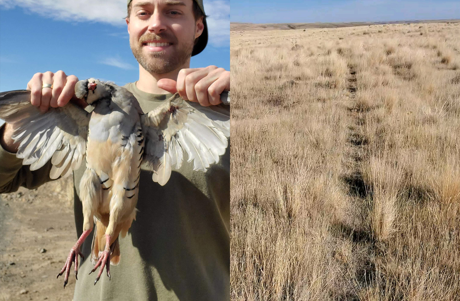
Photo credit: Jesse Abel
In total, he walked about 12 miles around the ranch, including walking along the Oregon Trail. The trail switchbacks down the canyon to where a ferry would shuttle wagons across the river in the 1800s. The wagon ruts are still visible on the property. The terrain that chukars like to live in is tough. “Since picking up chukar hunting, I’ve bought a pair of mountain climbing boots, really stiff ones so your ankle doesn’t roll.” It’s amazing that pioneers in their wagon carts could do this across such rugged terrain.
Connecting Parcels and Dissolving Landlocked Boundaries
As of Wednesday, August 30, WRC conveyed the property to the Bureau of Land Management. While the management plans are yet to be finalized, users can expect that the property will fall under the BLM’s plan for the John Day as a whole. As Dyches referenced, the property, at 4,054 acres, is neighbored by parcels of both private and public.
One particular piece of land is a 598-acre BLM-owned area that was previously landlocked. This result is what makes the work of WRC so special. “This opened up acres of public land, in a county that doesn’t have much of it on a wild and scenic river,” shares Alex Barton, a Project Manager for Western Rivers Conservancy. “The vast majority of these projects have a natural, long-term steward.” There’s a Plan A—meaning that the property of interest is adjacent to a land management agency like the U.S. Forest Service, U.S. Fish and Wildlife Service, or BLM. “In the case of McDonald’s Ferry, the BLM was motivated to acquire it and they managed lands adjacent to it.” Between their first project in Cottonwood Canyon and this, they had worked with the BLM to protect the lower nine miles of Thirtymile Creek—a coldwater refuge for steelhead. “We had a recent history with them, a positive working relationship, the funding from Land and Water Conservation Fund, and they are the big public landowner in the area which makes them a really logical long-term steward.” While there are countless factors that go into these transactions, and oftentimes a Plan B or C, the proximity to adjacent BLM land and their existing presence in the community will hopefully position the property for success in the years to come.
All Ahead
These types of projects—the ones where access is needed, in areas where an acre conserved opens up a multiplier effect, and where the landscape can support the changes—make great onX Adventure Forever Grant stories. We’re proud to contribute to WRC’s strategy of finding long-term land stewards and sharing their role in conservation. Take the chance to visit McDonald’s Ferry Ranch if you’re traveling through Oregon. Visit the local lodging options, try your hand at chukar hunting, or find yourself walking through the history of the Oregon Trail.
Learn more about onX’s ongoing access and stewardship initiatives.