
Off-Road Trails
Near Zephyr, Texas
Off-Road Trails Near Zephyr, Texas
Discover the best offroad trails near you. Browse trail maps, check difficulty ratings, and find your next adventure — whether you're looking for a quick ride or an all-day expedition.

Priddy Windmills
Priddy Windmills is an easy, scenic dirt and gravel route perfect for beginners, families, and any vehicle looking for a relaxing cruise through the Texas countryside. Stretching approximately 12.6 miles through the Flat Top wind farm between Goldthwaite and Priddy, this trail offers drivers up-clos...
Learn more about Priddy Windmills
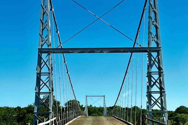
Regency Bridge (CR 433)
This is an easy gravel road that runs from FM 574 to FM 500. It's close to Goldthwaite, Brownwood, and San Saba, Texas. What makes the trail worth driving is the Regency Bridge which crosses the Colorado River. It is a single-lane suspension bridge with a wooden road deck, which was built in 1939 an...
Learn more about Regency Bridge (CR 433)
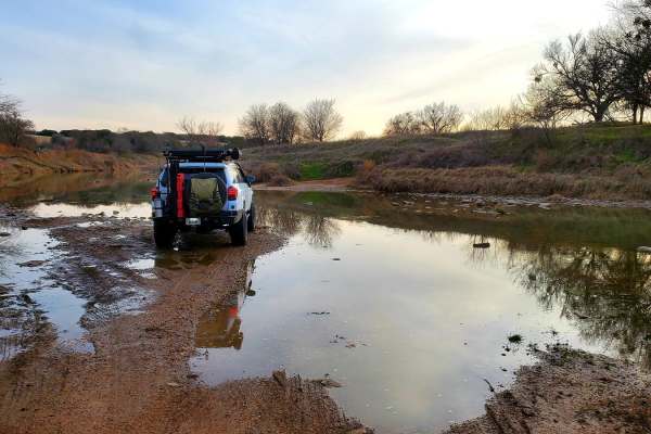
Goldthwaite Gallop
Beginning just south of the town of Goldthwaite, the trail begins at Ranch Road 3023 off of Hwy 16. A few miles of paved road abruptly ends and becomes a dirt road leading south towards Shaw Bend of the Colorado River. The long sweeping straightaways of the county road end after turning on to County...
Learn more about Goldthwaite Gallop
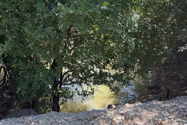
County Road 144/146
This route is a fun, easy country backroads drive that does not require 4WD. The roads are dirt/gravel with some high vegetation on the sides, water crossings, and some twists and turns through the Texas Hill Country. The road is a county road that winds through the area outside San Saba, around a r...
Learn more about County Road 144/146
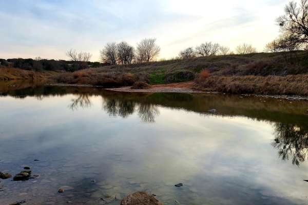
Double Ford
Step off the beaten path and explore the area flanking the Colorado River between San Saba and Goldthwaite. Starting near Hwy 190 in Lometa, this trail begins with a short dirt stretch and then transitions to a few miles of paved county road. Once the road passes the train tracks, it becomes dirt wi...
Learn more about Double Ford

Saba Stroll
Cutting from Hwy 16 to Hwy 190 around the town of San Saba and over the San Saba River, this quick drive offers beautiful views of the Texas countryside. A long straight stretch through grazing fields and under power lines leads to a grave yard flanked by a large power station, offering a stark cont...
Learn more about Saba Stroll
Cherokee Creek
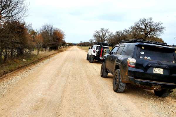
Meander through the north end of the Texas Hill Country along Cherokee Creek following unpaved county roads. Starting in the small town of Cherokee, this trail begins by turning onto County Road 409 from Hwy 16. Around the first bend in the road, pavement quickly turns to dirt and stays that way for...
Learn more about Cherokee Creek

County Road 414
This route is mainly red dirt with short patches of asphalt, especially around the low water crossings. It is an easy trail that does not require a 4x4. This scenic route will take you through farmland with loose livestock, including beautiful Texas Longhorns. The road winds through the backcountry ...
Learn more about County Road 414
Tudor Loop / 107
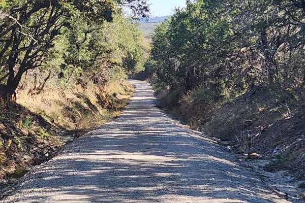
This trail consists of narrow county roads along the Erath and Eastland county line that cruise along exotic game ranches, old ranches from the 1880s, and dispersed cemeteries from the settling of the area. The road surface ranges from caliche to crushed sandstone & granite to hard-packed gravel and...
Learn more about Tudor Loop / 107
Bosque 1035
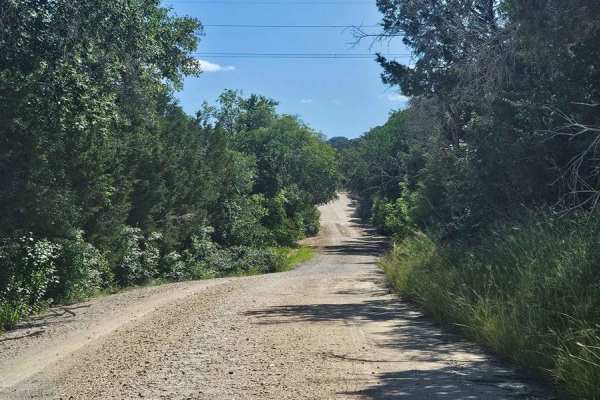
Typical central Texas dirt county road that only gets maintenance after rain washes it out. This is a nice side diversion to enjoy a few miles off of pavement while enjoying an old dirt road between old ranches. Drivers need to be aware of ranch and farm traffic on this tight road with sharp ditches...
Learn more about Bosque 1035
Honey Creek Trail #14
Honey Creek Trail #14 is an ideal route for beginners and stock vehicles looking for a scenic drive through the famous Katemcy Rocks off-road park. This easy-going trail serves as a scenic connector to more challenging areas of the park, allowing drivers to appreciate the unique terrain without high...
Learn more about Honey Creek Trail #14
Easy Street
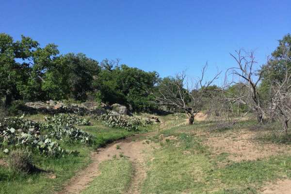
Easy Street starts off of Honey Creek Trail and is a very short, easy dirt trail that runs along a dry creek bottom and is a crossover to other trails in the park. Along the way is access to two extreme trails - Train Wreck and Dark Side. After rains, Easy Street can have muddy sections in the creek...
Learn more about Easy Street
Lambourghini Lane
Lambourghini Lane is rated an easy Green trail, which for the most part is correct. There is 2-way traffic so it can be accessed from Honey Creek Trail or the Blue-rated section of Cyclops. The trail is a mixture of dirt, rock shelves, and boulder fields and there are no bypasses. If coming in at th...
Learn more about Lambourghini Lane
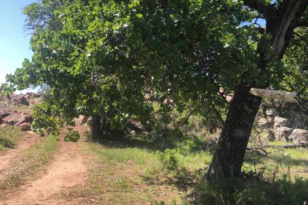
Most Wanted
Most Wanted is rated a moderate Blue trail by the park. It is one-way only and starts at the somewhat hidden trail sign on the ranch road. There are 2 ways to run this trail--the easy way through the bypasses or the hard way. At the entrance, you must carefully pick your way thru the large boulder f...
Learn more about Most Wanted
Devils Draw - Harder Section
Devils Draw - Harder Section, also known as Trail #7 on the Katemcy Rocks map, is a short but challenging connector trail designed for off-roaders looking to navigate between key sections of the park while testing their vehicle's articulation. Spanning just under two-tenths of a mile with minimal el...
Learn more about Devils Draw - Harder Section
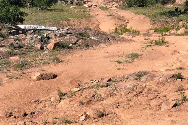
Bluebonnet Gang
Bluebonnet Gang can be accessed from Easter Egg Trail or the Park's Ranch Road. It is a dirt/rock Green-rated easy trail, however, it has a Blue-rated moderate obstacle at the very beginning (or end depending on which direction it is approached) in the form of a 3 foot ledge. Lockers and a minimum o...
Learn more about Bluebonnet Gang
Cyclops Access
Cyclops Access is a short but demanding connector trail built for experienced offroaders looking to reach the most technical sections of the Cyclops trail system while also providing access to the easier Lamborghini Lane. Despite its limited length, this route features consistently rocky terrain tha...
Learn more about Cyclops Access
Easter Eggs #16
Trail #16 is an easy-rated access road that serves as a primary connector to several of K2's most popular trail systems, making it ideal for drivers looking to reach more technical terrain without an immediately challenging approach. While the route itself is considered easy, expect a rough, rocky s...
Learn more about Easter Eggs #16
FENCELINE #11
Fenceline #11 is a popular, moderate off-road trail within the Katemcy Rocks off-road park near Mason, Texas, offering intermediate drivers an engaging experience with excellent visibility and access to several challenging optional obstacles. Running across the signature granite dome terrain of the ...
Learn more about FENCELINE #11
Devils Draw #7
Devils Draw #7 is a beginner-friendly sandy connector route ideal for stock 4x4s, OHVs, and novice drivers looking for an accessible way to navigate the trail network at the Katemcy Rocks off-road park. Spanning approximately 0.3 miles with a gentle descent of about 33 feet, this trail is designated...
Learn more about Devils Draw #7
ATV trails near Zephyr, Texas
Explore ATV-friendly trails near you. These trails are accessible for vehicles up to 50 inches wide, perfect for ATVs and smaller off-road machines.
UTV/side-by-side trails near Zephyr, Texas
Find UTV and side-by-side trails near you. These trails accommodate vehicles up to 60 inches wide, ideal for UTVs, side-by-sides, and wider off-road rigs.
Easter Eggs #16
Trail #16 is an easy-rated access road that serves as a primary connector to several of K2's most popular trail systems, making it ideal for drivers looking to reach more technical terrain without an immediately challenging approach. While the route itself is considered easy, expect a rough, rocky s...
Learn more about Easter Eggs #16
The onX Offroad Difference
onX Offroad combines trail photos, descriptions, difficulty ratings, width restrictions, seasonality, and more in a user-friendly interface. Available on all devices, with offline access and full compatibility with CarPlay and Android Auto. Discover what you're missing today!
Open Trail Map