
Off-Road Trails
Near Winchester, Tennessee
Off-Road Trails Near Winchester, Tennessee
Discover the best offroad trails near you. Browse trail maps, check difficulty ratings, and find your next adventure — whether you're looking for a quick ride or an all-day expedition.
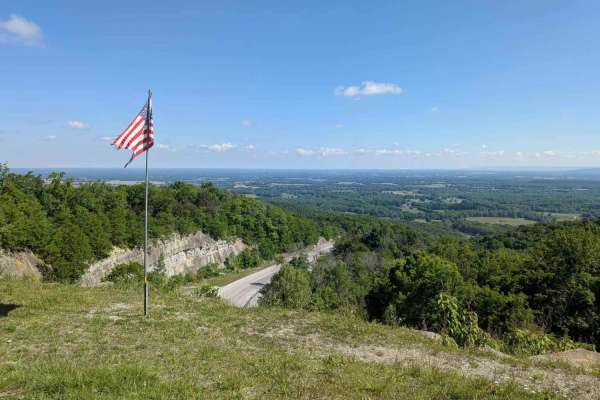
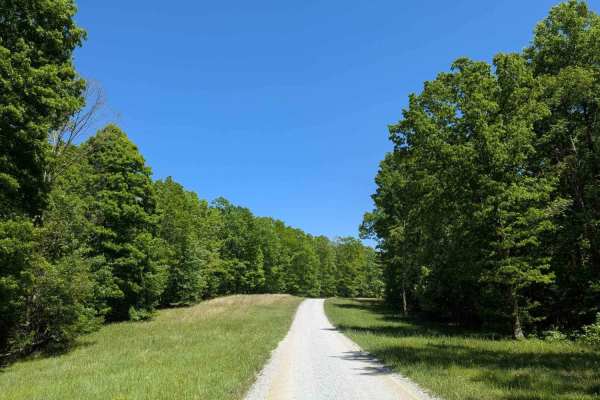
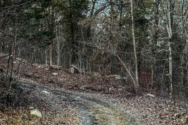
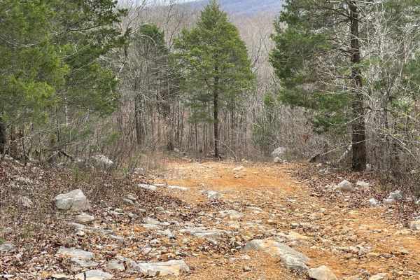
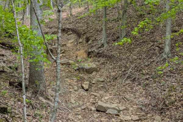
Old Rowe Gap Road
Old Rowe Gap Road is a steep, winding trail that branches off Rowe Gap Road and connects to Iron Gap Road. At the south end, you’ll find Miller Gap Overlook, a great spot to stop and take in the scenic beauty of the Cumberland Plateau. The trail surface is a mix of loose gravel, sections of tar-and-...
Learn more about Old Rowe Gap Road

Joe Carter Way
IMPORTANT: This trail is only open during Tennessee hunting seasons, typically from mid-August through late May. Visitors should reference the Tennessee Wildlife Resources Agency website for current access dates and regulations before visiting. Joe Carter Way is a 1.6-mile dirt trail that branches o...
Learn more about Joe Carter Way
Turnpike Road
IMPORTANT: This trail is only open during Tennessee hunting seasons, typically from mid-August through late May. Visitors should reference the Tennessee Wildlife Resources Agency website for current access dates and regulations before visiting. Turnpike Road is a 2.5-mile gravel trail that leads int...
Learn more about Turnpike Road
Paint Rock Trail
IMPORTANT: This trail is only open during Tennessee hunting seasons, typically from mid-August through late May. Visitors should reference the Tennessee Wildlife Resources Agency website for current access dates and regulations before visiting. Paint Rock Trail is a 3-mile gravel trail that leads in...
Learn more about Paint Rock Trail
Bear Hollow Road
IMPORTANT: This trail is only open during Tennessee hunting seasons, typically from mid-August through late May. Visitors should reference the Tennessee Wildlife Resources Agency website for current access dates and regulations before visiting. Bear Hollow Road is a 2.5-mile gravel trail that leads ...
Learn more about Bear Hollow Road
Poplar Springs Road
IMPORTANT: This trail is only open during Tennessee hunting seasons, typically from mid-August through late May. Visitors should reference the Tennessee Wildlife Resources Agency website for current access dates and regulations before visiting. Poplar Springs Road is a 3.2-mile gravel trail that lea...
Learn more about Poplar Springs Road
Betsy Gap Trail
This is a bi-directional trail that connects Little Coon River Trail to Poplar Springs Trail. When running from Little Coon River Trail, you will start out by climbing up an area of large slick rock and dirt. Some areas on the elevation change will be loose rock that can cause some traction issues. ...
Learn more about Betsy Gap Trail
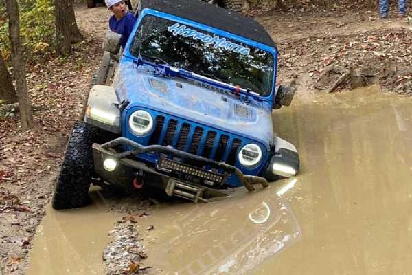
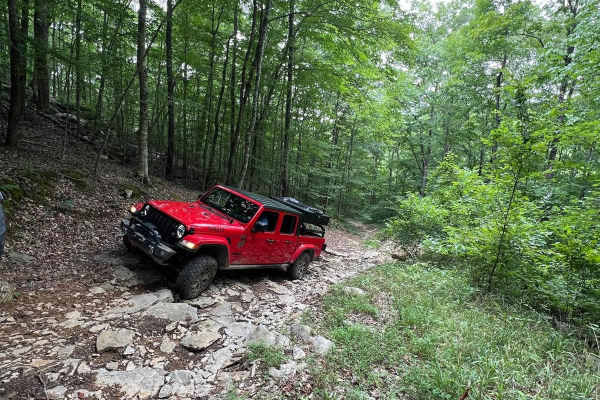
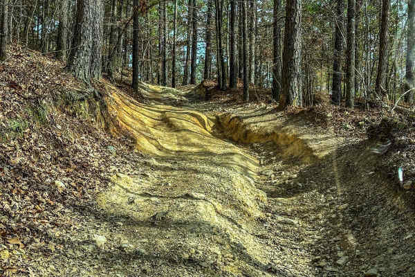
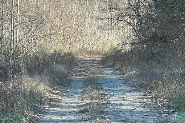
Powerline to Jumpoff Road
Some dirt and gravel road with washouts and ruts some of which are very deep. Must have a winch and off-road tires as the terrain varies. Mud holes that can be very deep. Several technical rocky climbs along the way and due to elevation changes, may need a spotter to see the line to get through with...
Learn more about Powerline to Jumpoff Road
Whites Gap Road
Whites Gap Road is a public road in southern Tennessee, located just north of the Alabama border. The route is primarily gravel with several rocky creek crossings that can add a bit of challenge depending on conditions. Traveling from north to south, you’ll encounter a creek crossing with a steep em...
Learn more about Whites Gap Road
Poplar Springs Trail
This trail can be run in either direction but is best run from North to South. Starting at the North part you will head South. The trail is mostly down the mountain. There are areas that have large mud areas that will be slick and can be deep depending on the time of year. A few areas have some dro...
Learn more about Poplar Springs Trail
Upper Ridge Trail
This trail is smoother than the surrounding trails it connects to. Once you come off the Evans Ridge Trail, you can turn left and continue onto many other trails. If you take a left, you can also exit the area and reach the main road. Continuing left onto the Upper Ridge Trail, you'll encounter a va...
Learn more about Upper Ridge Trail
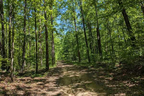
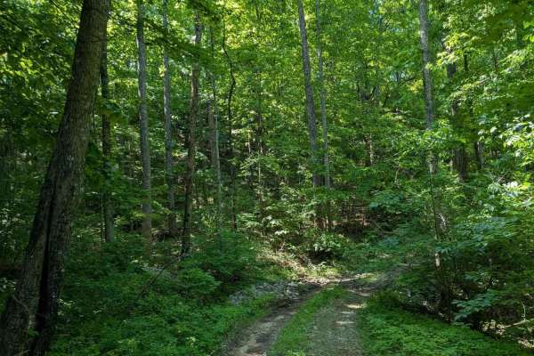
Overlook
This trail has off-camber terrain and deep ruts with some mud holes along the way up. Once there, it is a beautiful view of the valley and mountains! Also, a short walk to the right at the trail's end will take you to a waterfall. If it has rained, it's an especially beautiful sight.
Learn more about Overlook
Mountain Bypass Trail
This Trail connects near the end of the Tate's Cove trail to the intersection of Upper Ridge Trail and Little Coon River Trail. This is a bi-directional trail but there are very few places that two vehicles will be able to pass. The trail section closest to Tate's Cove Trail starts out by going thro...
Learn more about Mountain Bypass Trail

Counts Road
Counts Road is a public gravel road that winds through the farmland of southern Middle Tennessee. It connects Highway 22 to Old Highway 22, offering a fun and scenic alternative to the paved route. The road is very flat, well-maintained, and suitable for an easy countryside drive. At the intersectio...
Learn more about Counts Road

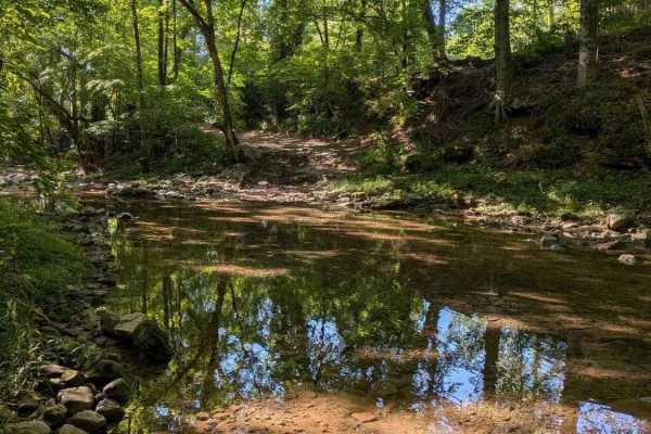
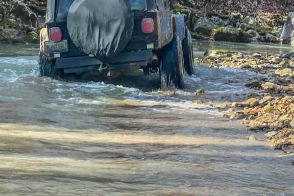
Little Coon River Trail
This trail is I bi-directional trail that connects the start of the James D. Martin Skyline WMA to the Upper Ridge Trail and Mountain Bypass Trail. This is an easy-to-moderate trail with multiple water crossings. The water level is dependent upon the season and the recent rain. More water will be in...
Learn more about Little Coon River Trail
Evan's Ridge
This Trail starts past the Skyline sign and heads up the hill to the right. The first hill is steep and rocky. If wet it can be slick. It continues up the side of the mountain and levels off for around half a mile. The trail has some areas that can hold water and have some sandy mud. The trail meets...
Learn more about Evan's Ridge
Hytop
This trail is best run from east to west but can be run both ways. If ran from east to west, you will come into the Skyline WMA where this track is located. As you enter the area you will come to a fork. Take the left trail and cross the creek. Depending on the time of year there may or may not be w...
Learn more about Hytop
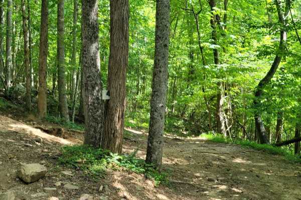
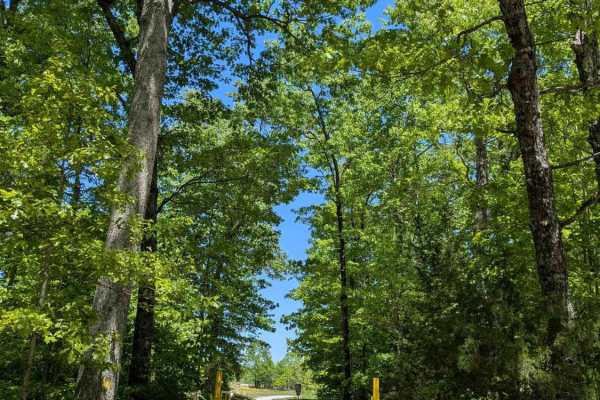
Trail 4
AOP Trail 4 - Mars is a short and simple connector trail that features a hard-packed route with lots of smaller rocks with little to no mud. While Trail 4 - Mars does not have any difficult features, it is a great trail to tie into others to make a good cruising route.
Learn more about Trail 4
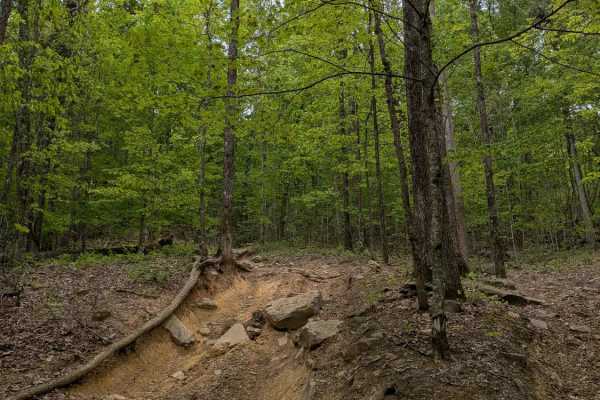
Trail 90
Trail 90 is a steep, winding trail at the top of the park with a lot of rock obstacles approaching 2 to 3 feet tall. The park rating for this trail is Blue (Moderate). A Park Day-Use Trail Pass is required to access this system of trails. Cell service is spotty in places, and trail conditions can ch...
Learn more about Trail 90
JW1
JW1 is a short, steep trail that connects Trails 4 and 17. Its main obstacle is a deep rut in a turn at the top of the hill. The trail is named after Jeeps and Wrenches, a club based in Nashville that originally cleared this trail. The park rating for this trail is Blue (Moderate). A Park Day-Use Tr...
Learn more about JW1
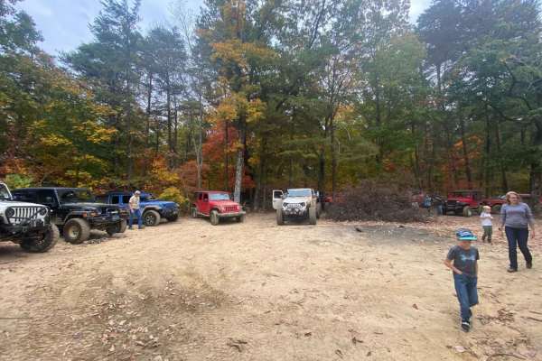
ATV trails near Winchester, Tennessee
Explore ATV-friendly trails near you. These trails are accessible for vehicles up to 50 inches wide, perfect for ATVs and smaller off-road machines.
Powerline to Jumpoff Road
Some dirt and gravel road with washouts and ruts some of which are very deep. Must have a winch and off-road tires as the terrain varies. Mud holes that can be very deep. Several technical rocky climbs along the way and due to elevation changes, may need a spotter to see the line to get through with...
Learn more about Powerline to Jumpoff Road
Overlook
This trail has off-camber terrain and deep ruts with some mud holes along the way up. Once there, it is a beautiful view of the valley and mountains! Also, a short walk to the right at the trail's end will take you to a waterfall. If it has rained, it's an especially beautiful sight.
Learn more about Overlook
Trail 4
AOP Trail 4 - Mars is a short and simple connector trail that features a hard-packed route with lots of smaller rocks with little to no mud. While Trail 4 - Mars does not have any difficult features, it is a great trail to tie into others to make a good cruising route.
Learn more about Trail 4
Trail 90
Trail 90 is a steep, winding trail at the top of the park with a lot of rock obstacles approaching 2 to 3 feet tall. The park rating for this trail is Blue (Moderate). A Park Day-Use Trail Pass is required to access this system of trails. Cell service is spotty in places, and trail conditions can ch...
Learn more about Trail 90
UTV/side-by-side trails near Winchester, Tennessee
Find UTV and side-by-side trails near you. These trails accommodate vehicles up to 60 inches wide, ideal for UTVs, side-by-sides, and wider off-road rigs.
Powerline to Jumpoff Road
Some dirt and gravel road with washouts and ruts some of which are very deep. Must have a winch and off-road tires as the terrain varies. Mud holes that can be very deep. Several technical rocky climbs along the way and due to elevation changes, may need a spotter to see the line to get through with...
Learn more about Powerline to Jumpoff Road
Poplar Springs Trail
This trail can be run in either direction but is best run from North to South. Starting at the North part you will head South. The trail is mostly down the mountain. There are areas that have large mud areas that will be slick and can be deep depending on the time of year. A few areas have some dro...
Learn more about Poplar Springs Trail
Overlook
This trail has off-camber terrain and deep ruts with some mud holes along the way up. Once there, it is a beautiful view of the valley and mountains! Also, a short walk to the right at the trail's end will take you to a waterfall. If it has rained, it's an especially beautiful sight.
Learn more about Overlook
Trail 4
AOP Trail 4 - Mars is a short and simple connector trail that features a hard-packed route with lots of smaller rocks with little to no mud. While Trail 4 - Mars does not have any difficult features, it is a great trail to tie into others to make a good cruising route.
Learn more about Trail 4
The onX Offroad Difference
onX Offroad combines trail photos, descriptions, difficulty ratings, width restrictions, seasonality, and more in a user-friendly interface. Available on all devices, with offline access and full compatibility with CarPlay and Android Auto. Discover what you're missing today!
Open Trail Map