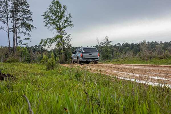
Off-road trails in undefined

Off-Road TrailsUnited States of AmericaRichland, Mississippi

Off-Road Trails Near Richland, Mississippi

Trail Length
Technical Rating
Best Time of Year
Sort By

Off-Road Trails Near Richland, Mississippi

Discover the best offroad trails near you. Browse trail maps, check difficulty ratings, and find your next adventure — whether you're looking for a quick ride or an all-day expedition.
Learn more about Bienville Scenic Trail
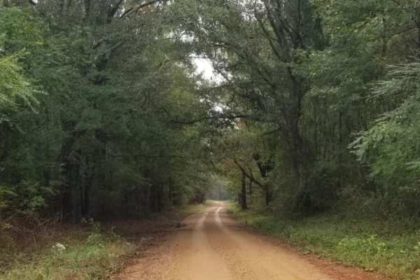
Bienville Scenic Trail

Bienville Scenic Trail

This is a scenic trail that goes north/south through the Bienville National Forest and some private land northeast of Jackson, MS. It's perfect for a short afternoon drive away from the busy city life. This trail is flat and well-maintained as it goes through the woods of the southeast US. Part of t...
Learn more about Bienville Scenic Trail
Total Miles
13.9
Tech Rating
1Easy
Best Time
Spring, Summer, Fall, Winter
Learn more about Pine Tar Corner
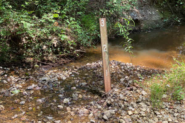
Pine Tar Corner

Pine Tar Corner

This is the southwest corner of Beinville National Forest. The trail is made up of 3 roads in this order, USFS Road 516, Smith County Road 521, and USFS Road 521-A. This is a pretty easy trail as long as you have 4wd. The end of this trail on USFS road 521-A isn't well maintained. USFS Rd 521-A coul...
Learn more about Pine Tar Corner

Total Miles
7.5
Tech Rating
3Easy
Best Time
Fall
Learn more about NF550
NF550

NF550

As you enter this trailhead you'll be on hard packed gravel that slowly turns into washouts, so keep a slower pace. As you advance down the trail you'll notice that the woods turn to cutover, soon after that you'll find some deep ruts that are extremely muddy when wet. The majority of this trail is ...
Learn more about NF550
Total Miles
4.9
Tech Rating
2Easy
Best Time
Spring, Summer, Fall, Winter
Learn more about FS 533
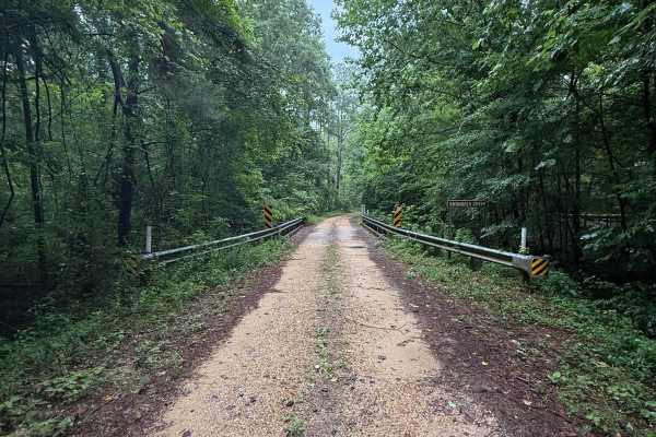
FS 533

FS 533

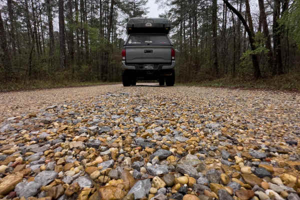
As you turn off Highway 35 onto FS 533, there will be well-maintained, hard-packed gravel for a while. Then, as you traverse the trail, the first obstacle is a gnarly washout that spans across the width of the road, followed by a muddy downhill descent. You'll eventually come across a bridge over Sh...
Learn more about FS 533
Total Miles
1.9
Tech Rating
2Easy
Best Time
Summer, Spring, Fall, Winter
Learn more about FS 527/FS 527A
FS 527/FS 527A

FS 527/FS 527A

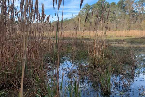
This forest service road is located right outside of Raleigh on Highway 35 in the Shongelo Ranger District. FS527 runs right into FS527A and that road dead ends into a 3 rig-sized campsite where you're very likely to see wildlife. This particular road is very well maintained other than a few spots w...
Learn more about FS 527/FS 527A
Total Miles
2.5
Tech Rating
1Easy
Best Time
Spring, Summer, Fall, Winter
Learn more about Beinville NF (Lena to Laurel)
Beinville NF (Lena to Laurel)

Beinville NF (Lena to Laurel)

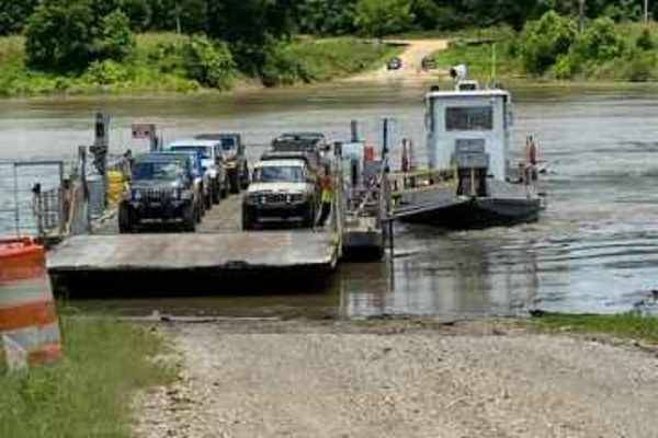
This trail is in the Beinville National Forest and it's all hard packed gravel from Hillsboro Ludlow Road to Highway 13 just North of Morton city limits. It has tons of turns that you can make to further your adventure, you can make loops back to the main trail. Be careful getting off of the main tr...
Learn more about Beinville NF (Lena to Laurel)

Total Miles
13.9
Tech Rating
1Easy
Best Time
Fall
Learn more about Kings Point Island
Kings Point Island

Kings Point Island

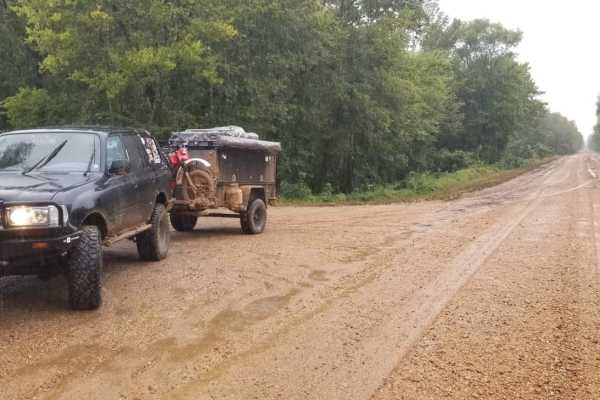
You can only reach Kings Point Island via Ferry. Begin your trip on Kings Point Ferry Road, which at the beginning consists of both gravel and asphalt, but don't let the asphalt fool you, it's just as bumpy as the gravel road. The trip to the ferry is 9 miles. You will pass many fields of soybeans, ...
Learn more about Kings Point Island
Total Miles
24.7
Tech Rating
1Easy
Best Time
Summer
Learn more about Delta NF, Sunflower WMA Access Road
Delta NF, Sunflower WMA Access Road

Delta NF, Sunflower WMA Access Road

This is a main access road to Sunflower Wildlife Management Area on the Delta National Forest unit north of Vicksburg. The road is atop a levee, and is flat and featureless, but leads towards a large number of campgrounds, trailheads and recreation opportunities on the Delta NF. Be aware that this a...
Learn more about Delta NF, Sunflower WMA Access Road

Total Miles
4
Tech Rating
1Easy
Best Time
Spring, Summer, Fall, Winter
Learn more about Pearl River Run
Pearl River Run

Pearl River Run

This trail starts on pavement and very quickly turns to gravel on St. Anne Road. This trail could be extremely difficult after a fair amount of rain. This trail is a poorly maintained gravel road with tons of washouts, sandy flats, and muddy ruts. Be prepared for a self-recovery if need be. There is...
Learn more about Pearl River Run

Total Miles
7.2
Tech Rating
4Moderate
Best Time
Spring, Summer, Fall, Winter
Learn more about HCNF 103B Cheek Trail
HCNF 103B Cheek Trail

HCNF 103B Cheek Trail

This trail located in the Homochitto National Forest is an old logging trail that leads to a large open clearing area that can be used for dispersed and primitive camping. There are spurs along the trail to explore and the route has some great views of deep spurs and ridge lines.It should be noted t...
Learn more about HCNF 103B Cheek Trail

Total Miles
1.4
Tech Rating
1Easy
Best Time
Spring, Summer, Fall, Winter
Learn more about HCNF 102E Trail
HCNF 102E Trail

HCNF 102E Trail

This trail, located in the Homochitto National Forest, is a newer logging trail that leads to various spurs and other trails. The views on this rouge has vast areas of recently logged ridge lines and draws that allow for some long views of the horizon. It should be noted that some spurs have posted ...
Learn more about HCNF 102E Trail

Total Miles
7.1
Tech Rating
1Easy
Best Time
Spring, Summer, Fall, Winter
Learn more about HCNF Woodlawn Trail
HCNF Woodlawn Trail

HCNF Woodlawn Trail

The Hommochitto National Forest Woodland Trail follows several trail sections including Hiram Road, Stump Road, Woodland Lane, 126A, and Davidson Road. This trail follows routes through the HCNF Pine Forest and connects to old logging operations. Some of the areas along the route will serve as possi...
Learn more about HCNF Woodlawn Trail

Total Miles
7.1
Tech Rating
2Easy
Best Time
Spring, Summer, Fall, Winter
Learn more about HCNF Swayze Trace Trail
HCNF Swayze Trace Trail

HCNF Swayze Trace Trail

This Hommochitto National Forest Trail follows the Swayze Trace and an unnamed trail spur that ends on a hardtop road (Perrytown Road). Much of the main trail is gravel, but once you enter the trail spur the route reduces to a one-lane constricted trail with bush coverage on much of the trail. Along...
Learn more about HCNF Swayze Trace Trail

Total Miles
6.3
Tech Rating
2Easy
Best Time
Spring, Summer, Fall, Winter
Learn more about Homochitto National Forest Trail 126B
Homochitto National Forest Trail 126B

Homochitto National Forest Trail 126B

This trail is located on the far western side of the Homochitto National Forest. The trail follows ridge lines along pine forest areas that allow trees to be well-spaced with undergrowth areas that provide great views along the entire route. Some of the areas have previously been part of logging ope...
Learn more about Homochitto National Forest Trail 126B

Total Miles
3
Tech Rating
2Easy
Best Time
Spring, Summer, Fall, Winter
Learn more about Trail 9
Trail 9

Trail 9

This trail runs along the creek; it connects to the Creek Side and Silver Creek Trail. The trails at Bogue Chitto are intricately connected, allowing riders to create custom routes that can extend for hours. Intersections and side trails enable riders to modify their path, ensuring a unique experien...
Learn more about Trail 9

Total Miles
0.3
Tech Rating
3Easy
Best Time
Spring, Summer, Fall, Winter
Learn more about Creek Side
Creek Side

Creek Side

Creek Side at Bogue Chitto ATV Park is a dynamic and adventurous trail that winds alongside the scenic Silver Creek, offering a blend of natural beauty and technical challenges. The terrain is a mix of soft sand and muddy patches, with sharp turns, steep inclines, and occasional washouts that test y...
Learn more about Creek Side

Total Miles
1.3
Tech Rating
6Moderate
Best Time
Spring, Summer, Fall, Winter
Learn more about Trail 3
Trail 3

Trail 3

The trails at Bogue Chitto are intricately connected, allowing riders to create custom routes that can extend for hours. Intersections and side trails enable riders to modify their path, ensuring a unique experience each time. The trail system is designed to be intuitive, with clear signage and well...
Learn more about Trail 3

Total Miles
0.1
Tech Rating
3Easy
Best Time
Spring, Summer, Fall, Winter
Learn more about Old Creek Bed
Old Creek Bed

Old Creek Bed

The trails at Bogue Chitto are intricately connected, allowing riders to create custom routes that can extend for hours. Intersections and side trails enable riders to modify their path, ensuring a unique experience each time. The trail system is designed to be intuitive, with clear signage and well...
Learn more about Old Creek Bed

Total Miles
0.1
Tech Rating
3Easy
Best Time
Spring, Summer, Fall, Winter
Learn more about Secondary Main Trail
Secondary Main Trail

Secondary Main Trail

This trail winds through a partially forested area, where moisture and terrain create a consistently muddy surface--especially after rainfall or in humid climates. The path ranges from narrow singletrack to wider open sections, often with slippery, uneven footing. The challenge lies not just in the ...
Learn more about Secondary Main Trail

Total Miles
0.7
Tech Rating
3Easy
Best Time
Spring, Summer, Fall, Winter
Learn more about Silver Creek Crossings
Silver Creek Crossings

Silver Creek Crossings

Enjoy a beautiful scenic route through Spring Creek's 4 Crossings at the park. Take a short trail ride to see the beautiful setting Native American's chose to settle hundreds of years ago. Many arrowheads have been found along this creek. This is a great spot to stop and let the kids swim or put you...
Learn more about Silver Creek Crossings

Total Miles
0.5
Tech Rating
6Moderate
Best Time
Spring

ATV trails near Richland, Mississippi

Explore ATV-friendly trails near you. These trails are accessible for vehicles up to 50 inches wide, perfect for ATVs and smaller off-road machines.

Learn more about Pine Tar Corner
Pine Tar Corner

Pine Tar Corner

This is the southwest corner of Beinville National Forest. The trail is made up of 3 roads in this order, USFS Road 516, Smith County Road 521, and USFS Road 521-A. This is a pretty easy trail as long as you have 4wd. The end of this trail on USFS road 521-A isn't well maintained. USFS Rd 521-A coul...
Learn more about Pine Tar Corner

Total Miles
7.5
Tech Rating
3Easy
Best Time
Fall
Learn more about NF550
NF550

NF550

As you enter this trailhead you'll be on hard packed gravel that slowly turns into washouts, so keep a slower pace. As you advance down the trail you'll notice that the woods turn to cutover, soon after that you'll find some deep ruts that are extremely muddy when wet. The majority of this trail is ...
Learn more about NF550

Total Miles
4.9
Tech Rating
2Easy
Best Time
Spring, Summer, Fall, Winter
Learn more about FS 533
FS 533

FS 533

As you turn off Highway 35 onto FS 533, there will be well-maintained, hard-packed gravel for a while. Then, as you traverse the trail, the first obstacle is a gnarly washout that spans across the width of the road, followed by a muddy downhill descent. You'll eventually come across a bridge over Sh...
Learn more about FS 533

Total Miles
1.9
Tech Rating
2Easy
Best Time
Summer, Spring, Fall, Winter
Learn more about Beinville NF (Lena to Laurel)
Beinville NF (Lena to Laurel)

Beinville NF (Lena to Laurel)

This trail is in the Beinville National Forest and it's all hard packed gravel from Hillsboro Ludlow Road to Highway 13 just North of Morton city limits. It has tons of turns that you can make to further your adventure, you can make loops back to the main trail. Be careful getting off of the main tr...
Learn more about Beinville NF (Lena to Laurel)

Total Miles
13.9
Tech Rating
1Easy
Best Time
Fall

UTV/side-by-side trails near Richland, Mississippi

Find UTV and side-by-side trails near you. These trails accommodate vehicles up to 60 inches wide, ideal for UTVs, side-by-sides, and wider off-road rigs.

Learn more about Pine Tar Corner
Pine Tar Corner

Pine Tar Corner

This is the southwest corner of Beinville National Forest. The trail is made up of 3 roads in this order, USFS Road 516, Smith County Road 521, and USFS Road 521-A. This is a pretty easy trail as long as you have 4wd. The end of this trail on USFS road 521-A isn't well maintained. USFS Rd 521-A coul...
Learn more about Pine Tar Corner

Total Miles
7.5
Tech Rating
3Easy
Best Time
Fall
Learn more about NF550
NF550

NF550

As you enter this trailhead you'll be on hard packed gravel that slowly turns into washouts, so keep a slower pace. As you advance down the trail you'll notice that the woods turn to cutover, soon after that you'll find some deep ruts that are extremely muddy when wet. The majority of this trail is ...
Learn more about NF550

Total Miles
4.9
Tech Rating
2Easy
Best Time
Spring, Summer, Fall, Winter
Learn more about FS 533
FS 533

FS 533

As you turn off Highway 35 onto FS 533, there will be well-maintained, hard-packed gravel for a while. Then, as you traverse the trail, the first obstacle is a gnarly washout that spans across the width of the road, followed by a muddy downhill descent. You'll eventually come across a bridge over Sh...
Learn more about FS 533

Total Miles
1.9
Tech Rating
2Easy
Best Time
Summer, Spring, Fall, Winter
Learn more about Beinville NF (Lena to Laurel)
Beinville NF (Lena to Laurel)

Beinville NF (Lena to Laurel)

This trail is in the Beinville National Forest and it's all hard packed gravel from Hillsboro Ludlow Road to Highway 13 just North of Morton city limits. It has tons of turns that you can make to further your adventure, you can make loops back to the main trail. Be careful getting off of the main tr...
Learn more about Beinville NF (Lena to Laurel)

Total Miles
13.9
Tech Rating
1Easy
Best Time
Fall

The onX Offroad Difference

onX Offroad combines trail photos, descriptions, difficulty ratings, width restrictions, seasonality, and more in a user-friendly interface. Available on all devices, with offline access and full compatibility with CarPlay and Android Auto. Discover what you're missing today!

Open Trail Map