
Off-Road Trails
Near Manhattan, Montana
Off-Road Trails Near Manhattan, Montana
Discover the best offroad trails near you. Browse trail maps, check difficulty ratings, and find your next adventure — whether you're looking for a quick ride or an all-day expedition.
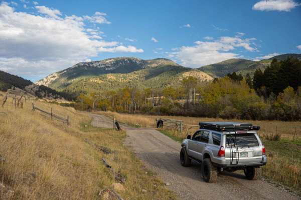
Dry Creek Road
Point-to-point, moderately traveled road north of Belgrade in the Gallatin Valley. Maintained dirt and gravel surface, typically two vehicles wide. Should not require 4WD in dry conditions. Expect muddy conditions when wet, and some drifting snow over the road in winter. If starting from the south, ...
Learn more about Dry Creek Road
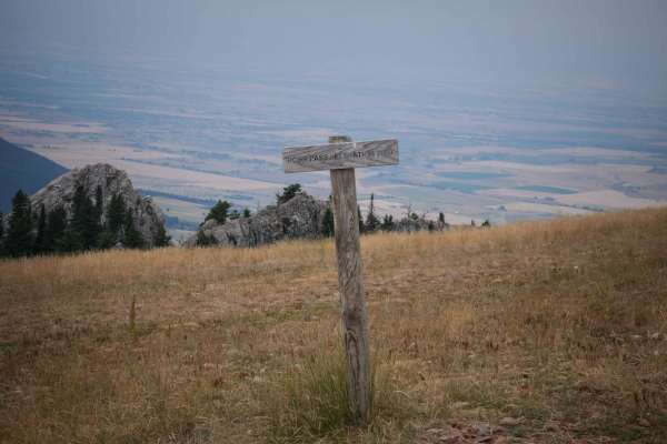
Flathead Pass
Flathead Pass is a short and sweet, easy trail filled with great views, a few off-camber sections, and some small to medium washouts. The trail starts after turning off Rocky Mountain Road and onto Flathead Pass Road. At first, it may seem like you are driving through a private ranch, but shortly af...
Learn more about Flathead Pass
Axtell Anceney Road
This point-to-point dirt and gravel two-lane road connects Highway 191 south of Four Corners to Norris Road west of Four Corners, offering a scenic alternative to the main highway. Portions of the road are unmaintained, and following recent snowmelt or rain, the surface can become very muddy and rut...
Learn more about Axtell Anceney Road
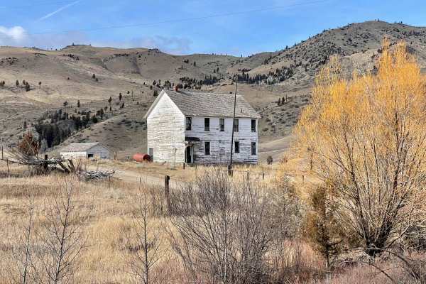
Buffalo Jump - Black Fords Fish Access
This is an easy trail with plenty of incredible scenery. Consisting of mostly dirt and gravel, the trail is typically maintained fairly well year-round. Depending on the time of year, you can expect to see bison roaming, a phenomenal view of the Madison River, and beautiful buttes and mountains. Alo...
Learn more about Buffalo Jump - Black Fords Fish Access
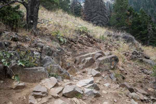
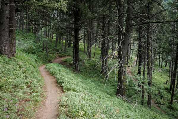
Corbly Gulch
Corbly Gulch is a 6.7-mile-long single track in the Gallatin National Forest north of Bozeman, Montana. From east to west, it's a steep descent almost the entire way, dropping down the mountain from the intersection of Bridger Ridge. It starts in the high elevation at the intersection with Bridger R...
Learn more about Corbly Gulch
Middle Cottonwood
The Middle Cottonwood Single Track starts on the west end at a small dirt parking lot on a well-maintained wide dirt path. There are many hikers on this trail, so please respect other users. It goes over a narrow wooden bridge and continues on an easy trail with some embedded rocks but mostly smooth...
Learn more about Middle Cottonwood
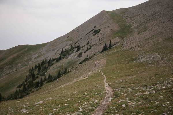
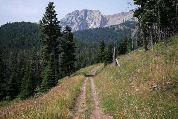
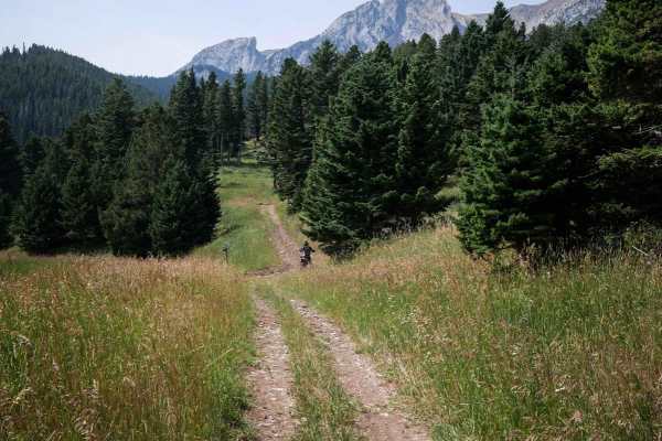
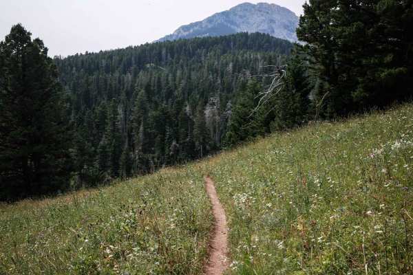
Bridger Ridge
Bridger Ridge is a top-tier single track in Montana's Bridger Mountain Range. It's full of incredible views and technical challenges and is mostly an epic skinny trail atop a ridge line around 8,000 feet elevation. It starts at the top of Ross Pass at the intersection with Upper Brackett Creek. It's...
Learn more about Bridger Ridge
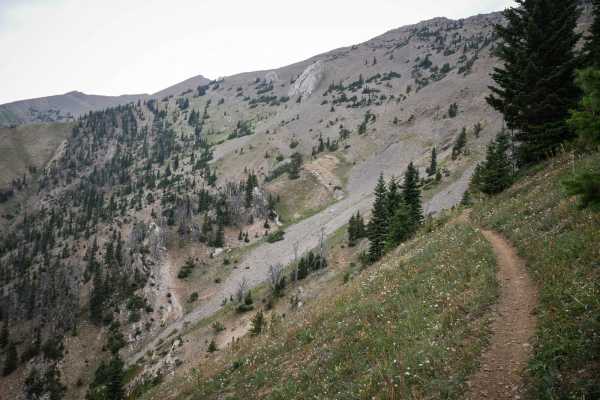
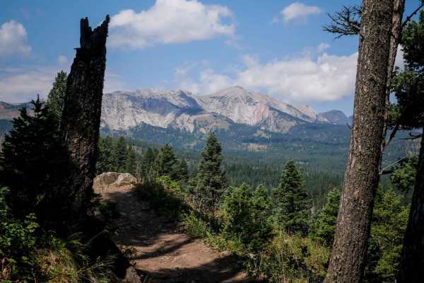
Bridger Foothills
Bridger Foothills is a long singletrack through the Gallatin National Forest, almost 7 miles long of challenging rocks, epic views, and technical switchbacks. The south end is more like a continuation of the Bridger Mountain trail. From the south, it starts on a narrow shelfy trail mid-way up the mo...
Learn more about Bridger Foothills
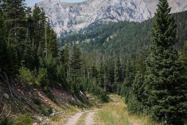
Ross Pass
Ross Pass is a 2.5-mile-long single track through the Gallatin National Forest. From the west end, it drops down from the summit of Ross Pass and the intersection with the Bridger Foothills, Bridger Ridge, and Upper Brackett Creek single tracks. It's a gradual descent the whole way, dropping 1,000 f...
Learn more about Ross Pass
Bridger Mountains
Bridger Mountain is 2.4 miles of single track with significant exposure and technical switchbacks, making it a challenging trail. The south end starts at the end of the Middle Cottonwood trail on an easy and flowy path with a few roots and rocks. Watch out for lots of hikers on this section of trail...
Learn more about Bridger Mountains
South Fork Flathead Creek
This is a 4.5-mile-long ATV trail designated for vehicles 50" or less. It's overall very easy, but does have some sections that have a bit of a rocky surface. The rocks are just small loose rocks and nothing that significantly increases the difficulty. It goes through beautiful grassy valleys undern...
Learn more about South Fork Flathead Creek
Carrol Creek
Carrol Creek is an easy 5 miles of ATV trail, designated for vehicles 50" or less. The south ends starts as a Jeep road, near the intersection with the Fairy Creek trail. After 1,000 feet or so, it turns into the ATV trail. It's still a very wide path though for the entire route. It goes pretty stra...
Learn more about Carrol Creek
Benchmark
Benchmark is a 1.5-mile long 50" trail through the Gallatin National Forest north of Bozeman, Montana. It's easy for the entire route, going through grassy valleys on an overgrown dirt trail. This one looks less ridden, with grass growing down the middle of the trail, and not many tracks. It starts...
Learn more about Benchmark
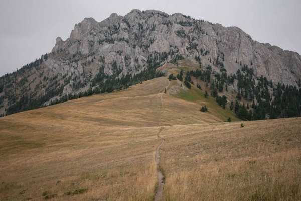
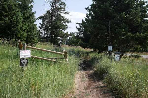
Truman Gulch
Truman Gulch is an easy spur trail off of the Bridger Foothills trail that descends 1,400 feet down to the Truman Gulch Trailhead. It looks like there has been a lot of trail maintenance on this to clear it of rocks, bench out any ruts, and make it overall very smooth and flowy, as it is also a popu...
Learn more about Truman Gulch
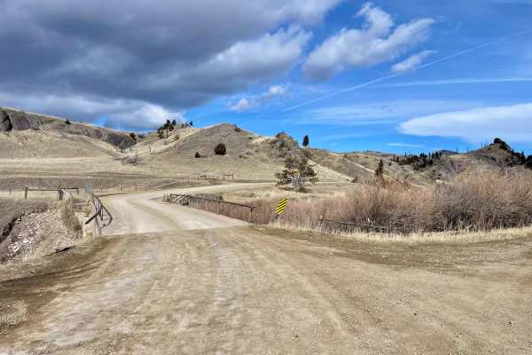
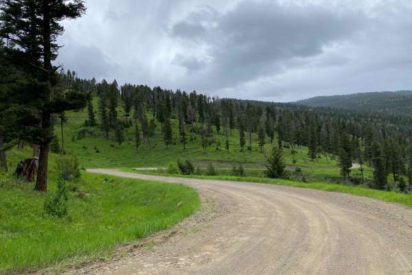
Sixteen Mile Creek Road
The track begins from the town of Maudlow from the south. From the north, it can be accessed from Meadow Creek Road via the town of Ringling. The track begins when you cross from Meagher County to Gallatin County. This is a point-to-point, one-lane dirt and gravel road with room to pass in plenty of...
Learn more about Sixteen Mile Creek Road
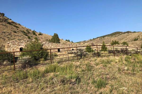
Lombard Coke Ovens
Traveling this rough clay-based gravel road between Toston and Lombard, you can expect to see range cattle, prickly pear cacti, plenty of sagebrush, and rattlesnakes. Use extreme caution on this road in the rain. Numerous washouts could make it dangerous. As you gain more than 1,300 feet in elevatio...
Learn more about Lombard Coke Ovens
Upper Brackett Creek
Upper Brackett Creek Single Track is an easy and really scenic single track through the Gallatin National Forest north of Bozeman, Montana in the Bridger Mountain Range. It's a narrow skinny single track through wide open grassy meadows, with few white fir trees lining the trail. This one is fast, f...
Learn more about Upper Brackett Creek
Fairy Creek - FS 500
Fairy Creek is an ATV Trail for vehicles 50" or less. It's also a snowmobile path after December 2. It leaves from the Battle Ridge dirt parking lot on the west side of Highway 86 and starts out as a wide, smooth, dirt path lined with tall grass and white fir trees. It has wide-open views through th...
Learn more about Fairy Creek - FS 500
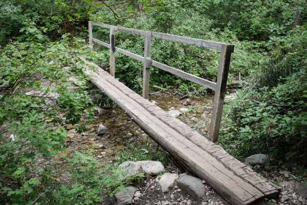
Bangtail Divide Trail #504
Bangtail Divide is an almost 13 mile long single track through the Gallatin National Forest. It starts at the Bracket Creek Trailhead off Highway 86, north of Bozeman, Montana. It leaves the large dirt parking lot by crossing a wooden bridge, then immediately goes into several easy and wide switchba...
Learn more about Bangtail Divide Trail #504
Start of Olsen Creek
The start of Olsen Creek Road is your basic gravel road, with somewhat deep potholes and parts of it washed out. There are no real obstacles or technical portions. There are tight switchbacks, so be mindful of oncoming traffic as well as the steep shoulders. There are privately owned parcels the rou...
Learn more about Start of Olsen Creek
ATV trails near Manhattan, Montana
Explore ATV-friendly trails near you. These trails are accessible for vehicles up to 50 inches wide, perfect for ATVs and smaller off-road machines.
Dry Creek Road
Point-to-point, moderately traveled road north of Belgrade in the Gallatin Valley. Maintained dirt and gravel surface, typically two vehicles wide. Should not require 4WD in dry conditions. Expect muddy conditions when wet, and some drifting snow over the road in winter. If starting from the south, ...
Learn more about Dry Creek Road
Flathead Pass
Flathead Pass is a short and sweet, easy trail filled with great views, a few off-camber sections, and some small to medium washouts. The trail starts after turning off Rocky Mountain Road and onto Flathead Pass Road. At first, it may seem like you are driving through a private ranch, but shortly af...
Learn more about Flathead Pass
Axtell Anceney Road
This point-to-point dirt and gravel two-lane road connects Highway 191 south of Four Corners to Norris Road west of Four Corners, offering a scenic alternative to the main highway. Portions of the road are unmaintained, and following recent snowmelt or rain, the surface can become very muddy and rut...
Learn more about Axtell Anceney Road
Buffalo Jump - Black Fords Fish Access
This is an easy trail with plenty of incredible scenery. Consisting of mostly dirt and gravel, the trail is typically maintained fairly well year-round. Depending on the time of year, you can expect to see bison roaming, a phenomenal view of the Madison River, and beautiful buttes and mountains. Alo...
Learn more about Buffalo Jump - Black Fords Fish Access
UTV/side-by-side trails near Manhattan, Montana
Find UTV and side-by-side trails near you. These trails accommodate vehicles up to 60 inches wide, ideal for UTVs, side-by-sides, and wider off-road rigs.
Dry Creek Road
Point-to-point, moderately traveled road north of Belgrade in the Gallatin Valley. Maintained dirt and gravel surface, typically two vehicles wide. Should not require 4WD in dry conditions. Expect muddy conditions when wet, and some drifting snow over the road in winter. If starting from the south, ...
Learn more about Dry Creek Road
Flathead Pass
Flathead Pass is a short and sweet, easy trail filled with great views, a few off-camber sections, and some small to medium washouts. The trail starts after turning off Rocky Mountain Road and onto Flathead Pass Road. At first, it may seem like you are driving through a private ranch, but shortly af...
Learn more about Flathead Pass
Axtell Anceney Road
This point-to-point dirt and gravel two-lane road connects Highway 191 south of Four Corners to Norris Road west of Four Corners, offering a scenic alternative to the main highway. Portions of the road are unmaintained, and following recent snowmelt or rain, the surface can become very muddy and rut...
Learn more about Axtell Anceney Road
Buffalo Jump - Black Fords Fish Access
This is an easy trail with plenty of incredible scenery. Consisting of mostly dirt and gravel, the trail is typically maintained fairly well year-round. Depending on the time of year, you can expect to see bison roaming, a phenomenal view of the Madison River, and beautiful buttes and mountains. Alo...
Learn more about Buffalo Jump - Black Fords Fish Access
The onX Offroad Difference
onX Offroad combines trail photos, descriptions, difficulty ratings, width restrictions, seasonality, and more in a user-friendly interface. Available on all devices, with offline access and full compatibility with CarPlay and Android Auto. Discover what you're missing today!
Open Trail Map