
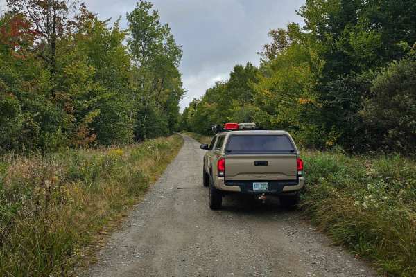
Off-Road Trails
Near Lincoln, New Hampshire
Off-Road Trails Near Lincoln, New Hampshire
Discover the best offroad trails near you. Browse trail maps, check difficulty ratings, and find your next adventure — whether you're looking for a quick ride or an all-day expedition.
Hubbard Brook Road
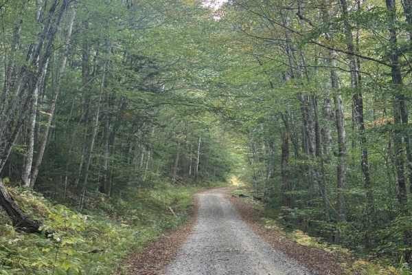
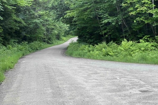
Hubbard Brook Road is a well-maintained U.S. Forest Service road located in the southwestern section of New Hampshire’s White Mountain National Forest. Conveniently accessed from Interstate 93, this route offers a quiet, scenic drive that sees far less traffic than many of the forest’s main corridor...
Learn more about Hubbard Brook Road
Tripoli Road
Tripoli Road is a well-maintained forest road that connects the Town of Waterville Valley to Thornton via a pass between Mt. Tecumseh and Mt. Osceola. This road is easily passable by any vehicle and is a popular road for access to hiking trails on Mt. Tecumseh and Mt. Osceola, as well as numerous ca...
Learn more about Tripoli Road
Gale River
Gale River is a well-maintained gravel road through White Mountain National Forest and has many hiking trails to access along the roadway. This winding and scenic roadway provides many views of the South Branch of the Gale River as well as designated dispersed campsites for tent and RV camping along...
Learn more about Gale River
Haystack Road
Haystack Road is a well-maintained gravel forest road that ends at the North Twin hiking trailhead. When we arrived, the Forest Service was grading the road that appears to be heavily traveled for hiking. 10 or so free designated dispersed campsites are marked along the roadway and can be utilized f...
Learn more about Haystack Road
Cherry Mountain
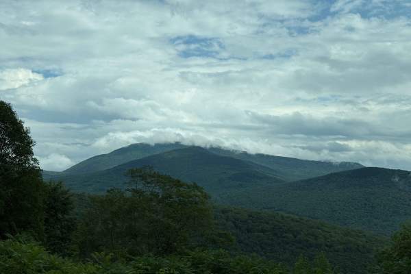
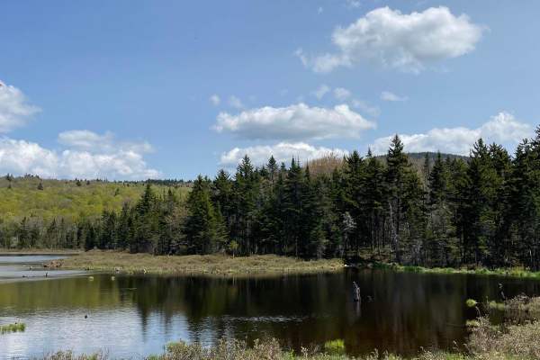
Cherry Mountain is a fun through road that climbs in elevation to an incredible alpine lake with a view of Mount Deception. Designated dispersed campsites are scattered along the road deep within the White Mountain National Forest. This road is well maintained gravel with some areas washed out in th...
Learn more about Cherry Mountain
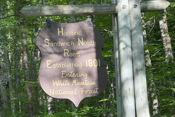
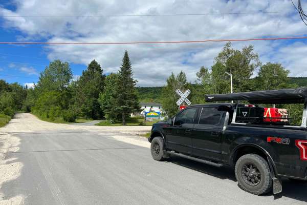
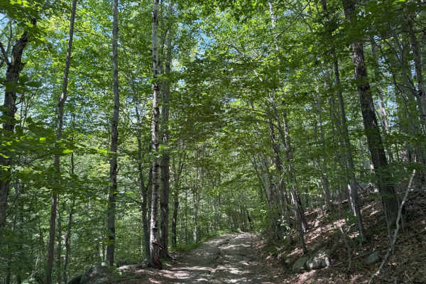
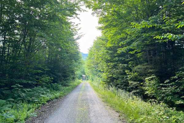
Sandwich Notch Road
Sandwich Notch Road is a well-maintained dirt forest road that runs between Thornton and Sandwich, New Hampshire, in the White Mountain National Forest. This iconic NH scenic byway was first established in 1801. This easy route has a lot of bang for your buck, as the scenery and views are breathtaki...
Learn more about Sandwich Notch Road
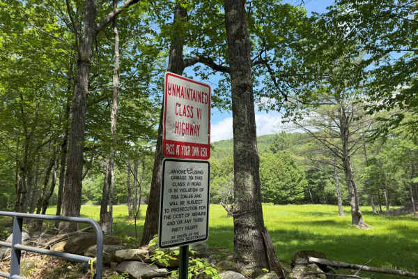
Thompson Road
Thompson Road is a "Class VI" public road in Sandwich, New Hampshire. The route is fairly easy and can be done in a stock 4WD vehicle. This route is an out-and-back, and is supposed to be longer, but was blocked by a gate at about 1.5 miles into the trail. This trail will take you up and down severa...
Learn more about Thompson Road
Mill Brook
Mill Brook is a short spur road in White Mountain National Forest that ends at a turnaround. There are large boulders blocking the remainder of the road that is presumed to be washed out from the nearby stream. A hiking trail continues on down the old roadway. This is a narrower forest road that see...
Learn more about Mill Brook

Top of the World
This trail will bring you along the powerlines on the Vermont side of Moore Reservoir. This trail is mainly made up of gravel roads with water bars, ascents, and descents. There are many many offshoots all along the way, from mild to wild. Following the main trail can be done by most AWD vehicles wi...
Learn more about Top of the World
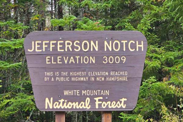
Jefferson Notch Road
Jefferson Notch Road is a pretty easy road that most vehicles can drive. That being said it makes it so more people can experience this road that winds next to a brook up into the mountains and brings you to the highest elevation reached by a public road in New Hampshire. Along this road, you can fi...
Learn more about Jefferson Notch Road
Pond Safety Road
This trail starts by following Ingerson Road where you will pass by a few old farmhouses and horse pastures. From there you will turn off onto a not very well marked road which is Pond of Safety Road. Along Pond of Safety Road, you will climb up the mountain on a decently developed dirt road through...
Learn more about Pond Safety Road
Wade Hill Road
Wade Hill Road is a Class 6 road in Hebron, NH. You can run it in both directions. Entering from the east side, you begin to ascend. You will reach the top in the middle of the trail. The trail travels through thick woods. It is muddy, has small ruts, and some loose, smaller rocks Weather will have...
Learn more about Wade Hill Road
Cass Road
Cass Road is a Class 6 road in Bridgewater, NH. This route can be driven in either direction. From East to West, it runs uphill for nearly the entire route with approximately 600 feet of elevation gain. This route is a good access road into the main part of the Class 6 road system in Bridgewater, as...
Learn more about Cass Road
Berry Hill to Old Country Road Loop
This great loop trail runs on Berry Hill and Old Country Class 6 roads in Bridgewater, NH. The trail starts and ends at the historic Bridgewater Town House (1806). Enter the access gate behind the Town House and begin an ascent up Berry Hill Road. The trail is fairly wet and covered with loose rocks...
Learn more about Berry Hill to Old Country Road Loop
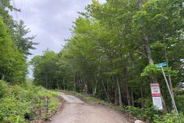
Talcott Road to Old Stage Road
This route starts out on Talcott Road and follows down to Old Stage Road in Bridgewater, NH. Both roads are Class 6 unmaintained roads. The entire route is a gradual descent, with some steep hills along the way. The route starts off with the million-dollar view from the trail's high point, overlooki...
Learn more about Talcott Road to Old Stage Road
Slippery Brook
This is a gravel road with many camping spots with some hiking trailheads. It is easily accessible by suv and maybe even a car. It is a great scenic view of the river both on the way to the trail and while on the trail. There are multiple gates that are closed depending on snow levels. It is not mai...
Learn more about Slippery Brook
Pine Mountain Notch (Dolly Copp Rd)
Pine Mountain Notch – Dolly Copp Road is a well-maintained forest road situated within the White Mountain National Forest. Typically closed during the winter months, the road provides a scenic connection between Randolph, New Hampshire, and Route 16 just south of Gorham. The route also affords acces...
Learn more about Pine Mountain Notch (Dolly Copp Rd)
East Branch Saco River
This is a well-maintained dirt gravel road with lots of pull-off spots to pop up camp and trailheads. It dead ends at a hiking trail. There are a lot of scenic views and a bridge crossing over the river. A campsite is next to the river and a small beaver pond are great locations.
Learn more about East Branch Saco River
New Colony - Orange Road
New Colony is a point-to-point trail running through the Cardigan Mountain State Forest. New Colony can be accessed and run from either direction. The terrain consists of rock, dirt, and weather-dependent mud. You can expect to encounter deep ruts, frequent washouts, and obstacles over two feet. Dow...
Learn more about New Colony - Orange Road
Jericho Mountain 4x4 Truck & Jeep Trail - Main Trail Extension
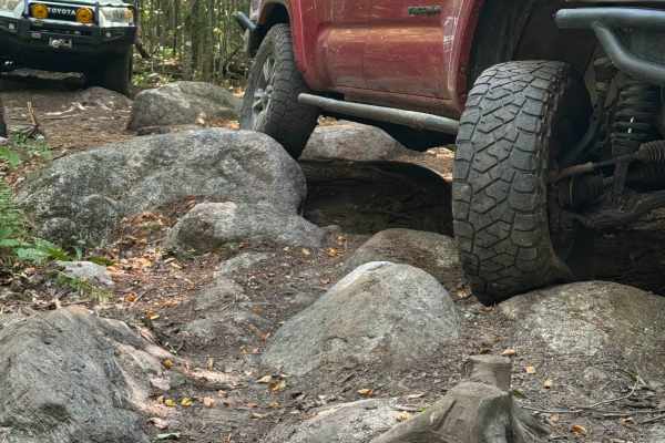
This route is rated "easiest" within the Jericho Mountain 4x4 Truck & Jeep Trail system, but it is slightly harder than the main trail. Continuing on after the turnaround loop at the end of the Main Trail, this is a tight technical route comprised mostly of rock gardens, stumps, deep ruts, and bould...
Learn more about Jericho Mountain 4x4 Truck & Jeep Trail - Main Trail Extension
ATV trails near Lincoln, New Hampshire
Explore ATV-friendly trails near you. These trails are accessible for vehicles up to 50 inches wide, perfect for ATVs and smaller off-road machines.
Top of the World
This trail will bring you along the powerlines on the Vermont side of Moore Reservoir. This trail is mainly made up of gravel roads with water bars, ascents, and descents. There are many many offshoots all along the way, from mild to wild. Following the main trail can be done by most AWD vehicles wi...
Learn more about Top of the World
Wade Hill Road
Wade Hill Road is a Class 6 road in Hebron, NH. You can run it in both directions. Entering from the east side, you begin to ascend. You will reach the top in the middle of the trail. The trail travels through thick woods. It is muddy, has small ruts, and some loose, smaller rocks Weather will have...
Learn more about Wade Hill Road
Cass Road
Cass Road is a Class 6 road in Bridgewater, NH. This route can be driven in either direction. From East to West, it runs uphill for nearly the entire route with approximately 600 feet of elevation gain. This route is a good access road into the main part of the Class 6 road system in Bridgewater, as...
Learn more about Cass Road
Berry Hill to Old Country Road Loop
This great loop trail runs on Berry Hill and Old Country Class 6 roads in Bridgewater, NH. The trail starts and ends at the historic Bridgewater Town House (1806). Enter the access gate behind the Town House and begin an ascent up Berry Hill Road. The trail is fairly wet and covered with loose rocks...
Learn more about Berry Hill to Old Country Road Loop
UTV/side-by-side trails near Lincoln, New Hampshire
Find UTV and side-by-side trails near you. These trails accommodate vehicles up to 60 inches wide, ideal for UTVs, side-by-sides, and wider off-road rigs.
Top of the World
This trail will bring you along the powerlines on the Vermont side of Moore Reservoir. This trail is mainly made up of gravel roads with water bars, ascents, and descents. There are many many offshoots all along the way, from mild to wild. Following the main trail can be done by most AWD vehicles wi...
Learn more about Top of the World
Wade Hill Road
Wade Hill Road is a Class 6 road in Hebron, NH. You can run it in both directions. Entering from the east side, you begin to ascend. You will reach the top in the middle of the trail. The trail travels through thick woods. It is muddy, has small ruts, and some loose, smaller rocks Weather will have...
Learn more about Wade Hill Road
Cass Road
Cass Road is a Class 6 road in Bridgewater, NH. This route can be driven in either direction. From East to West, it runs uphill for nearly the entire route with approximately 600 feet of elevation gain. This route is a good access road into the main part of the Class 6 road system in Bridgewater, as...
Learn more about Cass Road
Berry Hill to Old Country Road Loop
This great loop trail runs on Berry Hill and Old Country Class 6 roads in Bridgewater, NH. The trail starts and ends at the historic Bridgewater Town House (1806). Enter the access gate behind the Town House and begin an ascent up Berry Hill Road. The trail is fairly wet and covered with loose rocks...
Learn more about Berry Hill to Old Country Road Loop
The onX Offroad Difference
onX Offroad combines trail photos, descriptions, difficulty ratings, width restrictions, seasonality, and more in a user-friendly interface. Available on all devices, with offline access and full compatibility with CarPlay and Android Auto. Discover what you're missing today!
Open Trail Map