
Off-Road Trails
Near Encino, New Mexico
Off-Road Trails Near Encino, New Mexico
Discover the best offroad trails near you. Browse trail maps, check difficulty ratings, and find your next adventure — whether you're looking for a quick ride or an all-day expedition.
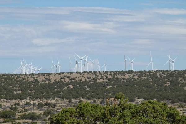
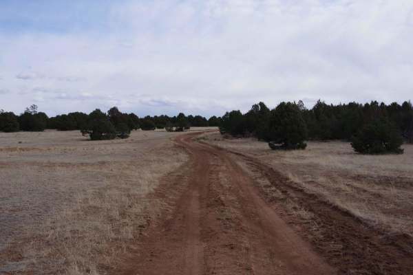
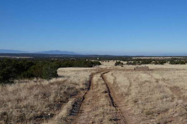
Windmill Way
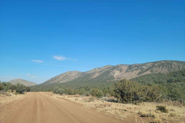
Windmill Way has a decent variety of terrain along its route. Composed of a combination of soft sand, dirt, and rocks, the trail winds its way to the southwest giving views of the surrounding mountains and a plateau to the north full of wind turbines. There are no obstacles larger than 10 inches alo...
Learn more about Windmill Way
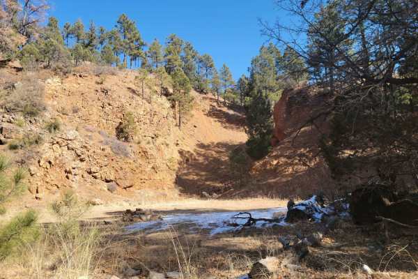
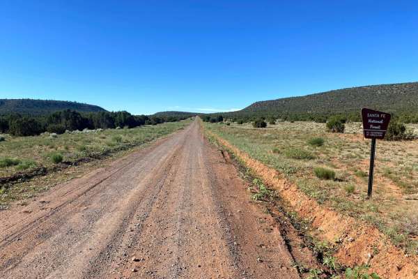
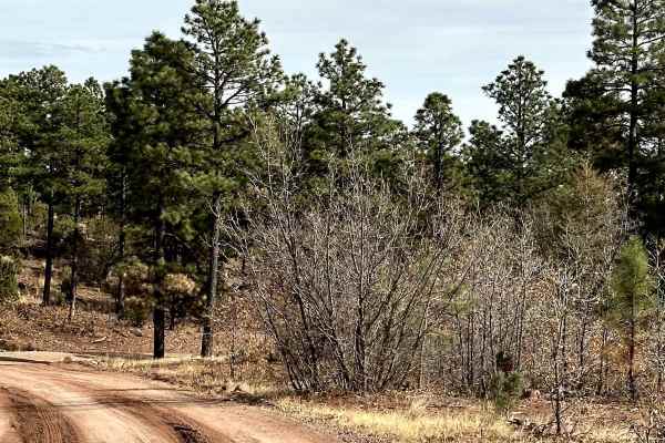
Red Cloud Trail
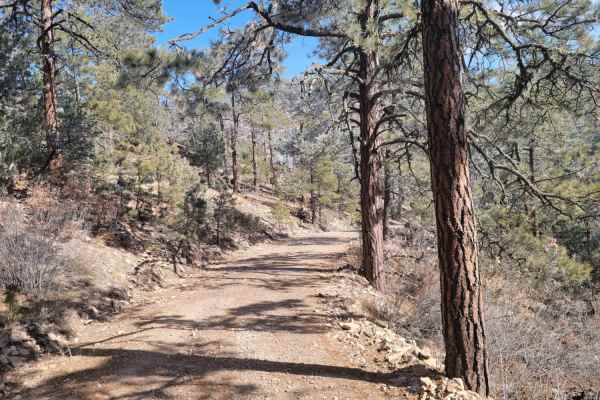
Red cloud trail works its way across the top of the peaks in Gallinas before descending into a forested area. With many dispersed camping opportunities, this is a great area for some more secluded outdoor activities. Multiple excellent views of the surrounding desert are available, especially while ...
Learn more about Red Cloud Trail
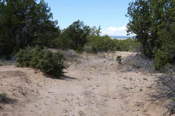
Sandwash
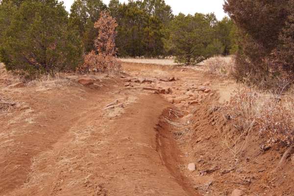
Sandwash is a trail that is exactly as named, beginning as a dirt hard-pack trail that quickly changes to a sandy wash track. As the trail begins to descend, it narrows to single-vehicle-width and changes from dirt to soft sand with one small rock garden hidden in the sand. The trail is easily trave...
Learn more about Sandwash
Wandering Wake
Wandering Wake is a trail that shows minimal signs of use and is very primitive with no signs of maintenance being performed. The surface changes frequently from dirt to sand with some smaller rocky sections scattered through the length of the trail. While there are no large obstacles along the trai...
Learn more about Wandering Wake
Cougar Mountain Road
A wide dirt track through the Gallinas district of Cibola National Forest. This route skirts the base of the Gallinas peak and is primarily used as a quick through road from the south side to the north side of the area. There are minimal washouts or other obstacles on this road, and it could easily ...
Learn more about Cougar Mountain Road
Clarion Course
Clarion Course is one of the more clear-cut trails in the area and shows more signs of use than many of the others. The trail surface is a combination of dirt, sand, and rocks but does not have any obstacles larger than 10 inches. There are sections with minor rutting and some off-camber turns, howe...
Learn more about Clarion Course
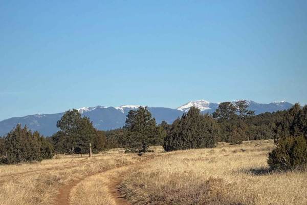
Glorieta Peak
This trail ascends a mountain surrounded by the desert to the South-East of Mountainair. When approaching the peak, it will be visible long before you start the trail when approaching from the west. The first part of the trail is driving on light gravel roads before you enter the National Forest. Th...
Learn more about Glorieta Peak
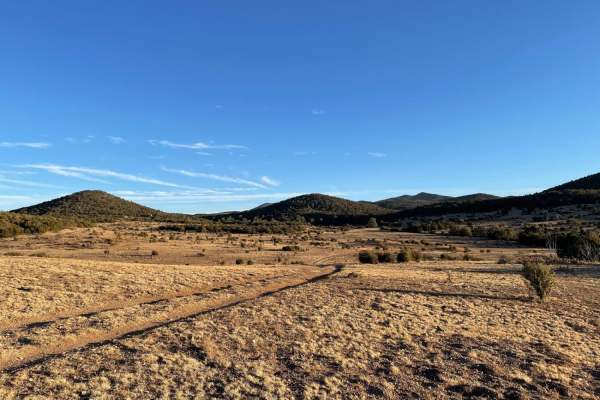
Valle Grande East Cut
Valle Grande East Cut is the furthest eastern motorized trail that extends east of the Hurtado Mesa area. This out-and-back trail offers a variety of terrain, foliage, and views. The trail is primarily single-vehicle wide but does offer areas to pass if traffic is encountered. The dirt and grass ter...
Learn more about Valle Grande East Cut
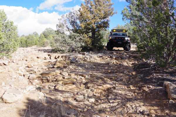
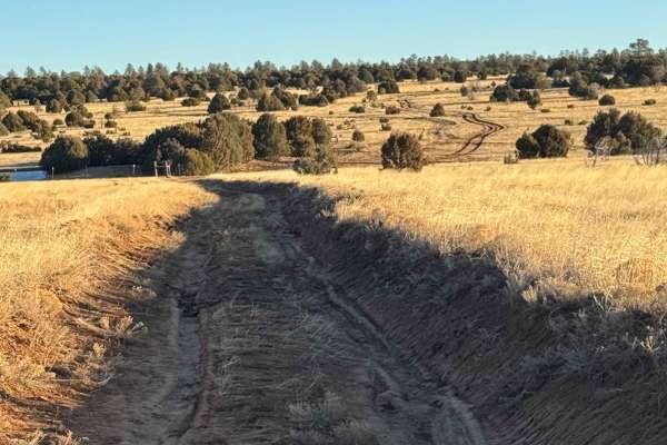
Arroyo de los Diegos
Arroyo de los Diegos is a primary dirt two-track that makes a partial loop from its connecting points off Valle Grande. The dirt surface shows some significant signs of rutting and erosion, with some areas of rutting being more than 20" or more in-depth, but still easily passable for most high clear...
Learn more about Arroyo de los Diegos
Rowe Mesa Loop
Suppose you're out looking for additional dispersed camping and some fantastic views. In that case, Rowe Mesa Loop will be quickly completed by most high clearance 2wd or AWD vehicles and offers a little bit of everything for offroading and camping. The most significant obstacles will be near the en...
Learn more about Rowe Mesa Loop
Barberro Mesa Drop
Barberro Mesa Drop begins on an easy dirt surface two-track through the upper mesa area before it ascends slightly over a loose rocky surface crest. The first 4.5 miles is a wide-open two-track with some rutting up to 15 inches in depth but no above-grade obstacles in excess of 8 inches. As the trai...
Learn more about Barberro Mesa Drop
Valle Grande
Mostly flat plains with sections of deep erosion causing washouts exceeding 10-12 inches deep. He trail has off-camber areas. Ock faces that are approximately 12 inches tall. Sections of deeply rutted muddy areas with standing water/mud can be 6-10 inches deep--scenic views of the surrounding mounta...
Learn more about Valle Grande
El Cerrito Area of Santa Fe National Forest
Open mesa plains with a web-like network of dirt roads with the occasional rocky obstacle and/or ledge. The general area is wide-open with scenic views of surrounding mesas. If you navigate deep enough into this area a couple nice rocky canyons can be found. Watch out for cattle as this is a commonl...
Learn more about El Cerrito Area of Santa Fe National Forest
FS 55 Tajique Canyon
This route is rocky in some areas and has other areas with deep ruts and slick, sticky mud with any type of moisture. It travels through private property before entering the Carson Forest. The route gradually climbs out of Diablo Canyon and levels out with gorgeous views of the Manzano Mountains.
Learn more about FS 55 Tajique Canyon
Cattle Run Pass
The trail is mostly dirt that runs through cattle pastures. The trail has ruts that can be 6-12 inches deep and can be off-camber. After rainfall, there are chances for multiple muddy sections and standing water. There are some rocky sections with rocks not exceeding over 6 inches. This trail provid...
Learn more about Cattle Run Pass
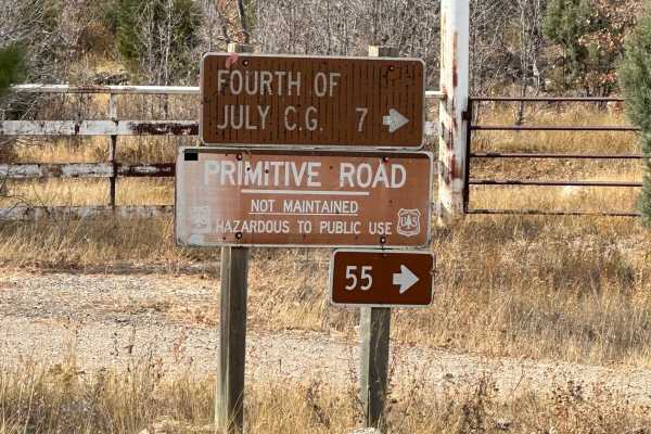
Fourth of July Campground
This route leads to the premier area to see the Big Tooth Maple in the Manzano Mountains. It is the largest stand of maples in New Mexico. The road is easy but narrow in spots. Camping is available from April through November for tents and tent trailers. There is also a parking area for some short h...
Learn more about Fourth of July Campground
Cerro Encinoso Loop
Cerro Encinoso Loop begins immediately off CR-34 and is an easy dirt two-track for the first mile before making its steeper 19.4% grade climb up to the Cerro Encinoso plateau and continuing on to Hogback Hill. The climb up is over a rocky and lightly rutted uneven surface that most 4WD vehicles will...
Learn more about Cerro Encinoso Loop
Red Canyon Campground
This is an easy route to the beautiful, well-shaded, and peaceful Red Canyon Campground. The campground is at 7,600 feet in elevation. It can accommodate RVs up to 22 feet. It is easy access to the Manzano Wilderness on the Red and Spruce Canyon trails on foot or horseback. The campground has corr...
Learn more about Red Canyon Campground
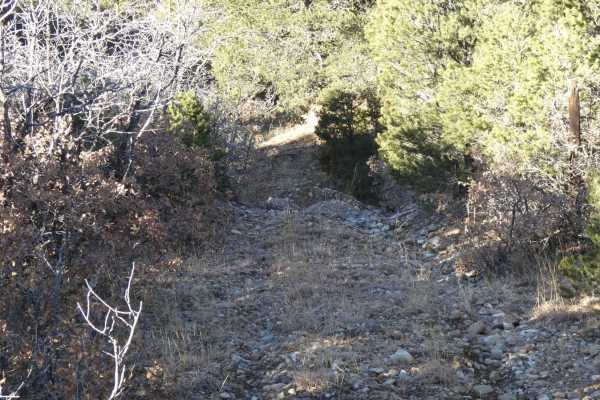
The Ascent
Relatively low threat at the start, but as you continue on, the two-track becomes slightly more narrow with larger rocks. The increased difficultly level is due to ledges with more significant mud holes proceeding them. It is situated on a more pronounced mesa before dipping back into the rolling hi...
Learn more about The Ascent
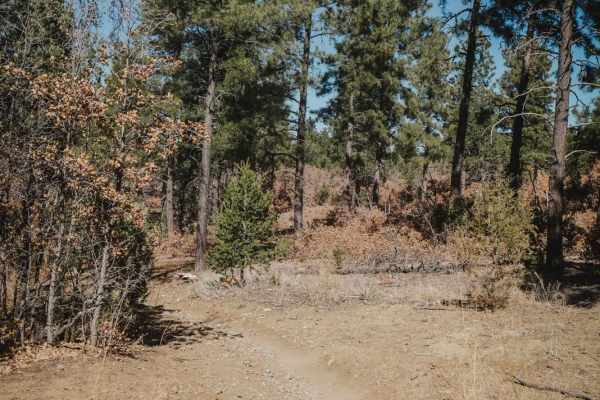
Caida del Pino
This is a short trail that connects Gamble Oak to Easy Pickin. It's pretty wide like an ATV trail for the entire 0.6 miles, meandering through an oak and pine forest, with small rocks embedded in the dirt. Unlike many of the surrounding trails, this one has no big rock ledges or obstacles, making it...
Learn more about Caida del Pino
ATV trails near Encino, New Mexico
Explore ATV-friendly trails near you. These trails are accessible for vehicles up to 50 inches wide, perfect for ATVs and smaller off-road machines.
Windmill Way
Windmill Way has a decent variety of terrain along its route. Composed of a combination of soft sand, dirt, and rocks, the trail winds its way to the southwest giving views of the surrounding mountains and a plateau to the north full of wind turbines. There are no obstacles larger than 10 inches alo...
Learn more about Windmill Way
Red Cloud Trail
Red cloud trail works its way across the top of the peaks in Gallinas before descending into a forested area. With many dispersed camping opportunities, this is a great area for some more secluded outdoor activities. Multiple excellent views of the surrounding desert are available, especially while ...
Learn more about Red Cloud Trail
Sandwash
Sandwash is a trail that is exactly as named, beginning as a dirt hard-pack trail that quickly changes to a sandy wash track. As the trail begins to descend, it narrows to single-vehicle-width and changes from dirt to soft sand with one small rock garden hidden in the sand. The trail is easily trave...
Learn more about Sandwash
Wandering Wake
Wandering Wake is a trail that shows minimal signs of use and is very primitive with no signs of maintenance being performed. The surface changes frequently from dirt to sand with some smaller rocky sections scattered through the length of the trail. While there are no large obstacles along the trai...
Learn more about Wandering Wake
UTV/side-by-side trails near Encino, New Mexico
Find UTV and side-by-side trails near you. These trails accommodate vehicles up to 60 inches wide, ideal for UTVs, side-by-sides, and wider off-road rigs.
Windmill Way
Windmill Way has a decent variety of terrain along its route. Composed of a combination of soft sand, dirt, and rocks, the trail winds its way to the southwest giving views of the surrounding mountains and a plateau to the north full of wind turbines. There are no obstacles larger than 10 inches alo...
Learn more about Windmill Way
Red Cloud Trail
Red cloud trail works its way across the top of the peaks in Gallinas before descending into a forested area. With many dispersed camping opportunities, this is a great area for some more secluded outdoor activities. Multiple excellent views of the surrounding desert are available, especially while ...
Learn more about Red Cloud Trail
Sandwash
Sandwash is a trail that is exactly as named, beginning as a dirt hard-pack trail that quickly changes to a sandy wash track. As the trail begins to descend, it narrows to single-vehicle-width and changes from dirt to soft sand with one small rock garden hidden in the sand. The trail is easily trave...
Learn more about Sandwash
Wandering Wake
Wandering Wake is a trail that shows minimal signs of use and is very primitive with no signs of maintenance being performed. The surface changes frequently from dirt to sand with some smaller rocky sections scattered through the length of the trail. While there are no large obstacles along the trai...
Learn more about Wandering Wake
The onX Offroad Difference
onX Offroad combines trail photos, descriptions, difficulty ratings, width restrictions, seasonality, and more in a user-friendly interface. Available on all devices, with offline access and full compatibility with CarPlay and Android Auto. Discover what you're missing today!
Open Trail Map