
Off-Road Trails
Near Cave City, Kentucky
Off-Road Trails Near Cave City, Kentucky
Discover the best offroad trails near you. Browse trail maps, check difficulty ratings, and find your next adventure — whether you're looking for a quick ride or an all-day expedition.
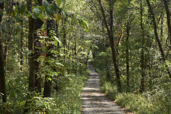
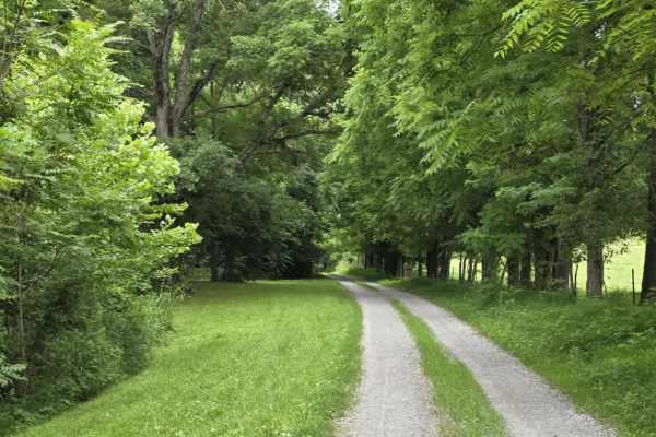
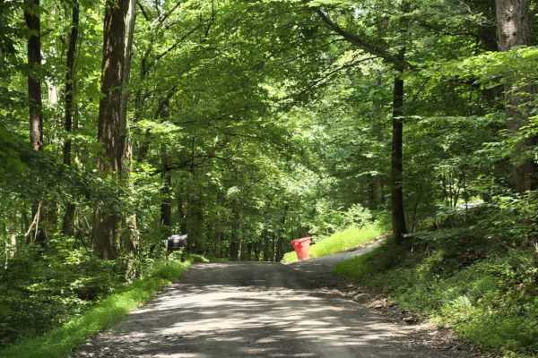
Ugly Creek - Mammoth Cave NP
Ugly Creek Road is a 3.5-mile one-way trail that is located within Mammoth Cave National Park. The trail begins off Green River Ferry Road (1352) and ends on Dennison Ferry Road. The trail can be run in either direction; however, there is a possible impassable water crossing closer to the Green Rive...
Learn more about Ugly Creek - Mammoth Cave NP
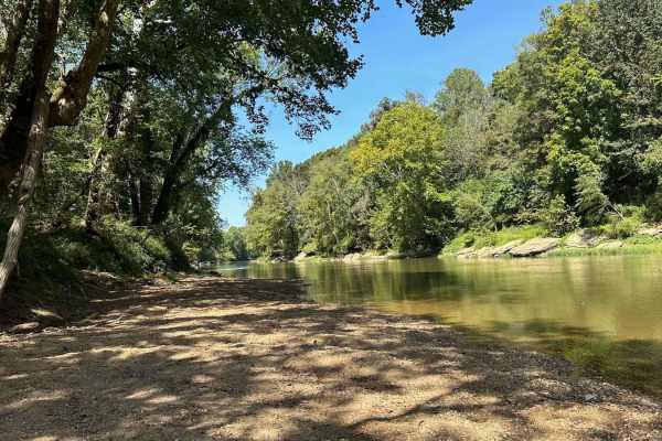
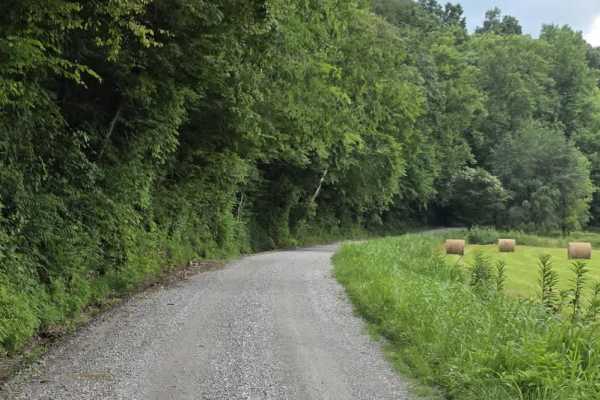
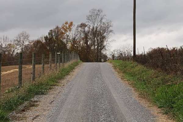
Houchin Ferry - Mammoth Cave NP
Houchin Ferry Road is a 5-mile out-and-back trail that is located within Mammoth Cave National Park. The trail begins off Ollie Road and ends along the Green River. There is no longer a possible way to cross the river at the end of the trail so you must turn back. Along the trail are a few parking a...
Learn more about Houchin Ferry - Mammoth Cave NP
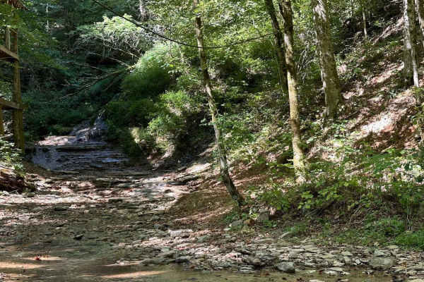
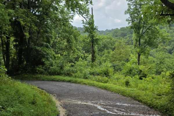
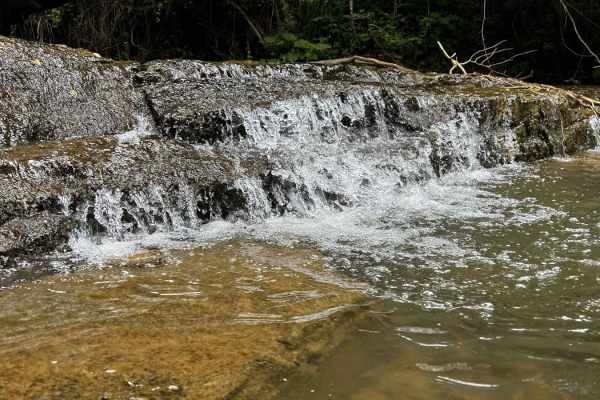
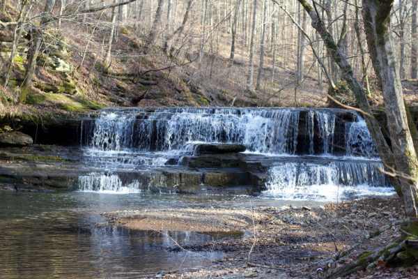
Waterfall Trail
This section of the trail takes you back to a scenic waterfall. The trail winds around a ridge with some tight turns but is not technical in nature. The waterfall is a cascade type that you can climb and is a great place to take photos or eat a light lunch.
Learn more about Waterfall Trail
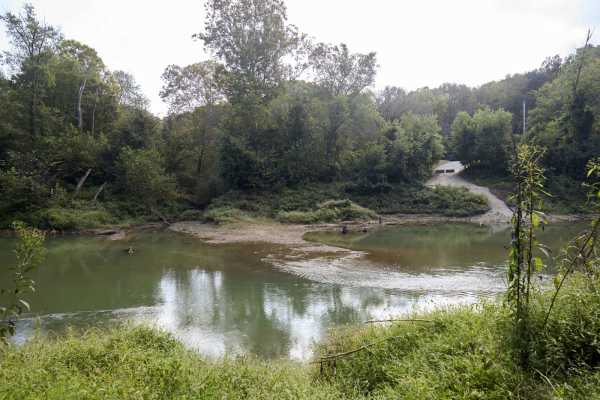
River Beach Access
The trail follows along the edge of a field before dropping down by the water's edge. You may encounter a few small mud holes on your way. The beach is rocky and big enough to fit several vehicles. There are optional steep climbs to return to the main trail if you want a challenge.
Learn more about River Beach Access
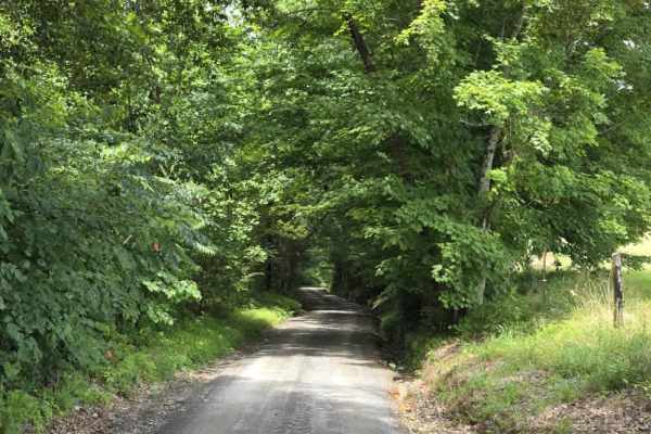
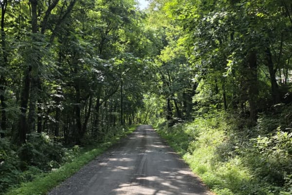
Wix Hollow Road - Macon County Tour
Wix Hollow Road is a scenic and slightly more dynamic segment of the Macon County Tour that briefly crosses into the state of Kentucky. The route features a mixed surface of dirt and gravel, offering a relaxed drive with a bit more character than a standard, maintained county road. The surrounding l...
Learn more about Wix Hollow Road - Macon County Tour
Knight Road - Macon County Tour
Knight Road is a slightly more engaging segment of the Macon County Tour that remains approachable while introducing a few mild features. The road follows a loose gravel surface and travels in close proximity to several rural homes and farms, so drivers should maintain slow speeds and remain alert f...
Learn more about Knight Road - Macon County Tour
Puncheon Creek Road - Macon County Tour
Puncheon Creek Road is a scenic gravel segment of the Macon County Tour that follows and repeatedly crosses flowing water, creating a relaxed drive with 3 shallow creek features. The road surface consists primarily of loose gravel and travels in close proximity to rural homes and working farms, so m...
Learn more about Puncheon Creek Road - Macon County Tour
Beech Grove Road - Macon County Tour
Beech Grove Road is a short gravel segment of the Macon County Tour that offers mild elevation changes and a quiet rural setting. The entrance can be easy to miss, so drivers should watch carefully for the turnoff when navigating the route. Once on the road, the surface consists of gravel that has e...
Learn more about Beech Grove Road - Macon County Tour
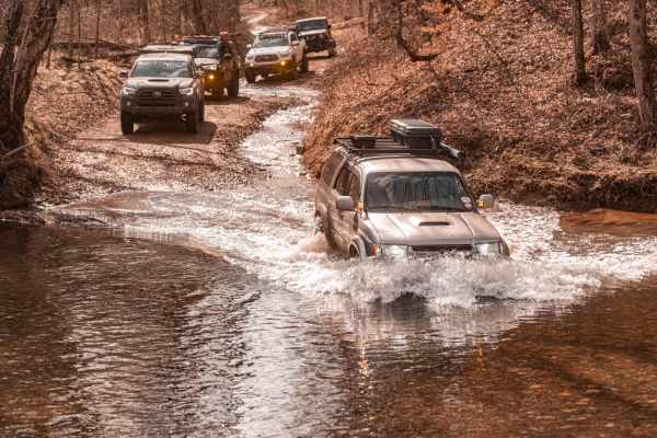
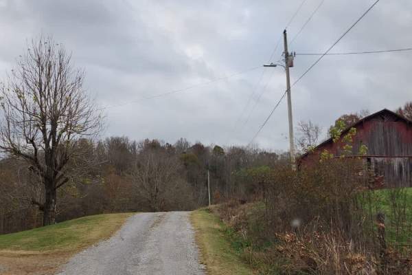
Salt Lick Creek Crossing
Salt Lick Creek is one of the larger and deeper creeks you will have to cross during the Macon Country Tour ride. The trail leading up to and following the crossing is not technical, however, depending on conditions, the crossing may be too deep for some vehicles. There is no bypass on this direct r...
Learn more about Salt Lick Creek Crossing
Shockley Hill Road - Macon County Tour
Shockley Hill Road is a very brief connector within the Macon County Tour, serving as a short transition between longer segments of pavement along the route. The road surface is gravel and straightforward for easy navigation, for 4WD and high-clearance 2WD vehicles. While not a destination segment o...
Learn more about Shockley Hill Road - Macon County Tour
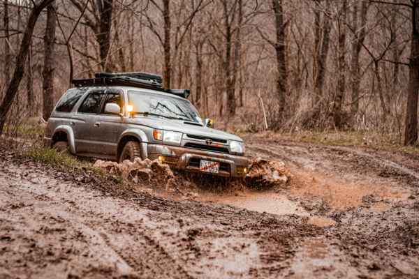
Shiloh's Playground
Shiloh's Playground consists of multiple muddy lines through some tight woods. It can be done in full-size 4x4s, SxS, or dirt bikes. If unloading on a trailer, there is a dirt lot across the paved road for parking/unloading. From this lot, you can also access the creek and drive through to get to sm...
Learn more about Shiloh's Playground
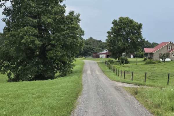
Highland Road - Macon County Tour
Highland Road is an easy, tightly packed gravel segment of the Macon County Tour that offers a straightforward rural drive. The surface is composed primarily of compacted rock and gravel, providing consistent traction under normal dry conditions. The road is generally one to one and a half lanes wid...
Learn more about Highland Road - Macon County Tour
Spring Hollow Road - Macon County Tour
Spring Hollow Road is an easy gravel segment of the Macon County Tour that offers a relaxed drive with minor surface irregularities to keep drivers attentive. The road is typically about one and a half lanes wide, with periodic pull-offs that allow vehicles to pass when needed. While generally strai...
Learn more about Spring Hollow Road - Macon County Tour
Holland Road - Macon County Tour
Holland Road is a short but scenic gravel segment of the Macon County Tour that offers a relaxed drive with a memorable water crossing at its end. The road is county-maintained and generally easy to navigate, though it can feel tight in places as it passes near farms and rural residences. Drivers sh...
Learn more about Holland Road - Macon County Tour
Tooley Branch Road
This trail starts off as an easy gravel track with several creek crossings. About halfway through the track, the gravel stops, and the track turns into a mixture of dirt and rock that will lead you through another creek crossing. The entrance and exit of this creek crossing is slick shale that could...
Learn more about Tooley Branch Road
Hance Hollow Road - Macon County Tour
Hance Hollow Road is an old county road that is now rarely used. It's a steady steep descent or climb on a narrow road with tight switchbacks. It is located in a heavily wooded area in northeastern middle Tennessee on the Macon County Tour, or M.C.T. In the fall, you'll find colorful foliage in a ca...
Learn more about Hance Hollow Road - Macon County Tour
Clear Creek
Clear Creek is a scenic out-and-back trail that follows a rocky creek bed. It is somewhat stock vehicle-friendly with correct line choices, but there are some slick rock ledges and harder lines if you want more adventure. Be mindful of pooled water areas where flow is not as apparent; this is a sign...
Learn more about Clear Creek
Sullivan Hollow Road - Macon County Tour
This scenic off-road trail, part of the Macon County Tour (MCT), offers an easy yet engaging drive through Tennessee's rolling backcountry. While the route follows a graded path, multiple washouts and narrow stretches without shoulders--some with steep drop-offs--add a layer of caution to the otherw...
Learn more about Sullivan Hollow Road - Macon County Tour
Long Fork Waterfall
Woodard Road is not a technical route;it is an easy gravel road leading down to a shallow creek crossing that includes a waterfall. The creek is shallow but the rock bottom can be slick. You can drive across it and continue further down the road or just turn around and head back out.
Learn more about Long Fork Waterfall
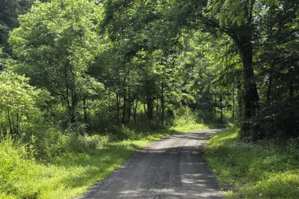
Gravley Hill Road - Macon County Tour
Winding through the gentle terrain of northern Tennessee, this graded gravel trail marks the starting point of the iconic Macon County Tour (MCT), a 100+ mile off-road journey that explores the rolling hills and hardwood forests of Tennessee and Kentucky. While generally easy and well-maintained, th...
Learn more about Gravley Hill Road - Macon County Tour
ATV trails near Cave City, Kentucky
Explore ATV-friendly trails near you. These trails are accessible for vehicles up to 50 inches wide, perfect for ATVs and smaller off-road machines.
Ugly Creek - Mammoth Cave NP
Ugly Creek Road is a 3.5-mile one-way trail that is located within Mammoth Cave National Park. The trail begins off Green River Ferry Road (1352) and ends on Dennison Ferry Road. The trail can be run in either direction; however, there is a possible impassable water crossing closer to the Green Rive...
Learn more about Ugly Creek - Mammoth Cave NP
Houchin Ferry - Mammoth Cave NP
Houchin Ferry Road is a 5-mile out-and-back trail that is located within Mammoth Cave National Park. The trail begins off Ollie Road and ends along the Green River. There is no longer a possible way to cross the river at the end of the trail so you must turn back. Along the trail are a few parking a...
Learn more about Houchin Ferry - Mammoth Cave NP
Waterfall Trail
This section of the trail takes you back to a scenic waterfall. The trail winds around a ridge with some tight turns but is not technical in nature. The waterfall is a cascade type that you can climb and is a great place to take photos or eat a light lunch.
Learn more about Waterfall Trail
River Beach Access
The trail follows along the edge of a field before dropping down by the water's edge. You may encounter a few small mud holes on your way. The beach is rocky and big enough to fit several vehicles. There are optional steep climbs to return to the main trail if you want a challenge.
Learn more about River Beach Access
UTV/side-by-side trails near Cave City, Kentucky
Find UTV and side-by-side trails near you. These trails accommodate vehicles up to 60 inches wide, ideal for UTVs, side-by-sides, and wider off-road rigs.
Ugly Creek - Mammoth Cave NP
Ugly Creek Road is a 3.5-mile one-way trail that is located within Mammoth Cave National Park. The trail begins off Green River Ferry Road (1352) and ends on Dennison Ferry Road. The trail can be run in either direction; however, there is a possible impassable water crossing closer to the Green Rive...
Learn more about Ugly Creek - Mammoth Cave NP
Houchin Ferry - Mammoth Cave NP
Houchin Ferry Road is a 5-mile out-and-back trail that is located within Mammoth Cave National Park. The trail begins off Ollie Road and ends along the Green River. There is no longer a possible way to cross the river at the end of the trail so you must turn back. Along the trail are a few parking a...
Learn more about Houchin Ferry - Mammoth Cave NP
Waterfall Trail
This section of the trail takes you back to a scenic waterfall. The trail winds around a ridge with some tight turns but is not technical in nature. The waterfall is a cascade type that you can climb and is a great place to take photos or eat a light lunch.
Learn more about Waterfall Trail
River Beach Access
The trail follows along the edge of a field before dropping down by the water's edge. You may encounter a few small mud holes on your way. The beach is rocky and big enough to fit several vehicles. There are optional steep climbs to return to the main trail if you want a challenge.
Learn more about River Beach Access
The onX Offroad Difference
onX Offroad combines trail photos, descriptions, difficulty ratings, width restrictions, seasonality, and more in a user-friendly interface. Available on all devices, with offline access and full compatibility with CarPlay and Android Auto. Discover what you're missing today!
Open Trail Map