
Dirt Bike Trails
Near Whiterocks, Utah
Explore All Dirt Bike Trails Near Whiterocks, Utah
Dirt Bike Trails Near Whiterocks, Utah
Discover the best dirt bike trails near you. Browse trail maps, check difficulty ratings, and find your next adventure — whether you're looking for a quick ride or an all-day expedition.
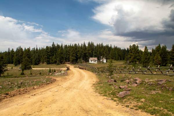
Mosby Mountain - FS 10104
This trail is an out-and-back trail that runs up to Paradise Park Reservoir and continues past it through some dispersed camping areas before ending. This trail is a well-maintained gravel road up until you pass the turn to Paradise Park Reservoir, where it switches to a natural road base and will s...
Learn more about Mosby Mountain - FS 10104
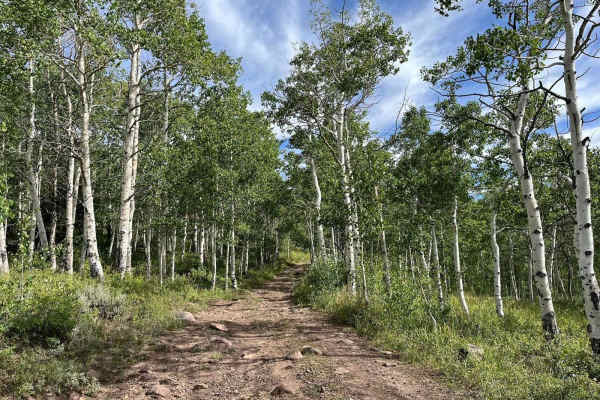
Mosby Park
This trail is a bypass of the main road. It takes you up through the trees. It is fairly rocky, and, in most cases, you will find mud. There can be a lot of fallen trees over the trail, so vehicles that are too tall can run into problems (nothing a chainsaw can't fix).
Learn more about Mosby Park
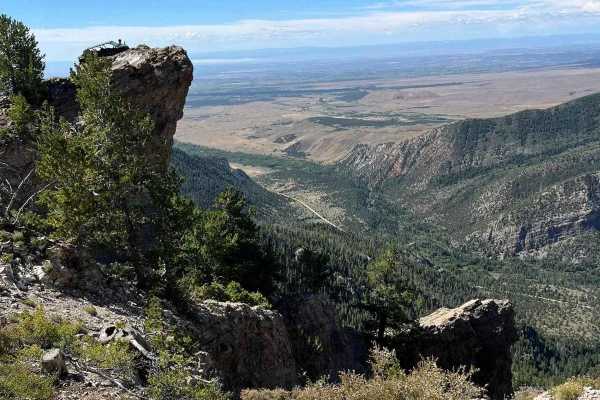
Ice Peak Cave
This is an easy, well-traveled dirt road. It takes you to a lookout where you can turn around and come back. You can walk up to the lookout and if you are daring enough, you can drive your machine up to the ledge for a great photo op.
Learn more about Ice Peak Cave
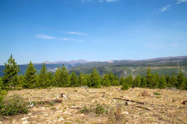
Harmston Overlook
Harmston Overlook is a short out-and-back trail that branches off of Elkhorn Loop and heads West to where it ends at a parking lot right next to a large overlook of the canyon below. This trail is rough as it heads to the overlook, with some small ruts and sections with small rocks throughout. This ...
Learn more about Harmston Overlook
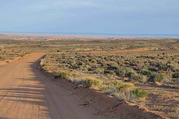
Halfway Hollow Road - Uintah County 2230
This road is graded and suitable for all types of vehicles. The width of the road is adequate for passing. Campers and trailers can traverse this road. This area is dry desert sagebrush terrain (no trees). Rock formations with varied colors make the desert look like it is in bloom. Rock spires and s...
Learn more about Halfway Hollow Road - Uintah County 2230
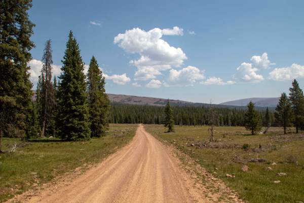
Elkhorn Loop - FS 10117
Elkhorn Loop is a 26-mile point-to-point trail that runs up into the Uintas before turning back and heading down a different canyon and back down and out of the Uintas. This trail is well maintained, with the east half better maintained than the west half. The west half has a few small rocks in the ...
Learn more about Elkhorn Loop - FS 10117
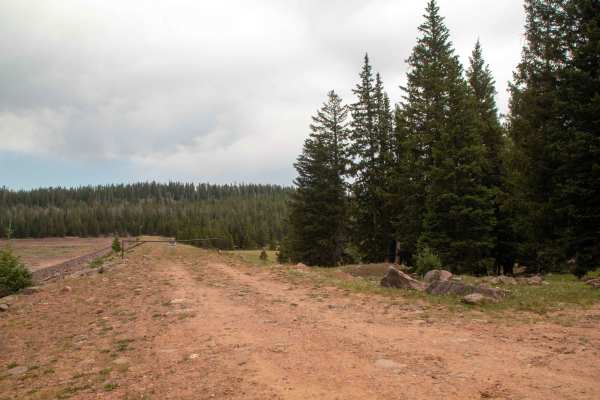
Paradise Park Reservoir Access - FS 10752
This trail is a short out-and-back trail that branches off of Mosby Mountain and heads North to where it ends at a small parking area at Paradise Park Reservoir Dam. This trail is an easy gravel road that is well maintained. This trail is open to all vehicles and has no seasonal closure date, but wi...
Learn more about Paradise Park Reservoir Access - FS 10752
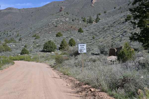
Red Cloud Loop
Red Cloud Loop (FS 10018) is a laidback forest road route perfect for beginners or anyone looking for an easy 4x4 trail near Vernal. Winding through the southeastern section of Ashley National Forest, this loop offers a scenic, low-stress drive through mixed forest with occasional rocky patches and ...
Learn more about Red Cloud Loop
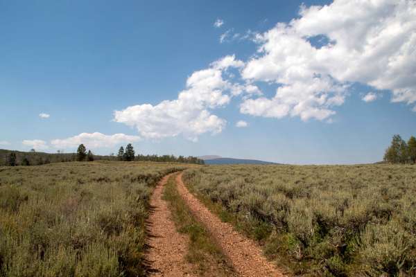
Charleys Park Spur - FS 10760
This trail is a short spur off of Charleys Park that leads across the field to the edge of the ridge, providing a good overlook down into the canyon at the end of the trail. This trail is easy, with no major obstacles to cross in the trail. This trail has plenty of good dispersed campsites located a...
Learn more about Charleys Park Spur - FS 10760
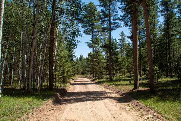
Charleys Park - FS 10234
This trail branches off of Red Cloud Loop and leads to a large area of dispersed camping sites. This trail starts off as a well-maintained road before it transitions to a tighter trail through the trees, with small rocks embedded in the trail along with a couple of smaller potential mud pits as it a...
Learn more about Charleys Park - FS 10234
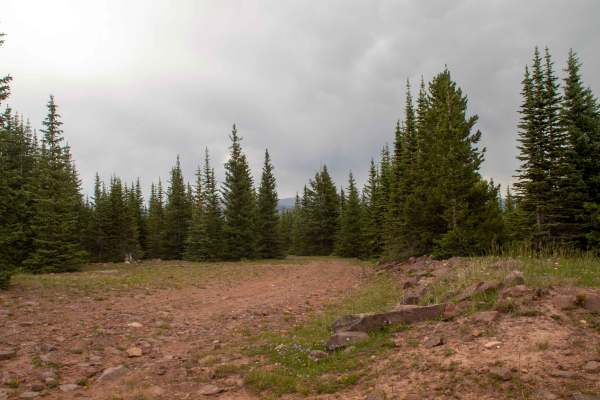
Johnson Bench - FS 10754
This trail is a short trail that runs between Mosby Mountain and Johnson Creek, serving as the main access to Johnson Creek. This trail is rough, with sections of small rocks embedded into the road as well as small ruts scattered throughout. This trail stays low in the trees for the short distance i...
Learn more about Johnson Bench - FS 10754
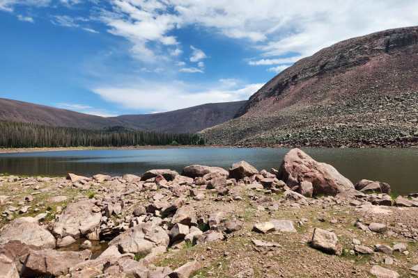
Johnson Creek - FS 10459
This trail is a rough out-and-back trail that travels from the end of Johnson Bench Trail to Cliff Lake. This trail is rocky throughout, with a few rockier sections that will provide a challenge when heading back from Cliff Lake, as they will be steeper uphill climbs with lots of loose rock and some...
Learn more about Johnson Creek - FS 10459
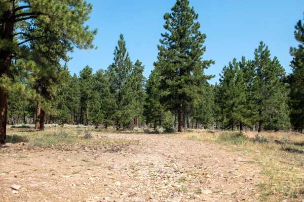
Crow Canyon - FS 10266
This trail is a short spur off Yellowstone Loop that heads north a ways to where it dead-ends at an intersection with Dry Gulch ATV Trail. This trail is easy, with only a few minor rock obstacles to traverse along the trail. This trail provides some quite dispersed camping spots along the trail, wit...
Learn more about Crow Canyon - FS 10266
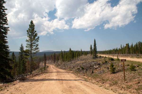
Ashley Twin Lakes Loop - FS 10027
This trail is a rough out-and-back trail that branches off of Red Cloud Loop and heads northwest to Ashley Twin Lakes Reservoir, where it ends after crossing the dam. This trail is unmaintained and rocky as it travels to the lake, with most of the trail being smaller rocks, with larger ones scattere...
Learn more about Ashley Twin Lakes Loop - FS 10027
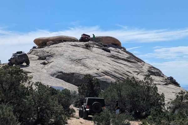
Coyote Gulch
Coyote Gulch is one of several trails within the Outlaw Trail System in and around Vernal, Utah. This trail was created for Rock Rally 2024 and is between the Doc's Beach and Sand Bar trails. Rated 6 of 10, this trail consists of waving surfaces including canyons, wedges, and ledges. Throw in some s...
Learn more about Coyote Gulch
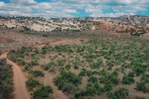
Red Mountain West Access-Vernal
Red Mountain West Access is a 1-mile point-to-point trail rated 3 of 10 located in Uintah County, Utah. This trail provides access from the pavement on the west side of Red Mountain up to the Red Mountain Loop trail. Running the loop west to east is the easier direction (rated 6) as the most difficu...
Learn more about Red Mountain West Access-Vernal
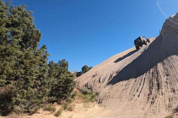
Sand Bar Loop
The Sand Bar Loop is one of several trails within the Outlaw Trail System in and around Vernal, Utah. This 3.3-mile point-to-point trail rate is used both during the Vernal Rock Rally and the Outlaw ATV Jamboree. The Rock Rally is focused on full-size 4x4 vehicles and rates the trail a 4 of 10 while...
Learn more about Sand Bar Loop
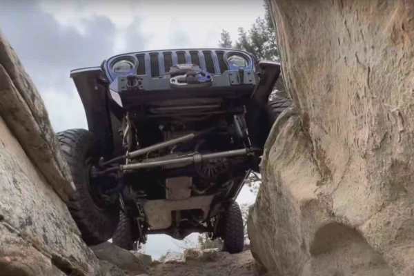
Doc's Beach-Vernal
Docs Beach is a 4.6-mile looping trail rated 7 of 10 located in Uintah County, Utah. Doc's Beach is one of the pinnacle trails of the Vernal area and has become well-known for its grippy sandstone surface, moon-like appearance, and some of the greatest scenery that can only be seen from this trail. ...
Learn more about Doc's Beach-Vernal
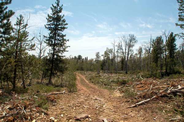
77 Flat Road - FS 10275
This trail branches off Yellowstone Loop and heads north to where it connects to Limekiln. This trail is easy, with only a few small rocks and ruts to cross along the trail, as well as a shallow mudhole that is fed by a small creek. This trail has had trees cleared near the trail to make it a fire b...
Learn more about 77 Flat Road - FS 10275
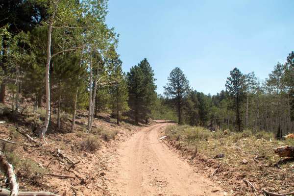
Limekiln - FS 10123
This short trail branches off of Yellowstone Loop and runs to the north, where it ends at a parking area next to Limekiln Spring. This trail is easy, with only some shallow ruts and small rocks for most of the trail, except for the south end, where the trail is sandy as it climbs uphill. This trail ...
Learn more about Limekiln - FS 10123
ATV trails near Whiterocks, Utah
Explore ATV-friendly trails near you. These trails are accessible for vehicles up to 50 inches wide, perfect for ATVs and smaller off-road machines.
Mosby Mountain - FS 10104
This trail is an out-and-back trail that runs up to Paradise Park Reservoir and continues past it through some dispersed camping areas before ending. This trail is a well-maintained gravel road up until you pass the turn to Paradise Park Reservoir, where it switches to a natural road base and will s...
Learn more about Mosby Mountain - FS 10104
Mosby Park
This trail is a bypass of the main road. It takes you up through the trees. It is fairly rocky, and, in most cases, you will find mud. There can be a lot of fallen trees over the trail, so vehicles that are too tall can run into problems (nothing a chainsaw can't fix).
Learn more about Mosby Park
Ice Peak Cave
This is an easy, well-traveled dirt road. It takes you to a lookout where you can turn around and come back. You can walk up to the lookout and if you are daring enough, you can drive your machine up to the ledge for a great photo op.
Learn more about Ice Peak Cave
Harmston Overlook
Harmston Overlook is a short out-and-back trail that branches off of Elkhorn Loop and heads West to where it ends at a parking lot right next to a large overlook of the canyon below. This trail is rough as it heads to the overlook, with some small ruts and sections with small rocks throughout. This ...
Learn more about Harmston Overlook
UTV/side-by-side trails near Whiterocks, Utah
Find UTV and side-by-side trails near you. These trails accommodate vehicles up to 60 inches wide, ideal for UTVs, side-by-sides, and wider off-road rigs.
Mosby Mountain - FS 10104
This trail is an out-and-back trail that runs up to Paradise Park Reservoir and continues past it through some dispersed camping areas before ending. This trail is a well-maintained gravel road up until you pass the turn to Paradise Park Reservoir, where it switches to a natural road base and will s...
Learn more about Mosby Mountain - FS 10104
Mosby Park
This trail is a bypass of the main road. It takes you up through the trees. It is fairly rocky, and, in most cases, you will find mud. There can be a lot of fallen trees over the trail, so vehicles that are too tall can run into problems (nothing a chainsaw can't fix).
Learn more about Mosby Park
Ice Peak Cave
This is an easy, well-traveled dirt road. It takes you to a lookout where you can turn around and come back. You can walk up to the lookout and if you are daring enough, you can drive your machine up to the ledge for a great photo op.
Learn more about Ice Peak Cave
Harmston Overlook
Harmston Overlook is a short out-and-back trail that branches off of Elkhorn Loop and heads West to where it ends at a parking lot right next to a large overlook of the canyon below. This trail is rough as it heads to the overlook, with some small ruts and sections with small rocks throughout. This ...
Learn more about Harmston Overlook
The onX Offroad Difference
onX Offroad combines trail photos, descriptions, difficulty ratings, width restrictions, seasonality, and more in a user-friendly interface. Available on all devices, with offline access and full compatibility with CarPlay and Android Auto. Discover what you're missing today!
Open Trail Map