
Dirt Bike Trails
Near Vernal, Utah
Explore All Dirt Bike Trails Near Vernal, Utah
Dirt Bike Trails Near Vernal, Utah
Discover the best dirt bike trails near you. Browse trail maps, check difficulty ratings, and find your next adventure — whether you're looking for a quick ride or an all-day expedition.
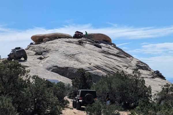
Coyote Gulch
Coyote Gulch is one of several trails within the Outlaw Trail System in and around Vernal, Utah. This trail was created for Rock Rally 2024 and is between the Doc's Beach and Sand Bar trails. Rated 6 of 10, this trail consists of waving surfaces including canyons, wedges, and ledges. Throw in some s...
Learn more about Coyote Gulch
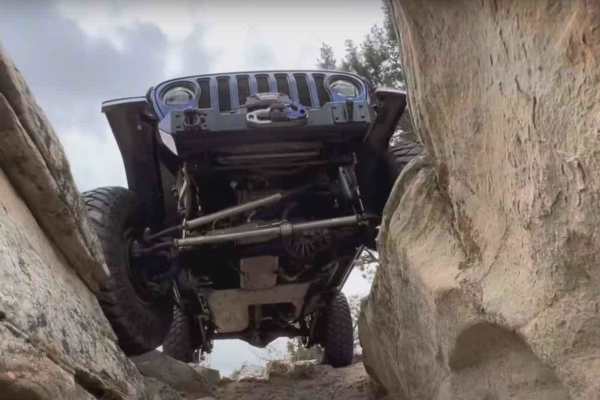
Doc's Beach-Vernal
Docs Beach is a 4.6-mile looping trail rated 7 of 10 located in Uintah County, Utah. Doc's Beach is one of the pinnacle trails of the Vernal area and has become well-known for its grippy sandstone surface, moon-like appearance, and some of the greatest scenery that can only be seen from this trail. ...
Learn more about Doc's Beach-Vernal
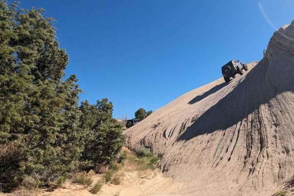
Sand Bar Loop
The Sand Bar Loop is one of several trails within the Outlaw Trail System in and around Vernal, Utah. This 3.3-mile point-to-point trail rate is used both during the Vernal Rock Rally and the Outlaw ATV Jamboree. The Rock Rally is focused on full-size 4x4 vehicles and rates the trail a 4 of 10 while...
Learn more about Sand Bar Loop
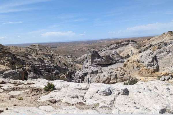
Sand Dune Gulch-Vernal
Sand Dune Gulch is a 2.7-mile looping trail rated 8 of 10 located in Uintah County, Utah. The trail is well known to locals and is run during both the Vernal Rock Rally and the Outlaw ATV Jamboree. Don't let the name fool you, these are not sand dunes like at the beach, these are solid sand rocks th...
Learn more about Sand Dune Gulch-Vernal
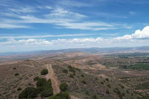
Butch Cassidy Loop
The Butch Cassidy Loop is one of several trails within the Outlaw Trail System in and around Vernal, Utah. This 15-mile loop trail is used both during the Vernal Rock Rally and the Outlaw ATV Jamboree. The Rock Rally is focused on full-size 4x4 vehicles and rates the trail a 4 of 10 while the Outlaw...
Learn more about Butch Cassidy Loop
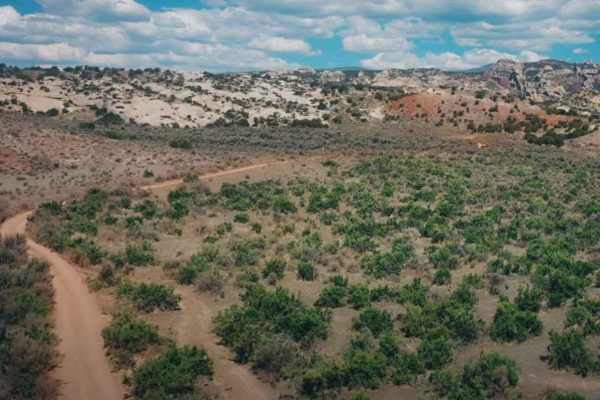
Red Mountain West Access-Vernal
Red Mountain West Access is a 1-mile point-to-point trail rated 3 of 10 located in Uintah County, Utah. This trail provides access from the pavement on the west side of Red Mountain up to the Red Mountain Loop trail. Running the loop west to east is the easier direction (rated 6) as the most difficu...
Learn more about Red Mountain West Access-Vernal
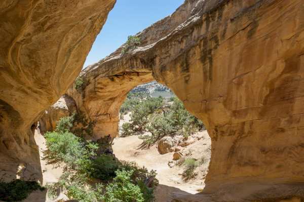
Red Mountain Moonshine Arch
Red Mountain Moonshine Arch is a challenging and highly scenic 18.8-mile loop designed for experienced offroaders seeking demanding slickrock obstacles and stunning views of the Uintah Basin near Vernal, Utah. This route climbs over 3,400 feet, rising from an elevation of 5,532 feet to a peak of 7,7...
Learn more about Red Mountain Moonshine Arch
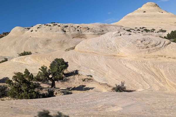
White Lightning-Vernal
White Lightning is a 2.4-mile looping trail rated 7 of 10 located in Uintah County, Utah. White Lightning is one of the newer trails in the area and not as well-known as many of the others. There are those who say that this is Vernal's version of Moab's Hell's Revenge Trail. The trail is definitely ...
Learn more about White Lightning-Vernal
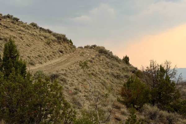
Widow Maker Road
Widow Maker Road is a point-to-point 4/10 trail running through BLM and Utah Trust lands in the Honda Hills area north of Vernal, Utah. Mostly desert terrain, it stretches across flat open land and tackles climbs and descents over multiple ridgelines. The southwestern part is generally open desert t...
Learn more about Widow Maker Road
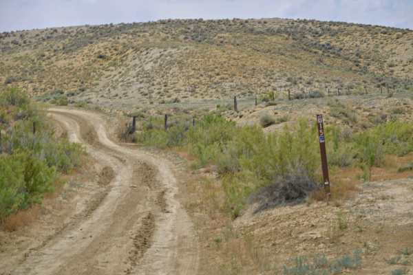
Little Valley Road
Little Valley Road is a point-to-point trail in the Honda Hills area, just south of Red Fleet State Park near Vernal, Utah. As part of the Outlaw Trail system, it’s marked as Outlaw Trail 15 and winds its way along several ridgelines. Along the route, you can catch glimpses of Red Fleet State Park, ...
Learn more about Little Valley Road
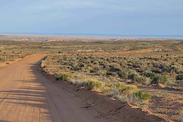
Halfway Hollow Road - Uintah County 2230
This road is graded and suitable for all types of vehicles. The width of the road is adequate for passing. Campers and trailers can traverse this road. This area is dry desert sagebrush terrain (no trees). Rock formations with varied colors make the desert look like it is in bloom. Rock spires and s...
Learn more about Halfway Hollow Road - Uintah County 2230
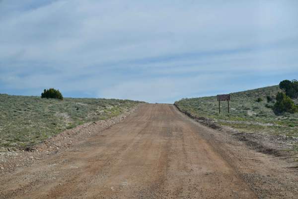
Taylor Mountain Road - FS 10044
Taylor Mountain Road is a scenic Forest Service road rated 1/10 in the Ashley National Forest. It connects Vernal to the south and FS 10018 at its northern terminus. It is passable by most any vehicle, although the USFS does restrict travel to legally tagged vehicles. The road passes numerous majest...
Learn more about Taylor Mountain Road - FS 10044
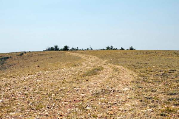
Single Trough - FS10293
This is a short out-and-back trail that splits off from East Ashley Grasshopper and heads southwest to the edge of Ashley Gorge. This trail is easy, as it travels across the open flat with only a short section of small rocks leading up the small hill to the viewpoint, along with there being a gate a...
Learn more about Single Trough - FS10293
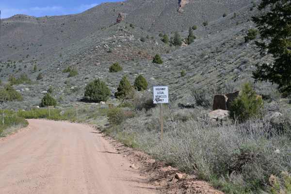
Red Cloud Loop
Red Cloud Loop (FS 10018) is a laidback forest road route perfect for beginners or anyone looking for an easy 4x4 trail near Vernal. Winding through the southeastern section of Ashley National Forest, this loop offers a scenic, low-stress drive through mixed forest with occasional rocky patches and ...
Learn more about Red Cloud Loop
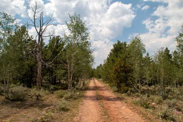
Roaring Fork - FS 10568
This trail is a short out-and-back trail that branches off Taylor Mountain and heads east to Clarks Park, which sits on the edge of Big Brush Gorge, just above Roaring Fork. This trail starts well-maintained as it branches off before transitioning into a natural surface trail with a couple of shallo...
Learn more about Roaring Fork - FS 10568
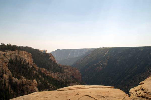
Fence Line - FS10568
This trail is a short out-and-back trail that splits off from Taylor Mountain and follows the fence in a straight line to the edge of the gorge. This trail is mostly smooth, with some small rocks and ruts scattered throughout; the hardest spot is just east of East Ashley Grasshopper, where the trail...
Learn more about Fence Line - FS10568
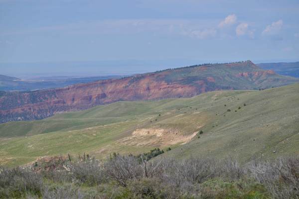
Barker Ridge - FS 10583
Barker Ridge - FS 10583 is an out-and-back trail rated 2/10 in the Ashley National Forest, offering a scenic overlook of the Uinta Valley, including Red Fleet State Park and Steinaker State Park. Popular for sightseeing, it’s the first trail you’ll encounter when heading north from Vernal into the f...
Learn more about Barker Ridge - FS 10583
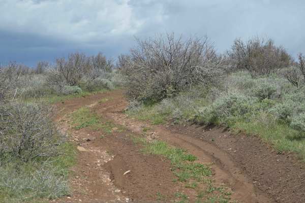
Little Brush Creek - FS 10052
Little Brush Creek - FS 10052 is a point-to-point trail with a 2/10 difficulty rating in the Ashley National Forest. It stretches from US191 to a hiking and overlook spot. One unique highlight is a Utah Wildlife/USFS area called an "exclosure" rather than an enclosure, with a somewhat mysterious his...
Learn more about Little Brush Creek - FS 10052
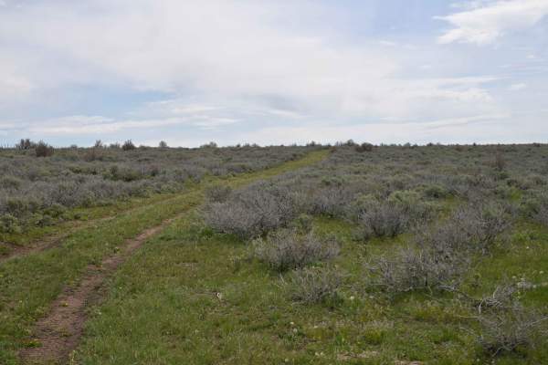
Dutch Charles Cutoff - FR10582
Dutch Charles Cutoff - FR 10582 is a point-to-point trail rated 1/10 on the east side of Ashley National Forest. This narrow, two-track path connects Little Brush Creek - FR 10052 and Barker Spring Loop - FR 10051 to form the loop named by the USFS. It’s an intriguing route, seemingly seldom travele...
Learn more about Dutch Charles Cutoff - FR10582
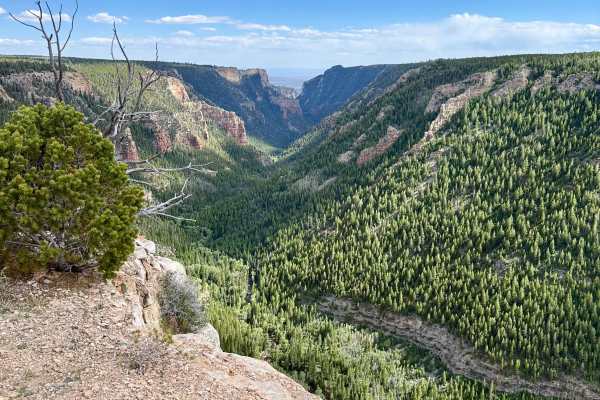
Ashley Gorge Viewpoint
This is a lollipop loop trail that leads to a stunning overlook of the Ashley Gorge. It is an easy trail with a few steep climbs, some tight turns through the trees, and potential for pinstripes. There is an outcropping of rock at the overlook that makes for a great vehicle photo opportunity. The t...
Learn more about Ashley Gorge Viewpoint
ATV trails near Vernal, Utah
Explore ATV-friendly trails near you. These trails are accessible for vehicles up to 50 inches wide, perfect for ATVs and smaller off-road machines.
Coyote Gulch
Coyote Gulch is one of several trails within the Outlaw Trail System in and around Vernal, Utah. This trail was created for Rock Rally 2024 and is between the Doc's Beach and Sand Bar trails. Rated 6 of 10, this trail consists of waving surfaces including canyons, wedges, and ledges. Throw in some s...
Learn more about Coyote Gulch
Sand Bar Loop
The Sand Bar Loop is one of several trails within the Outlaw Trail System in and around Vernal, Utah. This 3.3-mile point-to-point trail rate is used both during the Vernal Rock Rally and the Outlaw ATV Jamboree. The Rock Rally is focused on full-size 4x4 vehicles and rates the trail a 4 of 10 while...
Learn more about Sand Bar Loop
Butch Cassidy Loop
The Butch Cassidy Loop is one of several trails within the Outlaw Trail System in and around Vernal, Utah. This 15-mile loop trail is used both during the Vernal Rock Rally and the Outlaw ATV Jamboree. The Rock Rally is focused on full-size 4x4 vehicles and rates the trail a 4 of 10 while the Outlaw...
Learn more about Butch Cassidy Loop
Red Mountain Moonshine Arch
Red Mountain Moonshine Arch is a challenging and highly scenic 18.8-mile loop designed for experienced offroaders seeking demanding slickrock obstacles and stunning views of the Uintah Basin near Vernal, Utah. This route climbs over 3,400 feet, rising from an elevation of 5,532 feet to a peak of 7,7...
Learn more about Red Mountain Moonshine Arch
UTV/side-by-side trails near Vernal, Utah
Find UTV and side-by-side trails near you. These trails accommodate vehicles up to 60 inches wide, ideal for UTVs, side-by-sides, and wider off-road rigs.
Coyote Gulch
Coyote Gulch is one of several trails within the Outlaw Trail System in and around Vernal, Utah. This trail was created for Rock Rally 2024 and is between the Doc's Beach and Sand Bar trails. Rated 6 of 10, this trail consists of waving surfaces including canyons, wedges, and ledges. Throw in some s...
Learn more about Coyote Gulch
Doc's Beach-Vernal
Docs Beach is a 4.6-mile looping trail rated 7 of 10 located in Uintah County, Utah. Doc's Beach is one of the pinnacle trails of the Vernal area and has become well-known for its grippy sandstone surface, moon-like appearance, and some of the greatest scenery that can only be seen from this trail. ...
Learn more about Doc's Beach-Vernal
Sand Bar Loop
The Sand Bar Loop is one of several trails within the Outlaw Trail System in and around Vernal, Utah. This 3.3-mile point-to-point trail rate is used both during the Vernal Rock Rally and the Outlaw ATV Jamboree. The Rock Rally is focused on full-size 4x4 vehicles and rates the trail a 4 of 10 while...
Learn more about Sand Bar Loop
Sand Dune Gulch-Vernal
Sand Dune Gulch is a 2.7-mile looping trail rated 8 of 10 located in Uintah County, Utah. The trail is well known to locals and is run during both the Vernal Rock Rally and the Outlaw ATV Jamboree. Don't let the name fool you, these are not sand dunes like at the beach, these are solid sand rocks th...
Learn more about Sand Dune Gulch-Vernal
The onX Offroad Difference
onX Offroad combines trail photos, descriptions, difficulty ratings, width restrictions, seasonality, and more in a user-friendly interface. Available on all devices, with offline access and full compatibility with CarPlay and Android Auto. Discover what you're missing today!
Open Trail Map