
Dirt Bike Trails
Near Sahuarita, Arizona
Explore All Dirt Bike Trails Near Sahuarita, Arizona
Dirt Bike Trails Near Sahuarita, Arizona
Discover the best dirt bike trails near you. Browse trail maps, check difficulty ratings, and find your next adventure — whether you're looking for a quick ride or an all-day expedition.
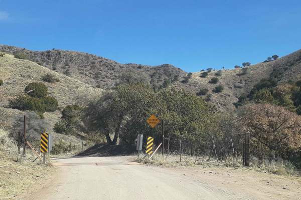
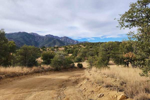
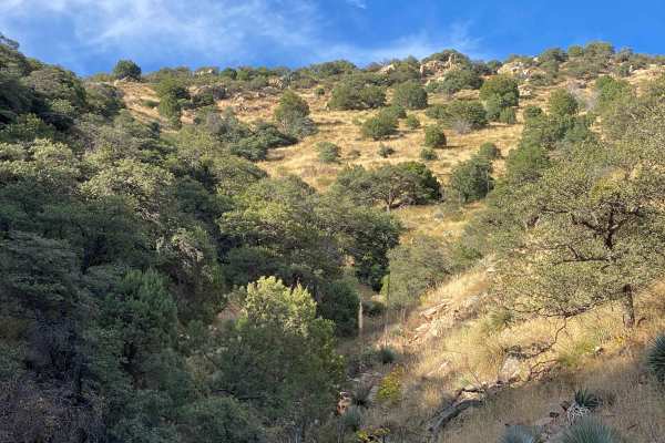
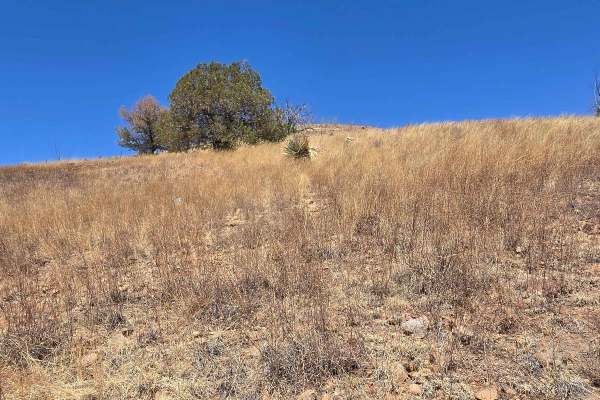
Box Canyon Road
This is a scenic drive through the Santa Rita Mountains that gets you up and out of the desert and into the oaks. Great views along the way! Coming from the east side of the mountains, it tops out behind the community of Greaterville and brings you back out to Highway 83. From there, you can head so...
Learn more about Box Canyon Road
Forest Road 183
Forest Road 183 takes you from the low desert up to nearly 6,000FT in elevation past the hiking trail heads for Elephant Head and Aguas Caliente. The route varies from 2wd high clearance to steep and 4wd high clearance recommended by the terminus at a locked gate and towers. There are campsites all ...
Learn more about Forest Road 183
Proctor Trail
A trail that will get you towards Keystone Peak in the Sierrita Mountains. If you want to continue onward, bring a mountain bike or hike; access is blocked by large boulders. Not too difficult with a Jeep or side-by-side. May be overgrown in areas, bring a hand chain saw. Goes through State Trust la...
Learn more about Proctor Trail

12 Mile Trail
This 12-mile route contains off-camber turns, steep, short climbs, river bed washes, rocky paths, and beautiful scenery that contains wildlife, mountains, and several herds of cattle. Additionally, this area is highly used by illegal immigration and caution should be taken when traveling this area a...
Learn more about 12 Mile Trail
Bull Springs Road
Experienced drivers will find this trail easy, but it has its share of rough sections, and it is extremely remote. You'll cross through ranchland and then hit Coronado National Forest to climb the lower part of the Santa Rita Mountains to 5,000 feet. There are some mines and cool adobe ruins you can...
Learn more about Bull Springs Road
Melendrez Pass
Melendrez Pass is a scenic off-road trail located in Arizona, ideal for those looking to explore the rugged beauty of the desert. Along the way, you'll encounter stunning views of the surrounding mountains and valleys, as well as opportunities to spot local wildlife. It's a great spot for a day trip...
Learn more about Melendrez Pass
Oak Tree Wash Trail
The trail starts out pretty narrow, but large enough for a Jeep or truck to pass one way. It starts out with a steep, off-camber drop. Drivers beware that normal 4x4 suspension can be damaged here along with side quarter panels if you take the drop too fast or at the wrong angle. Thereafter, the tra...
Learn more about Oak Tree Wash Trail
Fish East
Fish East is a fairly easy connector trail with few obstacles. Along Fish East, you'll discover a blend of intriguing sights and natural beauty. You'll come across remnants of old mining operations, such as those from the Santa Rita Water and Mining Company. This area is also abundant in wildlife an...
Learn more about Fish East
Red Springs Pass
Beautiful scenic trail that takes you through the middle of the Tumacacori mountains range. The first leg of the trail heading south from Amado requires high clearance and 4wd to navigate the washes and steep hills. After this section the trail opens up to the mountain pass and great views and poten...
Learn more about Red Springs Pass
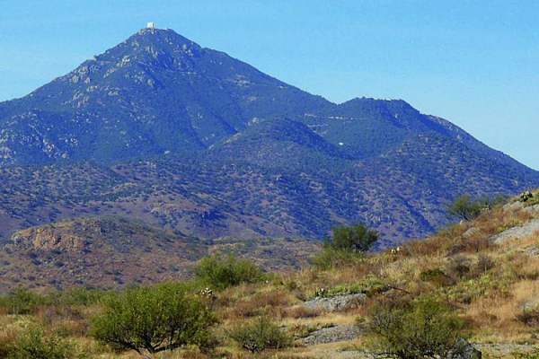
Whipple Obervatory Rally
Are you visiting family in Tucson and want to scratch that dirt road itch? Looking for a quick and easy adventure with sweeping views? Do you want to rally your family's crossover by taking the long way to the car wash? Buckle up, because this is the adventure for you!Mount Hopkins is home to the Wh...
Learn more about Whipple Obervatory Rally
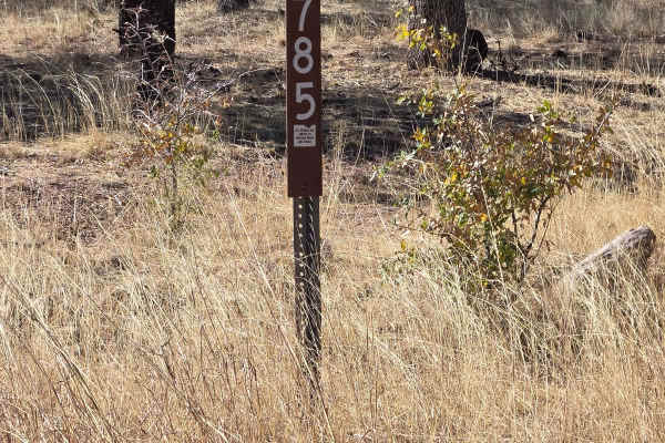
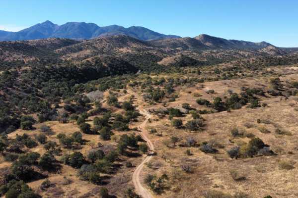
Hog Canyon- BLM 4111
From Gardner Canyon Road, turn left on 785 to the intersection, then go left on 4111. Follow this trail to the T intersection, turn right on 4088, follow this to another T intersection. This trail is passable by most vehicles. 4 wheel drive is recommended during inclement weather. The day we rode th...
Learn more about Hog Canyon- BLM 4111
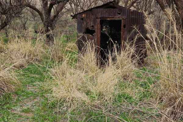
Fish Canyon
If you think the destination is as important as the journey, the kinds of artifacts you can see along this trail will really pique your interest. Deep in the foothills of the Santa Rita Mountains southeast of Tucson, you can find this hidden gem. This area is rich in mining history with old building...
Learn more about Fish Canyon
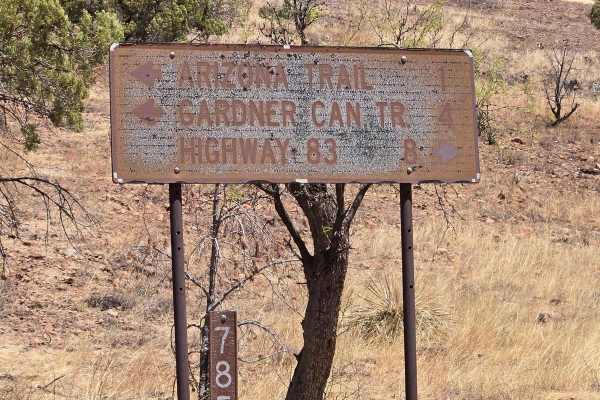
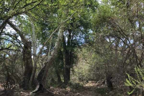
FSR 785 to trailhead
FSR 785 is a scenic drive to the trailhead in the wilderness area. You will drive through a canyon with dispersed camping areas. The ride is under sycamore, Alligator Juniper, and oak trees. There are several wash crossings, and many hiking trailheads off this trail. You may see an abundance of wild...
Learn more about FSR 785 to trailhead
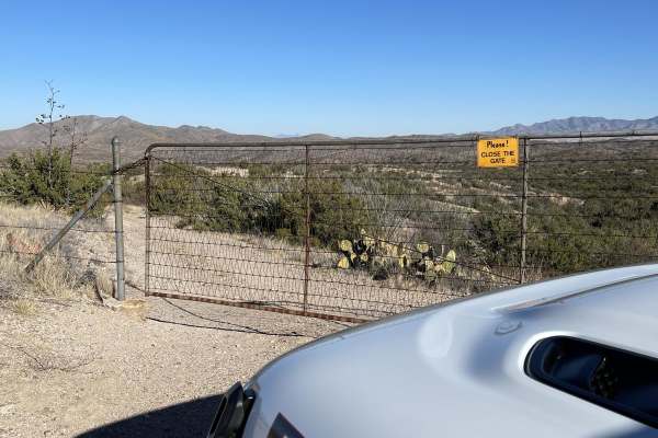
Hog Canyon Side Trail
This was a fun and engaging side trail off of Hog Canyon Trail. It meanders down the hill until you reach a gate. Be sure to close the gate if it's closed when you get there. Follow this trail to the end at a large watering pond in the trees. You may or nmay ot find cows at the end of the pond.
Learn more about Hog Canyon Side Trail
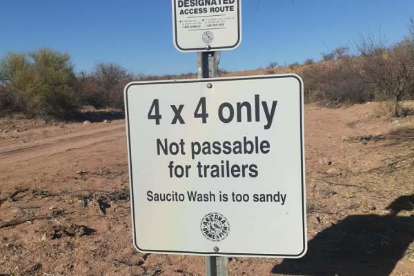
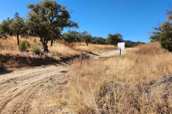
North Tumacacori Trail
Good easy trail with a lot of spurs and views of the Tumacacori Mountains,the Cerro Colorado mountain range as well as Santa Rita mountain range. Also the option of taking a bypass through the saucito wash back to Arivaca Road. Along the trail from the I-19 frontage road headed west you will pass by...
Learn more about North Tumacacori Trail
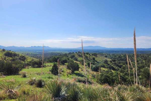
Andrada Tank Loop FR 6905
The Andrada Tank Loop is a scenic trail that offers breathtaking views of the Sonoran Desert landscape and the nearby Whetstone Mountains. The trail winds through desert terrain featuring prickly pear cacti, ocotillo plants, and rocky outcrops. When driving from the south end of the trail, about one...
Learn more about Andrada Tank Loop FR 6905
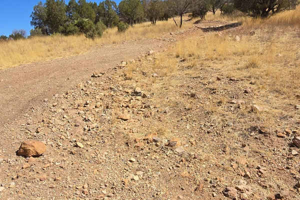
Hog Ridge - Trail 4859
This trail is a bit rocky, it rides the ridge above Hog Canyon. You will have views of the town and the mountains in the distance. You will be riding through grassy fields dotted with Mesquite and Oak trees, along with yucca, ocotillo cactus. This is a typical trail not requiring 4-wheel drive or hi...
Learn more about Hog Ridge - Trail 4859
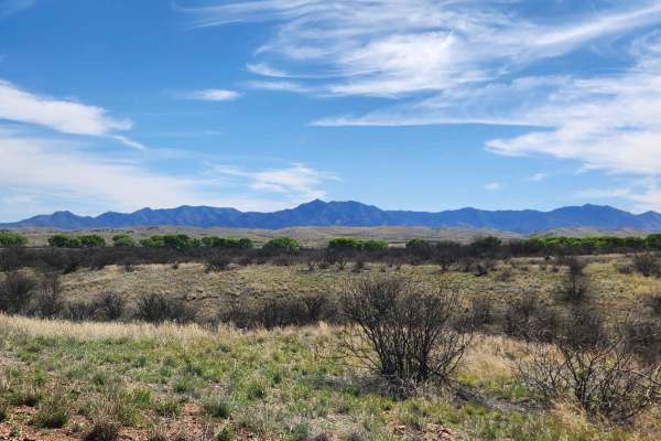
Forty Nine Wash Trail
Nestled in Arizona's expanse, a slice of "Big Sky" country unfolds along Cienega Creek. Just 45 miles southeast of Tucson, this landscape boasts wide-open grasslands, panoramic mountain views, and meandering waters that transport you to another realm. Here, cattle still graze amidst a tapestry of pr...
Learn more about Forty Nine Wash Trail
Kentucky Gulch - FR 163
Kentucky Gulch provides a gentle ascent through undulating hill terrain, with the trail meandering amidst grassy hills dotted with oak, juniper, agave, and other distinctive plant species. Be sure to check the weather conditions before heading out, as rain or snow could affect the road. Traveling on...
Learn more about Kentucky Gulch - FR 163

Oak Tree Canyon
Oak Tree Canyon is on the historic Empire Ranch, which is now known as the Las Cienegas National Conservation Area. This section features expansive mountain views, craggy peaks, and a visit to a historical site. The conservation area hosts a working ranch, so you might encounter a few cows. Thus, it...
Learn more about Oak Tree Canyon
ATV trails near Sahuarita, Arizona
Explore ATV-friendly trails near you. These trails are accessible for vehicles up to 50 inches wide, perfect for ATVs and smaller off-road machines.
Box Canyon Road
This is a scenic drive through the Santa Rita Mountains that gets you up and out of the desert and into the oaks. Great views along the way! Coming from the east side of the mountains, it tops out behind the community of Greaterville and brings you back out to Highway 83. From there, you can head so...
Learn more about Box Canyon Road
Forest Road 183
Forest Road 183 takes you from the low desert up to nearly 6,000FT in elevation past the hiking trail heads for Elephant Head and Aguas Caliente. The route varies from 2wd high clearance to steep and 4wd high clearance recommended by the terminus at a locked gate and towers. There are campsites all ...
Learn more about Forest Road 183
Proctor Trail
A trail that will get you towards Keystone Peak in the Sierrita Mountains. If you want to continue onward, bring a mountain bike or hike; access is blocked by large boulders. Not too difficult with a Jeep or side-by-side. May be overgrown in areas, bring a hand chain saw. Goes through State Trust la...
Learn more about Proctor Trail
12 Mile Trail
This 12-mile route contains off-camber turns, steep, short climbs, river bed washes, rocky paths, and beautiful scenery that contains wildlife, mountains, and several herds of cattle. Additionally, this area is highly used by illegal immigration and caution should be taken when traveling this area a...
Learn more about 12 Mile Trail
UTV/side-by-side trails near Sahuarita, Arizona
Find UTV and side-by-side trails near you. These trails accommodate vehicles up to 60 inches wide, ideal for UTVs, side-by-sides, and wider off-road rigs.
Box Canyon Road
This is a scenic drive through the Santa Rita Mountains that gets you up and out of the desert and into the oaks. Great views along the way! Coming from the east side of the mountains, it tops out behind the community of Greaterville and brings you back out to Highway 83. From there, you can head so...
Learn more about Box Canyon Road
Forest Road 183
Forest Road 183 takes you from the low desert up to nearly 6,000FT in elevation past the hiking trail heads for Elephant Head and Aguas Caliente. The route varies from 2wd high clearance to steep and 4wd high clearance recommended by the terminus at a locked gate and towers. There are campsites all ...
Learn more about Forest Road 183
Proctor Trail
A trail that will get you towards Keystone Peak in the Sierrita Mountains. If you want to continue onward, bring a mountain bike or hike; access is blocked by large boulders. Not too difficult with a Jeep or side-by-side. May be overgrown in areas, bring a hand chain saw. Goes through State Trust la...
Learn more about Proctor Trail
12 Mile Trail
This 12-mile route contains off-camber turns, steep, short climbs, river bed washes, rocky paths, and beautiful scenery that contains wildlife, mountains, and several herds of cattle. Additionally, this area is highly used by illegal immigration and caution should be taken when traveling this area a...
Learn more about 12 Mile Trail
The onX Offroad Difference
onX Offroad combines trail photos, descriptions, difficulty ratings, width restrictions, seasonality, and more in a user-friendly interface. Available on all devices, with offline access and full compatibility with CarPlay and Android Auto. Discover what you're missing today!
Open Trail Map