
Dirt Bike Trails
Near Rogue River, Oregon
Explore All Dirt Bike Trails Near Rogue River, Oregon
Dirt Bike Trails Near Rogue River, Oregon
Discover the best dirt bike trails near you. Browse trail maps, check difficulty ratings, and find your next adventure — whether you're looking for a quick ride or an all-day expedition.
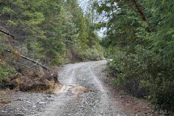
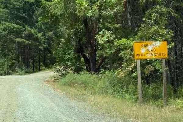
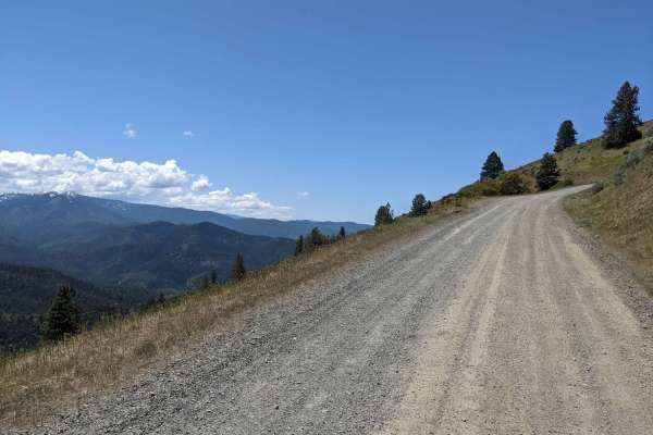
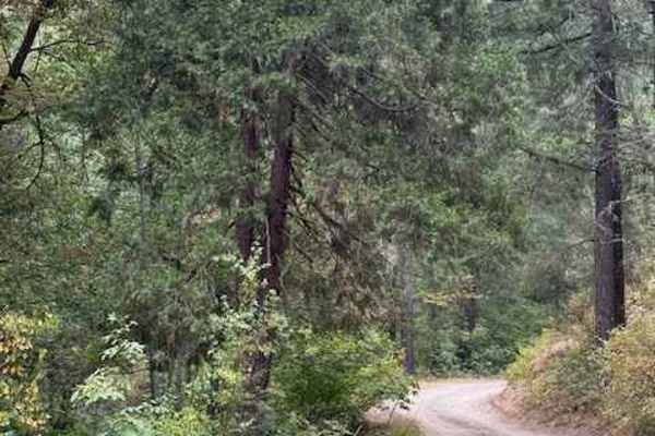
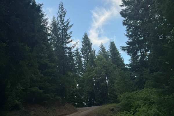
Walker Mountain Road
This trail follows a decent road that is somewhat rocky but not overly difficult. Located a short drive from Grants Pass, it offers great scenery and several pull-offs suitable for stopping to enjoy lunch and take in impressive mountain views. It remains passable in light rain and is well worth the ...
Learn more about Walker Mountain Road
Fugawe Loop
This route includes rough trails, rocks, ruts, tree roots, and very steep hills (some are longer than others). It has tight, technical single track trails with some flowy, fast spots, some deep ruts, fallen trees, and some exposed spots. It's mostly a narrow trail but is a good loop to do with a sma...
Learn more about Fugawe Loop
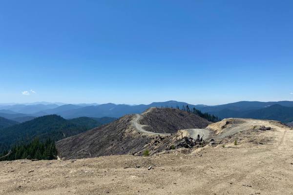
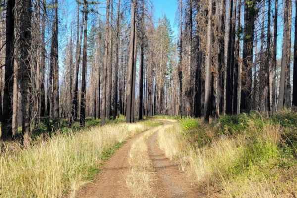
Moon Watch
Bumpy uneasy gravel roads with a lot connections to explore. Logging is active in the area, so be aware of logging trucks. When wet expect plenty of mud and a good chance of getting stuck. Has lots of blind corners and some stunning views. It's my favorite starting route to take down to Elderberry F...
Learn more about Moon Watch
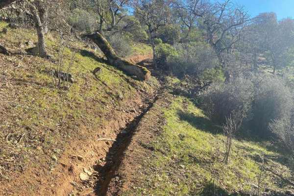
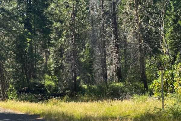
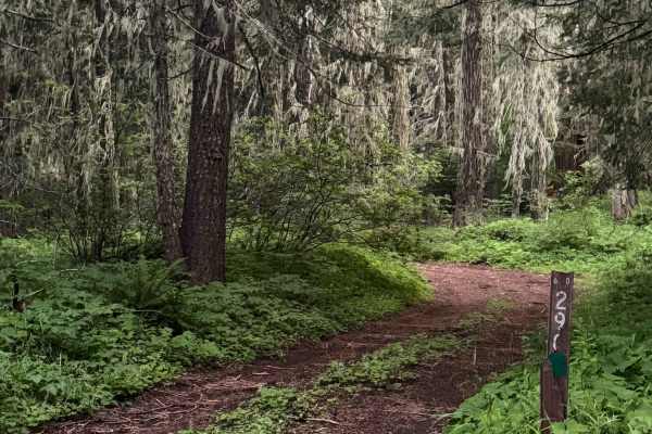
Elderberry Dead End
Lots of little hubs that branch off of this gravel road. There is no connection to candy spur hub as depicted on the GPS, so you can't loop around as it's a dead end. It's got a blue gate that is currently open just before you cross the bridge that Evens creek flows beneath.
Learn more about Elderberry Dead End
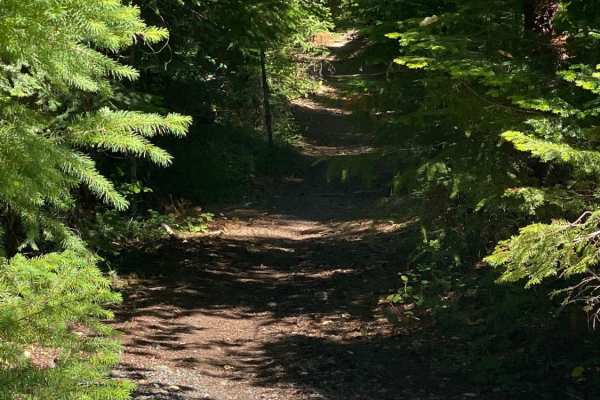
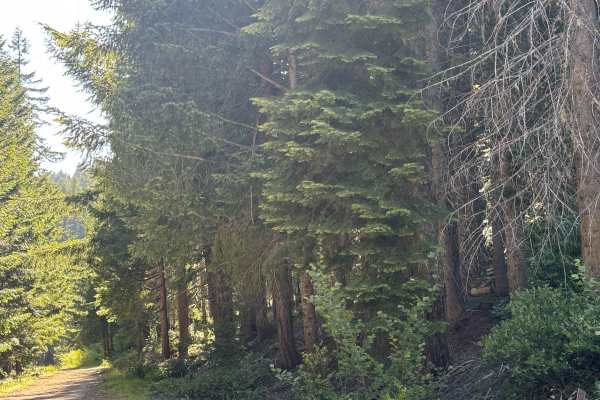
Onion Mountain, Shan Creek
Onion Mountain is a great place to break away from the crowds in town and take in some beautiful scenery. If you're lucky, you might even see a bear or two. Most of the trails are open year-round; however, heavy snow can be expected in the winter, and there are spots where you can get cell phone rec...
Learn more about Onion Mountain, Shan Creek
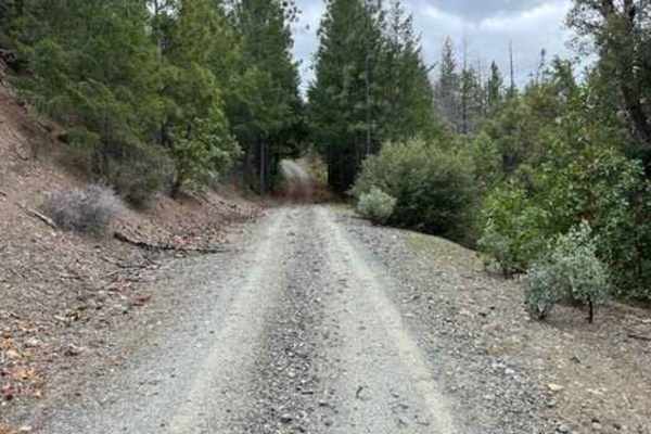
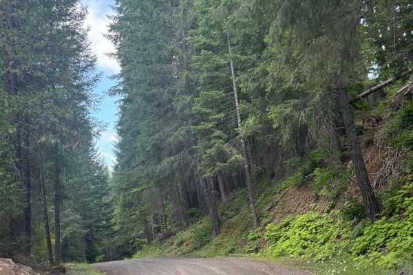
Lower Stratton Creek Road
This is a nice and easy drive. It is a gravel road with some low branches, but most full-size trucks will fit under them. There are no real washouts on this section, even with all the rain. The trail is pretty easy to drive most times of the year. The trail has a nice turnaround at the end.
Learn more about Lower Stratton Creek Road

Right Fork Hellgate Recreation Site
This is a gravel road with some middle-of-the-road washouts that you will have to straddle with your vehicle. Great overlook of the valley below and the Rogue River about halfway up. The trail is a bit overgrown from the winter. So if you're concerned about scratches may want to pick a different pat...
Learn more about Right Fork Hellgate Recreation Site
Spur Road
This is a spur road following Palmer creek. There are lots of active mining claims along this stretch of creek. Also lots of side roads that just dead-end. Up by Baily Gulch, there are remains of an old hard rock mine. Concrete structures. Be careful as they are still actively mining this area.
Learn more about Spur Road
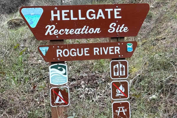
Hellgate Recreation Site
This is a nice trail that is definitely easier during the summer. The technical rating ranges from between a 1 to 3 in difficulty. There are some mud slides, but they are easy enough to get through, and the road ended at a good-sized washout. This trail goes through some beautiful country. The trail...
Learn more about Hellgate Recreation Site
Anderson Butte Road
Anderson Butte Road is exceptionally scenic and can be run in most seasons. There are not many obstacles, though there are a couple of off-shoots that are fun (including Picnic Trail which is a nice spot for camping or a picnic). The road is largely a well maintained dirt/gravel road, with very fe...
Learn more about Anderson Butte Road
Taylor Ridge Road
This trail is best ridden during the summer. It's a great road even in the rain. Lots of trees are down on the road, depending on the time of year, as you will see in the pictures. This road is about 2 miles up Taylor Creek Road. There are a couple of good overnight camping spots on this road, as we...
Learn more about Taylor Ridge Road
Long Way to Little Applegate River
This is a connection road between the back side of Talent, OR and the Rogue River/Siskiyou National Forests. The road leaves an area of homes and farms and climbs to about 4,200 feet before descending to Brick Pile Road. The road can be run in either direction. There are some beautiful views of the ...
Learn more about Long Way to Little Applegate River
Wagner & Siskiyou
This is a great run from Wagner Creek through parts of Siskiyou Pass to Maple Dell Gap. From Maple Dell Gap you can continue on to Squaw Lake or head north and reconnect with Siskiyou Pass. You can also head South into CA. We ran this trail Memorial Day weekend and encountered a downed tree and c...
Learn more about Wagner & Siskiyou
Payette Trail - FS 970
Payette Trail #970 is accessible during late summer when the Applegate Lake water levels are lower. It is located at the southeast end of the lake off of Forest Road 1075, which takes you to Acorn Womans Lake. The trail starts off as a single wide dirt road with some turnouts to pass. As you get clo...
Learn more about Payette Trail - FS 970
Page Mountain
The Page Mountain Trail is an out and back at Siskiyou National Forest in Oregon. It is a very easy ride with one tight spot that could potentially cause pinstripes if not passed with care. There's a very large rocky area at the top that makes for some cool campsites. The base of the trail has 2 res...
Learn more about Page Mountain
FS 6640
This is a hard-packed, gravel-based forest road that gradually climbs over 2,300 feet in elevation. In the beginning, the views are of forest and surrounding peaks and ridges, but closer to the top it opens up into meadows. There are some potholes you want to avoid as well as minor ruts and wash, bu...
Learn more about FS 6640
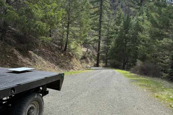
Buck Basin - FS 6600-300
This is a narrow, one-lane, gravel-based forest road with 1,300 feet of elevation change. The trail has lots of overgrown vegetation, and you will have dense forest views and views of the surrounding ridges. Camping is allowed along this trail, and there are several pre-existing campsites. There are...
Learn more about Buck Basin - FS 6600-300
White Point Lookout Trail
This is a dirt-based forest road that climbs up to the White Point Lookout Tower. The trail is narrow and one vehicle wide, with overgrown vegetation most of the way. There are some small ledges and a couple of mud holes, but overall this is an easy trail that is suitable for any vehicle type, but e...
Learn more about White Point Lookout Trail
Hall's Point - FS 6400-200
This trail is a forest road that starts off with some gravel and then transitions to dirt. The trail steadily climbs over 2,300 feet in elevation over approximately 5.6 miles. The trail is mostly one lane wide with places to pass, and some areas have overgrown vegetation and tight trees. As the trai...
Learn more about Hall's Point - FS 6400-200
FS 6400
This is a hard-packed, gravel-based forest road in the Prospect OHV area. The trail begins as you cross an old wooden bridge where there is minor wash. The trail gradually climbs around 500 feet in elevation over just under 7 miles. This is a main trail into the network of trails, and one end of the...
Learn more about FS 6400
ATV trails near Rogue River, Oregon
Explore ATV-friendly trails near you. These trails are accessible for vehicles up to 50 inches wide, perfect for ATVs and smaller off-road machines.
Walker Mountain Road
This trail follows a decent road that is somewhat rocky but not overly difficult. Located a short drive from Grants Pass, it offers great scenery and several pull-offs suitable for stopping to enjoy lunch and take in impressive mountain views. It remains passable in light rain and is well worth the ...
Learn more about Walker Mountain Road
Moon Watch
Bumpy uneasy gravel roads with a lot connections to explore. Logging is active in the area, so be aware of logging trucks. When wet expect plenty of mud and a good chance of getting stuck. Has lots of blind corners and some stunning views. It's my favorite starting route to take down to Elderberry F...
Learn more about Moon Watch
Elderberry Dead End
Lots of little hubs that branch off of this gravel road. There is no connection to candy spur hub as depicted on the GPS, so you can't loop around as it's a dead end. It's got a blue gate that is currently open just before you cross the bridge that Evens creek flows beneath.
Learn more about Elderberry Dead End
Onion Mountain, Shan Creek
Onion Mountain is a great place to break away from the crowds in town and take in some beautiful scenery. If you're lucky, you might even see a bear or two. Most of the trails are open year-round; however, heavy snow can be expected in the winter, and there are spots where you can get cell phone rec...
Learn more about Onion Mountain, Shan Creek
UTV/side-by-side trails near Rogue River, Oregon
Find UTV and side-by-side trails near you. These trails accommodate vehicles up to 60 inches wide, ideal for UTVs, side-by-sides, and wider off-road rigs.
Walker Mountain Road
This trail follows a decent road that is somewhat rocky but not overly difficult. Located a short drive from Grants Pass, it offers great scenery and several pull-offs suitable for stopping to enjoy lunch and take in impressive mountain views. It remains passable in light rain and is well worth the ...
Learn more about Walker Mountain Road
Moon Watch
Bumpy uneasy gravel roads with a lot connections to explore. Logging is active in the area, so be aware of logging trucks. When wet expect plenty of mud and a good chance of getting stuck. Has lots of blind corners and some stunning views. It's my favorite starting route to take down to Elderberry F...
Learn more about Moon Watch
Elderberry Dead End
Lots of little hubs that branch off of this gravel road. There is no connection to candy spur hub as depicted on the GPS, so you can't loop around as it's a dead end. It's got a blue gate that is currently open just before you cross the bridge that Evens creek flows beneath.
Learn more about Elderberry Dead End
Onion Mountain, Shan Creek
Onion Mountain is a great place to break away from the crowds in town and take in some beautiful scenery. If you're lucky, you might even see a bear or two. Most of the trails are open year-round; however, heavy snow can be expected in the winter, and there are spots where you can get cell phone rec...
Learn more about Onion Mountain, Shan Creek
The onX Offroad Difference
onX Offroad combines trail photos, descriptions, difficulty ratings, width restrictions, seasonality, and more in a user-friendly interface. Available on all devices, with offline access and full compatibility with CarPlay and Android Auto. Discover what you're missing today!
Open Trail Map