
Dirt Bike Trails
Near Rockvale, Colorado
Explore All Dirt Bike Trails Near Rockvale, Colorado
Dirt Bike Trails Near Rockvale, Colorado
Discover the best dirt bike trails near you. Browse trail maps, check difficulty ratings, and find your next adventure — whether you're looking for a quick ride or an all-day expedition.
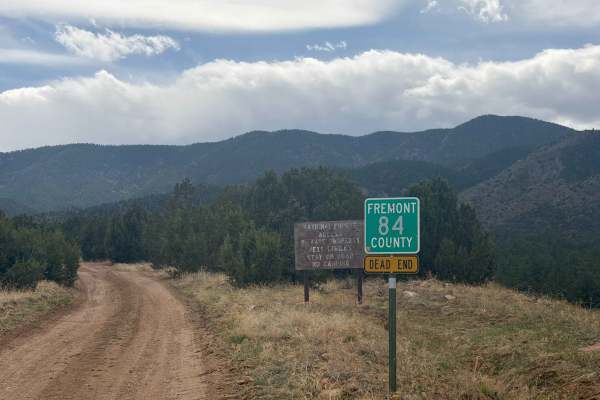
Fremont County 84
Easy access road (FS 84) reached via County Road 84 outside Florence, CO. The route primarily crosses private property before entering the San Isabel National Forest. At the end, there’s a small turnaround loop with limited parking (one vehicle), and camping is not permitted. This road serves as a c...
Learn more about Fremont County 84
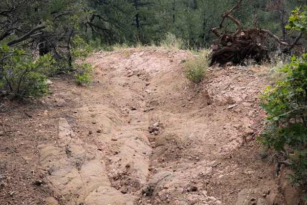
Tanner Peak Trail - FS 1333
Tanner Peak Trail is a long and technical ATV trail near Cañon City, Colorado. There are fun rocky challenges in every mile of the 10-mile-long route. The trail is in great shape- not rutted out or off-camber, clear of logs, and an ideal width for 50 inches vehicles. Starting at the Tanner trailhead...
Learn more about Tanner Peak Trail - FS 1333
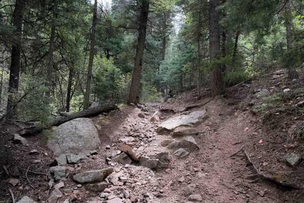
Lion Canyon Trail 1329
Lion Canyon Trail provides a technical and rocky single-track experience in the San Isabel National Forest south of Cañon City, Colorado. The north end of the trail starts at a small parking area with a couple of dispersed campsites, on a spur off of County Road 143. The single track starts off with...
Learn more about Lion Canyon Trail 1329

East Bear Trail
East Bear Trailhead is the beginning point. It is shared trail with hiking, motorcycles, bikes, and horses. Spring to fall is a decent time to be on the trail, as the area doesn't get a lot of snow and stays warmer. Making the way through the tight single-track trail, it has loose rocks, flowy secti...
Learn more about East Bear Trail
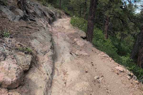
Stultz Trail - FS 1334
Stultz Trail is a 6.4-mile-long easy ATV trail through the San Isabel National Forest, south of Cañon City, Colorado. The trail is a gradual descent from west to east, dropping over 2,500 feet in elevation throughout the route. The first 5 miles are very easy, starting on a grassy and forested hillt...
Learn more about Stultz Trail - FS 1334
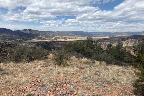
BLM 6181
Easy-to-moderate trail located near Cañon City, CO, off Temple Canyon Road, offering a mix of off-camber sections, rocky obstacles, and tight stretches without bypasses that can challenge less experienced drivers. The trail winds through rugged terrain and rewards you at the end with panoramic, brea...
Learn more about BLM 6181
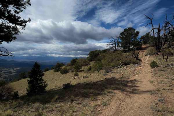
FS 1333A
FSl 1333A is a short ATV spur off of Tanner Peak Trail that leads to an incredible view overlooking the Wet Mountains and several homes in the Yorkville valley. The short trail is about a half mile long and will be ridden as an out-and-back, making it a quick detour with a very rewarding view. It st...
Learn more about FS 1333A
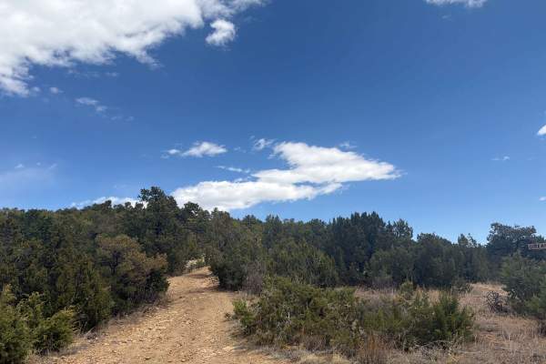
BLM 6182
Easy-to-moderate dirt trail located off Temple Canyon Road just outside Cañon City. This narrow route winds through tight trees, making it better suited for smaller vehicles rather than full-size rigs. Along the way, it offers a scenic overlook of Temple Canyon with Grape Creek flowing below, and pr...
Learn more about BLM 6182

Second Newlins SO. Road
This road gets rocky in places, requiring 4WD. At the National Forest boundary, there is a sign that calls the road Willow Creek Road 274. Once you get on top of the ridge, the road is fairly easy. You will pass through areas of aspens, pines, and open meadows.
Learn more about Second Newlins SO. Road
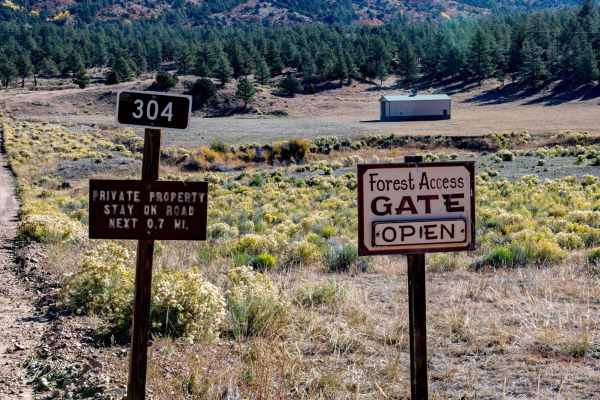
Bear Gulch Road FR 304
The first mile runs through private property. At the 2 mile mark, the road starts climbing and gets more rocky and will require four-wheel drive. The first marked camping spot is large enough for a RV trailer up to 20 feet, or the area could be used for staging.
Learn more about Bear Gulch Road FR 304
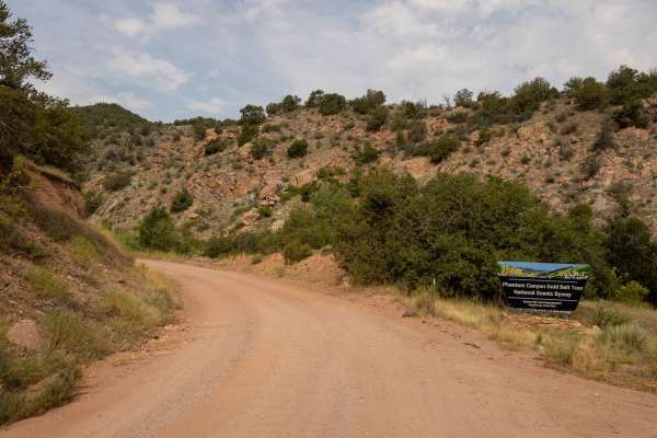
Phantom Canyon
Phantom Canyon Road is a historic and scenic 30-mile unpaved route in southern Colorado, connecting Cañon City to Victor. Part of the Gold Belt Scenic Byway, it follows the path of the Florence and Cripple Creek Railroad, constructed in 1894 to transport gold and supplies to the Cripple Creek mining...
Learn more about Phantom Canyon
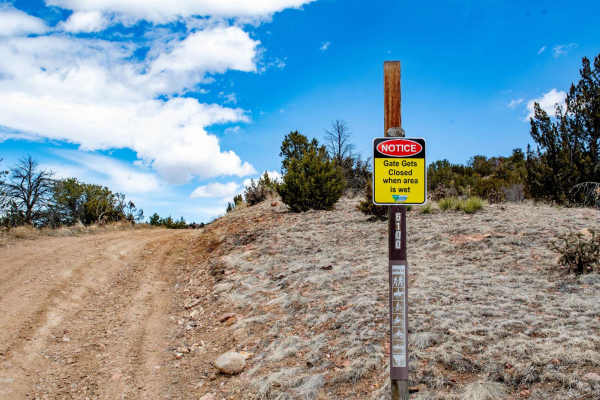
Grand Canyon Hills Road BLM 6100
The trail is pretty easy unless wet; then it is really muddy in places. Sometimes when conditions are wet and muddy, the BLM will close the gate. The trail travels up through pinyon pine, cedar trees, and some meadows. At the top, the last quarter mile of the trail gets narrow and rockier. There, yo...
Learn more about Grand Canyon Hills Road BLM 6100
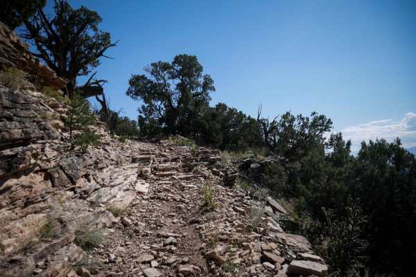
6101A
This 2-mile-long ATV trail rides along the west perimeter of the Penrose Commons Recreation Area. The southern beginning is pretty easy, just curving through the pinyon pine on a smoother trail. It gets rockier later as it starts ascending steeply up the mesa, with more loose rock in the trail, and ...
Learn more about 6101A

Penrose Commons (BLM #1602)
Penrose Commons OHV Trail# 6102 is the main trail that connects other trails in the area. Enjoy panoramic views including the Sangre De Cristo Mountain Range. The trail traverses through Pinon and Juniper Trees as well as the occasional deer sighting. There are a couple of steep ledges up to 12"-18"...
Learn more about Penrose Commons (BLM #1602)
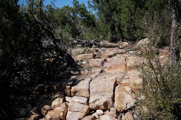
The Ridge - Penrose Commons Recreation Area
This is a new singletrack within the Penrose Commons Recreation Area. The south end starts out on top of a mesa, on a rocky trail that rides over a bunch of rock slab and rock ledges. It goes up some two-foot tall blunt rock ledges, similarly tall drop-offs, and curves around through the pinyon pine...
Learn more about The Ridge - Penrose Commons Recreation Area
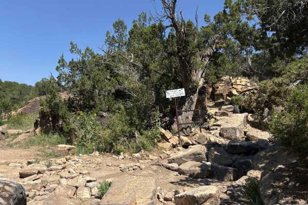
Liberty
Part of the legendary Independence Off-Road Trail System, Liberty Trail is the longest and also the easiest, but it still provides a technical rock-crawling challenge. Expect scattered rock gardens leading to larger and more challenging obstacles littered throughout the canyon floor. Similar to the ...
Learn more about Liberty

Penrose Commons BLM#6102A
Penrose Commons OHV Trail# 6102A is the trail that overlooks a narrow valley where the famous Patriot trails traverse (Independence Trail, Patriot Trail, and Liberty Trail). Although this trail connects the well-known extreme 4x4 trail, 6102A is a moderate trail consisting of mostly rocks and surrou...
Learn more about Penrose Commons BLM#6102A
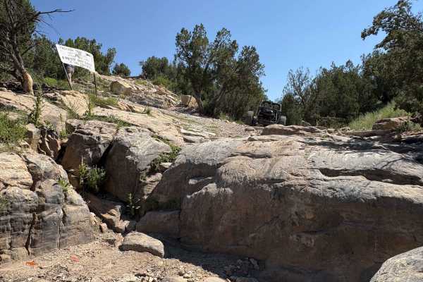
Independece
The trail that started it all, Independence, is a short but brutal crawl through rocky washes and canyon terrain. Its steep drop-ins, vertical ledges, and tight exits make it every bit as difficult as Patriot, despite its shorter length. Independence serves as a gateway to the full trail system, del...
Learn more about Independece
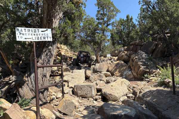
Patriot
Patriot Trail is the heart-pounding centerpiece of the Independence Off-Road Trail System, widely regarded as one of Colorado’s most challenging rock-crawling trails. Tucked into rugged canyon country, Patriot delivers a relentless gauntlet of vertical waterfalls, deep cracks, and tight boulder-stre...
Learn more about Patriot
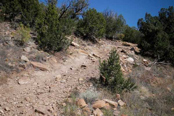
6101B
This is an intermediate ATV trail through Penrose Commons that curves through the pinyon pine on a wide dirt track with lots of loose rock on the surface. There are embedded rock layers in the trail that make small ledges, and some steep hill climbs that are full of loose rock. The trail has some sh...
Learn more about 6101B
ATV trails near Rockvale, Colorado
Explore ATV-friendly trails near you. These trails are accessible for vehicles up to 50 inches wide, perfect for ATVs and smaller off-road machines.
Fremont County 84
Easy access road (FS 84) reached via County Road 84 outside Florence, CO. The route primarily crosses private property before entering the San Isabel National Forest. At the end, there’s a small turnaround loop with limited parking (one vehicle), and camping is not permitted. This road serves as a c...
Learn more about Fremont County 84
Tanner Peak Trail - FS 1333
Tanner Peak Trail is a long and technical ATV trail near Cañon City, Colorado. There are fun rocky challenges in every mile of the 10-mile-long route. The trail is in great shape- not rutted out or off-camber, clear of logs, and an ideal width for 50 inches vehicles. Starting at the Tanner trailhead...
Learn more about Tanner Peak Trail - FS 1333
Stultz Trail - FS 1334
Stultz Trail is a 6.4-mile-long easy ATV trail through the San Isabel National Forest, south of Cañon City, Colorado. The trail is a gradual descent from west to east, dropping over 2,500 feet in elevation throughout the route. The first 5 miles are very easy, starting on a grassy and forested hillt...
Learn more about Stultz Trail - FS 1334
BLM 6181
Easy-to-moderate trail located near Cañon City, CO, off Temple Canyon Road, offering a mix of off-camber sections, rocky obstacles, and tight stretches without bypasses that can challenge less experienced drivers. The trail winds through rugged terrain and rewards you at the end with panoramic, brea...
Learn more about BLM 6181
UTV/side-by-side trails near Rockvale, Colorado
Find UTV and side-by-side trails near you. These trails accommodate vehicles up to 60 inches wide, ideal for UTVs, side-by-sides, and wider off-road rigs.
BLM 6181
Easy-to-moderate trail located near Cañon City, CO, off Temple Canyon Road, offering a mix of off-camber sections, rocky obstacles, and tight stretches without bypasses that can challenge less experienced drivers. The trail winds through rugged terrain and rewards you at the end with panoramic, brea...
Learn more about BLM 6181
Second Newlins SO. Road
This road gets rocky in places, requiring 4WD. At the National Forest boundary, there is a sign that calls the road Willow Creek Road 274. Once you get on top of the ridge, the road is fairly easy. You will pass through areas of aspens, pines, and open meadows.
Learn more about Second Newlins SO. Road
Bear Gulch Road FR 304
The first mile runs through private property. At the 2 mile mark, the road starts climbing and gets more rocky and will require four-wheel drive. The first marked camping spot is large enough for a RV trailer up to 20 feet, or the area could be used for staging.
Learn more about Bear Gulch Road FR 304
Grand Canyon Hills Road BLM 6100
The trail is pretty easy unless wet; then it is really muddy in places. Sometimes when conditions are wet and muddy, the BLM will close the gate. The trail travels up through pinyon pine, cedar trees, and some meadows. At the top, the last quarter mile of the trail gets narrow and rockier. There, yo...
Learn more about Grand Canyon Hills Road BLM 6100
The onX Offroad Difference
onX Offroad combines trail photos, descriptions, difficulty ratings, width restrictions, seasonality, and more in a user-friendly interface. Available on all devices, with offline access and full compatibility with CarPlay and Android Auto. Discover what you're missing today!
Open Trail Map