
Dirt Bike Trails
Near Princeton, Idaho
Explore All Dirt Bike Trails Near Princeton, Idaho
Dirt Bike Trails Near Princeton, Idaho
Discover the best dirt bike trails near you. Browse trail maps, check difficulty ratings, and find your next adventure — whether you're looking for a quick ride or an all-day expedition.
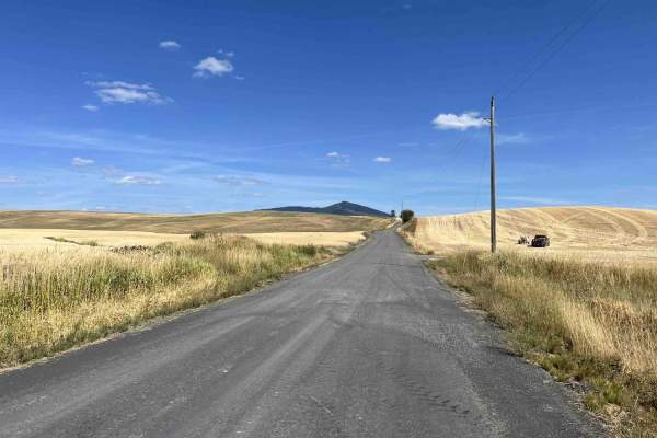
Gold Hill - FS 770
Gold Hill (FS 770) is a 5.6-mile, point-to-point trail that takes drivers from US Highway 95 up into the Gold Hill trail network. Gold Hill starts in rolling wheat fields and ends up in the hills at an intersection with Big Creek (FS 370). Coming from the west side, Gold Hill is a slow but steady cl...
Learn more about Gold Hill - FS 770
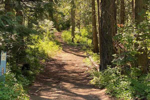
Wheelbarrow Mine
This out-and-back trail starts near Prospect Peak and takes you through timber and brush on several different surfaces on what is almost a total climb up to the top of Gold Hill. The trail begins in fairly smooth dirt with a nice banked S-turn on the first climb before shortly leveling out for a way...
Learn more about Wheelbarrow Mine
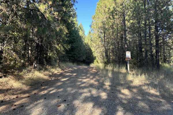
Hoteling Creek C - FS 73680
Hoteling Creek C is a 1-mile out-and-back trail that breaks off from Hoteling Creek. It continues north along the east side of Gold Hill before ending at an open area with space for several vehicles to camp or have lunch. FS 73680 is heavily overgrown in some spots; vehicles larger than quads will g...
Learn more about Hoteling Creek C - FS 73680
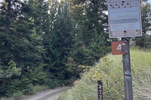
Carrico Mine - FS 4775
Carrico Mine is a 2.2-mile out-and-back single-lane trail that ends at an intersection with East Fork Gold Creek, a 50-inch and under trail. According to motor vehicle use maps (MVUMs), the trail continues for another 0.5 miles past East Fork Gold Creek. As of 9/15/25, there are large, essentially i...
Learn more about Carrico Mine - FS 4775
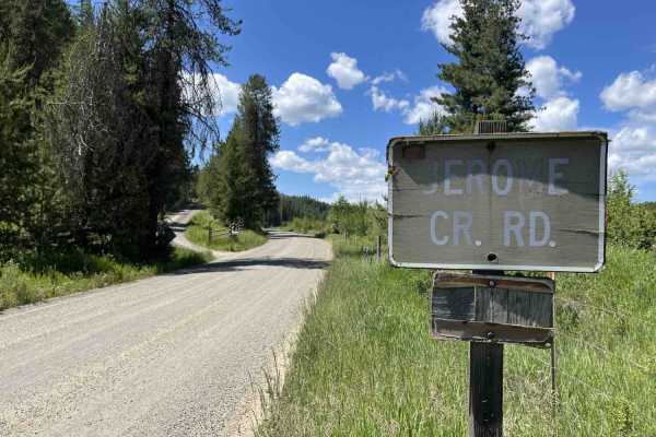
Jerome Creek - FS 788
Jerome Creek (FS 788) is a 10.4-mile, well-maintained gravel road loop that starts near Idaho Route 6 and climbs up the southeast side of Gold Hill before turning back down and reconnecting with itself. For the first 3 miles, Jerome Creek crosses several parcels of private property;fortunately, thes...
Learn more about Jerome Creek - FS 788
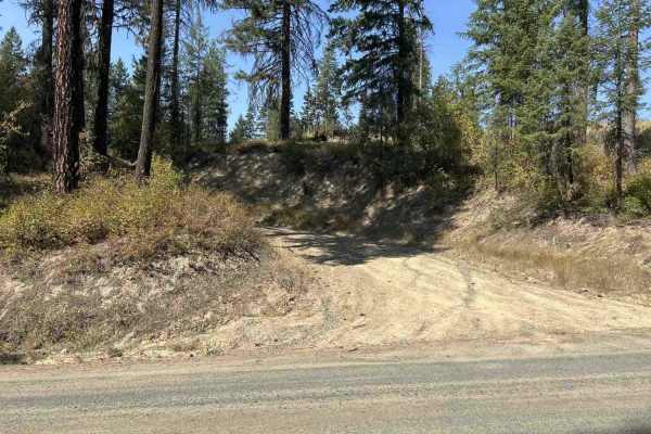
Gold Hill - FS 770-A
770-A Gold Hill is a 2-mile out-and-back trail that breaks off from 770 Gold Hill. It is gated at the bottom, and according to signs nearby, the gate may be closed at any time. 770-A is a good side trip from 770, with several short trails that break off from 770-A to explore. There are several pull-...
Learn more about Gold Hill - FS 770-A
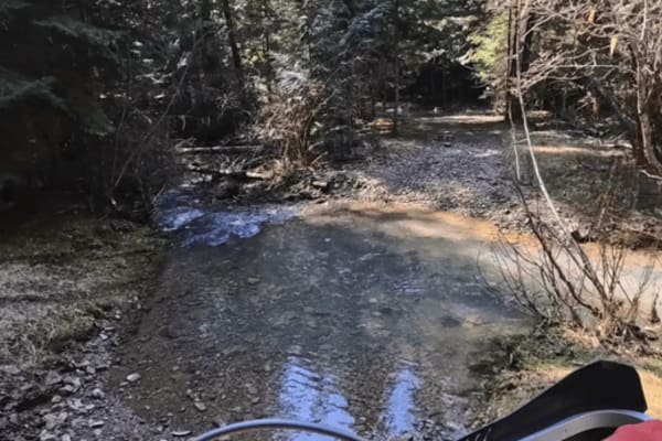
East Fork Gold Creek Trail 763
This is a popular trail in the area and has experienced much traffic. There are deeper ruts; in the early part of the season, expect some mud. The trail i almost all climb or descent depending which direction you ride from. It goes through a lot of timber, with some open patches. There is a creek...
Learn more about East Fork Gold Creek Trail 763
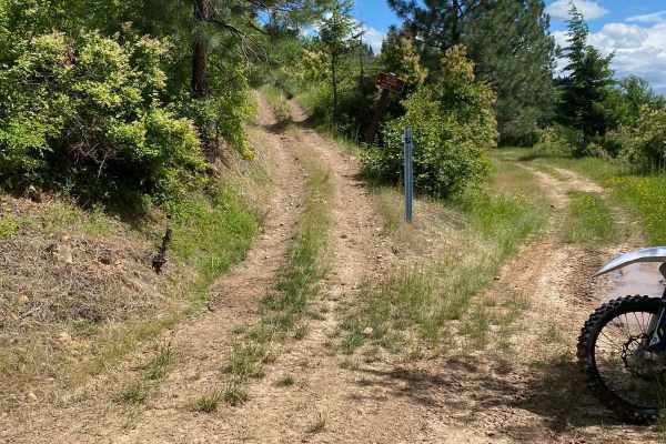
Mt. Margaret
The Mt. Margaret Trail is a short and at times intense trail that takes off from the west end of the flat creek trail before re-joining the flat creek trail to the east. The first third from the west side is all climbs and switchbacks/s-turns. Dirt bikers will have a lot of fun with the great banked...
Learn more about Mt. Margaret
Treasure Gulch - FS 1418
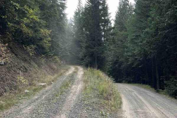
1418 Treasure Gulch is a 3-mile out-and-back trail that breaks off from 770 Gold Hill. FS 1418 climbs up and along the west side of the geographical feature by the same name, Treasure Gulch, before cresting the ridge at an intersection with Waterhole Creek, a 50" and under trail. Before the intersec...
Learn more about Treasure Gulch - FS 1418
Ruby Creek
Starting right at the trailhead, this is the main trail in the Ruby Creek/Mt. Margaret trail system. It is a relatively easy, two-track trail with some ruts, potholes, and washes but overall is a very easy trail to build loops from and access the other trails in the area. There are several signs alo...
Learn more about Ruby Creek
Flat Creek
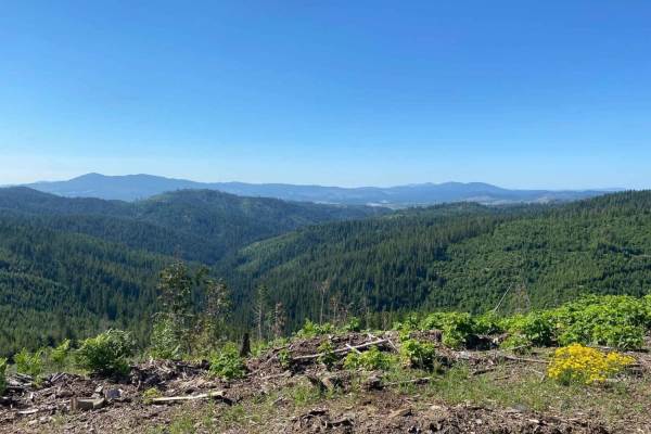
Flat Creek Trail takes you from the Ruby Creek Trailhead to Mica Mountain. This trail has a variety of surfaces, trail widths, and overall conditions throughout and presents an enjoyable trip for riders of various skill levels. There are a few steep climbs, washed-out ruts, water bars, and kelly hum...
Learn more about Flat Creek
Chelsey Creek - FS 1960
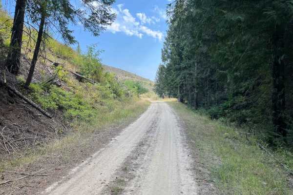
Chelsey Creek is a 6.4-mile point-to-point trail that breaks off of Big Creek Road into a small valley when starting from the lower east side. Through the valley, the road surface is a mix of dirt and thin silt. As the trail begins to climb, the surface turns to dirt with some smaller rocks. After t...
Learn more about Chelsey Creek - FS 1960
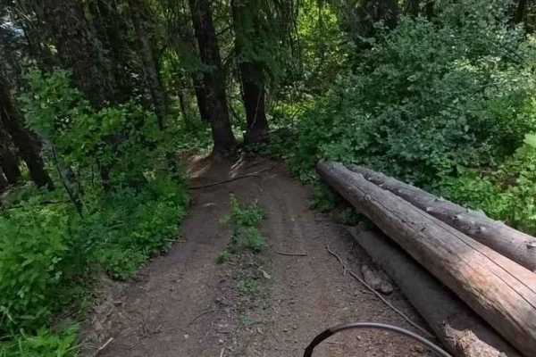
Chesley Creek Trail 19
This is one of the more enjoyable trails in the area, with lots of elevation changes, several banked corners, and switchbacks. It is smooth and flowy, which makes for a great ride. The trail winds through a mix of shady timber and open clear-cut areas. There has been some logging in the area, so the...
Learn more about Chesley Creek Trail 19
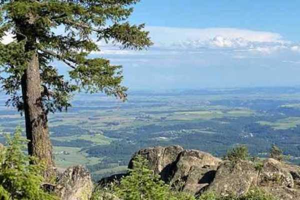
Moscow Mountain Lookout
This is a short but fun ride up to the Moscow Mountain lookout, which resides on the East Summit of Moscow Mountain. This trail is mostly dirt, with the first several hundred yards made up of large 2" gravel rock. This trail is relatively wide for a good portion before turning to a narrow two-track ...
Learn more about Moscow Mountain Lookout
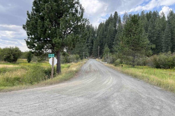
Big Creek Road - FS 370
Big Creek Road is a 13.5-mile out-and-back gravel road that climbs from ID6 around the north side of Gold Hill and serves as an access point to many other trails in the Gold Hill trail network. The first 8.4 miles weave in and out of private property and private timberland. Big Creek remains a well-...
Learn more about Big Creek Road - FS 370
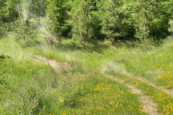
Ruby Creek C
This trail travels through an old clearcut and has a variety of level fast sections, water bars, and some really fun corners that drop in steep and bank back up pretty steeply where the trail crosses little drainages. Those sections can get a little off-camber so pick a good line through. The trail ...
Learn more about Ruby Creek C
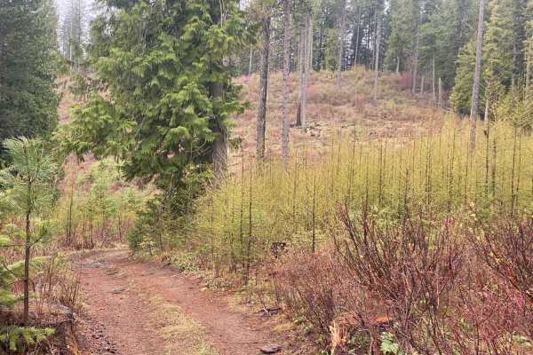
Waterhole Creek
Waterhole Creek Trail (Trail 15) is an engaging off-road route in the Palouse Trail System of the Hoodoo Mountains, perfect for drivers of high-clearance four-wheel-drive vehicles and SxSs seeking scenic ridge views and dense forest shade. Spanning approximately 4.8 miles, this trail links Gold Hill...
Learn more about Waterhole Creek
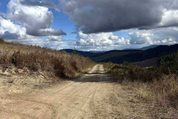
Palouse Divide West - FS 377
Palouse Divide West (FS 377) is a 15.3 point-to-point trail that, when starting from the west side, begins at the end of Big Creek Road. It winds down into the backside of Prospect Peak into a valley and continues along Meadow Creek for several miles before making a sharp left shown in the second pi...
Learn more about Palouse Divide West - FS 377
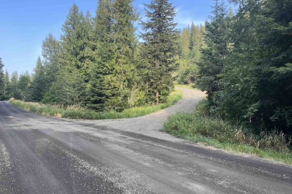
Crane Point/FS 1273
Crane Point is a 3.7-mile out-and-back gravel road that climbs from US95 to Crane Point. The gravel road is well maintained and ranges from one to two vehicles wide. Crane Point serves as the main access point to the Crane Point trail network. There is logging activity, so watch for logging trucks a...
Learn more about Crane Point/FS 1273
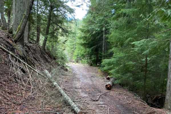
Boundary Point
This trail runs through timbered areas, with a good portion running through thick darker timbered areas making for a neat experience. This trail is not highly maintained so there is a fair amount of brush on either side of the trail in some portions. Expect to cross over and under blown-down trees. ...
Learn more about Boundary Point
ATV trails near Princeton, Idaho
Explore ATV-friendly trails near you. These trails are accessible for vehicles up to 50 inches wide, perfect for ATVs and smaller off-road machines.
Gold Hill - FS 770
Gold Hill (FS 770) is a 5.6-mile, point-to-point trail that takes drivers from US Highway 95 up into the Gold Hill trail network. Gold Hill starts in rolling wheat fields and ends up in the hills at an intersection with Big Creek (FS 370). Coming from the west side, Gold Hill is a slow but steady cl...
Learn more about Gold Hill - FS 770
Wheelbarrow Mine
This out-and-back trail starts near Prospect Peak and takes you through timber and brush on several different surfaces on what is almost a total climb up to the top of Gold Hill. The trail begins in fairly smooth dirt with a nice banked S-turn on the first climb before shortly leveling out for a way...
Learn more about Wheelbarrow Mine
Hoteling Creek C - FS 73680
Hoteling Creek C is a 1-mile out-and-back trail that breaks off from Hoteling Creek. It continues north along the east side of Gold Hill before ending at an open area with space for several vehicles to camp or have lunch. FS 73680 is heavily overgrown in some spots; vehicles larger than quads will g...
Learn more about Hoteling Creek C - FS 73680
Carrico Mine - FS 4775
Carrico Mine is a 2.2-mile out-and-back single-lane trail that ends at an intersection with East Fork Gold Creek, a 50-inch and under trail. According to motor vehicle use maps (MVUMs), the trail continues for another 0.5 miles past East Fork Gold Creek. As of 9/15/25, there are large, essentially i...
Learn more about Carrico Mine - FS 4775
UTV/side-by-side trails near Princeton, Idaho
Find UTV and side-by-side trails near you. These trails accommodate vehicles up to 60 inches wide, ideal for UTVs, side-by-sides, and wider off-road rigs.
Gold Hill - FS 770
Gold Hill (FS 770) is a 5.6-mile, point-to-point trail that takes drivers from US Highway 95 up into the Gold Hill trail network. Gold Hill starts in rolling wheat fields and ends up in the hills at an intersection with Big Creek (FS 370). Coming from the west side, Gold Hill is a slow but steady cl...
Learn more about Gold Hill - FS 770
Hoteling Creek C - FS 73680
Hoteling Creek C is a 1-mile out-and-back trail that breaks off from Hoteling Creek. It continues north along the east side of Gold Hill before ending at an open area with space for several vehicles to camp or have lunch. FS 73680 is heavily overgrown in some spots; vehicles larger than quads will g...
Learn more about Hoteling Creek C - FS 73680
Carrico Mine - FS 4775
Carrico Mine is a 2.2-mile out-and-back single-lane trail that ends at an intersection with East Fork Gold Creek, a 50-inch and under trail. According to motor vehicle use maps (MVUMs), the trail continues for another 0.5 miles past East Fork Gold Creek. As of 9/15/25, there are large, essentially i...
Learn more about Carrico Mine - FS 4775
Jerome Creek - FS 788
Jerome Creek (FS 788) is a 10.4-mile, well-maintained gravel road loop that starts near Idaho Route 6 and climbs up the southeast side of Gold Hill before turning back down and reconnecting with itself. For the first 3 miles, Jerome Creek crosses several parcels of private property;fortunately, thes...
Learn more about Jerome Creek - FS 788
The onX Offroad Difference
onX Offroad combines trail photos, descriptions, difficulty ratings, width restrictions, seasonality, and more in a user-friendly interface. Available on all devices, with offline access and full compatibility with CarPlay and Android Auto. Discover what you're missing today!
Open Trail Map