
Dirt Bike Trails
Near Pondera Colony, Montana
Explore All Dirt Bike Trails Near Pondera Colony, Montana
Dirt Bike Trails Near Pondera Colony, Montana
Discover the best dirt bike trails near you. Browse trail maps, check difficulty ratings, and find your next adventure — whether you're looking for a quick ride or an all-day expedition.
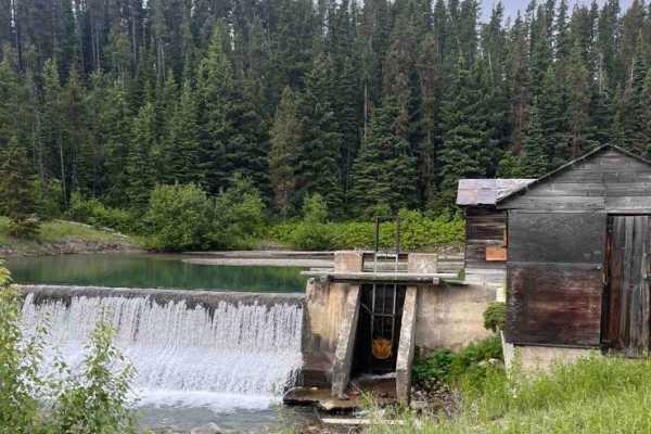
Junior Dam
This is an out-and-back route to a waterfall and scenic area. There is an old pumphouse station along a dam structure. There are very scenic views and a quick little run to get your tires dusty if you are in the area. Be advised that it is not on public property for the majority of the trail, so mak...
Learn more about Junior Dam
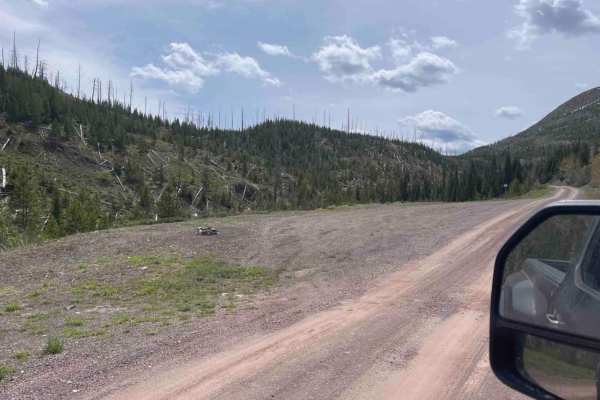
Skyland
Great views and free camp spots along this trail. It is an easy gravel road that can easily be used by larger vehicles and campers. A little creek and waterfall can be seen at the beginning. The Flathead Mountain Range can be seen throughout the whole trail. It is a great weekend spot for camping an...
Learn more about Skyland
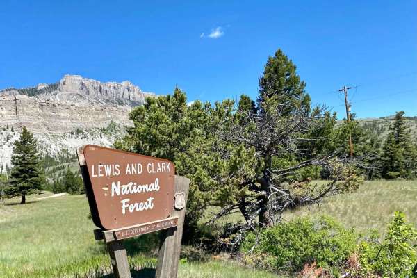
Sun Canyon Road
This is a two-lane dirt road that gives you access to amazing views, campgrounds, ATV trails, hiking and packing trails, picnic sites, and ending at the amazing Gibson Reservoir. From the Gibson Reservoir, you can access the Bob Marshall Wilderness by foot, boot, or horse. This is a nice and easy dr...
Learn more about Sun Canyon Road
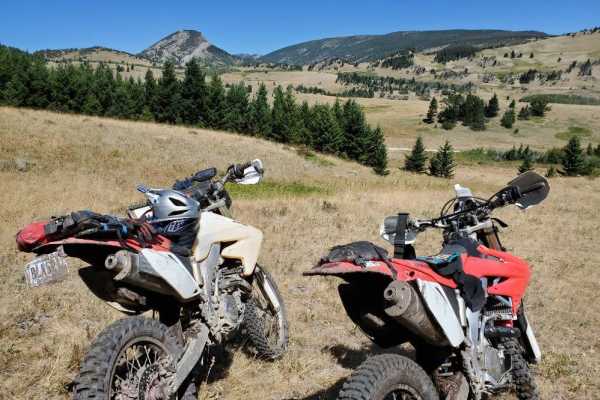
Ford Basin to Home/Lime Gulch
Don't forget your onX Offroad App for this trail that is not often travelled. It is very difficult to stay on the track without it. The route is short but sustained. Bring a chainsaw when attempting this route into mid summer because of the little traffic it sees. Some areas may see increased dif...
Learn more about Ford Basin to Home/Lime Gulch
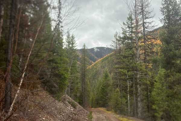
Old Highway 2
This trail used to be the original Highway 2 but was abandoned years ago when the highway was rerouted in 1956. There are still remnants of old broken asphalt and stone retaining walls are still in place. This trail is fairly level and very easy to transverse although it does get narrow and brushy i...
Learn more about Old Highway 2
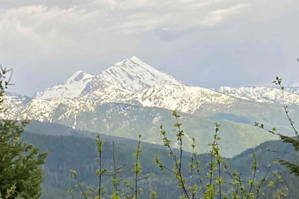
Emery Creek
This is a beautiful drive into areas of dense woods, mountain creeks, and seasonal waterfalls, with up-close views of the Great Northern Mountain. In the spring, be aware of lingering snow and clay mud, as parts of the trail are slow to melt. There are a few camping sites, dense trails, and lots of ...
Learn more about Emery Creek
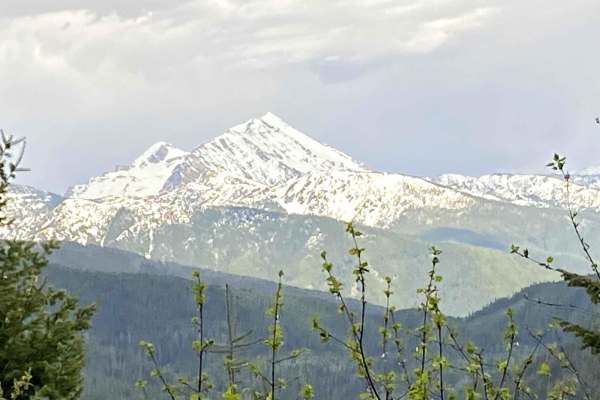
Emery Creek Desert Leg
Take this fun cut across from Desert Mountain to Emery Creek through dense woods and you will be rewarded with up-close views of the Great Northern Mountain. In the spring, be aware of lingering snow and clay mud, as parts of the trail are slow to melt. Expect seasonal mountain creeks and waterfalls...
Learn more about Emery Creek Desert Leg
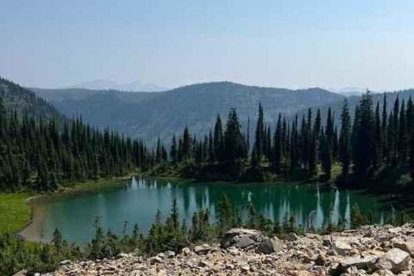
Alpine #7
This trail is packed full of views of alpine ridge tops and mountain peaks. You can make some really fun loops out of some of the access trails and the Alpine trail. The Alpine trail is not a difficult trail. There are a couple of spots that will challenge the novice rider. This trail has several ne...
Learn more about Alpine #7
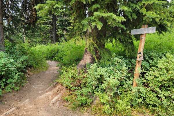
Aurora Basin Road
Fun trail with a great hike at the end to Doris Mountain. The trail is narrow, rocky, and slow going in some parts. 4x4 isn't necessary, but good tires are. Parking at the trailhead is limited, but there's a small meadow at the base of the trailhead with plenty of area to park.
Learn more about Aurora Basin Road
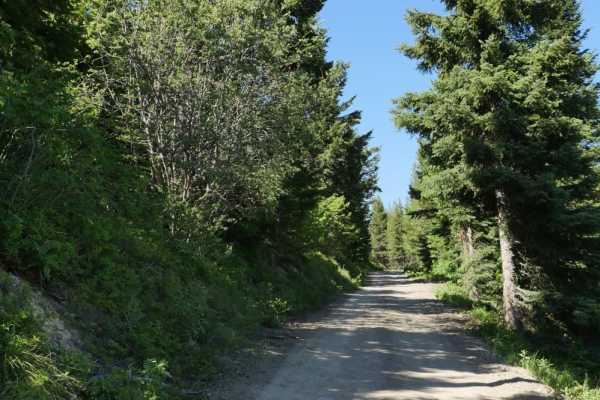
Desert Mountain
This is a scenic road that leads to the top of Desert Mountain where you can get a spectacular nearly 240 degree view of the surrounding area at an elevation of 6,415. There is also a very short road that leads to Belton Point once you get to the top. This single lane forest service road is accessed...
Learn more about Desert Mountain
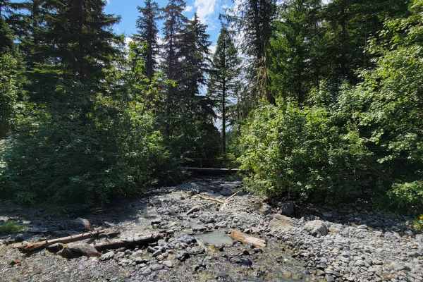
Strawberry Lake Trail
Strawberry Lake Trail is a scenic, moderately challenging climb in the Flathead National Forest that serves as the gateway for hikers and offroaders looking to access the Jewel Basin area. This 3.2-mile route winds up the mountain slopes, climbing approximately 800 feet from Foothill Road to the hik...
Learn more about Strawberry Lake Trail
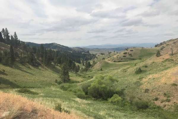
St. Peters Mission
The Adel Mountains are a geologist's dream to experience. Filled with small laccoliths and dikes, this igneous complex dates to approximately 65 million years ago. The resulting topography is that of rolling hills, lush had meadow valleys, and prominent igneous ridges and buttes. A beautiful vista i...
Learn more about St. Peters Mission
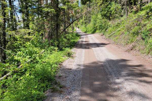
Jewel Basin Road
Fun, scenic trail that leads to epic hiking. Road is rough and narrow, but still passable with most 2wd cars. Expect potholes, washboard, and steep sections. You'll arrive at the Camp Misery trailhead about 30 mins after you start. There's a parking lot that's usually full, with a vault toilet and r...
Learn more about Jewel Basin Road
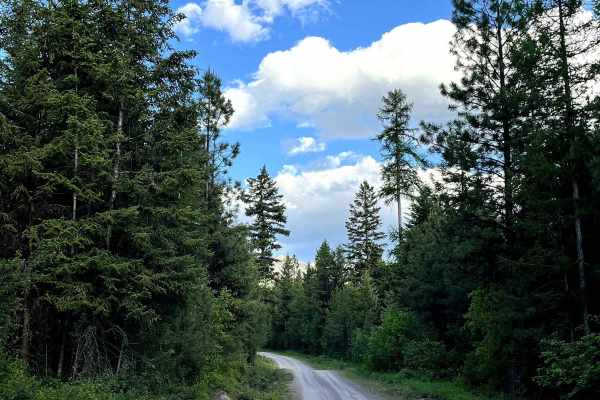
Falls Creek Alder Creek - NF901
Falls Creek Alder Creek - NF901 is a forest road located in Montana's scenic Swan Valley. This gravel route winds through dense timber and climbs to several elevated overlooks with sweeping views across the valley below. The road surface is generally in fair condition and suitable for most high-clea...
Learn more about Falls Creek Alder Creek - NF901
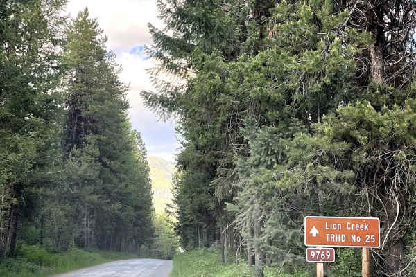
Upper Lion Creek - NF9769
Upper Lion Creek - NF9769 is a short, scenic forest road located in the Swan Valley of northwest Montana. It leads to the Lion Creek Trailhead, a popular access point for hiking and backcountry exploration. The road is gravel with a few large potholes but remains passable for most high-clearance veh...
Learn more about Upper Lion Creek - NF9769
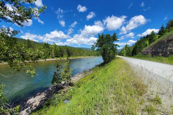
Hungry Horse Reservoir - East
This is an easy, scenic drive down the east side of Hungry Horse Reservoir. Many developed and primitive camping spots, with numerous lake access points and lots of hiking trails. This is considered the higher-traffic side, so expect a lot of trucks and trailers, especially on the weekends. This sid...
Learn more about Hungry Horse Reservoir - East
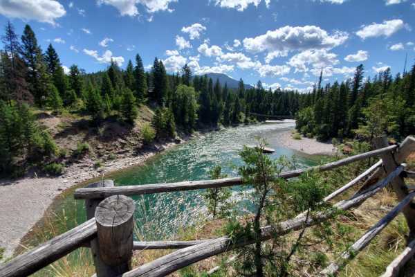
Hungry Horse Reservoir - West
This is a scenic drive down the west side of Hungry Horse Reservoir. There are plenty of developed and primitive camping spots, and lake access points everywhere. The road is maintained, and paved for the first 12 miles, but potholes are still abundant. Drive the distance, and you'll end up in Spott...
Learn more about Hungry Horse Reservoir - West
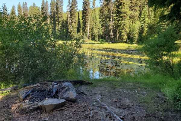
Mission Divide/Crane Mtn Road
Mission Divide/Crane Mountain Road is a scenic, 16-mile dirt-and-gravel route near Bigfork, Montana, offering views of Flathead Lake, Swan Lake, and the Swan Mountain Range. Traveling through the Flathead National Forest, the road climbs from 3,100 feet to over 5,730 feet with no technical obstacles...
Learn more about Mission Divide/Crane Mtn Road
ATV trails near Pondera Colony, Montana
Explore ATV-friendly trails near you. These trails are accessible for vehicles up to 50 inches wide, perfect for ATVs and smaller off-road machines.
Junior Dam
This is an out-and-back route to a waterfall and scenic area. There is an old pumphouse station along a dam structure. There are very scenic views and a quick little run to get your tires dusty if you are in the area. Be advised that it is not on public property for the majority of the trail, so mak...
Learn more about Junior Dam
Skyland
Great views and free camp spots along this trail. It is an easy gravel road that can easily be used by larger vehicles and campers. A little creek and waterfall can be seen at the beginning. The Flathead Mountain Range can be seen throughout the whole trail. It is a great weekend spot for camping an...
Learn more about Skyland
Sun Canyon Road
This is a two-lane dirt road that gives you access to amazing views, campgrounds, ATV trails, hiking and packing trails, picnic sites, and ending at the amazing Gibson Reservoir. From the Gibson Reservoir, you can access the Bob Marshall Wilderness by foot, boot, or horse. This is a nice and easy dr...
Learn more about Sun Canyon Road
Old Highway 2
This trail used to be the original Highway 2 but was abandoned years ago when the highway was rerouted in 1956. There are still remnants of old broken asphalt and stone retaining walls are still in place. This trail is fairly level and very easy to transverse although it does get narrow and brushy i...
Learn more about Old Highway 2
UTV/side-by-side trails near Pondera Colony, Montana
Find UTV and side-by-side trails near you. These trails accommodate vehicles up to 60 inches wide, ideal for UTVs, side-by-sides, and wider off-road rigs.
Junior Dam
This is an out-and-back route to a waterfall and scenic area. There is an old pumphouse station along a dam structure. There are very scenic views and a quick little run to get your tires dusty if you are in the area. Be advised that it is not on public property for the majority of the trail, so mak...
Learn more about Junior Dam
Skyland
Great views and free camp spots along this trail. It is an easy gravel road that can easily be used by larger vehicles and campers. A little creek and waterfall can be seen at the beginning. The Flathead Mountain Range can be seen throughout the whole trail. It is a great weekend spot for camping an...
Learn more about Skyland
Sun Canyon Road
This is a two-lane dirt road that gives you access to amazing views, campgrounds, ATV trails, hiking and packing trails, picnic sites, and ending at the amazing Gibson Reservoir. From the Gibson Reservoir, you can access the Bob Marshall Wilderness by foot, boot, or horse. This is a nice and easy dr...
Learn more about Sun Canyon Road
Old Highway 2
This trail used to be the original Highway 2 but was abandoned years ago when the highway was rerouted in 1956. There are still remnants of old broken asphalt and stone retaining walls are still in place. This trail is fairly level and very easy to transverse although it does get narrow and brushy i...
Learn more about Old Highway 2
The onX Offroad Difference
onX Offroad combines trail photos, descriptions, difficulty ratings, width restrictions, seasonality, and more in a user-friendly interface. Available on all devices, with offline access and full compatibility with CarPlay and Android Auto. Discover what you're missing today!
Open Trail Map