
Dirt Bike Trails
Near Nogales, Sonora
Explore All Dirt Bike Trails Near Nogales, Sonora
Dirt Bike Trails Near Nogales, Sonora
Discover the best dirt bike trails near you. Browse trail maps, check difficulty ratings, and find your next adventure — whether you're looking for a quick ride or an all-day expedition.
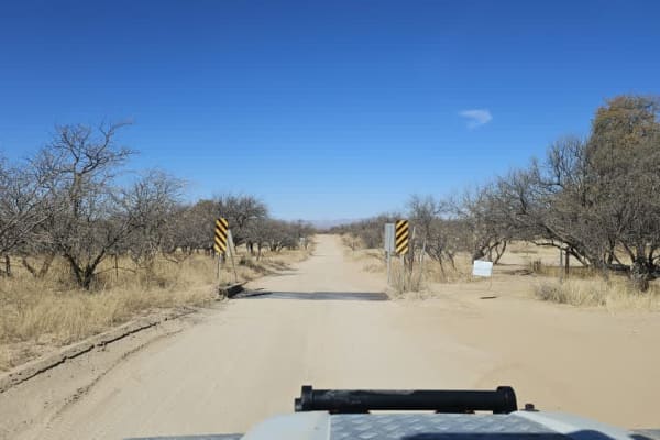
Washington Montezuma Pass
The Montezuma pass is well maintained but corrugated in sections due to high traffic, mostly border patrol vehicles. The views are excellent. You reach the top of the trail overlooking the border with Mexico, and there is a little campsite with a fire ring before the lookout. We camped in the flats ...
Learn more about Washington Montezuma Pass
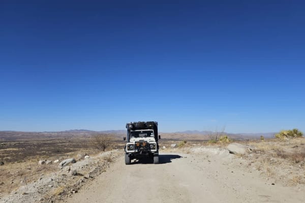
Piedragrosa - Forest Road 4667
This is a well-maintained and undulating trail that allows you to travel to where the border wall abruptly ends. In parts, there is loose sand along the trail, and there are many areas to camp, further away from the border wall, as well as a restricted area. This trail loops back to Washington Monte...
Learn more about Piedragrosa - Forest Road 4667
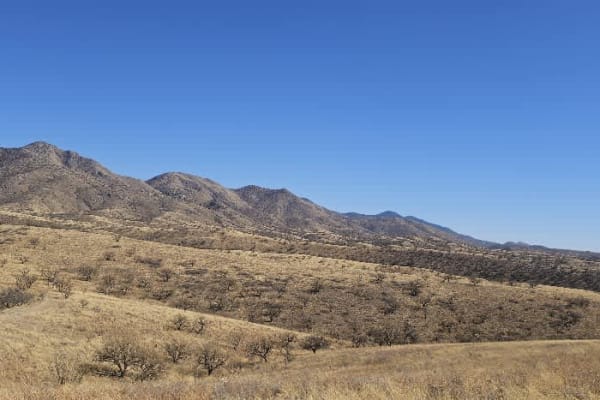
Grande Forest Road
This is a pleasant trail with great views. It is dry and dusty, with rocky sections and occasional moderate inclines and descents. The trail has a locked gate at the end, but dispersed camping is available. It is windy, and the road is not maintained or graded.
Learn more about Grande Forest Road
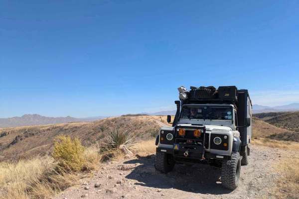
Wise Mesa - FR4151
Accessed through a suburb, this trail at first appears not to be very interesting, but the further you travel, the more scenic the trail becomes. Winding through ranchland, the trail is bumpy, dusty, and rocky but not challenging until you reach the trail down to the small lake where camping is poss...
Learn more about Wise Mesa - FR4151
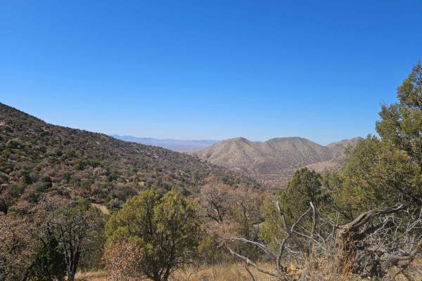
FR215 Three Canyon
The FR215 Three Canyon trail leads to an abandoned mine and has two two-track trails that lead to dead ends and private land. The trail surface is dry, dusty, and rocky, with occasional off-camber sections. The abandoned mine at the head of the two-track trail to private land offers a haunting but f...
Learn more about FR215 Three Canyon
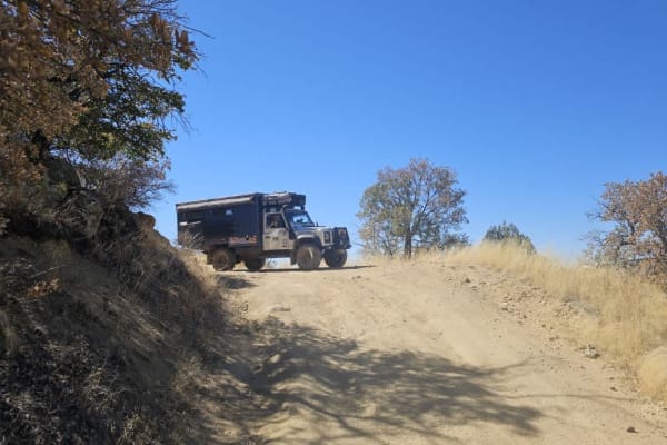
Flying R Ranch/Guajalote Flat Loop - FR 4695 - 4695A
This loop trail is accessed through a closed gate. There are private ranches along the trail, and it is imperative that travelers close all gates securely behind them. After the second gate, and beside a well-maintained ranch house, we met an elderly cowboy who stopped to chat, toothlessly thanked u...
Learn more about Flying R Ranch/Guajalote Flat Loop - FR 4695 - 4695A
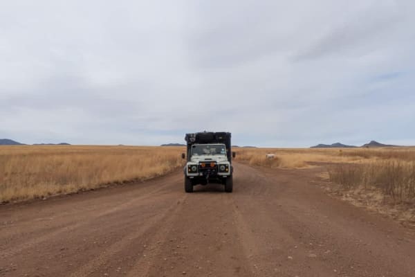
North Harshaw Road
North Harshaw Road is a well-traveled double-track route that winds into the upper grasslands, eventually connecting with the Patagonia Loop Trail. The road is generally well-maintained, with a flat and mostly straight path, making it accessible to a variety of vehicles. However, drivers should proc...
Learn more about North Harshaw Road
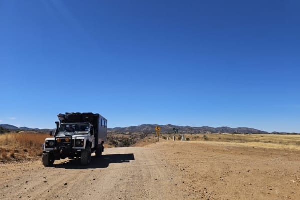
Apache Tank 214
The Apache Tank Road is a pleasant, easy drive through grassland and undulating hills. The trail drops down from the grassland into a forested area that is prone to flash flooding. There are a number of smaller trails branching off from the main trail, and there are many campsites to choose from, mo...
Learn more about Apache Tank 214
North Harshaw Road
The pavement ends at the junction of South Harshaw Road and North Harshaw Road, and you will cross the first of two streams running across the trail. A broad and well-traveled trail, the North Harshaw trail offers multiple campsites with fire rings, and most campsites are large enough to accommodate...
Learn more about North Harshaw Road
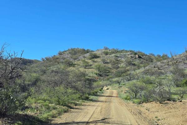
California Gulch Forest Road 217
This is a rolling maintained and well-used trail. It loops through the high desert, passing through many flowing streams in the wet seasons. There are old mines all along the route as well as an old dam. Also along the way are three old mining cemeteries. There are many spurs to explore off of this ...
Learn more about California Gulch Forest Road 217
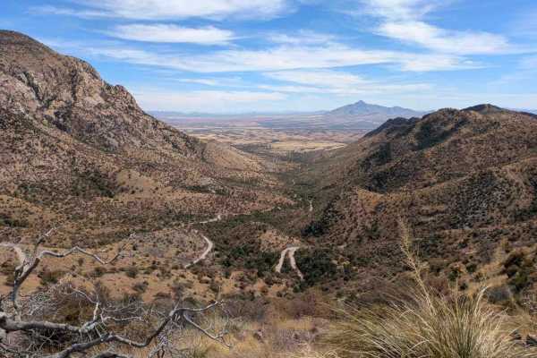
Washington Montezuma Pass
The Washington Montezuma Pass is a maintained dirt road, though frequent corrugations make for a bumpy ride. Border Patrol vehicles are a common sight along the route, as the trail runs parallel to the border, which is marked by a simple fence. The terrain varies, with rocky sections appearing inter...
Learn more about Washington Montezuma Pass
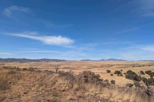
Jones Road - FR766
FR 766 is a well-maintained dirt road that winds through the sweeping grass highlands of Coronado National Forest, offering beautiful panoramic views of distant mountain ranges. Along the way, you'll pass a cattle guard crossing and find a few spots suitable for dispersed camping--just be prepared f...
Learn more about Jones Road - FR766
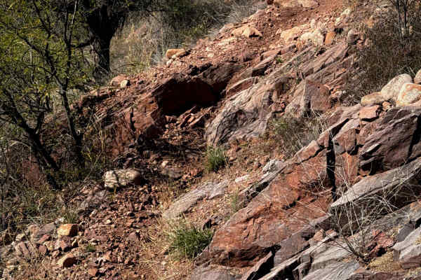
483B
This is a short but intermediate spur trail off of 483 that rides through constantly rocky terrain in the Coronado National Forest. The terrain is rolling desert hills covered in mesquite trees and ocotillos. The trail has sharp turns, little dips across sudden ravines, and frequent embedded boulder...
Learn more about 483B
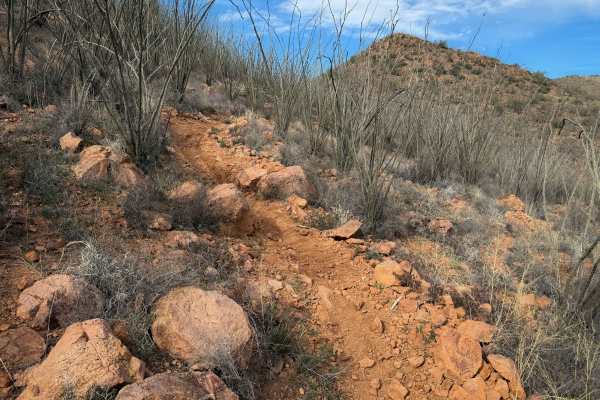
483
This is one of the longer trails through the Red Spring Pass trail system. The entire route is moderate difficulty, with frequent short climbs and descents that are full of loose baby head-sized rocks. Expect ruts, steep spots, and moderate rock obstacles. The south end of the trail is more gradual ...
Learn more about 483
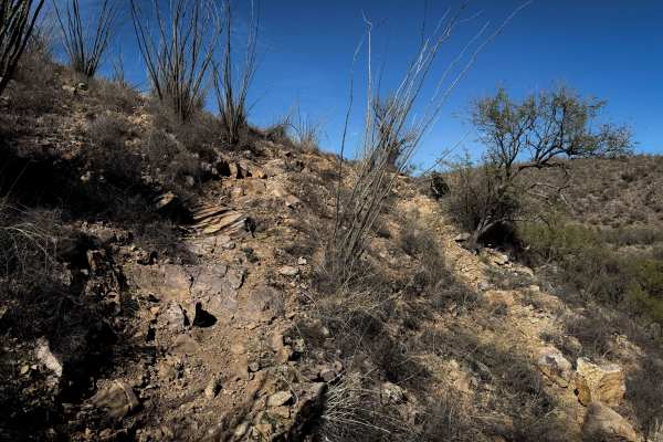
482A
This is a short spur off of the longer 482 single track that takes an alternate route back to Sardina Road (684). The trail has a mix of flowy singletrack through the flat desert terrain, through mesquite trees over the rolling hilltops, and more rugged rocky sections. It dips down into a ravine at ...
Learn more about 482A

482
This is the longest single track in the Red Spring Pass trail system. It goes for 5 miles through a rolling, rugged desert terrain that is constantly full of loose baby heads, with ruts and tight turns through cactus. Expect very loose terrain with sudden ruts, and small climbs and descents that wil...
Learn more about 482
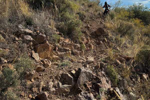
484
This trail within the Red Spring Pass trail system is full of small loose rocks, steep climbs, and short rock ledges that make it more physically demanding to handle the bike through all the rocks for 2.6 miles. From the north entrance at the intersection with 483, the trail starts climbing up the n...
Learn more about 484

480
This is a short trail through the Red Spring Pass trail system. It starts and ends off of Sardina Canyon Road (684), paralleling the main road as it winds through a rocky desert terrain full of mesquite trees and ocotillos. The middle of the trail rides over the “moonscape,” which is an area of ligh...
Learn more about 480
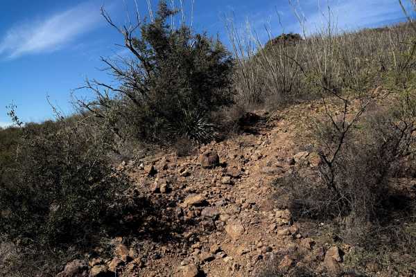
483A
This is a short but moderate spur that connects 482 and 483, which are two of the longer trails in the trail system. The mile-long route is constantly full of loose baby head-sized rocks, with short climbs and descents. The trail winds across the desert hilltops, past ocotillos and mesquite trees. T...
Learn more about 483A

486
This entire trail is road-width, although designated for dirt bikes only. It starts off Sardina Canyon Road (684) in a wash full of small rocks, and rides north towards some rocky outcroppings, riding past the entrance for 485. The trail surface is constantly full of small loose rocks and shallow ru...
Learn more about 486
ATV trails near Nogales, Sonora
Explore ATV-friendly trails near you. These trails are accessible for vehicles up to 50 inches wide, perfect for ATVs and smaller off-road machines.
Washington Montezuma Pass
The Montezuma pass is well maintained but corrugated in sections due to high traffic, mostly border patrol vehicles. The views are excellent. You reach the top of the trail overlooking the border with Mexico, and there is a little campsite with a fire ring before the lookout. We camped in the flats ...
Learn more about Washington Montezuma Pass
Piedragrosa - Forest Road 4667
This is a well-maintained and undulating trail that allows you to travel to where the border wall abruptly ends. In parts, there is loose sand along the trail, and there are many areas to camp, further away from the border wall, as well as a restricted area. This trail loops back to Washington Monte...
Learn more about Piedragrosa - Forest Road 4667
Grande Forest Road
This is a pleasant trail with great views. It is dry and dusty, with rocky sections and occasional moderate inclines and descents. The trail has a locked gate at the end, but dispersed camping is available. It is windy, and the road is not maintained or graded.
Learn more about Grande Forest Road
Wise Mesa - FR4151
Accessed through a suburb, this trail at first appears not to be very interesting, but the further you travel, the more scenic the trail becomes. Winding through ranchland, the trail is bumpy, dusty, and rocky but not challenging until you reach the trail down to the small lake where camping is poss...
Learn more about Wise Mesa - FR4151
UTV/side-by-side trails near Nogales, Sonora
Find UTV and side-by-side trails near you. These trails accommodate vehicles up to 60 inches wide, ideal for UTVs, side-by-sides, and wider off-road rigs.
Washington Montezuma Pass
The Montezuma pass is well maintained but corrugated in sections due to high traffic, mostly border patrol vehicles. The views are excellent. You reach the top of the trail overlooking the border with Mexico, and there is a little campsite with a fire ring before the lookout. We camped in the flats ...
Learn more about Washington Montezuma Pass
Piedragrosa - Forest Road 4667
This is a well-maintained and undulating trail that allows you to travel to where the border wall abruptly ends. In parts, there is loose sand along the trail, and there are many areas to camp, further away from the border wall, as well as a restricted area. This trail loops back to Washington Monte...
Learn more about Piedragrosa - Forest Road 4667
Grande Forest Road
This is a pleasant trail with great views. It is dry and dusty, with rocky sections and occasional moderate inclines and descents. The trail has a locked gate at the end, but dispersed camping is available. It is windy, and the road is not maintained or graded.
Learn more about Grande Forest Road
Wise Mesa - FR4151
Accessed through a suburb, this trail at first appears not to be very interesting, but the further you travel, the more scenic the trail becomes. Winding through ranchland, the trail is bumpy, dusty, and rocky but not challenging until you reach the trail down to the small lake where camping is poss...
Learn more about Wise Mesa - FR4151
The onX Offroad Difference
onX Offroad combines trail photos, descriptions, difficulty ratings, width restrictions, seasonality, and more in a user-friendly interface. Available on all devices, with offline access and full compatibility with CarPlay and Android Auto. Discover what you're missing today!
Open Trail Map