
Dirt Bike Trails
Near Mount Hood, Oregon
Explore All Dirt Bike Trails Near Mount Hood, Oregon
Dirt Bike Trails Near Mount Hood, Oregon
Discover the best dirt bike trails near you. Browse trail maps, check difficulty ratings, and find your next adventure — whether you're looking for a quick ride or an all-day expedition.
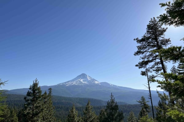
Long Prairie 17
Long Prairie 17 is a byway located in the 1.1-million-acre Mount Hood National Forest. Once you turn onto Long Prairie 17 it begins as pavement and then starts up the hill into gravel which is very bumpy with potholes. This route rides the ridge and parallels a popular hiking trail called Surveyors ...
Learn more about Long Prairie 17
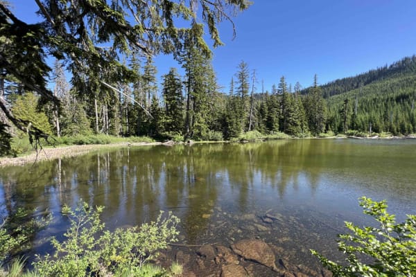
Green Point - 2810
Green Point - 2810 is a beautiful scenic drive through the Mount Hood National Forest in Northwest Oregon. This road is mainly gravel however there are areas where large boulders and rocks have come on the road and you have to swerve to avoid them as well as large trees lying over the road. Going up...
Learn more about Green Point - 2810
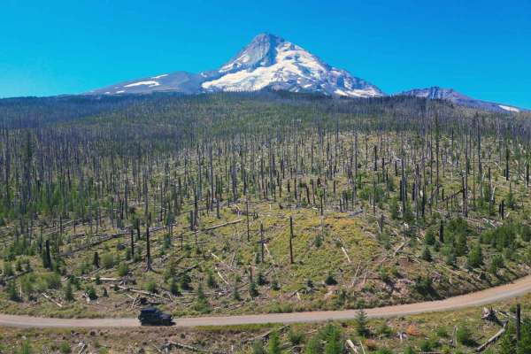
Cloud Cap Road
This trail is an irregular gravel road marked by large rocks, numerous potholes, and segments of profound dust which create the potential to get stuck. Its accessibility varies with the seasons and may be gated due to snowfall or fallen trees during winter. This route allows you to approach the Nort...
Learn more about Cloud Cap Road
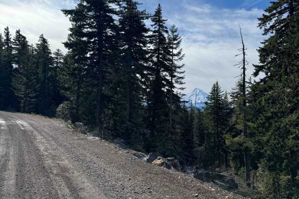
Dead Point - FS 2820
This forest road is mostly gravel and smooth surfaced. The road travels through dense forest, but in sections it opens up and you get amazing views of Mt. Hood. As you go further up the trail you will get views of Mount Defiance, which is the tallest peak on the Columbia River Gorge. The road dead e...
Learn more about Dead Point - FS 2820
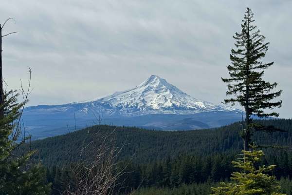
Larch Mountain Road
This trail leads you into the Mount Hood National Forest near Upper Green Point Reservoir. This area has many ATV and dirt bike trails, which cross the road in some places, so drive with care. The trail is a wide and smooth gravel road with little to no wash and ruts. There is a gradual incline and ...
Learn more about Larch Mountain Road
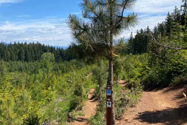
Hood River OHV 160 to 140 to 133
This is a loop of connecting trails in the Hood River OHV Park. There are lots more trails to come from this park. The system has some quad trails and a lot of single track. You will find a lot of Mountain bikers riding these trails as well. Some of the trails in the system are for non-motorized bik...
Learn more about Hood River OHV 160 to 140 to 133
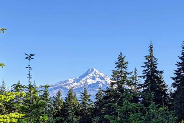
Mount Defiance - NF 2821000
Mount Defiance road scrambles 1600'+ out of the hills West of Hood River, Oregon to the summit of Mount Defiance and the edge of the Mark O Hatfield Wilderness. The summit tops out at just under 5,000'. Once the gravel forest service road passes 4,000', the road bed quickly turns to a loose shale an...
Learn more about Mount Defiance - NF 2821000
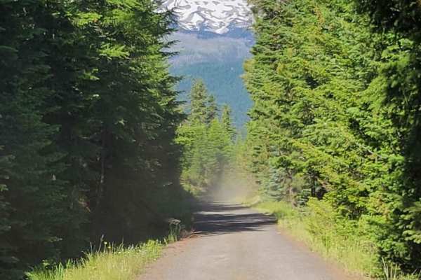
Lookout Mountain Road - FR 4410000
An easy dirt road that takes you through the Mt. Hood National Forest. It connects to several other trails in the area, and leads to a few trailheads for hiking and biking. The trail can get dusty behind other vehicles. Unmaintained in the winter months. Keep an eye open, and you'll catch glimpses o...
Learn more about Lookout Mountain Road - FR 4410000
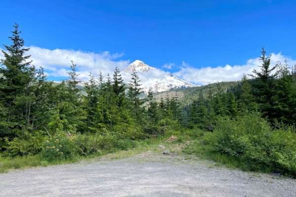
McGee Creek Overlook
This short spur provides access to the McGee Creek Trailhead. Driving past the hiking trailhead, immediately ascends into a short and slightly technical climbing section. Once clear of these ruts and rocks, the road becomes smooth gravel. Ultimately the road dead ends at a very large dispersed camps...
Learn more about McGee Creek Overlook
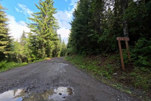
Top Spur - FS 1828118
Top Spur - FS 1828118 starts by turning right off the main access road onto a popular, well-maintained gravel path that leads to the Top Spur Trailhead. The wide track runs smoothly under a dense pine canopy with only a few minor potholes before the parking lot. Past the trailhead, the drive changes...
Learn more about Top Spur - FS 1828118
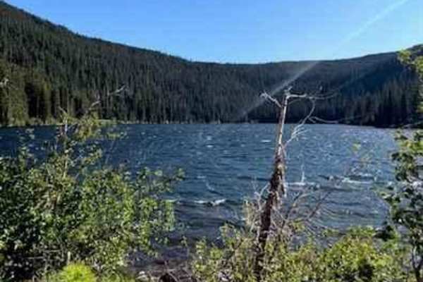
Badger Lake Via Bennett Pass
This route will lead you from Bennett Pass down into Badger Lake. After leaving Bennett Pass Road, you will be heading down a fairly steep grade on Forest Road 140. The road is a single track with some tight spaces that could pin stripe full-size rigs. Most high clearance vehicles will be able to ta...
Learn more about Badger Lake Via Bennett Pass
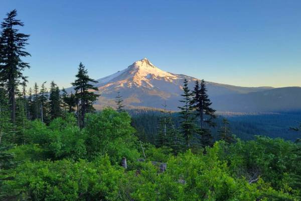
Bennett Pass 2
Bennett Pass is a popular seasonal Forest Service Road off Highway 35, along Mt. Hood's Eastern flank. It is open to vehicles from late spring (dependent on snowpack) to December 1st. When the trail was mapped in mid-July, there were still snow patches present in the shaded areas, in addition to mud...
Learn more about Bennett Pass 2
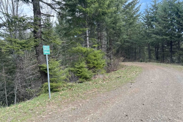
DNR N-4000 Road
Embark on an off-road journey through a conifer forest, where the towering trees guide your path. This route promises a blend of rugged terrain, panoramic vistas, and hidden gems waiting to be discovered. Your journey commences with a gentle ascent, leading you along the edge of a clear-cut. Here, t...
Learn more about DNR N-4000 Road
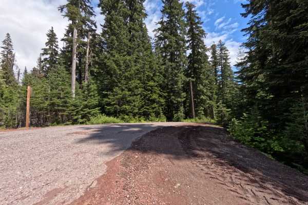
Barlow Butte Road - FS 3560
Turning off Highway 35, the unmarked entrance to Barlow Butte Road (FS 3560) drops you onto a smooth, single-lane gravel track through dense pine forest. Early on, you'll find some brush creeping into the driving corridor, but the road stays easy to follow. About halfway through the 3.5-mile run, yo...
Learn more about Barlow Butte Road - FS 3560
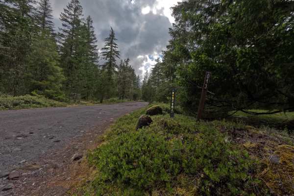
Camping Spur - FS 1825043
Camping Spur is a short flat spur road off Forest Service Road 1825043 with access to numerous campsites. The spots on the right side and at the turnaround include short hikes down to the sandy river, though no swimming exists on this stretch and the water is very cold. The half-mile drive is gravel...
Learn more about Camping Spur - FS 1825043
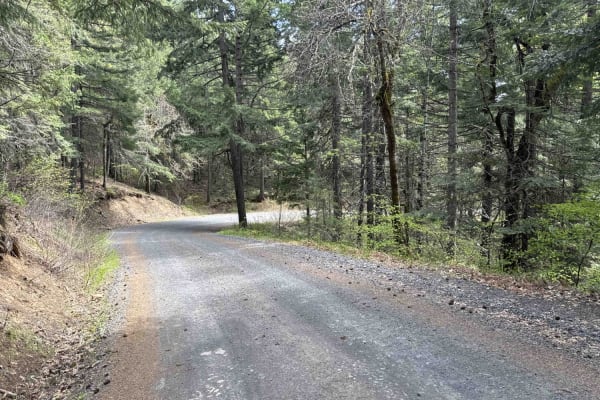
Buck Creek N-1000 to Little Baldy Peak
The journey begins with an opportunity to observe whitewater kayakers on the White Salmon River at Northwestern Park, providing a perfect spot to relax and enjoy the surroundings. Continuing west a short distance and turning left onto Nestor Peak Road/N-1000, the road ascends the ridge, passing thro...
Learn more about Buck Creek N-1000 to Little Baldy Peak
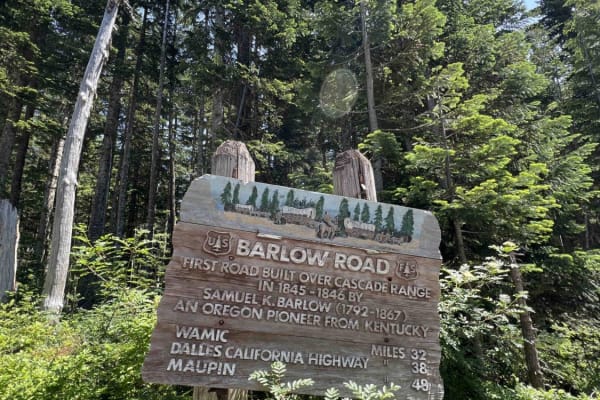
Oregon Trail Barlow - 3530
Step into the history books when you embark down this 7-mile section of the Oregon Trail Barlow Road. This late 1800's byway is a very technical, primitive, narrow, rocky road. It was not only created as an alternative to floating the wagon down the Columbia River but also to be the width and height...
Learn more about Oregon Trail Barlow - 3530
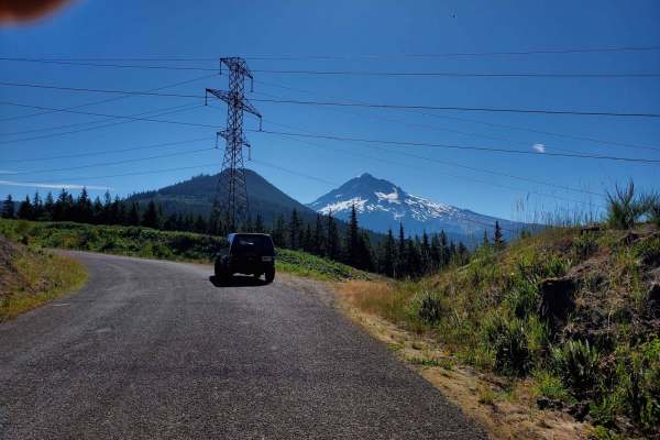
Forgotten Waterfall Cliffside Lolo Pass
Watch the city fall away and mount hood come closer and closer into view as each corner you turn takes you deeper into Mount Hood National Forest. Don't blink or you might miss a hidden waterfall on your left as you approach this path from the south. Tall power lines make for excellent cut outs in t...
Learn more about Forgotten Waterfall Cliffside Lolo Pass
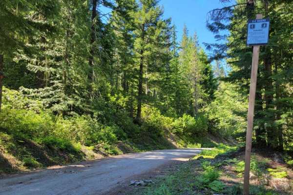
Still Creek Road
If you're looking for a quintessential PNW trail to run or a fun alternate to Highway 26, this is it. Dense forests shroud you as you parallel a flowing river, crossing mossy rock bridges a couple of times. There are potholes peppered throughout the entire trail, some large/deep. Keep an eye out for...
Learn more about Still Creek Road
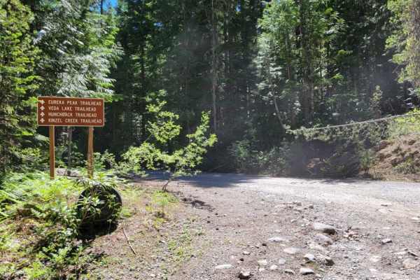
Sherar Burn Road
This trail begins easy and mild, but the further up and back you travel, the more rocky and overgrown it becomes. Erosion ruts and potholes are present throughout the trail - some ground clearance is advised. Trail debris (downed trees) are possible. About four miles into the trail, it begins to bec...
Learn more about Sherar Burn Road
ATV trails near Mount Hood, Oregon
Explore ATV-friendly trails near you. These trails are accessible for vehicles up to 50 inches wide, perfect for ATVs and smaller off-road machines.
Long Prairie 17
Long Prairie 17 is a byway located in the 1.1-million-acre Mount Hood National Forest. Once you turn onto Long Prairie 17 it begins as pavement and then starts up the hill into gravel which is very bumpy with potholes. This route rides the ridge and parallels a popular hiking trail called Surveyors ...
Learn more about Long Prairie 17
Green Point - 2810
Green Point - 2810 is a beautiful scenic drive through the Mount Hood National Forest in Northwest Oregon. This road is mainly gravel however there are areas where large boulders and rocks have come on the road and you have to swerve to avoid them as well as large trees lying over the road. Going up...
Learn more about Green Point - 2810
Cloud Cap Road
This trail is an irregular gravel road marked by large rocks, numerous potholes, and segments of profound dust which create the potential to get stuck. Its accessibility varies with the seasons and may be gated due to snowfall or fallen trees during winter. This route allows you to approach the Nort...
Learn more about Cloud Cap Road
Dead Point - FS 2820
This forest road is mostly gravel and smooth surfaced. The road travels through dense forest, but in sections it opens up and you get amazing views of Mt. Hood. As you go further up the trail you will get views of Mount Defiance, which is the tallest peak on the Columbia River Gorge. The road dead e...
Learn more about Dead Point - FS 2820
UTV/side-by-side trails near Mount Hood, Oregon
Find UTV and side-by-side trails near you. These trails accommodate vehicles up to 60 inches wide, ideal for UTVs, side-by-sides, and wider off-road rigs.
Long Prairie 17
Long Prairie 17 is a byway located in the 1.1-million-acre Mount Hood National Forest. Once you turn onto Long Prairie 17 it begins as pavement and then starts up the hill into gravel which is very bumpy with potholes. This route rides the ridge and parallels a popular hiking trail called Surveyors ...
Learn more about Long Prairie 17
Green Point - 2810
Green Point - 2810 is a beautiful scenic drive through the Mount Hood National Forest in Northwest Oregon. This road is mainly gravel however there are areas where large boulders and rocks have come on the road and you have to swerve to avoid them as well as large trees lying over the road. Going up...
Learn more about Green Point - 2810
Cloud Cap Road
This trail is an irregular gravel road marked by large rocks, numerous potholes, and segments of profound dust which create the potential to get stuck. Its accessibility varies with the seasons and may be gated due to snowfall or fallen trees during winter. This route allows you to approach the Nort...
Learn more about Cloud Cap Road
Dead Point - FS 2820
This forest road is mostly gravel and smooth surfaced. The road travels through dense forest, but in sections it opens up and you get amazing views of Mt. Hood. As you go further up the trail you will get views of Mount Defiance, which is the tallest peak on the Columbia River Gorge. The road dead e...
Learn more about Dead Point - FS 2820
The onX Offroad Difference
onX Offroad combines trail photos, descriptions, difficulty ratings, width restrictions, seasonality, and more in a user-friendly interface. Available on all devices, with offline access and full compatibility with CarPlay and Android Auto. Discover what you're missing today!
Open Trail Map