
Dirt Bike Trails
Near Lester, Alabama
Explore All Dirt Bike Trails Near Lester, Alabama
Dirt Bike Trails Near Lester, Alabama
Discover the best dirt bike trails near you. Browse trail maps, check difficulty ratings, and find your next adventure — whether you're looking for a quick ride or an all-day expedition.
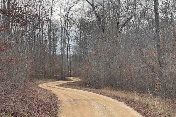
Burns Bottoms Road
Part of the Laurel Hill Wildlife Management Area Trail System. Drivers must possess a valid annual Hunt/Fish license, available online. Access is open year-round and restricted to daylight hours only (closed dusk to dawn). Burns Bottoms Road is a maintained gravel and dirt route winding through mixe...
Learn more about Burns Bottoms Road

VFW Road
Part of the Laurel Hill Wildlife Management Area trail system. A permit is not required to access this lake trail, only to fish. Access is open year-round and restricted to daylight hours only (closed dusk to dawn).
The VFW Lake Track is a short gravel access route that follows the shoreline of VFW...
Learn more about VFW Road
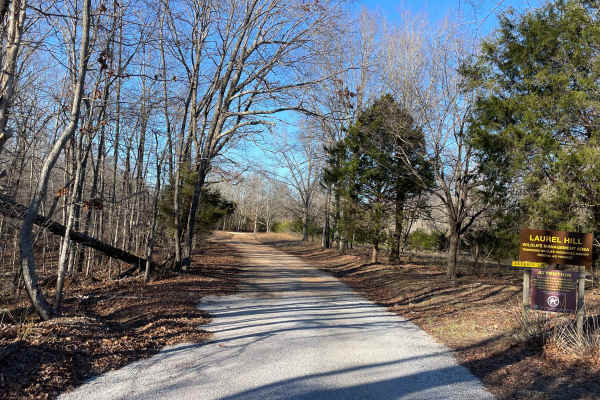
Artemis Lane
Artemis Lane is a primary interior access route within Laurel Hill Wildlife Management Area and one of the longest drivable tracks in the system at approximately six miles. Drivers must possess a valid annual Hunt/Fish license, available at GoOutdoorsTennessee.com. Tennessee resident licenses are $3...
Learn more about Artemis Lane
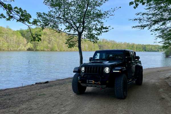
Peter Cave Road
Part of the Laurel Hill Wildlife Management Area Trail System. Drivers must possess a valid annual Hunt/Fish license, available online. Access is open year-round and restricted to daylight hours only (closed dusk to dawn). -- Peter Cave Rd. is a short access spur that provides direct entry to the we...
Learn more about Peter Cave Road
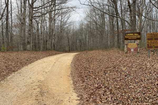
Finnie Road
Finnie Road is a gravel access route within Laurel Hill Wildlife Management Area, providing vehicle access through mixed hardwood forest and connecting interior management roads. Drivers must possess a valid annual Hunt/Fish license, available at GoOutdoorsTennessee.com. Tennessee resident licenses ...
Learn more about Finnie Road
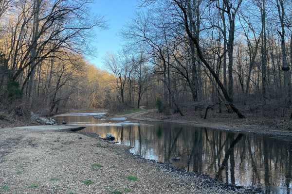
CC Road
CC Road is a short but important connector route within the Laurel Hill Wildlife Management Area, serving as one of the primary eastern access points into the WMA. The road links Laurel Hill Road on the east with Artemis Lane to the west, transitioning from pavement at the entrance to gravel once in...
Learn more about CC Road
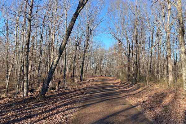
Laurel Hill Road
Laurel Hill Road is a scenic east–west traverse across the northern end of the Laurel Hill Wildlife Management Area, connecting Natchez Trace Parkway on the west to CC Road on the east. While both termini begin on pavement, the route quickly transitions to well-maintained gravel once inside the WMA,...
Learn more about Laurel Hill Road
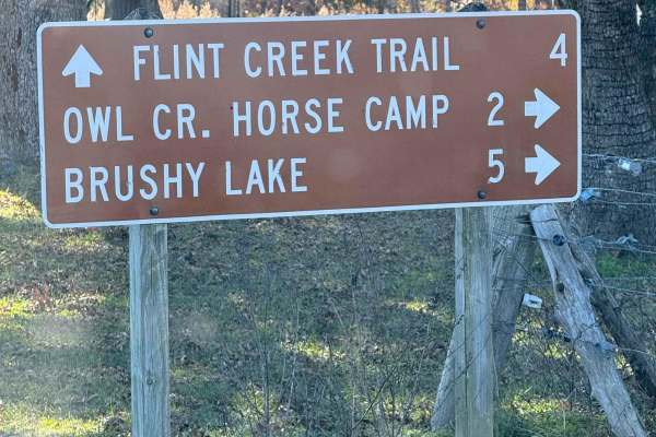
County Road 90 - FS 259
County Road 90 begins as a paved route meandering through picturesque farmland before transitioning into the lush expanse of the Bankhead National Forest. Along the way, travelers can enjoy abundant wildlife and admire charming, historic generational farmhouses lining the roadside. The route also pr...
Learn more about County Road 90 - FS 259
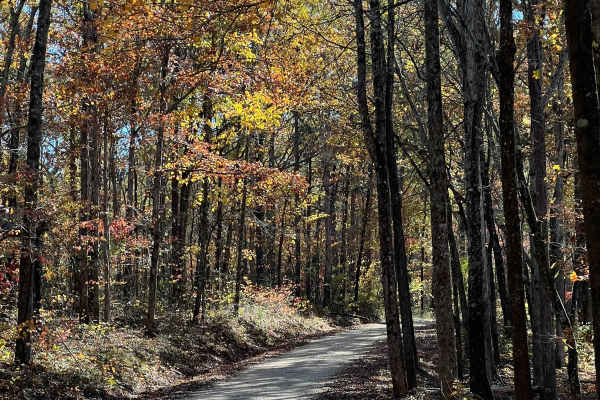
Indian Tomb Hollow Road
Indian Tomb Hollow County Road 86 is a scenic and heavily traveled forest route, known for its picturesque creek and charming bridge. This stretch of road is especially stunning during the fall when the foliage is in full color. Be mindful that the road can become slick after rain, so exercise cauti...
Learn more about Indian Tomb Hollow Road
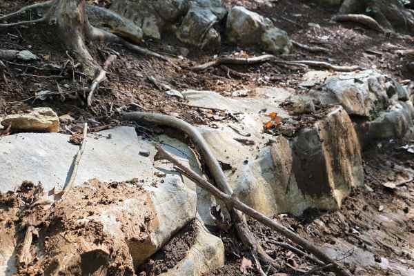
Homestead
This excellent offroad option features it all! Slick clay, exposed tree roots, ruts, slippery shale rock, ledges, and more! While this trail is difficult, it does not offer any dangerous off-camber positions. Riding this ravine uphill is sure to provide a challenge, with additional difficulties when...
Learn more about Homestead
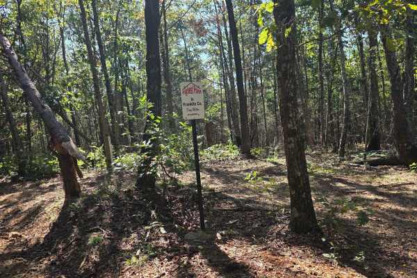
250 Acre Trail
250 Acre Trail is a cruiser's paradise. This trail contours to the mountainside with multiple trails of the same difficulty intersecting and splitting off. This is a perfect trail to let the younger riders take their time, as there are few to no obstacles that can pose a threat. The well-manicured t...
Learn more about 250 Acre Trail
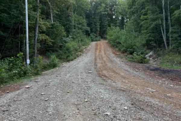
Main Road
The main road serves as the backbone of the trail system, with all routes connecting back to it. It is passable by stock four-wheel-drive vehicles in dry conditions and includes three creek crossings and one overlook with scenic views. The speed limit is 15 miles per hour, and wildlife such as deer ...
Learn more about Main Road
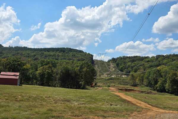
Power Line Trail
Power Line Trail can be a small spark or full-on electrifying! This trail offers a little bit of everything, with the main track being a cruising trail with many harder lines, should you try to take them. There are shorter, steep ledges on opposite sides of the trail for those who like to live on th...
Learn more about Power Line Trail
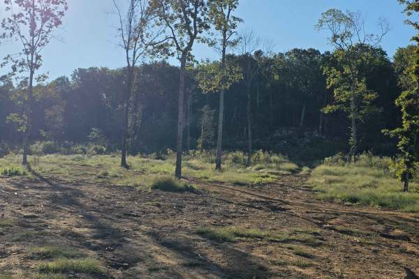
Can-am
Can-am is a trail close to camp that features a short flat ride to the nearest mountainside, where you will find an undercut ledge of slick rock and another line that is a bit more gradual. The easier of the two lines offers more of a stair-step climb, but puts the nose of your rig right into anothe...
Learn more about Can-am
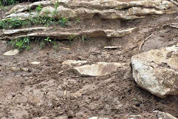
East View Ledges
East View Ledges is a great obstacle-type trail at NWALMP. This trail will test your line choices, driver skill, and machine durability. It features large exposed ridges with squishy clay filling each ledge as you climb this mountainside. Time for completion will vary greatly depending on how damp t...
Learn more about East View Ledges
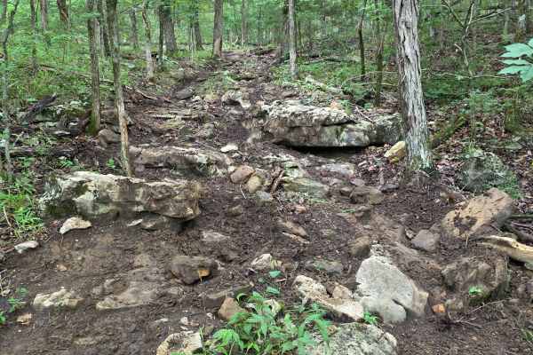
Where's Ed?
Where's Ed? is a short wrap-around trail with mild obstacles, and is more on the narrow side for the trails commonly found at NWALMP. This trail features the very common rich black soil and littered limestone rocks throughout. Due to the trail's distance, it is rarely traveled, but it is a great pul...
Learn more about Where's Ed?
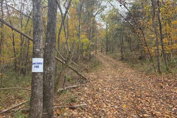
Spectator Hill #1
Spectator Hill #1 is one of many hill climbs that take you to the top of the mountain and give you access to the top of the monstrous hill climbs that Northwest Alabama Mountain Park has to offer. These trails are considered the access trails; however, with them being heavily travelled on race day, ...
Learn more about Spectator Hill #1
Rubicon
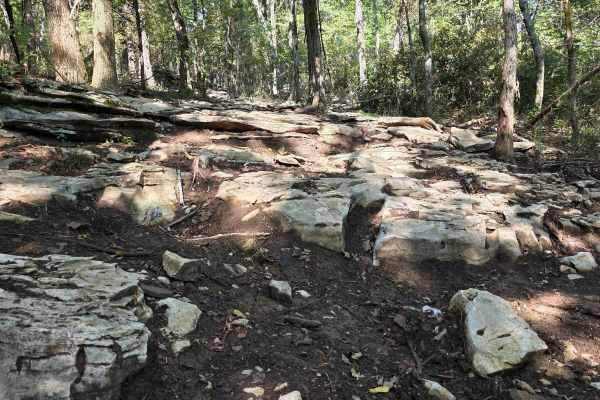
This Jeep-inspired trail, like many others on this side of the mountain, is created tough for a reason - to give you a great offroad experience. Rubicon is one that can live up to the name, as the trail is relentless, yet still able to be completed in a well-designed stock rig. The characteristic t...
Learn more about Rubicon
Titanic
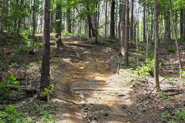
All Aboard! Titanic is a great cruising trail that, when paired with the surrounding trails, can get you lost quickly. The Titanic section of the park is a small group of easy-riding trails on the opposite side of the ridge from Send It Hollow. Titanic primarily runs the long ridge line; however, th...
Learn more about Titanic
Sinking Ship
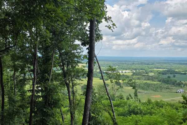
Sinking Ship is a dual drop trail - drop in to enter and drop in to exit. Once you are inside the middle portion of the trail, both exits are uphill. This means when the rain comes down, the exit off the trail will become increasingly difficult. Sinking ship offers beautiful mountainside views of th...
Learn more about Sinking Ship
ATV trails near Lester, Alabama
Explore ATV-friendly trails near you. These trails are accessible for vehicles up to 50 inches wide, perfect for ATVs and smaller off-road machines.
Burns Bottoms Road
Part of the Laurel Hill Wildlife Management Area Trail System. Drivers must possess a valid annual Hunt/Fish license, available online. Access is open year-round and restricted to daylight hours only (closed dusk to dawn). Burns Bottoms Road is a maintained gravel and dirt route winding through mixe...
Learn more about Burns Bottoms Road
VFW Road
Part of the Laurel Hill Wildlife Management Area trail system. A permit is not required to access this lake trail, only to fish. Access is open year-round and restricted to daylight hours only (closed dusk to dawn).
The VFW Lake Track is a short gravel access route that follows the shoreline of VFW...
Learn more about VFW Road
Artemis Lane
Artemis Lane is a primary interior access route within Laurel Hill Wildlife Management Area and one of the longest drivable tracks in the system at approximately six miles. Drivers must possess a valid annual Hunt/Fish license, available at GoOutdoorsTennessee.com. Tennessee resident licenses are $3...
Learn more about Artemis Lane
Peter Cave Road
Part of the Laurel Hill Wildlife Management Area Trail System. Drivers must possess a valid annual Hunt/Fish license, available online. Access is open year-round and restricted to daylight hours only (closed dusk to dawn). -- Peter Cave Rd. is a short access spur that provides direct entry to the we...
Learn more about Peter Cave Road
UTV/side-by-side trails near Lester, Alabama
Find UTV and side-by-side trails near you. These trails accommodate vehicles up to 60 inches wide, ideal for UTVs, side-by-sides, and wider off-road rigs.
Burns Bottoms Road
Part of the Laurel Hill Wildlife Management Area Trail System. Drivers must possess a valid annual Hunt/Fish license, available online. Access is open year-round and restricted to daylight hours only (closed dusk to dawn). Burns Bottoms Road is a maintained gravel and dirt route winding through mixe...
Learn more about Burns Bottoms Road
VFW Road
Part of the Laurel Hill Wildlife Management Area trail system. A permit is not required to access this lake trail, only to fish. Access is open year-round and restricted to daylight hours only (closed dusk to dawn).
The VFW Lake Track is a short gravel access route that follows the shoreline of VFW...
Learn more about VFW Road
Artemis Lane
Artemis Lane is a primary interior access route within Laurel Hill Wildlife Management Area and one of the longest drivable tracks in the system at approximately six miles. Drivers must possess a valid annual Hunt/Fish license, available at GoOutdoorsTennessee.com. Tennessee resident licenses are $3...
Learn more about Artemis Lane
Peter Cave Road
Part of the Laurel Hill Wildlife Management Area Trail System. Drivers must possess a valid annual Hunt/Fish license, available online. Access is open year-round and restricted to daylight hours only (closed dusk to dawn). -- Peter Cave Rd. is a short access spur that provides direct entry to the we...
Learn more about Peter Cave Road
The onX Offroad Difference
onX Offroad combines trail photos, descriptions, difficulty ratings, width restrictions, seasonality, and more in a user-friendly interface. Available on all devices, with offline access and full compatibility with CarPlay and Android Auto. Discover what you're missing today!
Open Trail Map