
Dirt Bike Trails
Near Lake Shore, Utah
Explore All Dirt Bike Trails Near Lake Shore, Utah
Dirt Bike Trails Near Lake Shore, Utah
Discover the best dirt bike trails near you. Browse trail maps, check difficulty ratings, and find your next adventure — whether you're looking for a quick ride or an all-day expedition.
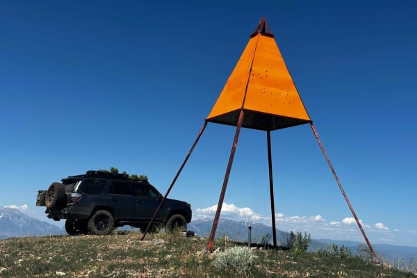
West Crest
The West Crest trail runs along the spine of West Mountain in southern Utah County. Hypothetically it can be done fully from the north to south (or vice versa) without having to do an out and back. Having tried this from various directions, logistically it is difficult to do due to a very steep sect...
Learn more about West Crest
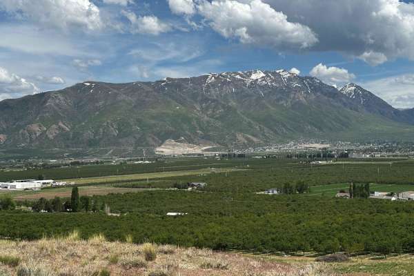
Dead End Overview
This trail has amazing 360-degree views, but ultimately you'll climb to a point where you won't be able to pass unless you're on a dirt bike or maybe a true off-road built side-by-side. Decent amount of climbing, and no gnarly obstacles per se, but high clearance is needed. If you do the loop it wil...
Learn more about Dead End Overview
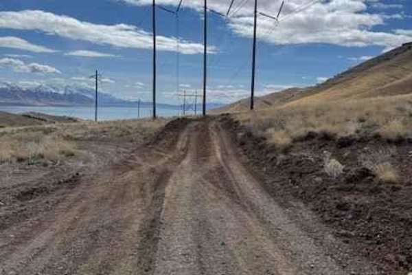
Dutchmen Run
This trail is an easy cruise at a slow pace with absolutely stunning views of the lake and mountains. At speed, this trail becomes one of the most thrilling trails in this area that will test your suspension and your talent. The trail is pretty straight and runs along the power lines and has recentl...
Learn more about Dutchmen Run
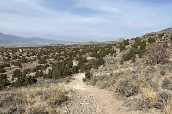
The Front 9
The Front 9 is an exciting intermediate singletrack trail ideal for dirt bike enthusiasts seeking a challenging, fast-paced ride through the scenic Lake Mountains. Starting from the Soldiers Pass parking area just south of the range, this 7.9-mile route immediately drops into a wash filled with deep...
Learn more about The Front 9
Gunsight
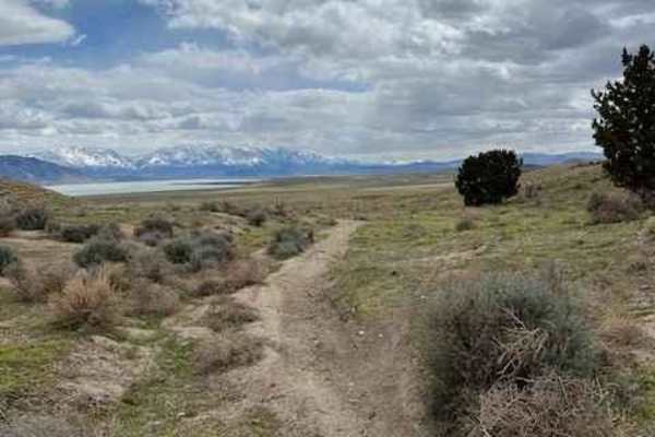
Gunsight is a mellow trail that starts south of the Soldier's Pass shooting area and runs 2.6 miles before intersecting with The Back 9. The track starts fast in an open field and then enters some small sagebrush. It then follows part of a wash and has several banked turns. The ground surface here i...
Learn more about Gunsight
Soldier Pass Spur Trail
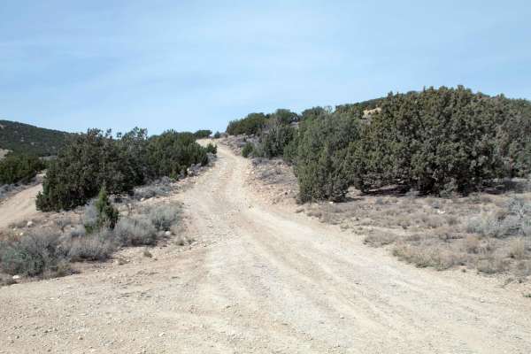
This trail is an out-and-back trail that splits off of Soldier Pass and heads West to where it dead-ends shortly before an active quarrying operation, where you must turn around and head back the way you came. This trail is relatively smooth, with the only difficulty being a couple of spots with som...
Learn more about Soldier Pass Spur Trail
Chimney Rock Pass
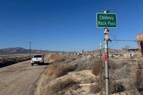
Easy, non-graded trail that travels from Highway 68 to Little Moab. There are several different ways to access Little Moab, but this one seems to be the most direct route from Highway 68. Nothing technical, and a passenger car could easily make it on this route. There are several offshoots to explor...
Learn more about Chimney Rock Pass
Bennie Creek - FS 8071
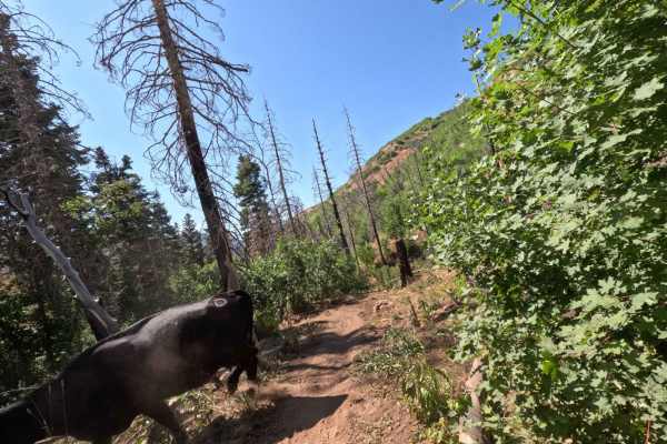
Bennie Creek is a 2.5-mile trail, which is part of the Payson/Mount Nebo trail system. It begins at a 3-way intersection with Loafer Mountain singletrack and hiking trails and heads west. The trail is entirely downhill when ridden in this direction. It terminates at FS 015 (paved road). This is a sh...
Learn more about Bennie Creek - FS 8071
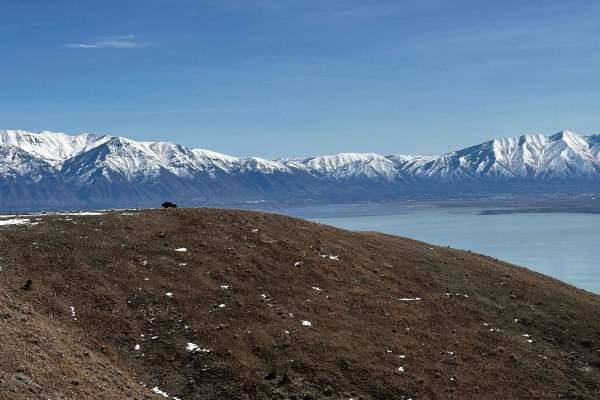
Israel Canyon Lake Mountain Skyline
This is a technical, enjoyable, and beautiful trail that takes you along the eastern crest of Lake Mountain with stunning 360-degree views almost the entire way. It can be run in either direction. There's more technical rock crawling on the southern end, so you'll want to decide if you'd rather go u...
Learn more about Israel Canyon Lake Mountain Skyline
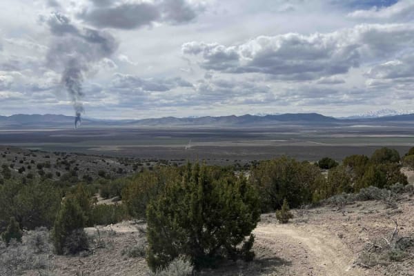
Lakeview Connector
Lakeview Connector is a 2.1-mile-long trail that runs north-south between The Back 9 and Lakeview East trails. This trail travels through short sagebrush and some smaller trees. The ground surface is hard-packed dirt and mostly smooth with few rocks. When traveling south, you'll have great views of ...
Learn more about Lakeview Connector
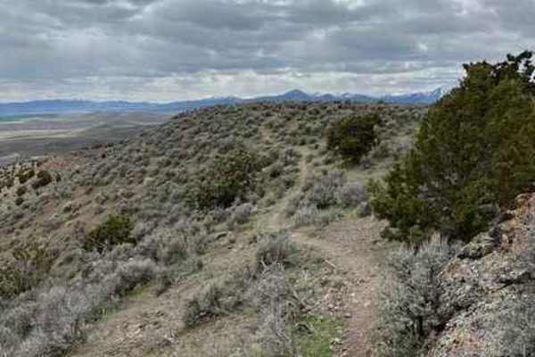
Hills Have Eyes
Hills Have Eyes branches off from Gunsight trail and travels 1 mile southwest, where it joins with Lakeview Connector. This short track gains about 200 feet of elevation before following rock formations along a ridgeline. The climb features a few steep turns--not quite switchbacks. Once on top, the ...
Learn more about Hills Have Eyes
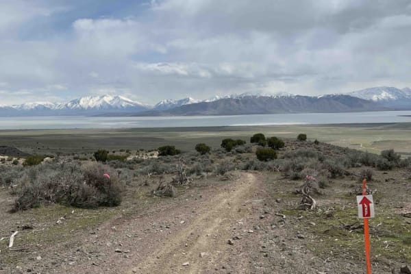
Lakeview East
Lakeview East runs 4.5 miles south and west from Sage Speedway. The trail surface is mostly smooth with occasional embedded rocks. When ridden towards the south, you'll get postcard views of Utah Lake. This route has several sections of S-turns through ravines which are really cool to ride. About ha...
Learn more about Lakeview East
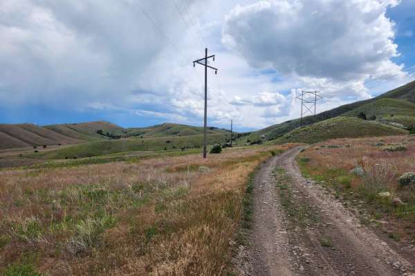
Powerline Road
This trail is a fun, easy cruise that follows the powerlines south-west of Saratoga Springs UT up and over some of the Lake Mountain foothills. The trail has some great views of the Utah lake and takes you into some neat areas that are worth exploring further on your own! This is a great trail for a...
Learn more about Powerline Road
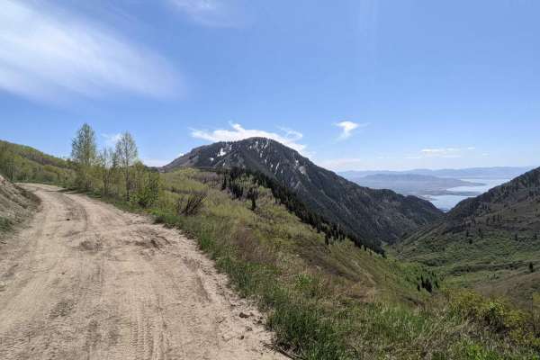
Kyhv Peak
From Provo Canyon, the road to Hope Campground is paved. From Hope Campground to Rock Canyon Campground, the road is easy and relatively smooth dirt. Beyond Rock Canyon Campground, the road becomes progressively more rocky and rutted until the final couple of miles, where the road becomes easier. ...
Learn more about Kyhv Peak
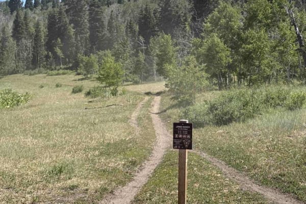
Jones Ranch North - FS 8123
The Jones Ranch North trail is a continuation of the Jones Ranch South trail in the Payson/Mount Nebo trail system. Jones Ranch North starts from the East end of Rock Spring near a stream. It runs 1.8 miles north before intersecting FS 015 (paved road). Caution: There is a cattle gate near the south...
Learn more about Jones Ranch North - FS 8123
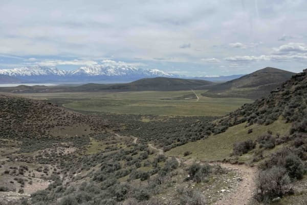
Cat East
Cat East is a 3.2-mile-long trail that begins after Lakeview East. It travels south with multiple climbs and short descents before passing and circling behind Cat Hill Mountain. This track starts in a sagebrush field that quickly becomes a grass field before crossing a dirt access road. After the ro...
Learn more about Cat East
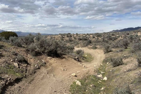
Lakeview West
Lakeview West is a 2.2-mile-long trail that branches off of Sage Speedway and ends at Lakeview East. This fast and flowy trail runs primarily north-south through small ravines and sagebrush. There are several sections of alternating banked turns, which are a lot of fun. The ground throughout is hard...
Learn more about Lakeview West
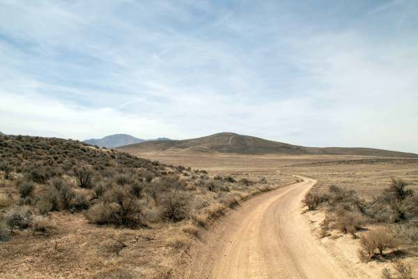
Greely Hill Flats
This trail is the last branch before you hit private property along the powerline trail and takes you from the powerline road over to Lake Mountain Block Trail, just over the hill from Little Moab. This trail is relatively smooth with some small rocky sections as it winds across the flats. This trai...
Learn more about Greely Hill Flats
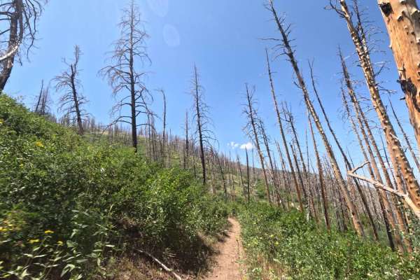
Sheepherder Hill - FS 8099
Sheepherder Hill is a difficult trail in the Payson/Mount Nebo trail system. It begins from the Sheepherder Trailhead parking lot, off of FS 015, and travels 5 miles southwest to Santaquin Meadows Road. The track is a steady climb of about 900 feet when ridden this direction. There's sometimes a lar...
Learn more about Sheepherder Hill - FS 8099
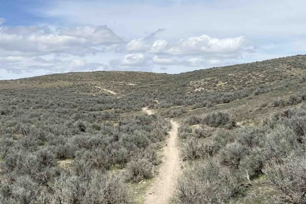
Cat West
Cat West starts on the backside of Cat Hill Mountain and travels north until hitting Lakeview West. This is a 2.4-mile-long trail that's generally open and high-speed. It has great flow with minimal obstacles, apart from whoops. Towards the north end, you'll run into a barbed wire gate. Remember to ...
Learn more about Cat West
ATV trails near Lake Shore, Utah
Explore ATV-friendly trails near you. These trails are accessible for vehicles up to 50 inches wide, perfect for ATVs and smaller off-road machines.
West Crest
The West Crest trail runs along the spine of West Mountain in southern Utah County. Hypothetically it can be done fully from the north to south (or vice versa) without having to do an out and back. Having tried this from various directions, logistically it is difficult to do due to a very steep sect...
Learn more about West Crest
Dead End Overview
This trail has amazing 360-degree views, but ultimately you'll climb to a point where you won't be able to pass unless you're on a dirt bike or maybe a true off-road built side-by-side. Decent amount of climbing, and no gnarly obstacles per se, but high clearance is needed. If you do the loop it wil...
Learn more about Dead End Overview
Dutchmen Run
This trail is an easy cruise at a slow pace with absolutely stunning views of the lake and mountains. At speed, this trail becomes one of the most thrilling trails in this area that will test your suspension and your talent. The trail is pretty straight and runs along the power lines and has recentl...
Learn more about Dutchmen Run
Soldier Pass Spur Trail
This trail is an out-and-back trail that splits off of Soldier Pass and heads West to where it dead-ends shortly before an active quarrying operation, where you must turn around and head back the way you came. This trail is relatively smooth, with the only difficulty being a couple of spots with som...
Learn more about Soldier Pass Spur Trail
UTV/side-by-side trails near Lake Shore, Utah
Find UTV and side-by-side trails near you. These trails accommodate vehicles up to 60 inches wide, ideal for UTVs, side-by-sides, and wider off-road rigs.
West Crest
The West Crest trail runs along the spine of West Mountain in southern Utah County. Hypothetically it can be done fully from the north to south (or vice versa) without having to do an out and back. Having tried this from various directions, logistically it is difficult to do due to a very steep sect...
Learn more about West Crest
Dead End Overview
This trail has amazing 360-degree views, but ultimately you'll climb to a point where you won't be able to pass unless you're on a dirt bike or maybe a true off-road built side-by-side. Decent amount of climbing, and no gnarly obstacles per se, but high clearance is needed. If you do the loop it wil...
Learn more about Dead End Overview
Dutchmen Run
This trail is an easy cruise at a slow pace with absolutely stunning views of the lake and mountains. At speed, this trail becomes one of the most thrilling trails in this area that will test your suspension and your talent. The trail is pretty straight and runs along the power lines and has recentl...
Learn more about Dutchmen Run
Soldier Pass Spur Trail
This trail is an out-and-back trail that splits off of Soldier Pass and heads West to where it dead-ends shortly before an active quarrying operation, where you must turn around and head back the way you came. This trail is relatively smooth, with the only difficulty being a couple of spots with som...
Learn more about Soldier Pass Spur Trail
The onX Offroad Difference
onX Offroad combines trail photos, descriptions, difficulty ratings, width restrictions, seasonality, and more in a user-friendly interface. Available on all devices, with offline access and full compatibility with CarPlay and Android Auto. Discover what you're missing today!
Open Trail Map