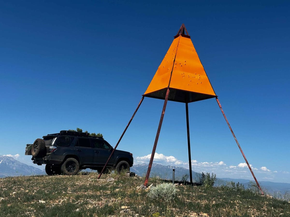
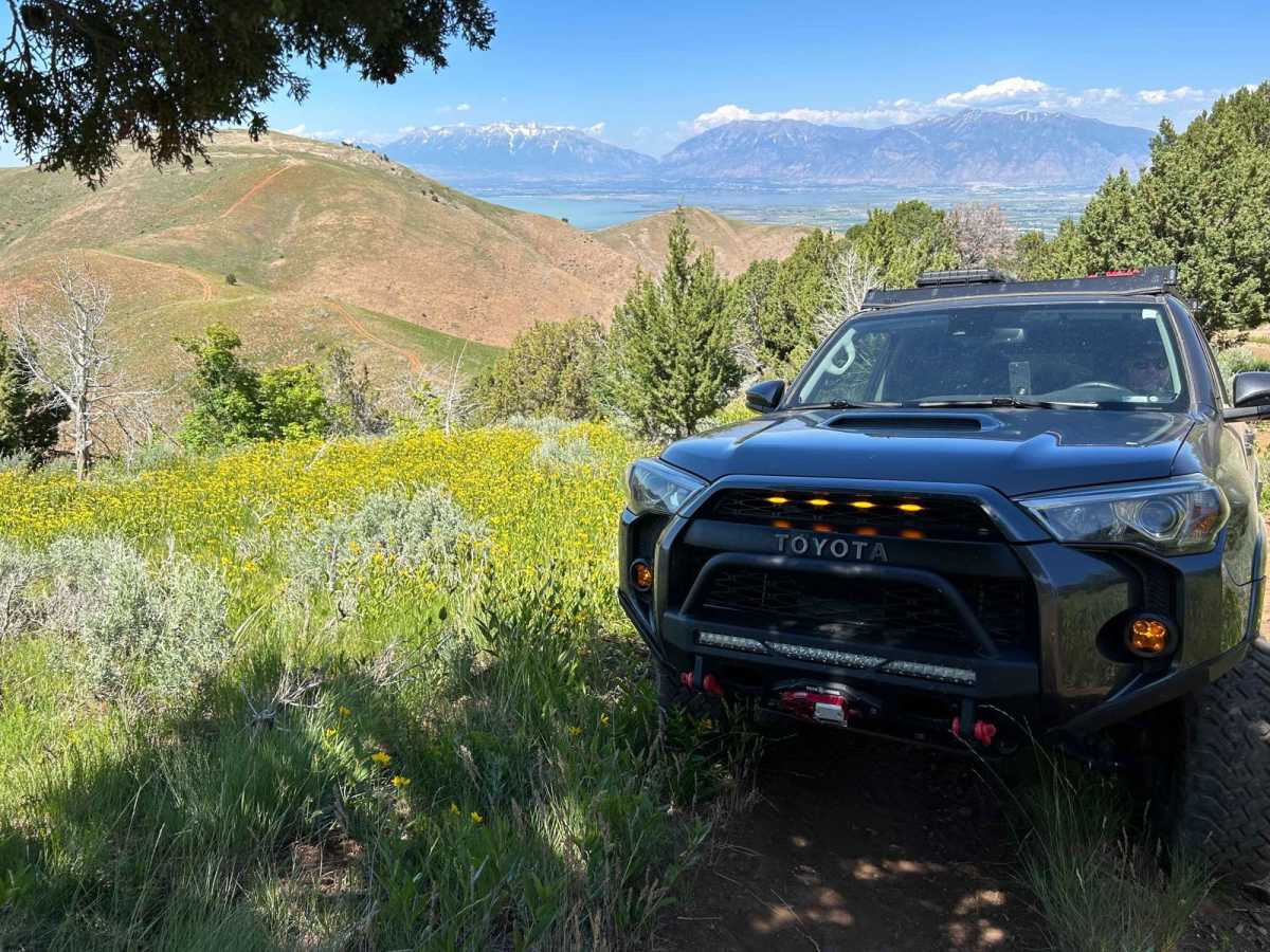
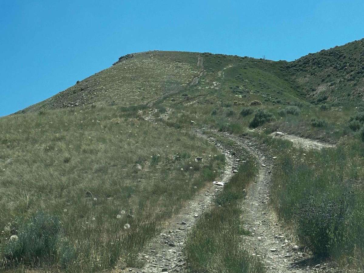
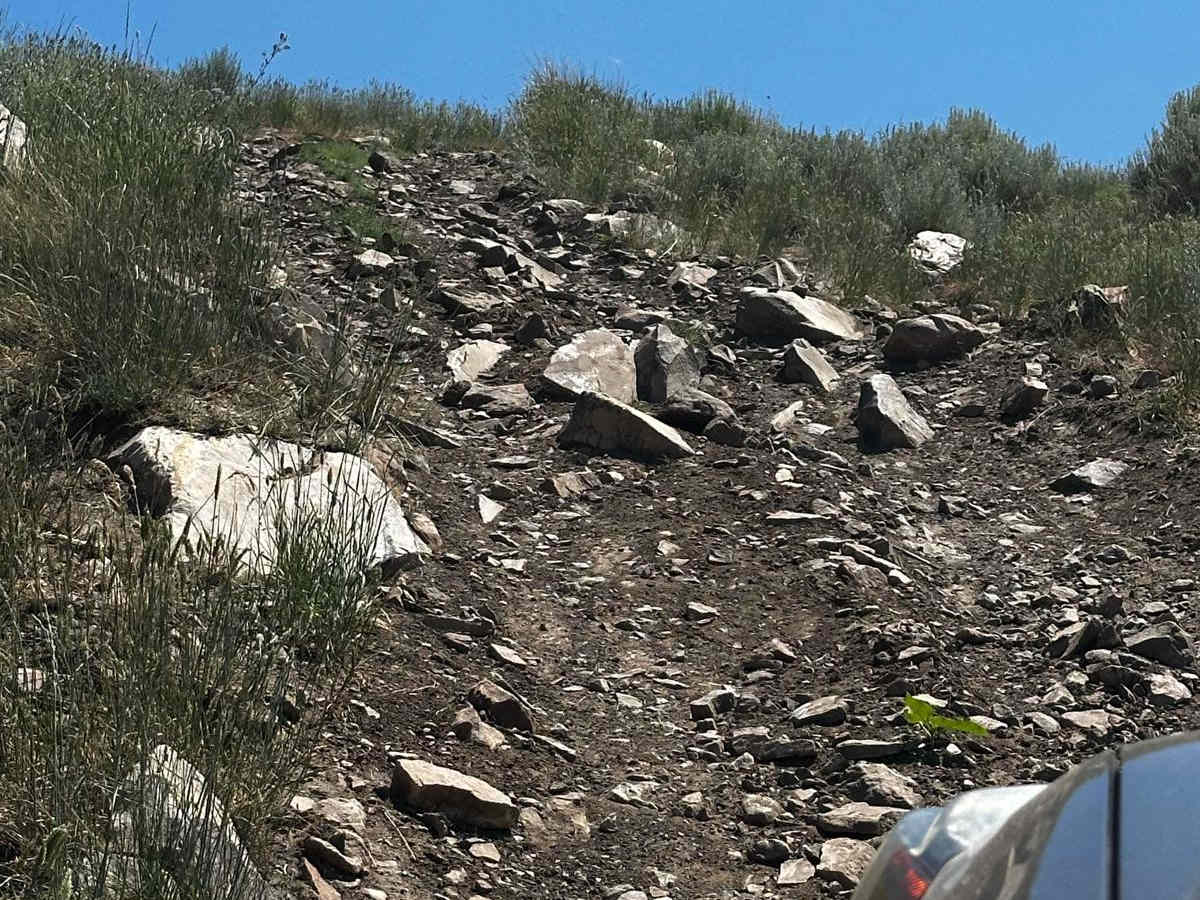
West Crest

Total Miles 6.4
Technical Rating
6 Moderate
Best Time Summer, Fall
Trail Type High-Clearance 4x4 Trail
Accessible By
Open Trail Map

Trail Overview

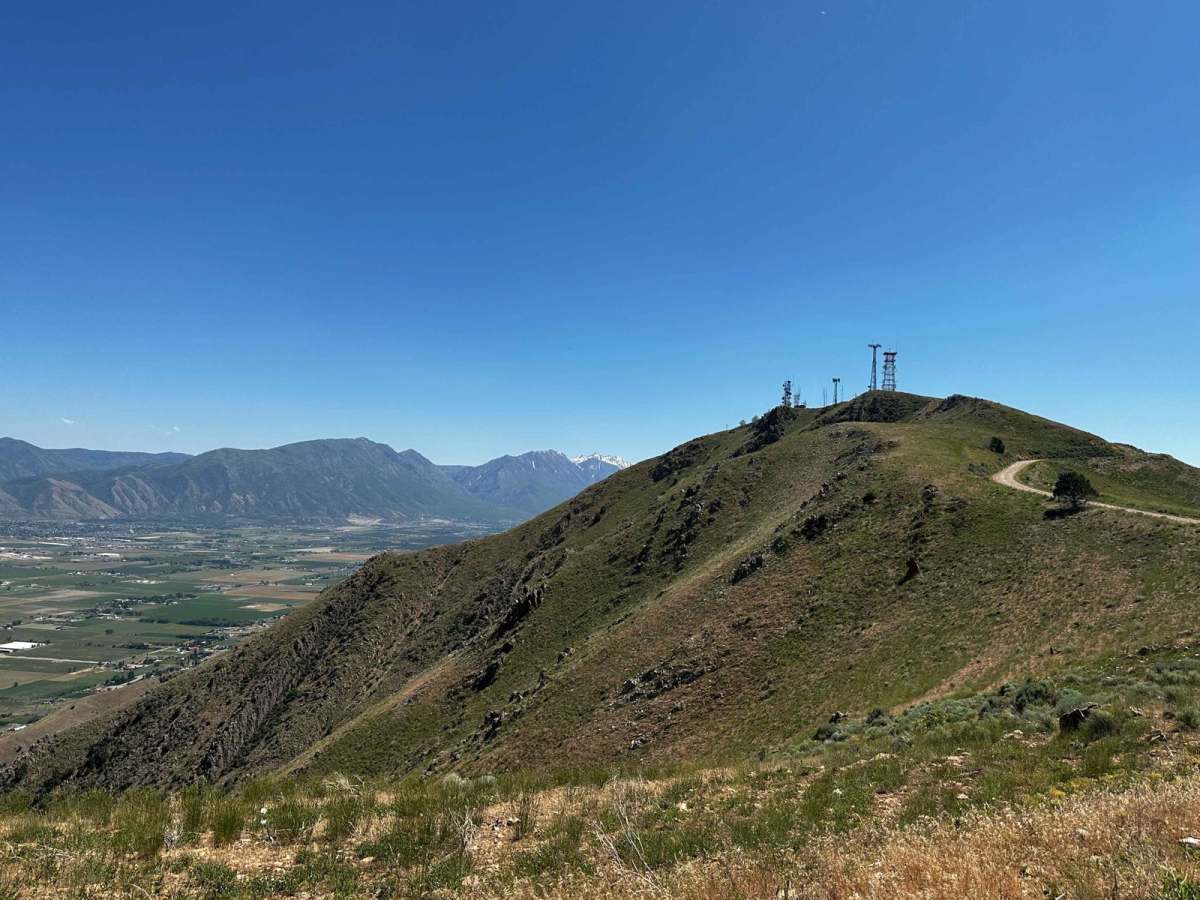
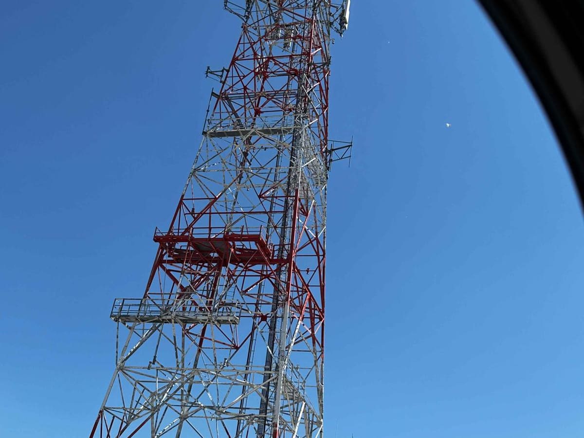
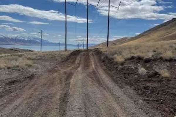
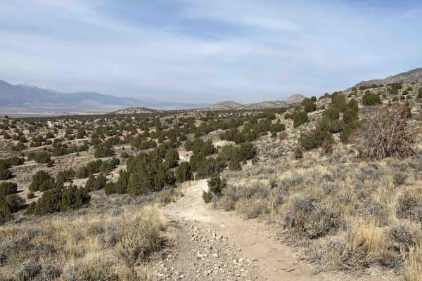
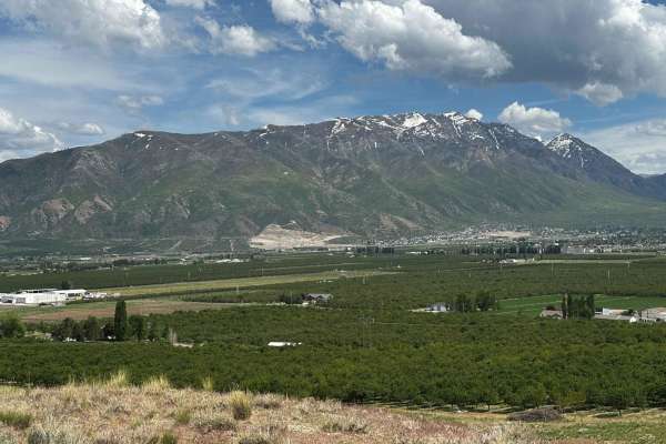
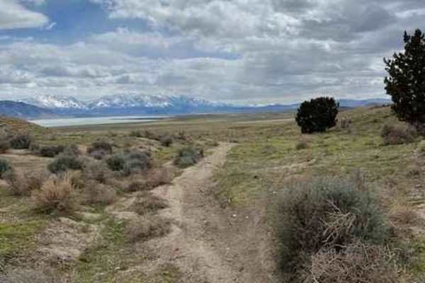
The West Crest trail runs along the spine of West Mountain in southern Utah County. Hypothetically it can be done fully from the north to south (or vice versa) without having to do an out and back. Having tried this from various directions, logistically it is difficult to do due to a very steep section covered in shale on the more southern end of the trail. If you run this from north to south, the first section can be done either via a very well-graded dirt road that meanders back and forth up the side of the mountain, or a much more direct, steep, deep-rutted route with boulders ranging from fist size to garbage can sized. The route mapped here is the latter. The trail will take you to the "West Mountain Tower" as well as the observation station at the summit. Continuing past the tower you begin to drop down the saddle before approaching a steep climb up the other side which is Y's. Either side of the Y ends in the same locale and each poses its own individual challenges. Continuing along this second ridge you then approach a section of the mountain that is very much more green and wooded than the rest. Hit it at the right time and you'll see beautiful wildflowers. The climb into this wooded area is quite steep, off-camber, and with some decent obstacles. You can likely do it solo, but having a spotter outside of the rig will certainly relieve the anxiety. After climbing above the tree line you will see a large, metal orange triangle structure. This is the geodetic survey station for West Mountain. After taking in some amazing 360-degree views you can continue down the other side which will bring you to a small saddle before another climb. Coming to the top of this climb you can see where the trail becomes much more indistinct as it descends down the other side. This is very steep and covered in unstable shale. This was the point that we turned back and doubled our way back north. Hypothetically you can continue down this side of the mountain and after two more saddles and two more summits, drop down the east side of the mountain and come out just above the Payson landfill. The shale descent would be very difficult in a full-size rig, SxS, and sketchy on a dirt bike. Overall the trail is very challenging and very fun. Your reward will be amazing views off either side of the mountain the whole time.

Photos of West Crest

Difficulty

This trail has very steep, off-camber sections and large boulder sections.

Technical Rating

6

Status Reports

Add Status Report
Jeff M
May 02, 2026
Open
The section through cedars there appears to have been some that slid off at some point. While passing the section did get high centered on a stump about 3/4 of the way up the steep hill before reaching the Survey Prism. Recommend hugging tight to the left while going up the hill a spotter would have been helpful. Overall wasn’t too bad had fun with the whole family.
Drew
Mar 28, 2026
Open
Easy enough on a bike, but the section near the peak when you climb through the trees has become narrow, steep, and rocky. I wouldn't do this in any kind of 4x4 unless you had a good spotter. Didn't go down the south side, turned around at the peak instead.
Tanner Green
Oct 21, 2025
Open
This last part to get up to the pinnacle was eroded and had some slides, was tough to get up. Couldn’t go all the way down the south side because the steep slate was too slippery.
Rhett Larsen
Aug 22, 2025
Open
Dracnaphobia vlad
Apr 27, 2025
Open
I wasn’t able to make it through the whole trail. Towards the end it got narrow and rocky so I couldn’t keep traction. Thankfully the gentleman that made a post before me was able to winch me back onto the trail! I was very close to the edge. Thank you again! Maybe he will see this! Lockers may be needed in some parts of the trail.
matt b
Apr 27, 2025
Open
Heff Guymon
Sep 13, 2024
Open
Quick morning ride. The smoke wasn't as bad, but not the best views of the valley trail conditions were fine.
Richard Harris
Jun 08, 2024
Open
I went out there to rescue my friend that got stuck on his way back. This is the last steep climb/descent and the downhill side of the trail was very soft. My winch and a snatch block came in very handy in pulling him back up onto the trail. Someone else had cut down one of the smaller trees to make the trail safer right here, but I don’t recommend going without a way to get yourself unstuck and a good spotter.
John F
Apr 13, 2024
Open
Logan Ericksen
Mar 09, 2024
Open
Trail is pretty open. Up towards the tower there is some snow. Tread lightly and be safe through there. We didn’t go past the towers.
Teagan Smith
Dec 24, 2023
Open
Christian Payne
Dec 16, 2023
Open
Isaac Paul
Sep 23, 2023
Open
Alex Bohl
Sep 03, 2023
Open

West Crest Trail can be accessed by the following ride types:

  • Single Track
  • 50 Inch
  • 60 Inch
  • High Clearance

West Crest Map

The onX Offroad Difference

onX Offroad combines trail photos, descriptions, difficulty ratings, width restrictions, seasonality, and more in a user-friendly interface. Available on all devices, with offline access and full compatibility with CarPlay and Android Auto. Discover what you're missing today!

Open Trail Map