
Dirt Bike Trails
Near Lake Isabella, California
Explore All Dirt Bike Trails Near Lake Isabella, California
Dirt Bike Trails Near Lake Isabella, California
Discover the best dirt bike trails near you. Browse trail maps, check difficulty ratings, and find your next adventure — whether you're looking for a quick ride or an all-day expedition.
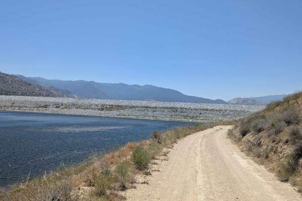
Engineer Point
Engineers Point runs along a shelf road tracing a peninsula on Lake Isabella, rolling up and down a series of steep hills with lake views throughout. The trail can be run as a straight out-and-back or extended into a loop by climbing the steep hill up to Engineers Point Overlook, combining two of th...
Learn more about Engineer Point
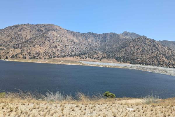
Engineer Point Overlook
Engineers Point Overlook is a short but steep climb delivering some of the best elevated views in the Lake Isabella area. The trail ascends over 100 feet to a high viewpoint above the lake where the water and surrounding mountains spread out below. The drop off the back side of the viewpoint is equa...
Learn more about Engineer Point Overlook
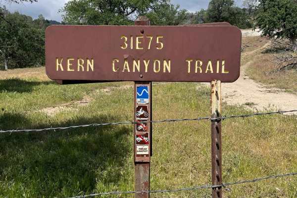
Kern Canyon 31E75
A tight, technical, meandering single-track trail with points of high exposure that provide beautiful views of the Kern Valley Canyon. A trail not for the faint of heart or those afraid of heights. Downhill exposure accompanied by a narrow trail can make for slow going, especially when traveling Eas...
Learn more about Kern Canyon 31E75
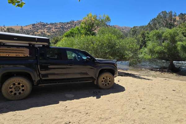
Kern River Getaway - 27S30
To get to this trail, you will first need to come down Black Gulch Jeep Trail heading West from Hwy 155. You will continue driving until the pavement turns to dirt at the last public restroom, which is a great place to pull over to stretch and air down or up. Once back on the trail, you will eventua...
Learn more about Kern River Getaway - 27S30
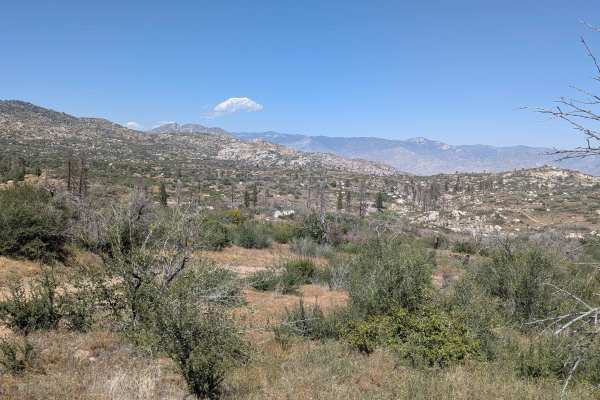
Borderline 4WD - FS 32E42
Borderline 4WD (FS 32E42) is one of the most demanding trails in the network, departing from Sawmill Road and climbing nearly 2,500 feet in just under 6 miles with only modest elevation relief along the way. The trail is maintained by the Trailblazers 4x4 Club and lives up to its name at every turn....
Learn more about Borderline 4WD - FS 32E42
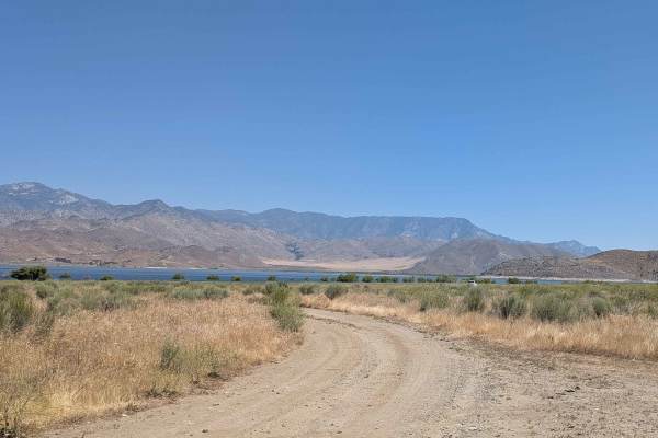
Mount Mesa - FS 26S40A
Mount Mesa (FS 26S40A) departs from California Route 198 and rolls through a large open meadow running parallel to Kissack Bay on Lake Isabella before looping around the bay. The meadow and bay setting delivers strong water views with Sequoia National Forest mountains framing the scene in the backgr...
Learn more about Mount Mesa - FS 26S40A
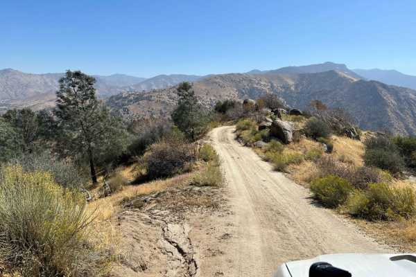
Freeway Ridge 4WD
This is a more steep and narrow trail coming up from the freeway leading into Lake Isabella, making a nice circuit if visiting the area. There are a couple more interesting sections, requiring 4-low to surmount. It is easier to travel down from another trail, but the climb will not be boring and the...
Learn more about Freeway Ridge 4WD
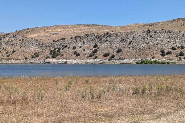
Kissack Cove
Kissack Cove runs along the shoreline of Kissack Cove on Lake Isabella through open grassland, offering one of the more relaxed and scenic drives in the area. The lake views are consistent throughout, with the Sequoia National Forest mountains providing a strong backdrop. Fishing access is the prima...
Learn more about Kissack Cove
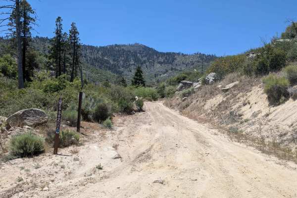
FS 25S02
FS 25S02 departs from the north side of Old State Road and runs along a shelf road delivering some of the most stunning views in the network. Lake Isabella, the town of Lake Isabella, and the surrounding mountains spread out in full panorama as the trail works its way along the ridge. Evidence of th...
Learn more about FS 25S02
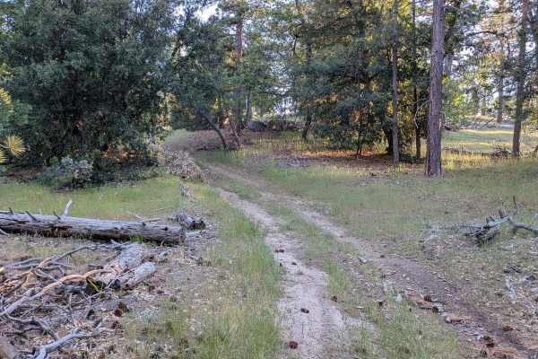
Lone Star - FS 26S24
Lone Star (FS 26S24) winds through a grassy hill area surrounded by trees within Sequoia National Forest, connecting Brown's Mill to the Mayflower 4x4 Trail. The landscape has an open, pastoral quality with grassy clearings breaking up the tree cover along the way. Evidence of trail maintenance is v...
Learn more about Lone Star - FS 26S24
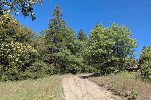
Evans Flat - FS 32E53A
Evans Flat (FS 32E53A) runs north to south from Evans Flat Campground, tracing a ridgetop course through the thick Sequoia National Forest. The dense canopy closes in along much of the route, with low-hanging branches posing a challenge for taller vehicles. A wide shelf road section opens up the sce...
Learn more about Evans Flat - FS 32E53A
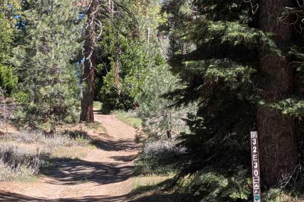
North Evans - FS 32E30
North Evans (FS 32E30) serves as a key connector linking Sawmill Road, Evans Flat (FS 32E53A), Woodward Peak (FS 32E53), Borderline 4WD (FS 32E42), and Rancheria Road North into a cohesive network. The trail cuts through the Sequoia National Forest with a mostly open canopy, though low-hanging branc...
Learn more about North Evans - FS 32E30
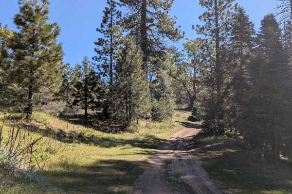
Woodward Peak - FS 32E53
Woodward Peak (FS 32E53) departs from the west side of Evans Flat Campground and pushes into Sequoia National Forest, staying narrow and enclosed for much of its length before the southern half opens up its canopy to offer glimpses of distant mountains. A shelf road section runs through the middle p...
Learn more about Woodward Peak - FS 32E53
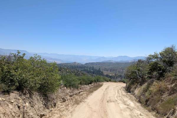
Sawmill Road
Sawmill Road is the primary west-to-east corridor in this section of the Sequoia National Forest, departing from Rancheria Road North and climbing over 2,300 feet in just over 7.5 miles. The trail runs along a shelf road with a canyon dropping away to the south and a drainage ditch to the north, giv...
Learn more about Sawmill Road
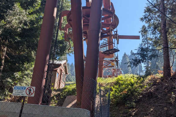
Shirley Meadows - FS 25S31
Shirley Meadows FS 25S31 departs from Rancheria Road and pushes into a thick stand of tall pine trees within Sequoia National Forest. The dense forest canopy and shelf road character give this trail a different feel from the more open desert and lakeshore routes in the surrounding network. Note that...
Learn more about Shirley Meadows - FS 25S31
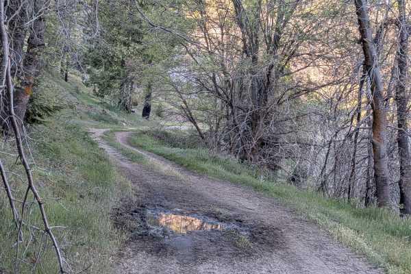
Likely Saddle - FS 26S20
Likely Saddle FS 26S20 serves as a connector between Rancheria Road and various other trails in the network, threading through thick pine forest within Sequoia National Forest. The hard-packed dirt surface is fairly smooth, and the trail is a practical and low-stress link between destinations. Evide...
Learn more about Likely Saddle - FS 26S20
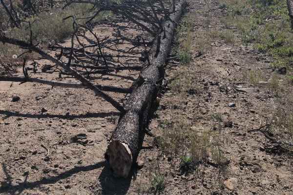
Frank - FS 26S07
Frank FS 26S07 departs from Rancheria Road and runs along a narrow shelf road through grass and pine forest, much of which shows significant burn damage from the 2021 French Fire. Views of the valley and canyons below appear along the shelf sections. The trail currently ends earlier than its full ex...
Learn more about Frank - FS 26S07
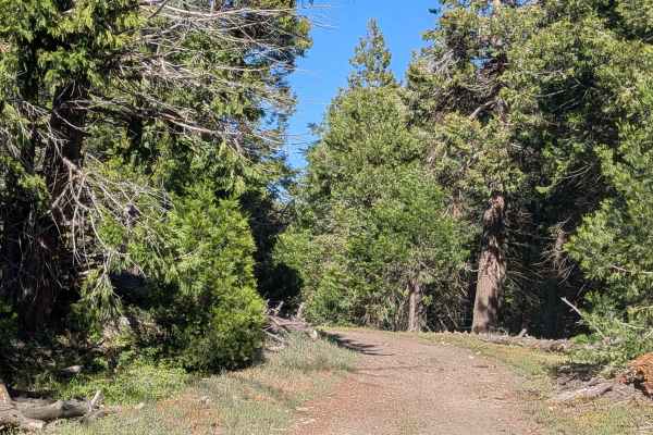
West Evans - FS 31E62
West Evans (FS 31E62) departs from Rancheria Road South and climbs steadily through dense pine forest within Sequoia National Forest. The trail is extremely narrow, barely one vehicle wide, with low-hanging branches that will make contact with taller vehicles throughout. Evidence of recent forest fi...
Learn more about West Evans - FS 31E62
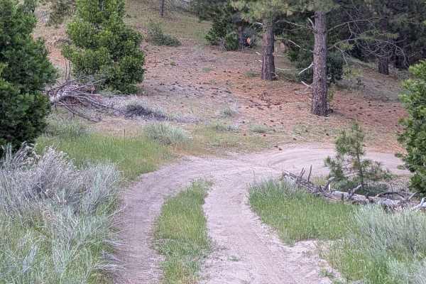
Eagle - FS 27S13
Eagle (FS 27S13) branches off Brown's Mill and winds through dense pine trees and grasses within Sequoia National Forest. Shelf road sections break open the canopy at intervals, revealing views of the mountains and valley below before the forest closes back in. Hawks and ground birds, including quai...
Learn more about Eagle - FS 27S13
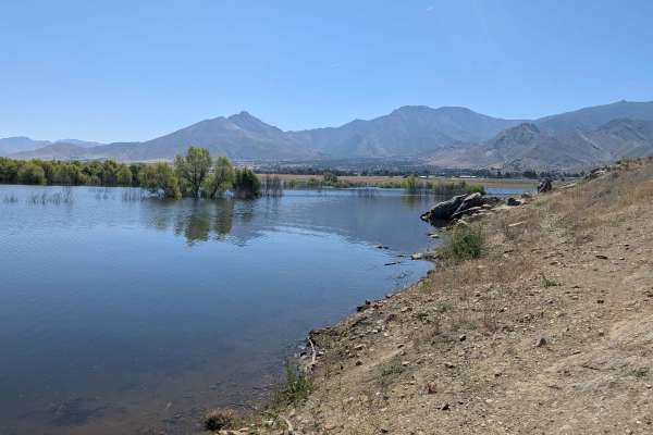
Rattlesnake - FS 26S34B
Rattlesnake (FS 26S34B) branches off Patterson Lane and runs along the south shore of Lake Isabella through an open grass meadow ringed by the foothills of the Sequoia National Forest. The lakeside access makes this a popular fishing spot, and visitors should expect to share the trail with anglers o...
Learn more about Rattlesnake - FS 26S34B
ATV trails near Lake Isabella, California
Explore ATV-friendly trails near you. These trails are accessible for vehicles up to 50 inches wide, perfect for ATVs and smaller off-road machines.
Engineer Point
Engineers Point runs along a shelf road tracing a peninsula on Lake Isabella, rolling up and down a series of steep hills with lake views throughout. The trail can be run as a straight out-and-back or extended into a loop by climbing the steep hill up to Engineers Point Overlook, combining two of th...
Learn more about Engineer Point
Engineer Point Overlook
Engineers Point Overlook is a short but steep climb delivering some of the best elevated views in the Lake Isabella area. The trail ascends over 100 feet to a high viewpoint above the lake where the water and surrounding mountains spread out below. The drop off the back side of the viewpoint is equa...
Learn more about Engineer Point Overlook
Kern River Getaway - 27S30
To get to this trail, you will first need to come down Black Gulch Jeep Trail heading West from Hwy 155. You will continue driving until the pavement turns to dirt at the last public restroom, which is a great place to pull over to stretch and air down or up. Once back on the trail, you will eventua...
Learn more about Kern River Getaway - 27S30
Borderline 4WD - FS 32E42
Borderline 4WD (FS 32E42) is one of the most demanding trails in the network, departing from Sawmill Road and climbing nearly 2,500 feet in just under 6 miles with only modest elevation relief along the way. The trail is maintained by the Trailblazers 4x4 Club and lives up to its name at every turn....
Learn more about Borderline 4WD - FS 32E42
UTV/side-by-side trails near Lake Isabella, California
Find UTV and side-by-side trails near you. These trails accommodate vehicles up to 60 inches wide, ideal for UTVs, side-by-sides, and wider off-road rigs.
Engineer Point
Engineers Point runs along a shelf road tracing a peninsula on Lake Isabella, rolling up and down a series of steep hills with lake views throughout. The trail can be run as a straight out-and-back or extended into a loop by climbing the steep hill up to Engineers Point Overlook, combining two of th...
Learn more about Engineer Point
Engineer Point Overlook
Engineers Point Overlook is a short but steep climb delivering some of the best elevated views in the Lake Isabella area. The trail ascends over 100 feet to a high viewpoint above the lake where the water and surrounding mountains spread out below. The drop off the back side of the viewpoint is equa...
Learn more about Engineer Point Overlook
Kern River Getaway - 27S30
To get to this trail, you will first need to come down Black Gulch Jeep Trail heading West from Hwy 155. You will continue driving until the pavement turns to dirt at the last public restroom, which is a great place to pull over to stretch and air down or up. Once back on the trail, you will eventua...
Learn more about Kern River Getaway - 27S30
Borderline 4WD - FS 32E42
Borderline 4WD (FS 32E42) is one of the most demanding trails in the network, departing from Sawmill Road and climbing nearly 2,500 feet in just under 6 miles with only modest elevation relief along the way. The trail is maintained by the Trailblazers 4x4 Club and lives up to its name at every turn....
Learn more about Borderline 4WD - FS 32E42
The onX Offroad Difference
onX Offroad combines trail photos, descriptions, difficulty ratings, width restrictions, seasonality, and more in a user-friendly interface. Available on all devices, with offline access and full compatibility with CarPlay and Android Auto. Discover what you're missing today!
Open Trail Map