
Dirt Bike Trails
Near Kohatk, Arizona
Explore All Dirt Bike Trails Near Kohatk, Arizona
Dirt Bike Trails Near Kohatk, Arizona
Discover the best dirt bike trails near you. Browse trail maps, check difficulty ratings, and find your next adventure — whether you're looking for a quick ride or an all-day expedition.
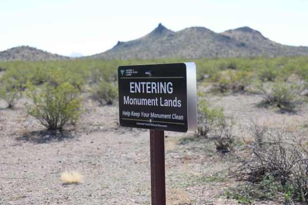
Widow Maker Pass
After you enter the gate, you go through a little sand, take a left, and head to the Sawtooth Mountains. Continue on the trail past the Ironwood Forest National Monument. There's wonderful scenery as you travel an easy trail. After you seem to be clearing the mountains, you will go right and up a st...
Learn more about Widow Maker Pass
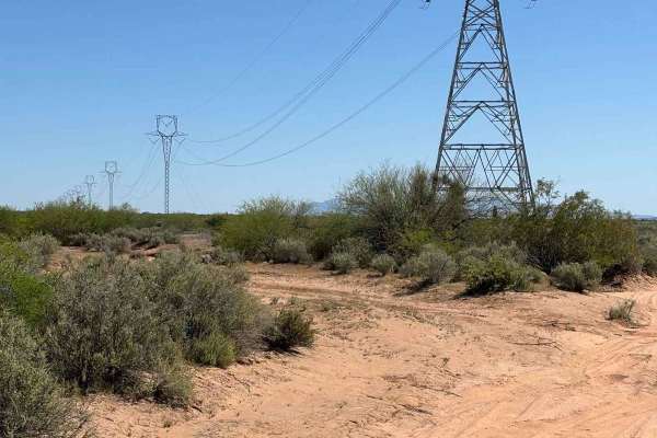
Sawtooth Powerline Trail
This powerline trail provides access to the West Silverbell Mountain Loop from the Sawtooth Mountain Loop. Other side trails give access to the Silverbell Sasco loop as well. This is a massive backcountry area with many unmapped trails, very few crowds, and an abundance of Sonoran desert flora and f...
Learn more about Sawtooth Powerline Trail
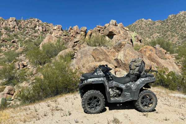
West Silverbell Mountain Loop
Explore a relatively easy trail meandering through quintessential Sonoran Desert landscapes. The trail is mostly smooth and has a good flow to it, with a handful of rockier sections. There are great views of the local mountains and unique rock outcrops. The southern end of West Silverbell Mountain f...
Learn more about West Silverbell Mountain Loop
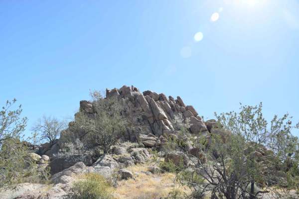
Backway to Waterfall
This easy backway to the waterfall trail makes for a fun drive with plenty of stops throughout. Along the way, you will find small and large rock features that will be great for stops for groups as well as for picture taking. It is suggested to have 4WD and high clearance for some areas and the Wate...
Learn more about Backway to Waterfall
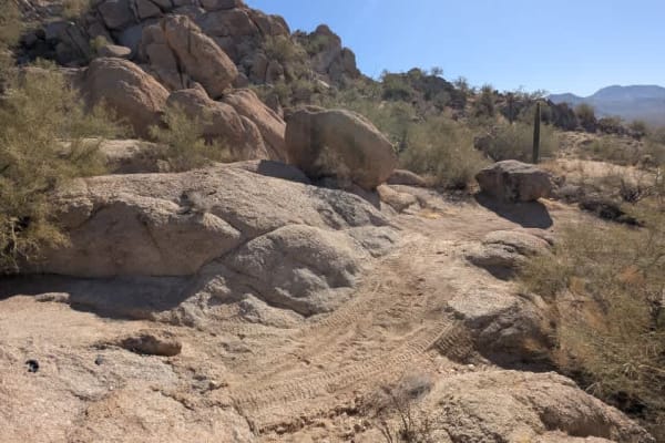
Chasing Waterfalls
This is a short but challenging offshoot of The Waterfall trail. It's a loop that has several significant obstacles and areas to play. After the obstacles, you're treated to an awesome view of the entire city of Maricopa and other parts of the valley. This trail is on Arizona State Trust land, so a ...
Learn more about Chasing Waterfalls
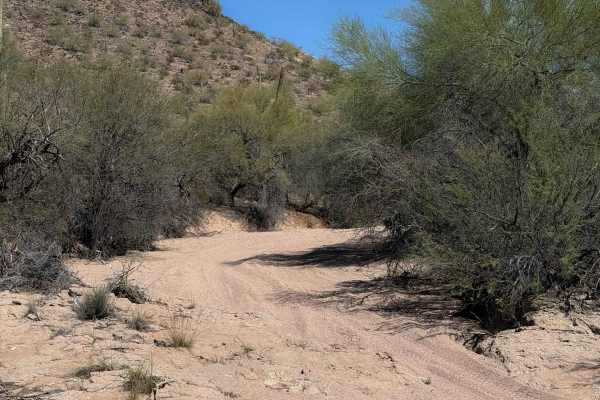
Bh1270
This is a 2.2-mile-long desert trail through the BLM land north of the Table Top Wilderness and Interstate 8. The east end of the trail departs from a more major desert road (Bh1271), and it meanders west through a flat desert terrain on a mix of hard-packed dirt and sand. The trail enters a wide sa...
Learn more about Bh1270
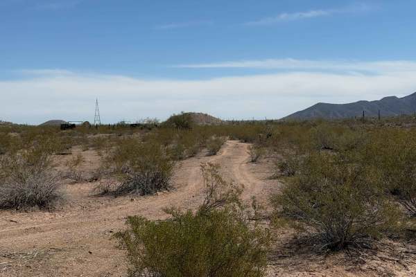
8042B
This is a short trail, 0.8 miles long, on the edge of the Table Top Wilderness and BLM land, easily accessible from the Sonoran Desert National Monument Staging Area. It’s mostly an easy desert trail on a mix of hard-packed dirt and sand, meandering through the creosote bushes with minimal elevation...
Learn more about 8042B
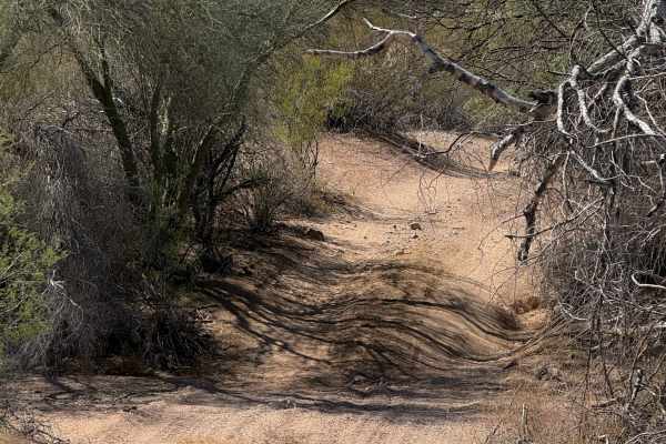
8042
BLM route 8042 starts on the north end as a narrower trail between a couple of paloverde trees, with branches sticking out into the trail. After the initial entrance, it opens up as it goes south, wider like a road. The route is a mix of sand washes and hard-packed dirt trails over the low rolling h...
Learn more about 8042
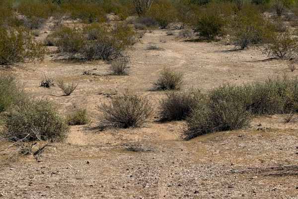
Hidden Valley
This is a 1.3-mile-long segment of primitive dirt bike trail through BLM land, accessed off of BLM Route 1273. The trail is lightly trafficked and faint at times, and will require some good navigation and a GPS track. It goes through a flat and barren desert terrain over hard-packed dirt and gravel,...
Learn more about Hidden Valley
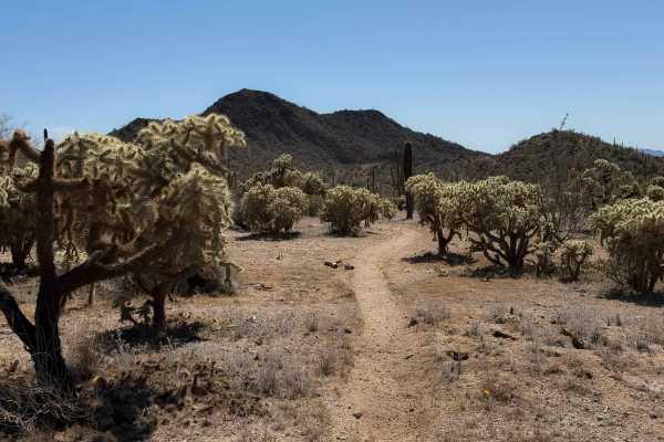
Bh1278 Singletrack
This dirt bike trail is a true singletrack through the BLM land north of Interstate 8, compared to the many wide wash trails. It goes through a flat desert terrain for 0.8 miles, on a skinny trail through cholla gardens and next to towering saguaro cactus. The trail weaves through the cactus with ge...
Learn more about Bh1278 Singletrack
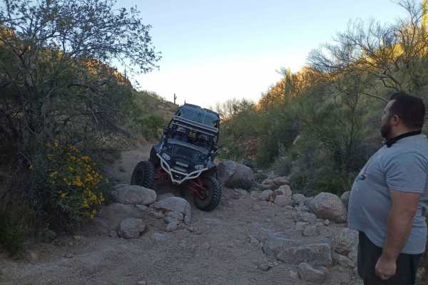
Hawk Hills Canyon
This is a serious rock garden and rock climb. Though not super steep, it's very technical due to the quantity and size of the rocks. Rock sliders and skid plates are strongly advised. You have to go significantly off-camber to get around the side of several large boulders, and it's not uncommon for ...
Learn more about Hawk Hills Canyon
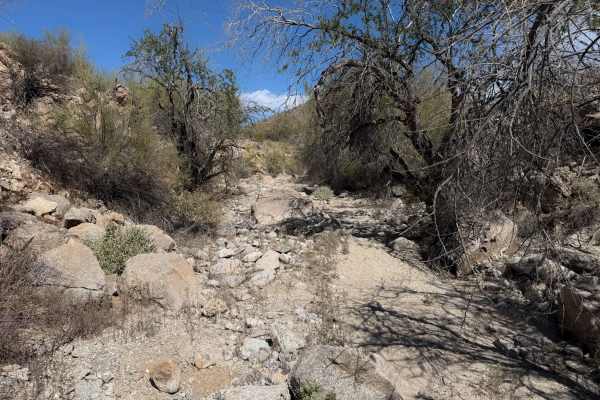
Hidden Valley Wash
This is a fun dirt bike trail through BLM land near the Hawk Hills. Although less than a mile long, it has some fun rocky sections that make it more interesting for the average rider. The trail starts off in easy desert flats, but is primitive through the creosote bushes. At times, it is wide open l...
Learn more about Hidden Valley Wash
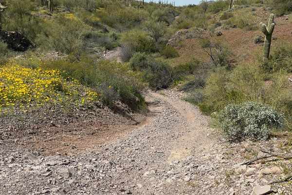
Javelina Mountain Trail
This trail is found in the Barry Goldwater Bombing Range, Sand Tank Mountain Area A. A permit is required and easily obtained for free at Luke.isportman.net. Check-in and check-out can easily be done on the same website. This trail takes off from Vekol Road and winds behind Maricopa Peak, Javelina M...
Learn more about Javelina Mountain Trail
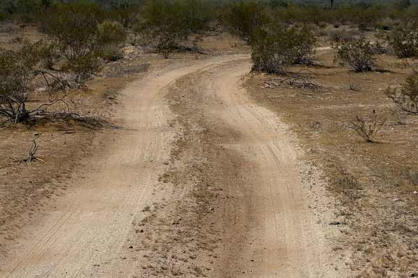
Hidden Valley Road
This is a road-width trail through BLM land that connects BLM route Bh1367 to private property. The trail is unmarked and looks like it gets used by full-width vehicles. It is a mix of sand and hard-packed dirt and a few loose rocks, traveling through wide open desert terrain for 1.3 miles. The trai...
Learn more about Hidden Valley Road
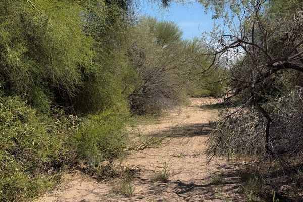
Bh1270 Wash
This is a 2-mile-long wash trail through BLM Land north of Interstate 8. The north end starts at the boundary of Arizona state trust land and BLM, accessed through a spur off the Vekol Wash. The entirety of the trail is a wide sandy wash with some grass growing through the sand. There are lots of tr...
Learn more about Bh1270 Wash
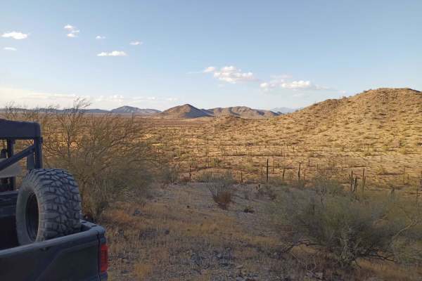
Hawk Hills Northern Hilltop
This is a rough trail but it is a good one for newbies to learn on a more moderate skill level. The Hill Climb at the end is very steep towards the top, low gear required on the climb even on an Polaris XP 1000, traction sketchy even in 4x4 in a few places, very good place for a beginner who is read...
Learn more about Hawk Hills Northern Hilltop
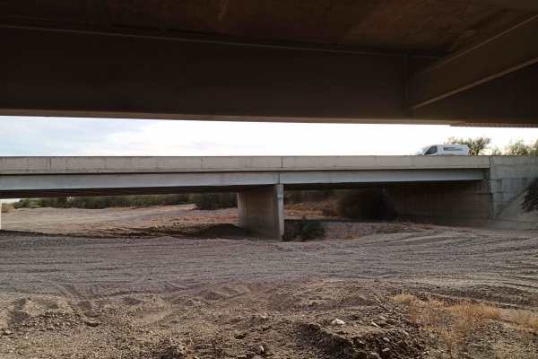
Vekol Wash I-8 Bridge Crossing
This is the leg of the Vekol Wash from Vekol Valley Road, Continuing South, crossing under the I-8 Bridge, and continuing into other trails leading further south; there is also a curve to the west that connects you to the I-8 onramp of Vekol Valley Road. Bridge clearance is approximately 12 feet but...
Learn more about Vekol Wash I-8 Bridge Crossing
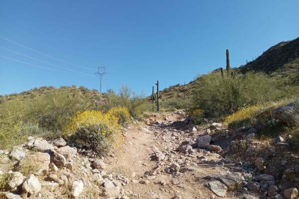
Power Line Road | Hidden Valley South
This trail has varying difficulty. There is an expert-level rock garden a couple of hundred feet long at the big hill climb, but otherwise, it's a level 4 difficulty. The rock garden has off-camber obstacles;higher clearance is recommended, as stock-height vehicles will likely get rocker damage. The...
Learn more about Power Line Road | Hidden Valley South
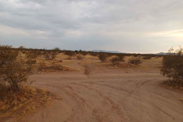
Barnes BLM Inlet
Barnes Rd Entrance to BLM Lands and Trails, Barnes Rd Staging area also here on the right and left side of the trail, lots of room for truck/trailer and unloading. There is a nice view from the top of Barnes Hill overlooking all directions that is a good spot for doing Panoramic Photos.
Learn more about Barnes BLM Inlet
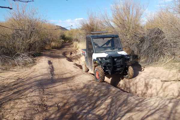
Upland BLM Inlet | Vekol Wash Access
This trail connects Upland Street to the Vekol Wash and the larger BLM Trail System. It's fairly beginner-level, however, there is very soft and deep sand at the crossing of the Vekol Wash, and it should not be attempted by most 2WD vehicles. Numerous low spots fill up with deceptively deep water af...
Learn more about Upland BLM Inlet | Vekol Wash Access
ATV trails near Kohatk, Arizona
Explore ATV-friendly trails near you. These trails are accessible for vehicles up to 50 inches wide, perfect for ATVs and smaller off-road machines.
Widow Maker Pass
After you enter the gate, you go through a little sand, take a left, and head to the Sawtooth Mountains. Continue on the trail past the Ironwood Forest National Monument. There's wonderful scenery as you travel an easy trail. After you seem to be clearing the mountains, you will go right and up a st...
Learn more about Widow Maker Pass
Sawtooth Powerline Trail
This powerline trail provides access to the West Silverbell Mountain Loop from the Sawtooth Mountain Loop. Other side trails give access to the Silverbell Sasco loop as well. This is a massive backcountry area with many unmapped trails, very few crowds, and an abundance of Sonoran desert flora and f...
Learn more about Sawtooth Powerline Trail
West Silverbell Mountain Loop
Explore a relatively easy trail meandering through quintessential Sonoran Desert landscapes. The trail is mostly smooth and has a good flow to it, with a handful of rockier sections. There are great views of the local mountains and unique rock outcrops. The southern end of West Silverbell Mountain f...
Learn more about West Silverbell Mountain Loop
Backway to Waterfall
This easy backway to the waterfall trail makes for a fun drive with plenty of stops throughout. Along the way, you will find small and large rock features that will be great for stops for groups as well as for picture taking. It is suggested to have 4WD and high clearance for some areas and the Wate...
Learn more about Backway to Waterfall
UTV/side-by-side trails near Kohatk, Arizona
Find UTV and side-by-side trails near you. These trails accommodate vehicles up to 60 inches wide, ideal for UTVs, side-by-sides, and wider off-road rigs.
Widow Maker Pass
After you enter the gate, you go through a little sand, take a left, and head to the Sawtooth Mountains. Continue on the trail past the Ironwood Forest National Monument. There's wonderful scenery as you travel an easy trail. After you seem to be clearing the mountains, you will go right and up a st...
Learn more about Widow Maker Pass
Sawtooth Powerline Trail
This powerline trail provides access to the West Silverbell Mountain Loop from the Sawtooth Mountain Loop. Other side trails give access to the Silverbell Sasco loop as well. This is a massive backcountry area with many unmapped trails, very few crowds, and an abundance of Sonoran desert flora and f...
Learn more about Sawtooth Powerline Trail
West Silverbell Mountain Loop
Explore a relatively easy trail meandering through quintessential Sonoran Desert landscapes. The trail is mostly smooth and has a good flow to it, with a handful of rockier sections. There are great views of the local mountains and unique rock outcrops. The southern end of West Silverbell Mountain f...
Learn more about West Silverbell Mountain Loop
Backway to Waterfall
This easy backway to the waterfall trail makes for a fun drive with plenty of stops throughout. Along the way, you will find small and large rock features that will be great for stops for groups as well as for picture taking. It is suggested to have 4WD and high clearance for some areas and the Wate...
Learn more about Backway to Waterfall
The onX Offroad Difference
onX Offroad combines trail photos, descriptions, difficulty ratings, width restrictions, seasonality, and more in a user-friendly interface. Available on all devices, with offline access and full compatibility with CarPlay and Android Auto. Discover what you're missing today!
Open Trail Map