
Dirt Bike Trails
Near Junction, Utah
Explore All Dirt Bike Trails Near Junction, Utah
Dirt Bike Trails Near Junction, Utah
Discover the best dirt bike trails near you. Browse trail maps, check difficulty ratings, and find your next adventure — whether you're looking for a quick ride or an all-day expedition.
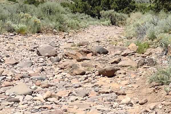
City Creek Canyon (FS# 40133)
City Creek runs parallel to Hwy 153 going west of Junction, Utah. This track goes up through the canyon City Creek runs in. It is also part of Paiute Side Trail 34. The canyon is filled with sagebrush, bushes, and trees. The trail in places is gravely dirt, but in places, it's mostly rocks. The rock...
Learn more about City Creek Canyon (FS# 40133)
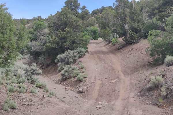
Oak Spring Rollercoaster
The Rollercoaster starts out as a dirt trail, wandering through the draws between the hills in this area. Before long, you are in and out of the wash, so early spring this trail will be wet, if accessible at all. Heavy summer rains may close this area, too. Once you turn uphill and leave the wash, t...
Learn more about Oak Spring Rollercoaster
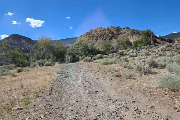
Kingston Canyon (Paiute 1 Trail)
This trail follows Kingston Canyon, which is part of the original Paiute 1 Trail near Circleville, Utah. It follows the canyon in and out of Rocky Ford Creek. Part of the trail is rocky, and part in the wash is sandy. There are no steep hill climbs or downgrades. You will see mountains to the side o...
Learn more about Kingston Canyon (Paiute 1 Trail)
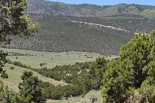
Oak Basin (FS# 40144)
Oak Basin is a beautiful location in southern Utah, accessible only to off-roaders and hikers. You come up out of the City Creek Canyon and enter this expansive, gorgeous valley teeming with oak brush. In the fall, the colors in this area will be amazing. There is plenty of feed and water, so wildli...
Learn more about Oak Basin (FS# 40144)
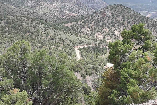
Monroe Mount Road (Kingston Cnyn to Forshea Mtn)
In mid-June, this road had recently been graded, so it was dusty and the gravel was on top, which made it harder to drive than if it was hard-packed. But it's a good road that runs from Kingston Canyon Recreation Area on Hwy 62 up to Forshea Mountain, the Paiute Trail System, and adjoining trails in...
Learn more about Monroe Mount Road (Kingston Cnyn to Forshea Mtn)
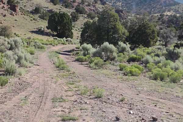
We're In A Tight Spot - BLM 5145
This track follows a two-track trail across BLM-managed lands, and it goes up through a wash in a canyon to the end, where you U-turn and drive back out. The two-track trail looks like it exits the canyon, but we have not been able to find that part of the trail. There are rock obstacles, tree obsta...
Learn more about We're In A Tight Spot - BLM 5145
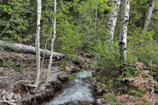
Tenmile Creek Trail
The Tenmile Creek Trail intersects at the top with the Tenmile Hiking Trail and Tenmile Creek. This is a dead-end track for vehicles. The hiking trail is open to hikers, horseback riders, and bikes. The trail is a good "road" which climbs to just over 8000 feet. Near the start of the trail, you cros...
Learn more about Tenmile Creek Trail
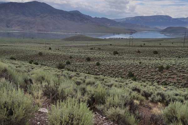
Powerline "Plus"
This is another section of the powerline trail that runs parallel to Highway 89 south of Marysvale, Utah. This section follows the curves of the hills as you cross BLM and Utah State Trust Lands, instead of going underneath the powerlines. It's a fun trail that rises up to an elevation high enough t...
Learn more about Powerline "Plus"
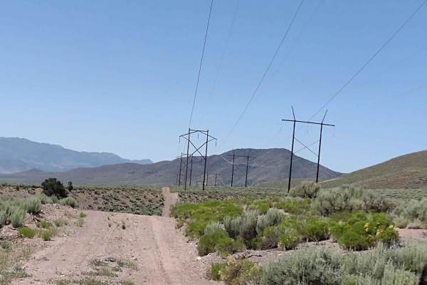
Powerline Trail
This 5-mile Powerline Trail takes you south from Fallen Tree Gulch to Highway 153 and the numerous trails in the area just west of Junction, UT. The Powerline Trail is easy, moving over and around the hills, generally following the powerline. There are a lot of side and spur trails to take as well. ...
Learn more about Powerline Trail
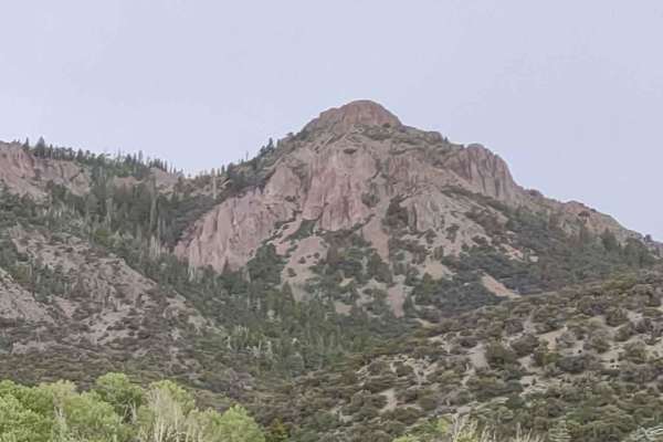
Mary's Nipple View (FS# 40617)
Mary's Nipple View is a dead-end trail that takes you up to 8938 feet, just below Mary's Nipple. The trail goes by Order Canyon and through Cougar Canyon. It's an easy trail, but in the spring and after a rainstorm, erosion will be evident on the trail. It rained and hailed on us at the top, but sti...
Learn more about Mary's Nipple View (FS# 40617)
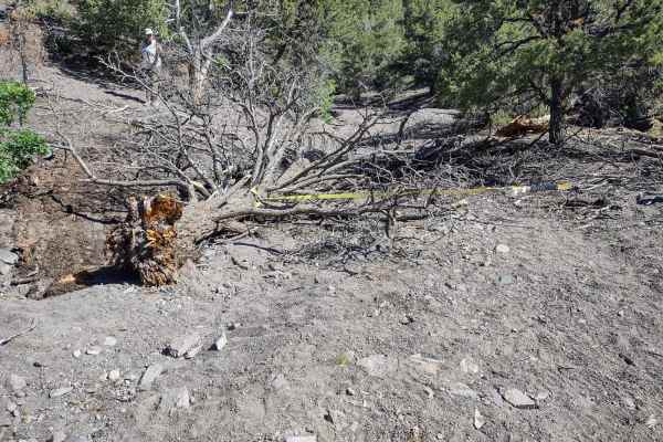
Fallen Tree Gulch (FS#40634)
Fallen Tree Gulch goes west from Old Hwy 89 just north of Junction, UT, ascending to 7700+ feet in the Fishlake National Forest. It begins as a grave, sandy wash with few obstacles. As you move up through the gulch, you encounter some rock obstacles to navigate, none of which are very difficult, but...
Learn more about Fallen Tree Gulch (FS#40634)
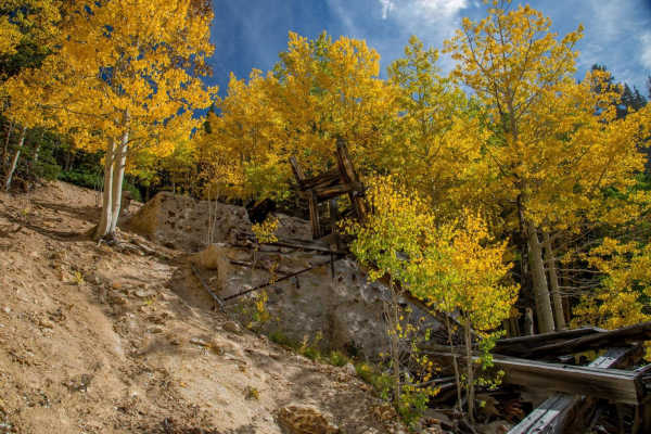
Paiute ATV Trail Cottonwood Canyon Trail 77
Paiute ATV Trail Cottonwood Canyon Trail 77 is an incredible high-elevation alpine adventure designed for ATV, SxS, dirt bike, and high-clearance four-wheel-drive enthusiasts looking to explore the rugged beauty of the Tushar Mountains. Starting near the historic town of Marysvale, Utah, this 63-mil...
Learn more about Paiute ATV Trail Cottonwood Canyon Trail 77
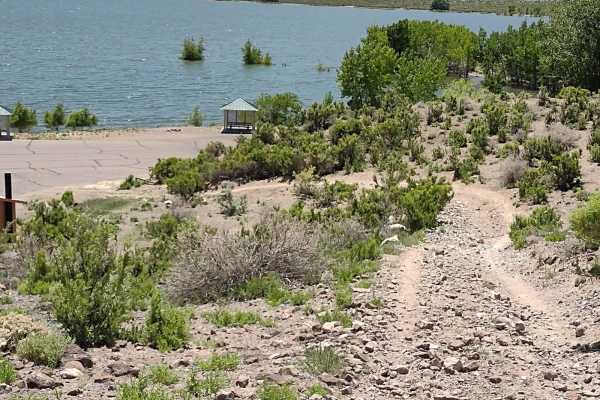
Piute Reservoir Parking
This trail maps the route from the playground north of Piute State Park/Reservoir to the parking area, picnic tables, and restroom. It's a fun trail that goes over the hills near the reservoir and drops into the parking lot right by the restrooms. The hill that drops down to the parking lot is steep...
Learn more about Piute Reservoir Parking
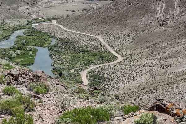
Sevier River South Overlook
This is another overlook point above the Sevier River north of the Piute Reservoir. From this vantage point, you can see the river below, some of the farms and ranches in the river valley, and the Fishlake National Forest beyond the river. The trails in this area serve as a playground for Piute Stat...
Learn more about Sevier River South Overlook
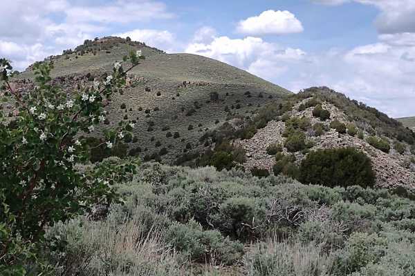
Monroe Road Cut-Across (FS #41204/BLM #5162)
We discovered this cut-across trail, going around the east side of Twin Peaks, that connects Papa Bear Poker Run 2021 Trail (which is also called Monroe Mtn Trail) on the north end with Monroe Rd on the south end, which connects to Highway 62. It's a beautiful drive down into some canyons, over hil...
Learn more about Monroe Road Cut-Across (FS #41204/BLM #5162)
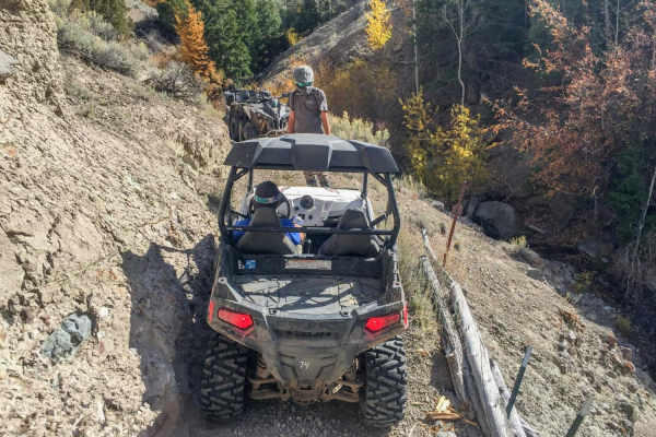
Paiute ATV Trail Rocky Ford
The Rocky Ford Trail is technically not part of the Paiute Trail, but it begins breaking off trail 01 and is almost always done when riding parts of the Paiute Trail. It's one of the more unique trails in the area. There are some great views. You have the option to start in Circleville, or just outs...
Learn more about Paiute ATV Trail Rocky Ford
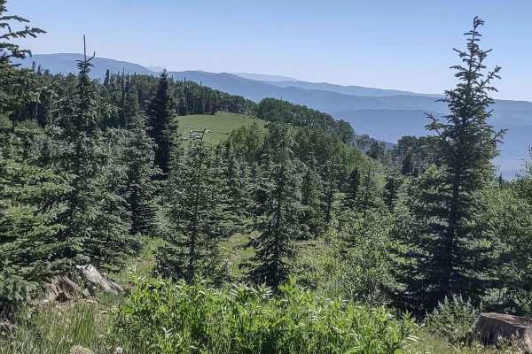
Big Flat Long Flat (FS 40581/Paiute D-3/Trail 1A)
This is not a very descriptive or original trail name, but it's the one that is already on the map! This trail also holds the identifiers of Paiute (D-3), Trail ID 1A, and FS 40581. The south end of the trail is marked as a Paiute 60-inch trail, but a 72-inch, 4-seat SXS fits nicely. The area deline...
Learn more about Big Flat Long Flat (FS 40581/Paiute D-3/Trail 1A)
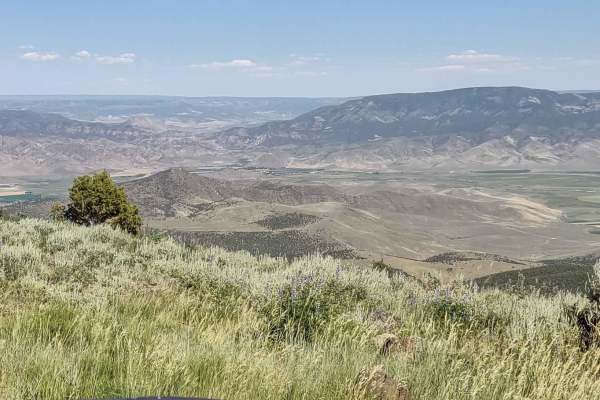
UT-153 (East End)
UT-153 is a main access road during the summertime from Junction, Utah, up into the Fishlake National Forest. This track shows where the dirt road begins, just 5 miles outside of Junction. UT-153 climbs over 2,000 feet in this section of the road, and it extends across the top of the mountains and o...
Learn more about UT-153 (East End)
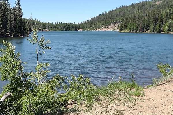
Rigger to Puffer Lake (FS 40129/PST 29)
Rigger to Puffer Lake, from its southernmost point goes north and west around Puffer Lake. The trail is nearly 6.5 miles, and it winds through the pine trees up to an elevation of just under 10,600 feet. The pine scent is clean and amazing. In places you travel through aspen groves, and in the fall ...
Learn more about Rigger to Puffer Lake (FS 40129/PST 29)
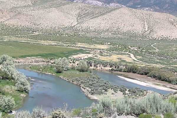
Sevier River North Overlook
This trail takes you out onto an overlook point above the Sevier River north of the Piute Reservoir. You see the river, some of the farms in the river valley, and the Fishlake National Forest beyond the river. The trails are easy and fun in this area. There are multiple side trails and spurs that do...
Learn more about Sevier River North Overlook
ATV trails near Junction, Utah
Explore ATV-friendly trails near you. These trails are accessible for vehicles up to 50 inches wide, perfect for ATVs and smaller off-road machines.
City Creek Canyon (FS# 40133)
City Creek runs parallel to Hwy 153 going west of Junction, Utah. This track goes up through the canyon City Creek runs in. It is also part of Paiute Side Trail 34. The canyon is filled with sagebrush, bushes, and trees. The trail in places is gravely dirt, but in places, it's mostly rocks. The rock...
Learn more about City Creek Canyon (FS# 40133)
Oak Spring Rollercoaster
The Rollercoaster starts out as a dirt trail, wandering through the draws between the hills in this area. Before long, you are in and out of the wash, so early spring this trail will be wet, if accessible at all. Heavy summer rains may close this area, too. Once you turn uphill and leave the wash, t...
Learn more about Oak Spring Rollercoaster
Kingston Canyon (Paiute 1 Trail)
This trail follows Kingston Canyon, which is part of the original Paiute 1 Trail near Circleville, Utah. It follows the canyon in and out of Rocky Ford Creek. Part of the trail is rocky, and part in the wash is sandy. There are no steep hill climbs or downgrades. You will see mountains to the side o...
Learn more about Kingston Canyon (Paiute 1 Trail)
Oak Basin (FS# 40144)
Oak Basin is a beautiful location in southern Utah, accessible only to off-roaders and hikers. You come up out of the City Creek Canyon and enter this expansive, gorgeous valley teeming with oak brush. In the fall, the colors in this area will be amazing. There is plenty of feed and water, so wildli...
Learn more about Oak Basin (FS# 40144)
UTV/side-by-side trails near Junction, Utah
Find UTV and side-by-side trails near you. These trails accommodate vehicles up to 60 inches wide, ideal for UTVs, side-by-sides, and wider off-road rigs.
City Creek Canyon (FS# 40133)
City Creek runs parallel to Hwy 153 going west of Junction, Utah. This track goes up through the canyon City Creek runs in. It is also part of Paiute Side Trail 34. The canyon is filled with sagebrush, bushes, and trees. The trail in places is gravely dirt, but in places, it's mostly rocks. The rock...
Learn more about City Creek Canyon (FS# 40133)
Oak Spring Rollercoaster
The Rollercoaster starts out as a dirt trail, wandering through the draws between the hills in this area. Before long, you are in and out of the wash, so early spring this trail will be wet, if accessible at all. Heavy summer rains may close this area, too. Once you turn uphill and leave the wash, t...
Learn more about Oak Spring Rollercoaster
Kingston Canyon (Paiute 1 Trail)
This trail follows Kingston Canyon, which is part of the original Paiute 1 Trail near Circleville, Utah. It follows the canyon in and out of Rocky Ford Creek. Part of the trail is rocky, and part in the wash is sandy. There are no steep hill climbs or downgrades. You will see mountains to the side o...
Learn more about Kingston Canyon (Paiute 1 Trail)
Oak Basin (FS# 40144)
Oak Basin is a beautiful location in southern Utah, accessible only to off-roaders and hikers. You come up out of the City Creek Canyon and enter this expansive, gorgeous valley teeming with oak brush. In the fall, the colors in this area will be amazing. There is plenty of feed and water, so wildli...
Learn more about Oak Basin (FS# 40144)
The onX Offroad Difference
onX Offroad combines trail photos, descriptions, difficulty ratings, width restrictions, seasonality, and more in a user-friendly interface. Available on all devices, with offline access and full compatibility with CarPlay and Android Auto. Discover what you're missing today!
Open Trail Map