
Dirt Bike Trails
Near Incline Village, Nevada
Explore All Dirt Bike Trails Near Incline Village, Nevada
Dirt Bike Trails Near Incline Village, Nevada
Discover the best dirt bike trails near you. Browse trail maps, check difficulty ratings, and find your next adventure — whether you're looking for a quick ride or an all-day expedition.
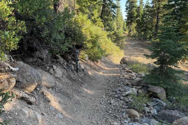
Powerline Connector
This trail is relatively straightforward and practically a straight line. Powerline Connector is on the easier side, but due to all the logging taking place, the trail is covered in bark and loads of decent-sized sticks, which adds difficulty. Used as a way after Powerline to head over towards the n...
Learn more about Powerline Connector
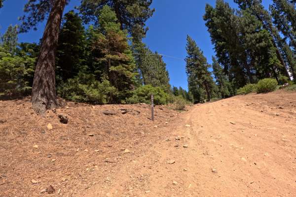
Red Cedar Overlook - FS 16N57
From the junction of FS 16N86, this route takes off to the right and begins climbing a rocky dirt road past some impressively large cedar trees. The road climbs at a steady grade up the hill. After navigating a couple of rock gardens, you quickly arrive at a spacious parking area surrounded by large...
Learn more about Red Cedar Overlook - FS 16N57
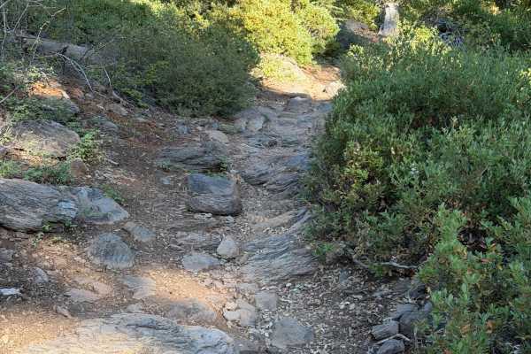
Powerline
This trail is an upper-intermediate to advanced trail. Pop onto it from the road or connect it between Beaver Tail Trail Upper and Powerline Connector. Powerline has a handful of proper rock sections. A few of them are smaller rocks and just need a little momentum to get through, and some others ha...
Learn more about Powerline
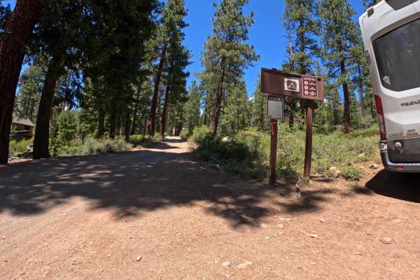
Beaver Street Extension - FS 16N86
Beginning from the back of the Brockway Vista neighborhood, the Beaver Street Extension - FS 16N86 sneaks into the forest as a nicely graded dirt road. It maintains an easy character until you pass the junction with FS 16N57. Here, the road takes a hard right and ascends a steep, loose hill, signifi...
Learn more about Beaver Street Extension - FS 16N86
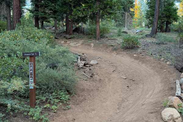
Beaver Tail Trail (Upper)
Beaver Tail Trail (Upper) is another fun one that mixes some flow and technical bits together for a great all-around trail. The trail is moderate-paced and flows well in the corners. There are a few small rock sections to navigate, but with a little momentum and line choice, they aren't of concern. ...
Learn more about Beaver Tail Trail (Upper)
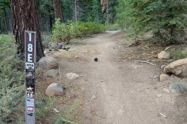
18E
18E is a short trail that connects Beaver Tail Trail Upper and Old Grist Mill Road. The trail is very straightforward to ride and easy for all skill levels. It is a straight line, and there are no obstacles on it. Can cross the road and hop onto 18N or go uphill and take Beaver Tail Trail Upper for ...
Learn more about 18E
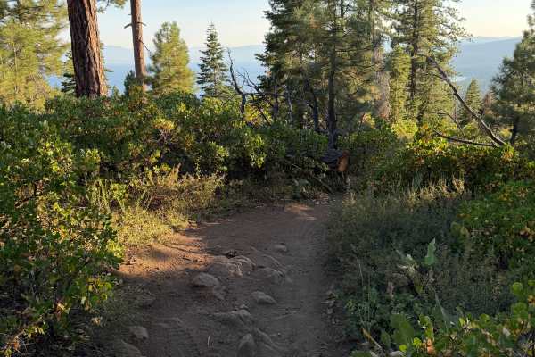
Rise and Shine (Upper)
Rise and Shine Upper is a great intermediate trail with phenomenal lake views. There are no tough obstacles on this trail, but there are a few small embedded rocks here and there to navigate with line choice. Other than that, the trail is straightforward to ride and just has some classic loose Tahoe...
Learn more about Rise and Shine (Upper)
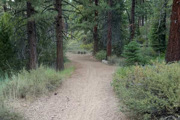
Grist Mill Connector
Grist Mill Connector connects 16N87 and the junction of Beaver Trail (non-OHV), Beaver Tail Trail Lower, and Grist Mill Loop (East). It is a short connector trail but allows you to get off the roads and onto singletrack, or use it as a way to get off the trails and onto the road for easier travel to...
Learn more about Grist Mill Connector
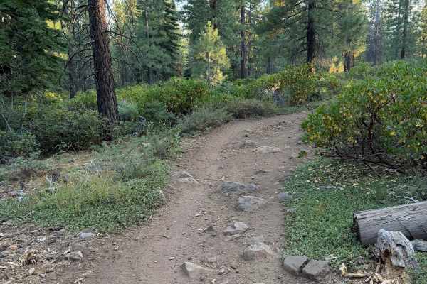
Rise and Shine (Lower)
This trail connects Rise and Shine Middle and the junction of Grist Mill Loop East and Grist Mill Loop West. It is a very beginner-friendly trail and mostly obstacle-free. There are a few small exposed roots and small embedded rocks here and there, but with line choice, they all can be navigated eas...
Learn more about Rise and Shine (Lower)
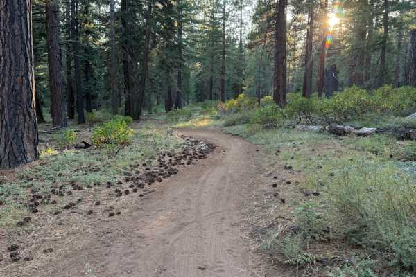
Grist Mill Loop (West)
Grist Mill Loop (West) is another more beginner-friendly trail in the King Beach trail network. It is obstacle-free and carries a moderate pace through its flowing corners. It has a couple of looser spots (classic Tahoe sand), but is mostly easy to ride everywhere. It is ridden in conjunction with e...
Learn more about Grist Mill Loop (West)
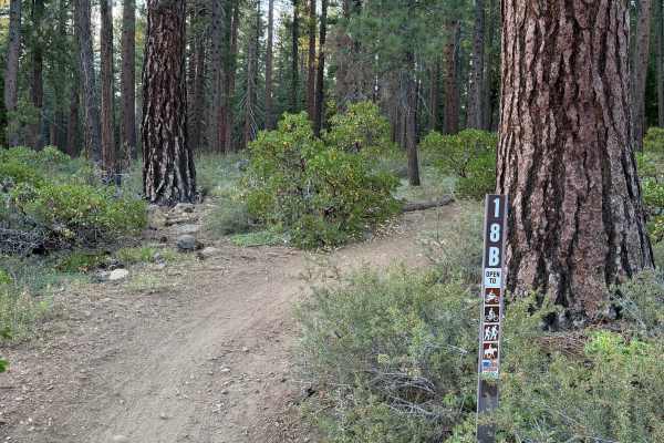
Grist Mill Loop (East)
Grist Mill Loop (East) is another great, beginner-friendly, and fun trail in the Kings Beach area. It has a few small rocks to navigate, but nothing to be concerned with. The remainder of the trail is all very smooth and flowy. It carries a moderate pace. It can be used to go uphill and connect with...
Learn more about Grist Mill Loop (East)
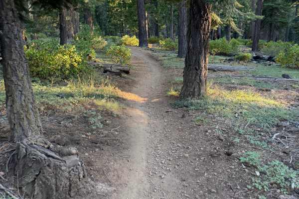
Rise and Shine (Middle)
This trail starts at the intersection of KB#2 and Rise and Shine (Upper) on the uphill side, and Rise and Shine (Lower) on the bottom end. Rise and Shine (Middle) is a little faster-paced and smoother than the upper portion. It is obstacle-free and flows well. Great one to tie in with all the Rise a...
Learn more about Rise and Shine (Middle)
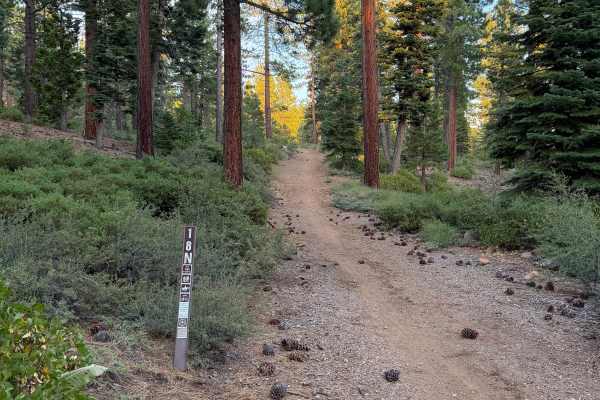
18N
18N is a trail that branches off of Old Grist Mill Road and eventually ties back into Old Grist Mill Road. A fun one to add singletrack to the ride and avoid roads. It has a few small rocks and some elevation change, but is overall quite easy to ride and obstacle-free. Fun to add in with 18E and the...
Learn more about 18N
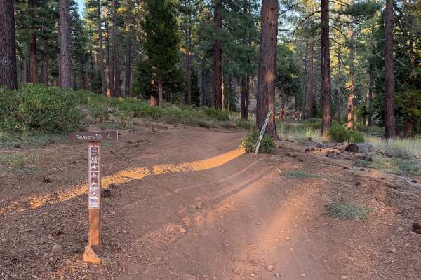
Beaver Tail Trail (Lower)
Beaver Tail Trail (Lower) is at the junction of Grist Mill Loop East and West on either end, and Beaver trail/Grist Mill Loop Connector. Be careful not to ride Beaver Trail, as it is ridden in the downhill direction by mountain bikers and motorcycles are not allowed on it. This trail has some fun ro...
Learn more about Beaver Tail Trail (Lower)
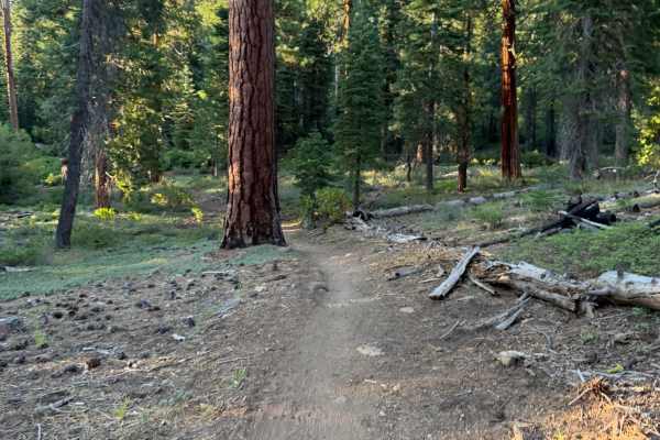
KB #2
This trail is another fun fast and flowy trail. The turns are mellow and the only rocks on the trail are small and not an issue. Along the trail, there are a few small rollers on the side you can jump for some added fun. This trail drops off of Gas Line Road and bumps into the intersection of Rise a...
Learn more about KB #2
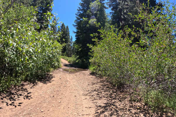
Gas Line Road - FS 16N52
Gas Line Rd - FS 16N52 is a challenging 4.2-mile trail. If approaching from the bottom at the junction with Highway 267, you will quickly reach a wooden bridge. Important Note: Crossing this bridge in a full-size vehicle is NOT recommended. After the bridge, the road climbs steeply through boulder g...
Learn more about Gas Line Road - FS 16N52
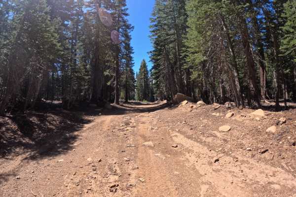
FS 16N92B
FS 16N92B is a nice mellow forest road that connects from Martis Peak Road. The route proceeds to the boundary where Sierra Pacific Industries' private property prevents further access. Towards the Martis Peak Road junction, there is a parking area located at the Tahoe Rim Trail junction. The surfac...
Learn more about FS 16N92B
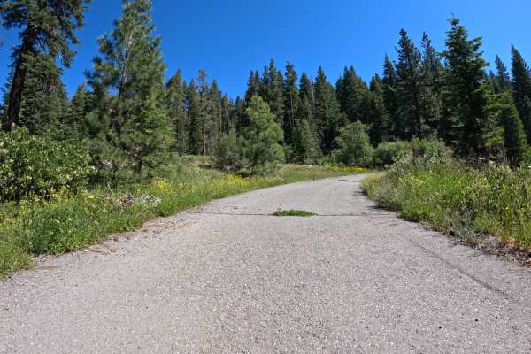
Martis Slope - FS 16N55
Martis Slope - FS 16N55 begins at the junction with Martis Peak Road - FS 17E02, starting as a mellow forest traverse across a beautiful mix of ponderosa pine and small meadows. The track is primarily dirt, with some loose-gravel sections. Once you pass the junction for Gas Line Road - FS 16N52, the...
Learn more about Martis Slope - FS 16N55
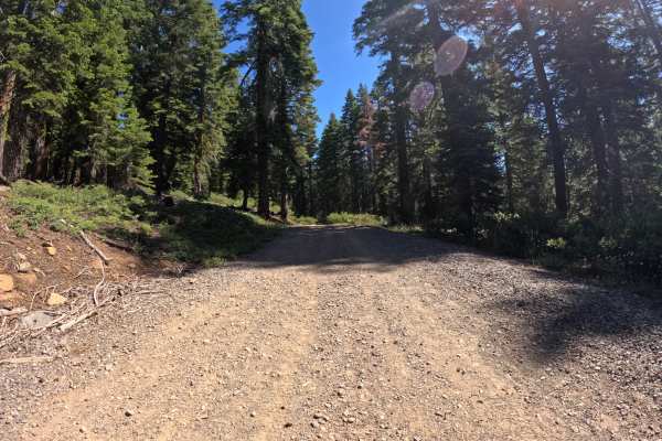
Martis Tie - FS 16N56
Martis Tie - FS 16N56 begins at the junction of FS 267, located directly across from the popular trailhead for Brockway Summit and the Tahoe Rim Trail. The start of this route is marked by a seasonally closed gate. Once past the gate, the trail begins a climb up a gentle grade, winding through a pon...
Learn more about Martis Tie - FS 16N56
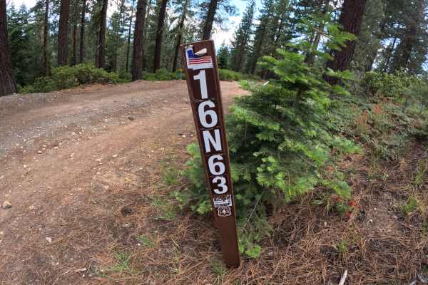
Carnelian Road - FS 16N63
Beginning from the back of the Agate Bay neighborhood, Carnelian Road - FS 16N63 climbs through a ponderosa pine forest at a moderate grade with minimal obstacles. Along the way, a couple of small obstacles provide passage as the trail continues to the junction of 73 - Mt. Watson Boulevard. Overall,...
Learn more about Carnelian Road - FS 16N63
ATV trails near Incline Village, Nevada
Explore ATV-friendly trails near you. These trails are accessible for vehicles up to 50 inches wide, perfect for ATVs and smaller off-road machines.
Red Cedar Overlook - FS 16N57
From the junction of FS 16N86, this route takes off to the right and begins climbing a rocky dirt road past some impressively large cedar trees. The road climbs at a steady grade up the hill. After navigating a couple of rock gardens, you quickly arrive at a spacious parking area surrounded by large...
Learn more about Red Cedar Overlook - FS 16N57
Beaver Street Extension - FS 16N86
Beginning from the back of the Brockway Vista neighborhood, the Beaver Street Extension - FS 16N86 sneaks into the forest as a nicely graded dirt road. It maintains an easy character until you pass the junction with FS 16N57. Here, the road takes a hard right and ascends a steep, loose hill, signifi...
Learn more about Beaver Street Extension - FS 16N86
Gas Line Road - FS 16N52
Gas Line Rd - FS 16N52 is a challenging 4.2-mile trail. If approaching from the bottom at the junction with Highway 267, you will quickly reach a wooden bridge. Important Note: Crossing this bridge in a full-size vehicle is NOT recommended. After the bridge, the road climbs steeply through boulder g...
Learn more about Gas Line Road - FS 16N52
FS 16N92B
FS 16N92B is a nice mellow forest road that connects from Martis Peak Road. The route proceeds to the boundary where Sierra Pacific Industries' private property prevents further access. Towards the Martis Peak Road junction, there is a parking area located at the Tahoe Rim Trail junction. The surfac...
Learn more about FS 16N92B
UTV/side-by-side trails near Incline Village, Nevada
Find UTV and side-by-side trails near you. These trails accommodate vehicles up to 60 inches wide, ideal for UTVs, side-by-sides, and wider off-road rigs.
Red Cedar Overlook - FS 16N57
From the junction of FS 16N86, this route takes off to the right and begins climbing a rocky dirt road past some impressively large cedar trees. The road climbs at a steady grade up the hill. After navigating a couple of rock gardens, you quickly arrive at a spacious parking area surrounded by large...
Learn more about Red Cedar Overlook - FS 16N57
Beaver Street Extension - FS 16N86
Beginning from the back of the Brockway Vista neighborhood, the Beaver Street Extension - FS 16N86 sneaks into the forest as a nicely graded dirt road. It maintains an easy character until you pass the junction with FS 16N57. Here, the road takes a hard right and ascends a steep, loose hill, signifi...
Learn more about Beaver Street Extension - FS 16N86
Gas Line Road - FS 16N52
Gas Line Rd - FS 16N52 is a challenging 4.2-mile trail. If approaching from the bottom at the junction with Highway 267, you will quickly reach a wooden bridge. Important Note: Crossing this bridge in a full-size vehicle is NOT recommended. After the bridge, the road climbs steeply through boulder g...
Learn more about Gas Line Road - FS 16N52
FS 16N92B
FS 16N92B is a nice mellow forest road that connects from Martis Peak Road. The route proceeds to the boundary where Sierra Pacific Industries' private property prevents further access. Towards the Martis Peak Road junction, there is a parking area located at the Tahoe Rim Trail junction. The surfac...
Learn more about FS 16N92B
The onX Offroad Difference
onX Offroad combines trail photos, descriptions, difficulty ratings, width restrictions, seasonality, and more in a user-friendly interface. Available on all devices, with offline access and full compatibility with CarPlay and Android Auto. Discover what you're missing today!
Open Trail Map