
Dirt Bike Trails
Near Hollister, California
Explore All Dirt Bike Trails Near Hollister, California
Dirt Bike Trails Near Hollister, California
Discover the best dirt bike trails near you. Browse trail maps, check difficulty ratings, and find your next adventure — whether you're looking for a quick ride or an all-day expedition.
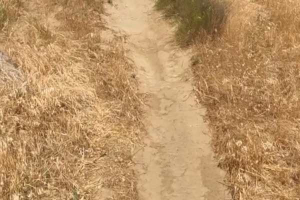
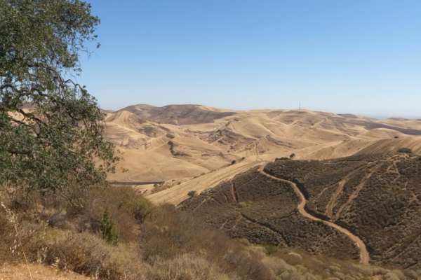
Four Corners-Old Ranch Loop
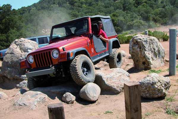
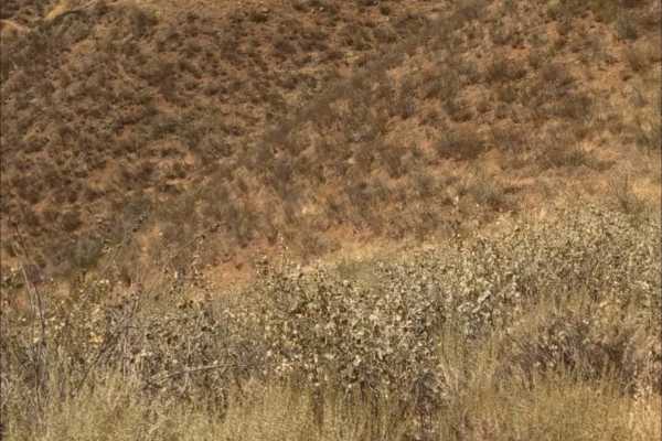
Four Corners-Old Ranch Loop is a beginner-friendly ATV and dirt bike trail in Hollister Hills SVRA that offers a manageable introduction to California’s Diablo Range foothill terrain while still keeping intermediate riders engaged. This designated OHV loop winds through gently rolling hills on prima...
Learn more about Four Corners-Old Ranch Loop
Adobe Basin Loop
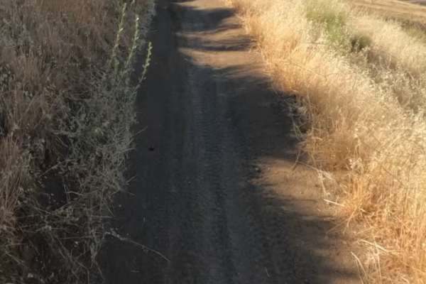
Adobe Basin Loop in Hollister Hills SVRA is a solid choice for intermediate ATV riders and dirt bikers looking for a flowing, well-marked loop with enough variation to stay engaging without becoming overly technical. This one-way, clockwise trail winds through rolling hills on predominantly hard-pac...
Learn more about Adobe Basin Loop
Hollister Hills SVRA
Hollister Hills State Vehicular Recreation Area is a Northern California off-road staple. Tucked into the Gabilan Mountains just south of Hollister, this SVRA gives 4x4s, dirt bikes, ATVs, and UTVs room to explore a mix of wooded trails, hill climbs, ruts, rocks, and wide-open dirt.
This is the kin...
Learn more about Hollister Hills SVRA
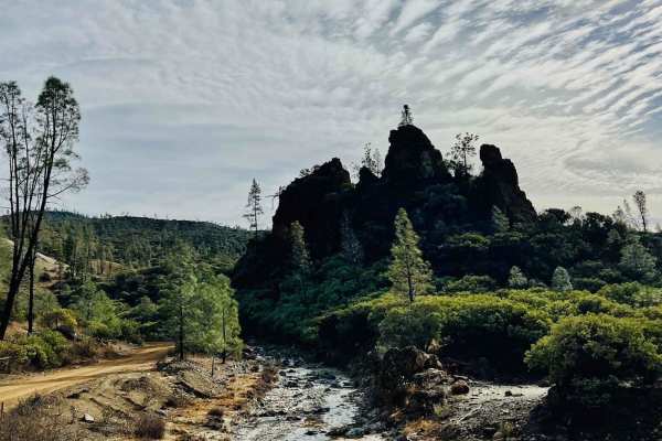
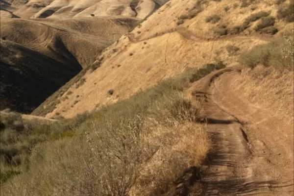
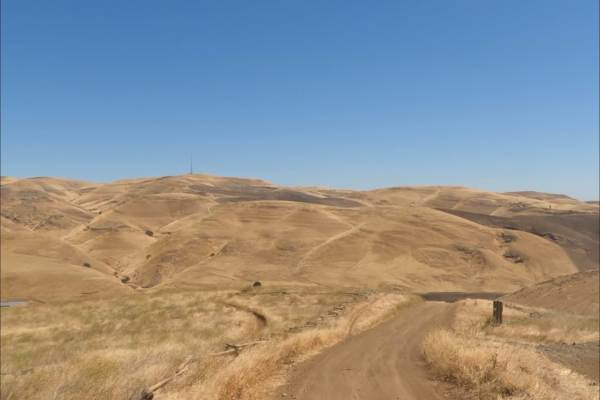
R1 Clear Creek Road
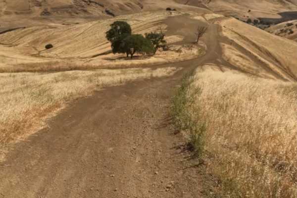
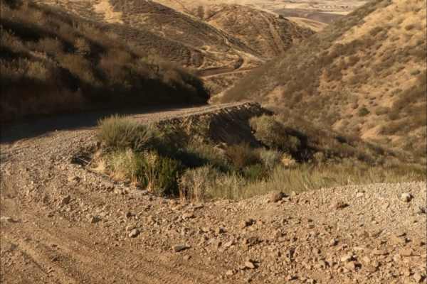
R1 Clear Creek Road lives up to its namesake by following the crisp, flowing waters of Clear Creek as it twists and winds through the canyon toward the hills. This trail provides an enjoyable adventure, rated as a 2, making it accessible for many vehicles. Be aware that there is no cell service alon...
Learn more about R1 Clear Creek Road
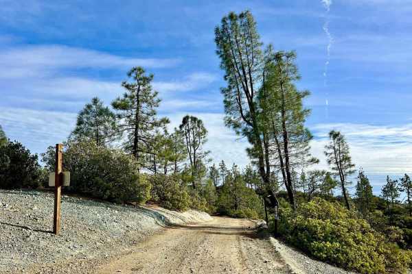
Aurora Cutoff R14
Aurora Cutoff R14 is a narrow two-track trail that traces the top of a ridge, leading you toward the historic Aurora Mine. This scenic route offers plenty of opportunities to explore single-track trails branching off to either side, inviting you to venture deeper into the area's rugged beauty. The m...
Learn more about Aurora Cutoff R14
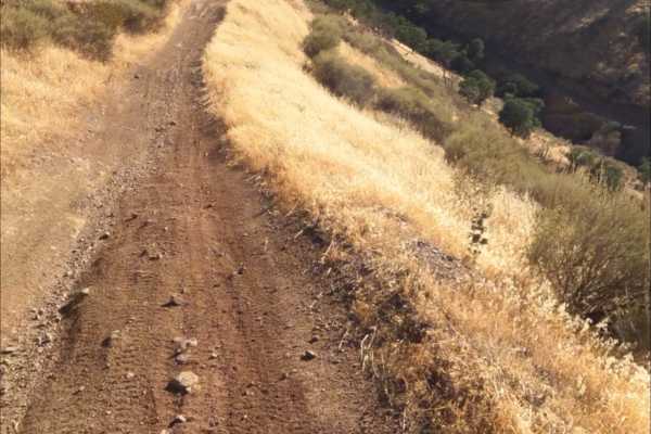
East Serpentine Trail
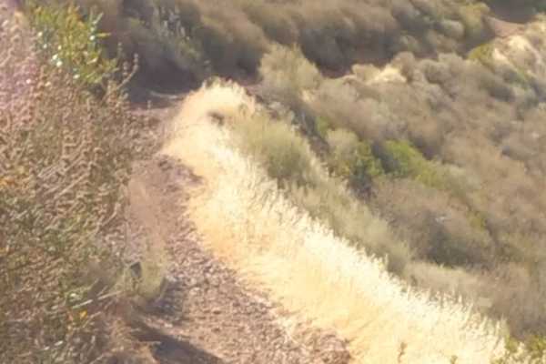
East Serpentine Trail is a short but steep single-track route that traverses a hillside. The trail features mostly hardpack dirt with a few rutted sections and scattered loose rock.
The steep grade requires good brake and throttle control, adding a moderate challenge despite the relatively predictab...
Learn more about East Serpentine Trail
Badger
Badger Trail runs parallel to Ridge Trail, following the same hillside at a lower elevation. The route consists of firm hardpack dirt and a series of winding turns that contour along the slope. Technical obstacles are minimal, with few rocks or ruts to navigate. However, the steep hillside and narro...
Learn more about Badger
Red Trail
Juniper Trail is one of the park's primary connector routes, linking riders to the broader trail network. The trail features mostly smooth hardpack dirt with a mix of winding turns, climbs, and descents that make for an enjoyable ride.
As the route progresses, riders gain access to several steeper h...
Learn more about Red Trail
Sri Loop
SRI Loop begins with a steep, winding descent on hardpack dirt. The trail follows a narrow, mostly groomed path with rolling terrain, featuring several steep climbs and descents along the way. Expect light rutting in places, but few significant obstacles. After the loop, you can enter the Golden Eag...
Learn more about Sri Loop
Golden Eagle
Golden Eagle Trail is a mellow hardpack dirt route that serves as a connector to SRI Loop and several other trails within the network. The trail is generally smooth and easy to follow, with a mix of steep climbs and descents along the way.
Riders traveling toward SRI Loop will need to cross a paved ...
Learn more about Golden Eagle
Ridge trail
Ridge Trail is a narrow, hardpack dirt trail that traverses the side of a steep hillside. The route is winding and exposed in places, with the adjacent slope adding an extra sense of challenge and consequence.
The trail surface is generally smooth, with occasional light rutting and scattered rocks t...
Learn more about Ridge trail
Juniper Trail
Juniper Trail is one of the park's primary connector routes, linking riders to the broader trail network. The trail features mostly smooth hardpack dirt with a mix of winding turns, climbs, and descents that make for an enjoyable ride.
As the route progresses, riders gain access to several steeper h...
Learn more about Juniper Trail
Brewers Trail
Brewers Trail is a short single-track spur branching off Juniper Trail. The narrow dirt trail is best suited for dirt bikes, as its width and terrain are not ideal for larger vehicles.
The route winds along a hillside with a mix of hardpack dirt and scattered patches of loose rock. While the trail i...
Learn more about Brewers Trail
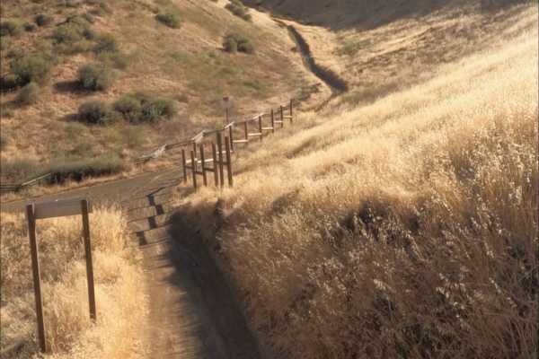
Kiln Trail
Kiln Trail is one of the primary entrances to the park. The route begins as a mellow hardpack dirt road leading to the park boundary, where signs outline park regulations and warn visitors about mountain lions. Shortly after entering, riders encounter the first notable obstacle: a steep climb with l...
Learn more about Kiln Trail
Franciscan Loop trail
Franciscan Loop Trail is a fun route that circles the trails-only section of the park. The trail is generally double-track width with a hardpack dirt surface, making it accessible while still offering plenty of variety.
Riders can expect a mix of terrain, including small whoops, loose dirt, and scat...
Learn more about Franciscan Loop trail
Carrol Climb
Carroll Climb is a fun, short detour off Juniper Trail. The route begins with a descent on a narrow single-track trail to a turnaround at the bottom. From there, riders tackle a climb back to the top through a series of whoops and rocky sections that add a bit of challenge and excitement.
Though bri...
Learn more about Carrol Climb
Los Osos Trail
The Los Osos Trail is one of the park's main connector routes, providing access to many of the surrounding trails and trail networks. The trail consists mostly of smooth, well-groomed hardpack dirt and offers an easy, enjoyable ride through the park.
Expect a mix of winding turns, gradual climbs, an...
Learn more about Los Osos Trail
4 South Coast Road-20S05.5
This trail mostly follows a chaparral ridge in the southern part of Big Sur. This trail includes dramatic valley and ocean views. There is dispersed camping and established campgrounds. This trail goes adjacent to Fort Hunter Liggett which is a testing ground for artillery. Before this trail starts ...
Learn more about 4 South Coast Road-20S05.5
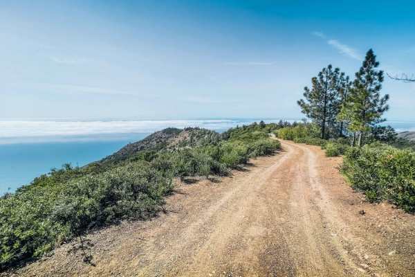
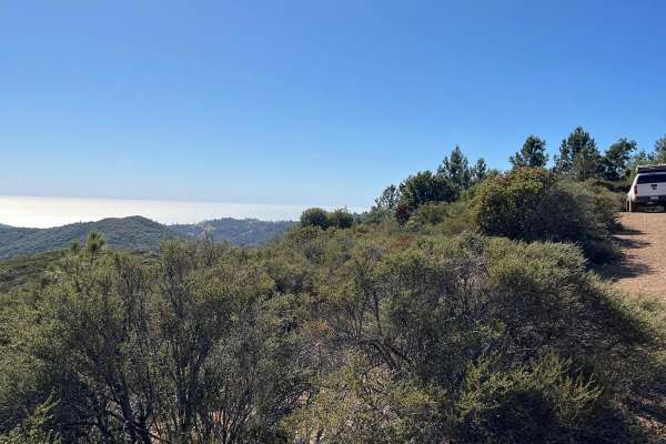
San Martin
San Martin is a short trail dotted with many campsites along the San Martin Ridgeline. The trail stays mostly above the fog line, offering beautiful views of the Pacific Ocean. The trail dead-ends at a High Clearance 4x4 trail leading to the cliffside. There are also plenty of places to turn around ...
Learn more about San Martin
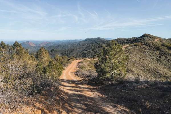
South Coast Road
This is a 14-mile trail along a ridgeline that dead-ends on private property. Spectacular views span from the sea to the valley. Many Big Sur hiking trails end on this road. Numerous side trails lead illegally into Fort Hunter Liggett. Do not take them! The fort is a testing ground for tanks and art...
Learn more about South Coast Road
ATV trails near Hollister, California
Explore ATV-friendly trails near you. These trails are accessible for vehicles up to 50 inches wide, perfect for ATVs and smaller off-road machines.
Four Corners-Old Ranch Loop
Four Corners-Old Ranch Loop is a beginner-friendly ATV and dirt bike trail in Hollister Hills SVRA that offers a manageable introduction to California’s Diablo Range foothill terrain while still keeping intermediate riders engaged. This designated OHV loop winds through gently rolling hills on prima...
Learn more about Four Corners-Old Ranch Loop
Adobe Basin Loop
Adobe Basin Loop in Hollister Hills SVRA is a solid choice for intermediate ATV riders and dirt bikers looking for a flowing, well-marked loop with enough variation to stay engaging without becoming overly technical. This one-way, clockwise trail winds through rolling hills on predominantly hard-pac...
Learn more about Adobe Basin Loop
Hollister Hills SVRA
Hollister Hills State Vehicular Recreation Area is a Northern California off-road staple. Tucked into the Gabilan Mountains just south of Hollister, this SVRA gives 4x4s, dirt bikes, ATVs, and UTVs room to explore a mix of wooded trails, hill climbs, ruts, rocks, and wide-open dirt.
This is the kin...
Learn more about Hollister Hills SVRA
R1 Clear Creek Road
R1 Clear Creek Road lives up to its namesake by following the crisp, flowing waters of Clear Creek as it twists and winds through the canyon toward the hills. This trail provides an enjoyable adventure, rated as a 2, making it accessible for many vehicles. Be aware that there is no cell service alon...
Learn more about R1 Clear Creek Road
UTV/side-by-side trails near Hollister, California
Find UTV and side-by-side trails near you. These trails accommodate vehicles up to 60 inches wide, ideal for UTVs, side-by-sides, and wider off-road rigs.
Hollister Hills SVRA
Hollister Hills State Vehicular Recreation Area is a Northern California off-road staple. Tucked into the Gabilan Mountains just south of Hollister, this SVRA gives 4x4s, dirt bikes, ATVs, and UTVs room to explore a mix of wooded trails, hill climbs, ruts, rocks, and wide-open dirt.
This is the kin...
Learn more about Hollister Hills SVRA
R1 Clear Creek Road
R1 Clear Creek Road lives up to its namesake by following the crisp, flowing waters of Clear Creek as it twists and winds through the canyon toward the hills. This trail provides an enjoyable adventure, rated as a 2, making it accessible for many vehicles. Be aware that there is no cell service alon...
Learn more about R1 Clear Creek Road
Aurora Cutoff R14
Aurora Cutoff R14 is a narrow two-track trail that traces the top of a ridge, leading you toward the historic Aurora Mine. This scenic route offers plenty of opportunities to explore single-track trails branching off to either side, inviting you to venture deeper into the area's rugged beauty. The m...
Learn more about Aurora Cutoff R14
Juniper Trail
Juniper Trail is one of the park's primary connector routes, linking riders to the broader trail network. The trail features mostly smooth hardpack dirt with a mix of winding turns, climbs, and descents that make for an enjoyable ride.
As the route progresses, riders gain access to several steeper h...
Learn more about Juniper Trail
The onX Offroad Difference
onX Offroad combines trail photos, descriptions, difficulty ratings, width restrictions, seasonality, and more in a user-friendly interface. Available on all devices, with offline access and full compatibility with CarPlay and Android Auto. Discover what you're missing today!
Open Trail Map