
Dirt Bike Trails
Near Gold Camp, Arizona
Explore All Dirt Bike Trails Near Gold Camp, Arizona
Dirt Bike Trails Near Gold Camp, Arizona
Discover the best dirt bike trails near you. Browse trail maps, check difficulty ratings, and find your next adventure — whether you're looking for a quick ride or an all-day expedition.
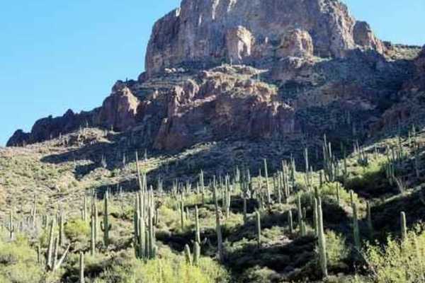
Millsite Canyon
A scenic Jeep trail from the Queen Valley golf course to the Woodbury trailhead on Montana Mountain. The trail starts on the edge of the golf course in Queen Valley. Be wary of errant balls. It continues past a few hints of civilization until turning into a Jeep trail headed for Hardt Tank Hill. Thi...
Learn more about Millsite Canyon
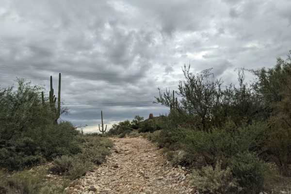
Montana Mountain Loop
This is a beautiful trail in close proximity to Phoenix. It starts in an amazing canyon and eventually climbs up to 5,000 feet, where you'll get breathtaking desert and mountain views. ATVs and UTVs can use Hewitt Station Road to complete a loop. There are some great camping spots along the way.
Learn more about Montana Mountain Loop
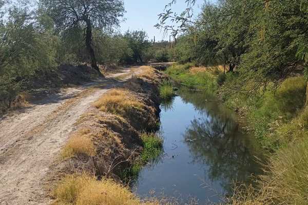
J/K Trail
This bypass branches directly off the popular Montana Mountain Loop, providing a scenic and engaging connector route to the backside of Queen Valley within the Tonto National Forest. This trail is an exceptional training ground for novice off-roaders looking to advance their technical driving skills...
Learn more about J/K Trail
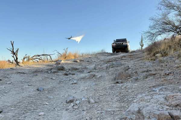
FDR 1900
FDR 1900, also known as FS MT1900, is a thrilling rocky trail that weaves dynamically in and out of sandy washes, creating an adventurous off-road experience. As you navigate this trail, you'll encounter narrow bushes and trees, including Creosote and Palo Verde, which can potentially cause paint da...
Learn more about FDR 1900
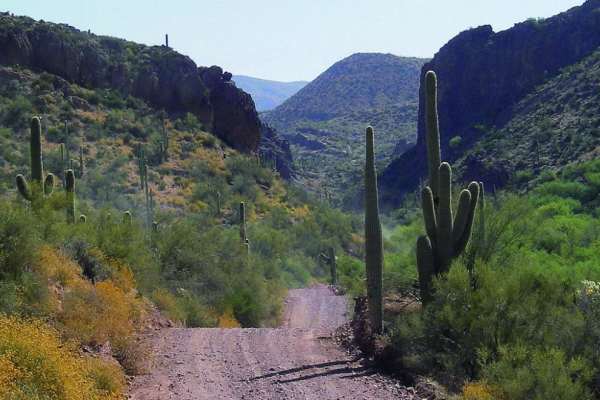
Montana Mountain
This is a beautiful trail in close proximity to Phoenix. It starts in an amazing canyon and eventually climbs up to 5,000 feet where you'll get breathtaking desert and mountain views. ATVs and UTVs can use Hewitt Station Road to complete a loop. There are some great camping spots along the way.
Learn more about Montana Mountain
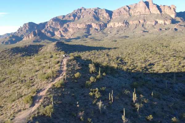
26 Hill
This off-road route is very short but very rewarding. '26 Hill' gets its name from the 26-degree steep angle (as pictured) you will be climbing at the end of this trail. You will be surrounded by rewarding views of the Superstition Mountains at the top. The climb and incline are the obstacles, in ad...
Learn more about 26 Hill
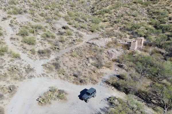
Reymert Ovens
The Reymert Mine Ovens Trail offers a scenic and moderately adventurous experience, lined with stunning cacti that characterize the Arizona desert landscape. As you navigate through washes, adding some natural variation to the trail. The route provides excellent views of the surrounding mountains, g...
Learn more about Reymert Ovens
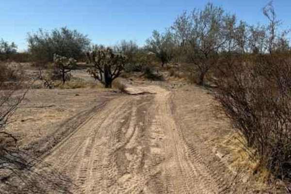
Nw2230
Nw2230 is located to the East of AZ State Route 79 and North of the Box Canyon trail. Coming from Box Canyon, it is a little difficult to find at first because of the dirt bike play area. The trail is a mix of single track and wash. Not suitable for full-size vehicles. Pinstriping is imminent and lo...
Learn more about Nw2230
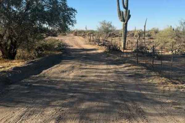
Nw2030
This trail consists of dirt and rock. It is on the BLM side and borders Arizona State Trust Land. It connects the main East and West arteries to a small wash. When guided, travelling West in the wash will bring you to an open gate to Arizoa State Trust Land. Note: Arizona State Trust Land requires a...
Learn more about Nw2030
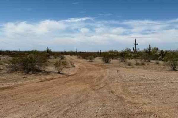
Nw2233
Nw2233 is located to the East of Arizona State Route 79 and South of the Box Canyon trail. This side trail connects Nw2006 to Nw2014 and consists of dirt and small rocks. It is a single track with places to pass. Pinstriping is possible for full-size vehicles. One bar of Verizon LTE service was avai...
Learn more about Nw2233
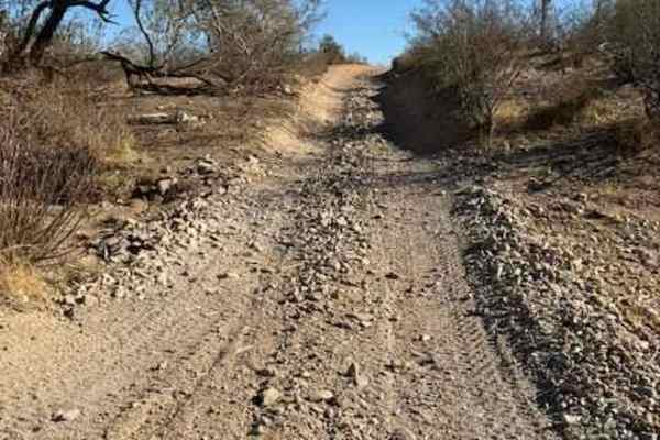
Nw2014
Nw2014 is located to the East of Arizona State Route 79 and South of the Box Canyon trail. It connects Box Canyon to the main North/South Nw2006 trail. The trail consists of dirt, small loose rocks, and minor ruts. Full-size vehicles are susceptible to pinstriping. One bar of Verizon LTE service was...
Learn more about Nw2014
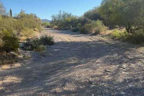
Nw2077a
This is a small wash consisting of dirt and rock. There are a few low-hanging trees and a landslide from the adjacent cliff partially blocking the wash. Mid-size and full-size vehicles can still pass, with pinstriping being inevitable. Traveling East will keep you on BLM and bring you to a well-grad...
Learn more about Nw2077a
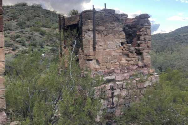
Reymert Mine Trail
The western end is an easy trail through the desert but the trail gets rocky and more difficult as you get closer to the mine. You will have to cross the creek and drive up it for a short distance. This section can vary in difficulty depending on erosion from recent water flows.
Learn more about Reymert Mine Trail
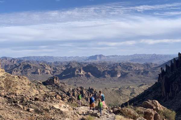
Peralta road
Peralta road is an easy, graded dirt road. Although the road is not challenging, it still leads to great views and has plenty of turn-offs for dispersed camping. If you are into hiking, this road ends at a trailhead for miles of great hiking. The trailhead has a restroom, but it can be crowded.
Learn more about Peralta road
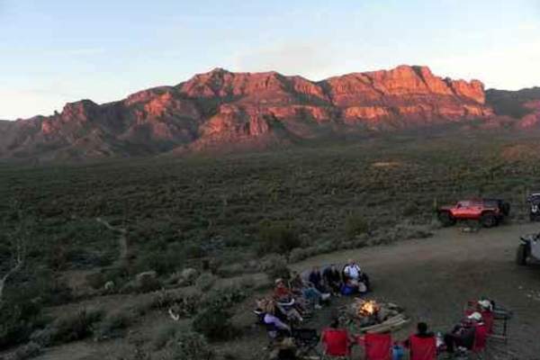
Superstition Backroads
The Superstition Backroads are easy Jeep trails, close to town, that take you on a short day trip to an abandoned gypsum mine. The western end of the trail is close to the Superstition Mountains. The main trail is 4, while a short optional climb and the Gypsum Overlook Loop are 5. There is a picnic ...
Learn more about Superstition Backroads
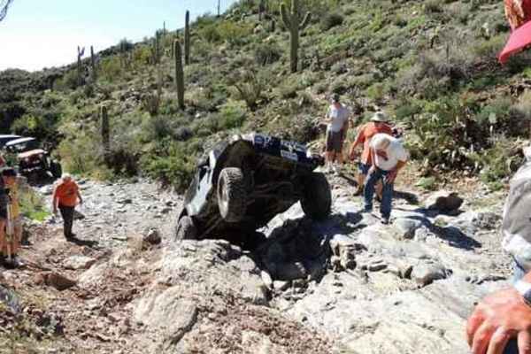
Highway to Hell
Highway to Hell is one of the most popular Jeep trails in Arizona. You know you are in for a challenge when you are greeted by the shrine of broken parts at the entrance. Be prepared, once you commit there are no exits and only a few bypasses. Minor body damage is almost guaranteed.A well-equipp...
Learn more about Highway to Hell
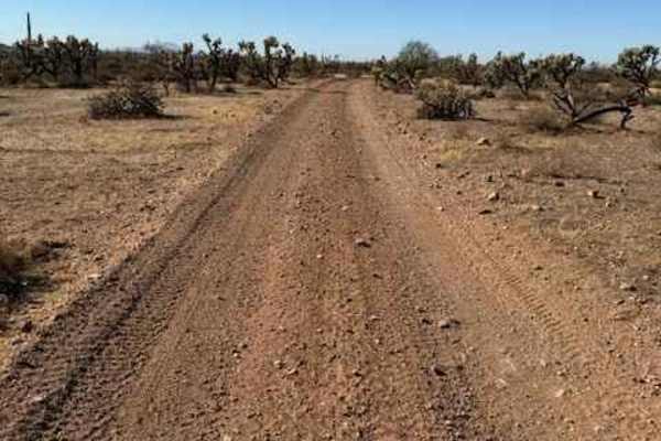
Nw2006a
Nw2006a is located to the East of Arizona State Route 79 and South of the Box Canyon trail. This is a side trail to the main North/South Nw2006 trail. The trail consists of dirt and small rocks. It is wide and suitable for full-size vehicles. One bar of Verizon LTE service was available.
Learn more about Nw2006a
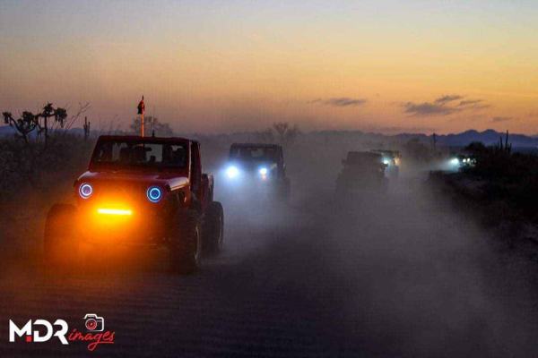
Upper Woodpecker to Ajax Mine
This trail follows the difficult wash known as Upper Woodpecker. At the eastern end of the wash, the trail climbs up a narrow winding trail to join Ajax Mine Road. The wash is very difficult. Lockers and 33 inch or larger tires are recommended. The trail following the wash is intermediate and does n...
Learn more about Upper Woodpecker to Ajax Mine
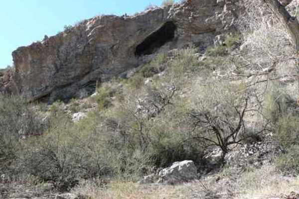
Pucker Ridge Bat Cave
Pucker Ridge Bat Cave is a short, scenic spur trail designed for offroaders looking to combine a quick drive with an adventurous hike to a hidden desert cave. Spanning just 0.2 miles near Whitford Canyon in the Tonto National Forest, this route features a brief but steep climb with a technical ratin...
Learn more about Pucker Ridge Bat Cave
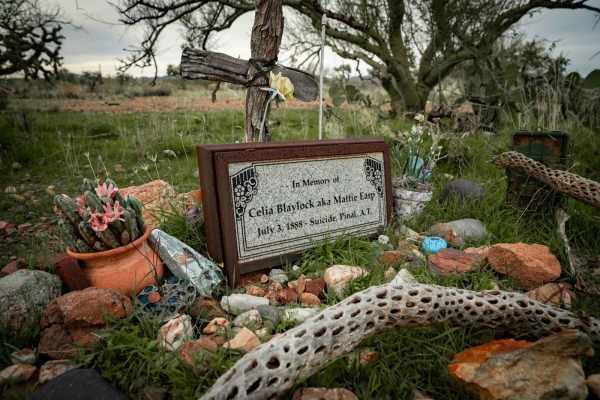
Historic Pinal Cemetery Trail
Just outside of Superior, Arizona, you can experience some Wild West, Wyatt Earp lore. The legendary cowboy was involved in the famous gunfight at the O.K. Corral. Multiple movies have been made about him, but I bet you have not heard of Mattie Earp. This trail will take you to the gravesite of Matt...
Learn more about Historic Pinal Cemetery Trail
ATV trails near Gold Camp, Arizona
Explore ATV-friendly trails near you. These trails are accessible for vehicles up to 50 inches wide, perfect for ATVs and smaller off-road machines.
Millsite Canyon
A scenic Jeep trail from the Queen Valley golf course to the Woodbury trailhead on Montana Mountain. The trail starts on the edge of the golf course in Queen Valley. Be wary of errant balls. It continues past a few hints of civilization until turning into a Jeep trail headed for Hardt Tank Hill. Thi...
Learn more about Millsite Canyon
Montana Mountain Loop
This is a beautiful trail in close proximity to Phoenix. It starts in an amazing canyon and eventually climbs up to 5,000 feet, where you'll get breathtaking desert and mountain views. ATVs and UTVs can use Hewitt Station Road to complete a loop. There are some great camping spots along the way.
Learn more about Montana Mountain Loop
J/K Trail
This bypass branches directly off the popular Montana Mountain Loop, providing a scenic and engaging connector route to the backside of Queen Valley within the Tonto National Forest. This trail is an exceptional training ground for novice off-roaders looking to advance their technical driving skills...
Learn more about J/K Trail
FDR 1900
FDR 1900, also known as FS MT1900, is a thrilling rocky trail that weaves dynamically in and out of sandy washes, creating an adventurous off-road experience. As you navigate this trail, you'll encounter narrow bushes and trees, including Creosote and Palo Verde, which can potentially cause paint da...
Learn more about FDR 1900
UTV/side-by-side trails near Gold Camp, Arizona
Find UTV and side-by-side trails near you. These trails accommodate vehicles up to 60 inches wide, ideal for UTVs, side-by-sides, and wider off-road rigs.
Millsite Canyon
A scenic Jeep trail from the Queen Valley golf course to the Woodbury trailhead on Montana Mountain. The trail starts on the edge of the golf course in Queen Valley. Be wary of errant balls. It continues past a few hints of civilization until turning into a Jeep trail headed for Hardt Tank Hill. Thi...
Learn more about Millsite Canyon
Montana Mountain Loop
This is a beautiful trail in close proximity to Phoenix. It starts in an amazing canyon and eventually climbs up to 5,000 feet, where you'll get breathtaking desert and mountain views. ATVs and UTVs can use Hewitt Station Road to complete a loop. There are some great camping spots along the way.
Learn more about Montana Mountain Loop
J/K Trail
This bypass branches directly off the popular Montana Mountain Loop, providing a scenic and engaging connector route to the backside of Queen Valley within the Tonto National Forest. This trail is an exceptional training ground for novice off-roaders looking to advance their technical driving skills...
Learn more about J/K Trail
FDR 1900
FDR 1900, also known as FS MT1900, is a thrilling rocky trail that weaves dynamically in and out of sandy washes, creating an adventurous off-road experience. As you navigate this trail, you'll encounter narrow bushes and trees, including Creosote and Palo Verde, which can potentially cause paint da...
Learn more about FDR 1900
The onX Offroad Difference
onX Offroad combines trail photos, descriptions, difficulty ratings, width restrictions, seasonality, and more in a user-friendly interface. Available on all devices, with offline access and full compatibility with CarPlay and Android Auto. Discover what you're missing today!
Open Trail Map