Millsite Canyon

Total Miles 14.8
Technical Rating
5 Moderate
Best Time Spring, Fall, Winter
Trail Type High-Clearance 4x4 Trail
Accessible By
Open Trail Map

Trail Overview

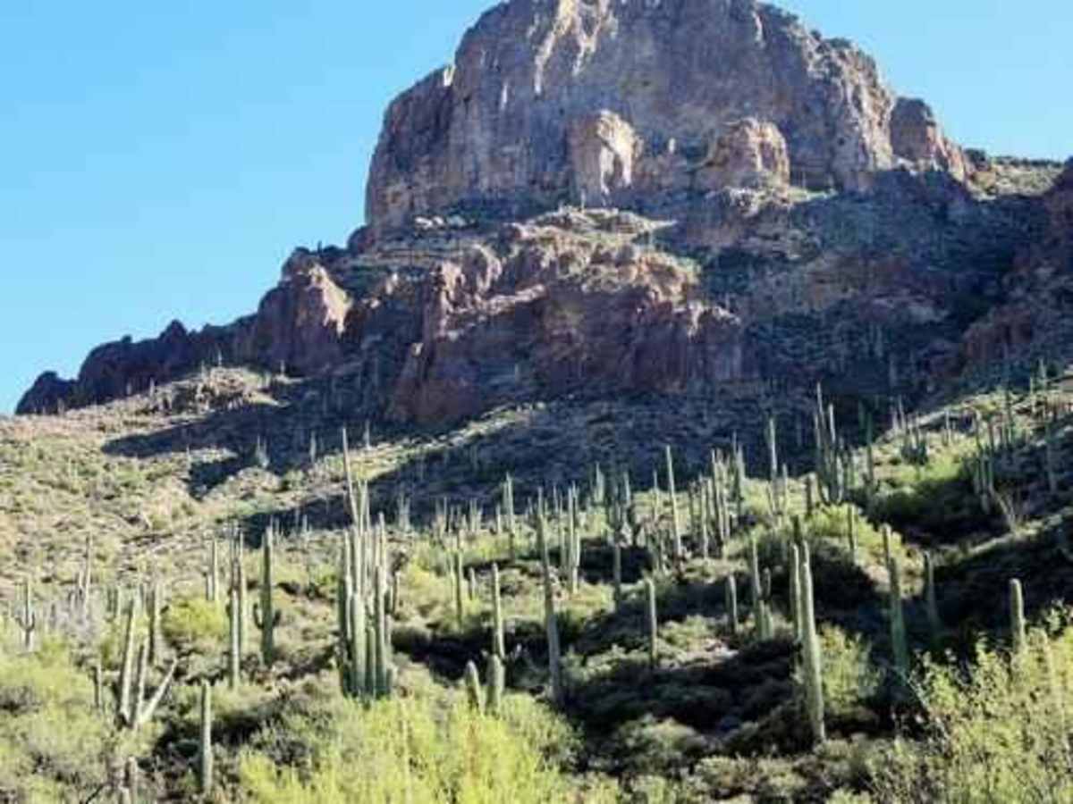
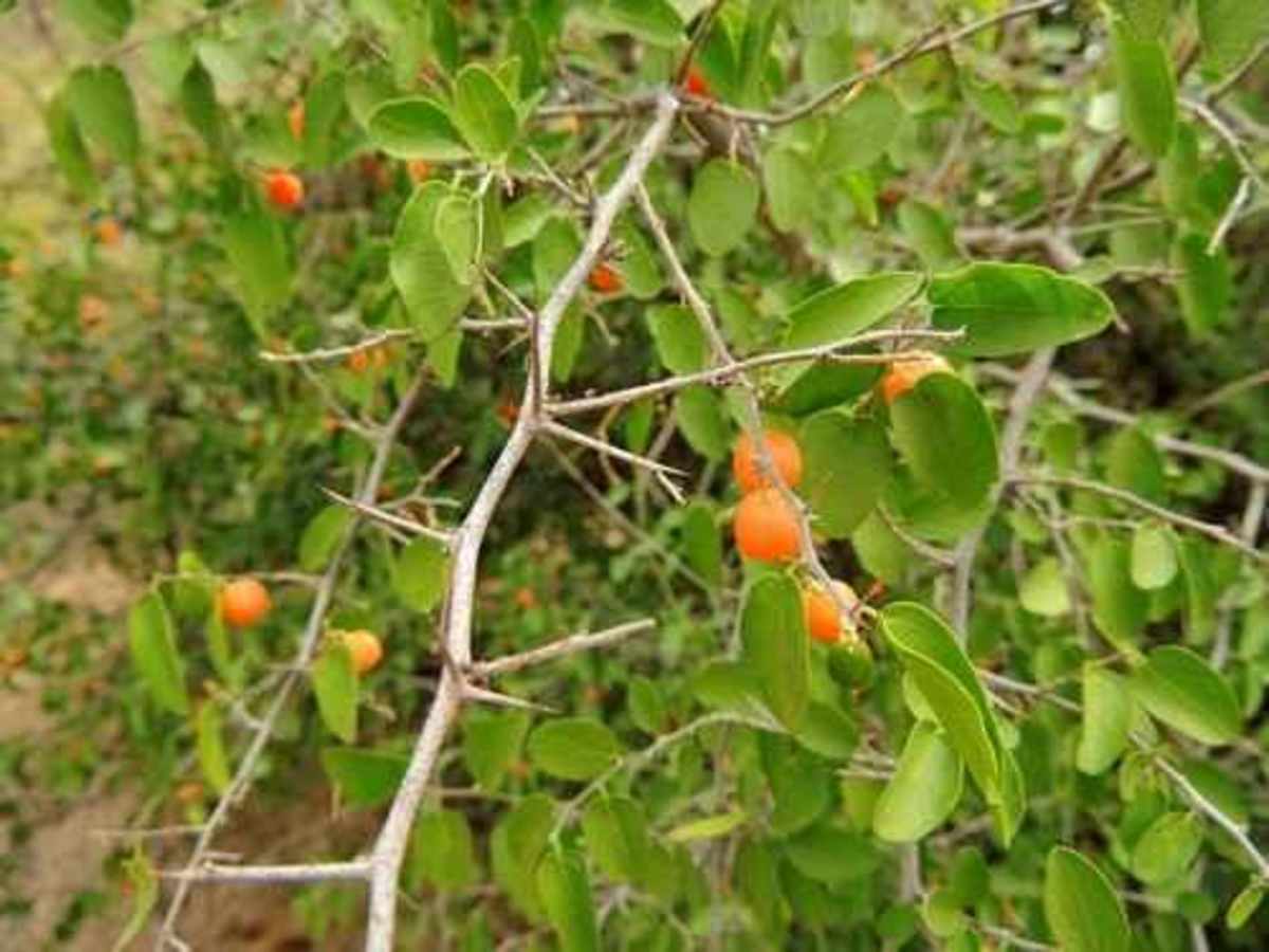
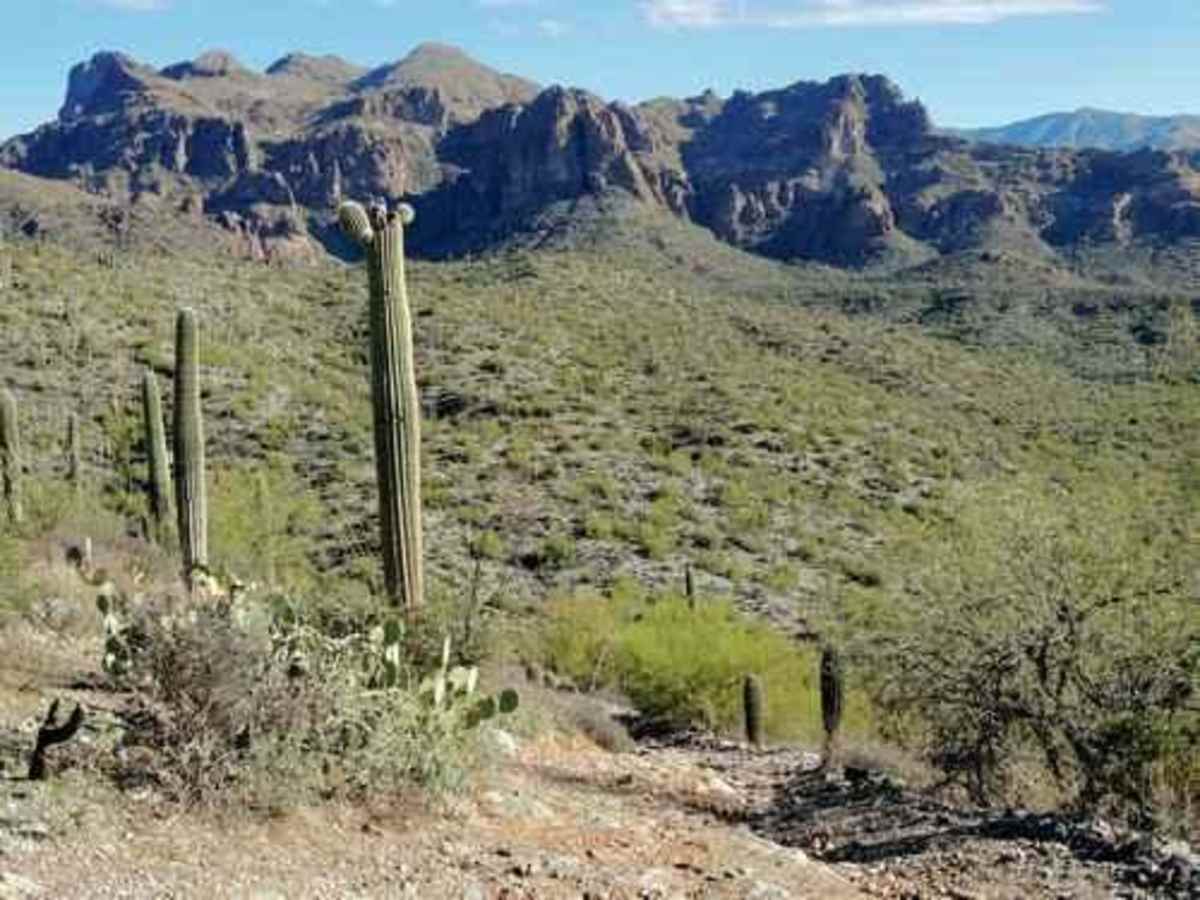
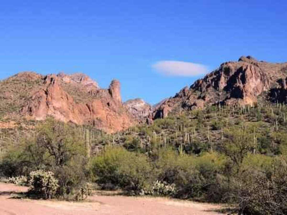
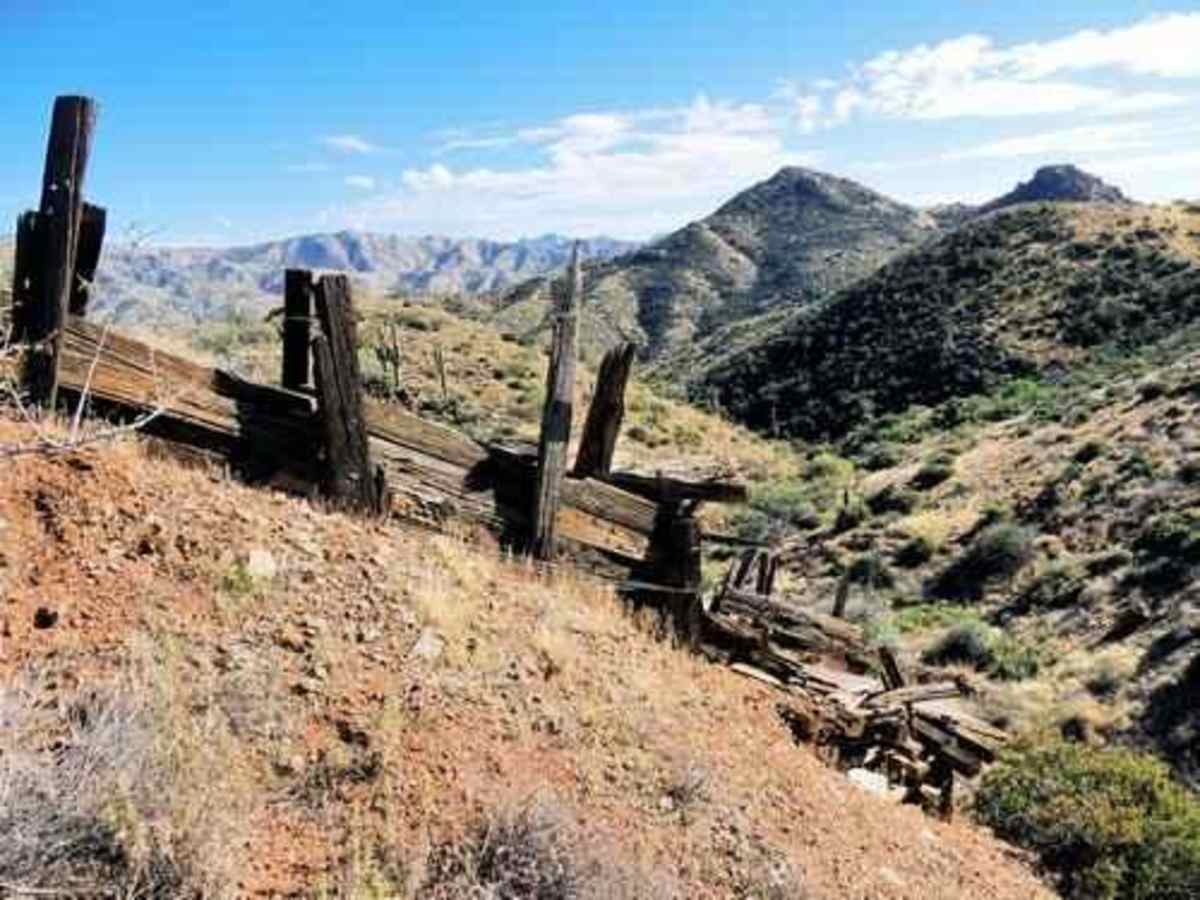
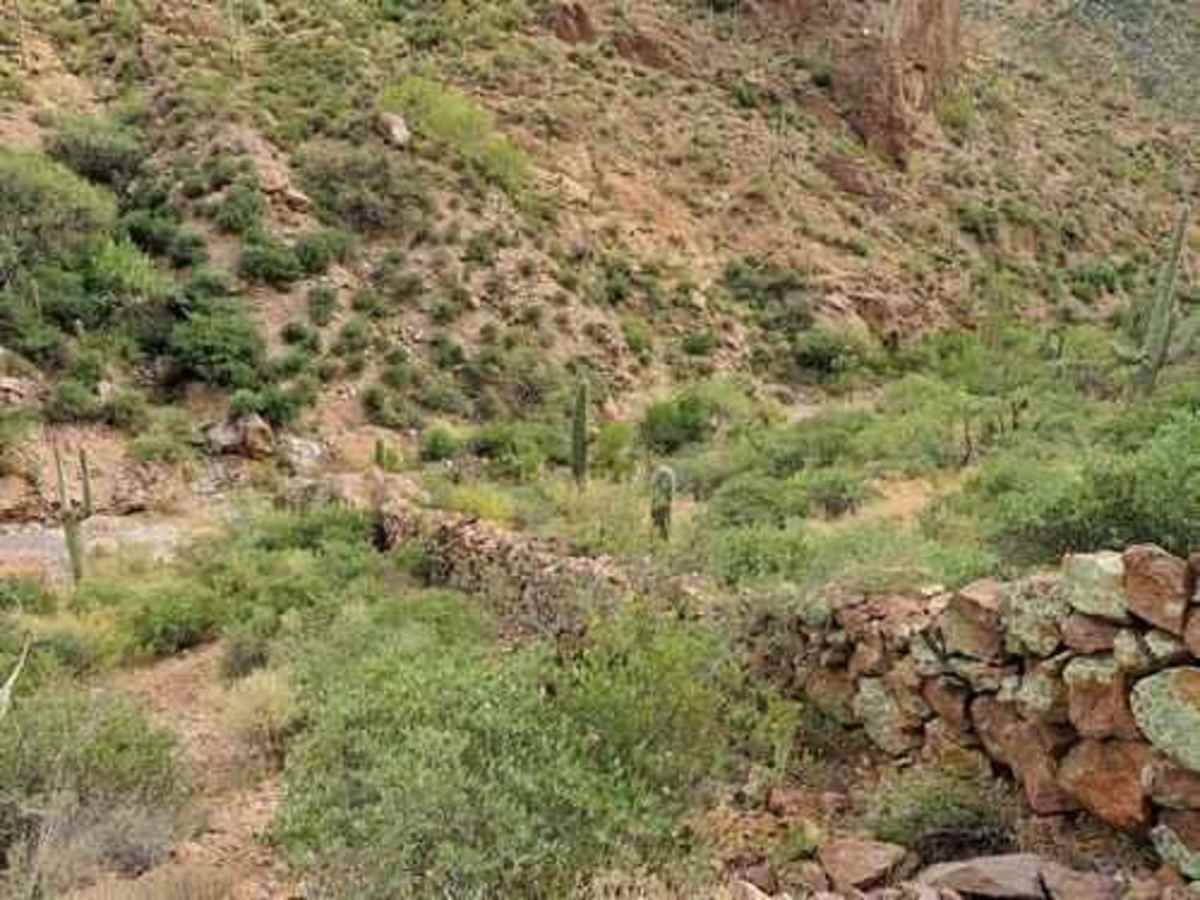
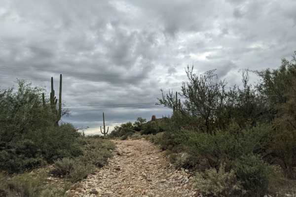
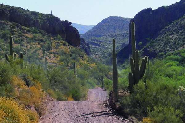
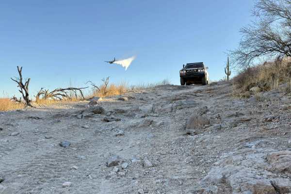
A scenic Jeep trail from the Queen Valley golf course to the Woodbury trailhead on Montana Mountain. The trail starts on the edge of the golf course in Queen Valley. Be wary of errant balls. It continues past a few hints of civilization until turning into a Jeep trail headed for Hardt Tank Hill. This area was in the Woodbury Fire in 2019. An update indicated it was much more difficult than originally described above. Conditions were improved, but recent storms may have degraded it again. Beware! This trail can change with every rain until the area becomes revegetated. The view from Hardt Tank Hill is great, and the trip down it can be interesting for stock Jeeps if there has been recent erosion. A short distance beyond Hardt Tank Hill is where you enter Millsite Canyon. The trail's southern portion has towering hills and expansive stands of saguaro. Hackberry is a really nasty bush that is common in the area. There are two man-made rock walls spanning the canyon from side to side. We do not know their history, but we are guessing they were built to keep livestock out of the most rugged central part of the canyon. Some people have seen only one of the walls and refer to it as the "Great Wall of the Superstitions." Both walls are visible from the road, but you must look from very specific areas because of the heavy brush. The viewpoint of the lower wall, on the left side of the road, is 50-100 feet south of a large rock that is part of the wall. The upper wall viewpoint is also on the left, between two of the most difficult obstacles on the trail. The best viewpoint for the natural bridge shown at the top of this page is about a quarter mile north of the upper wall. There is a waypoint in the gpx file. A hill blocks a view of the natural bridge immediately north of this spot, but a view reappears as you go north of the hill. There is a very tippy spot about a mile north of the natural bridge. This will test your tolerance for off-camber situations. Near the north end of the canyon is a spur that ends on a high point at the edge of the Superstition Wilderness. There is an old ore chute below the high point.

Photos of Millsite Canyon

Difficulty

The trail goes through washes and narrow trail segments which can become very washed out leading to large off-camber obstacles.

Technical Rating

5

Status Reports

Add Status Report
Pappa D Schultz
Nov 29, 2025
Open
Heavily eroded on FDR 1900 just south of the millsite minor wall.
frank Pendleton
Oct 23, 2025
Open
tonto national forest lists this as a non motorized road once it enters the canyon.
Jake Brigham
Oct 02, 2025
Open
Pretty rough for the section by the walls. Large rocks in the wash. Pinstriping is highly likely in full size vehicles and gets narrow for a few miles. Saw whitetail deer and some big horn sheep. Lots of cliffside views and is green.
Jason Henley
Jun 27, 2025
Open
I came from the backside but this track had a sign about a mile down from FS172 stating it was only for hiking, horseback and mountain bikes.
Steve B
May 03, 2025
Open
Got to a point specifically the Great Wall or what seems to be the obstacle and decided not to go forward since we didn’t know what awaited us past this very tight area that required high clearance. Not sure what’s north of the Mill site Great Wall location since we didn’t go past. Turned around and headed out. I plan to run the trail from North to south to see how far I get another day.
Ben Daugherty
Apr 20, 2025
Open
Definitely degraded a little more now and the canyon itself is quite overgrown. Expect some new pinstripes by the end. Rated a point higher than original due to wash outs, several spots had me white knuckled and holding my breath. The climb up to and then down the other side of Hordt Tank was my first clue that it had gotten rougher since the last report. The view from the flat parking area at the top was 100% worth it though. North of there is where the vegetation gets thick in the canyon. There are also two steep and narrow ravines to cross that will definitely test your approach and departure angles. Was able to snap a pic parked in the second slightly shallower one. Would not recommend in a stock height vehicle, even with 3” lift my skid plates and rock sliders got tested several times. Is definitely on my do over list when I’m back in the area.
Kevin O'Donnell
Apr 04, 2025
Open
Trail was actually really good. A little narrow for a full size truck but all drivable. A few off camber places and small rock self in the middle. 37s, 4wd and open diffs did drive though just fine.
Roy Fisher
Apr 02, 2025
Open
this is not an easy route it took 4 hours to go 13 mi on this trail very rough and hazardous
Daniel Gray
Feb 01, 2025
Open
Washed out hillside. Must have a vehicle that can go pass a 4’ vertical rock face.
Brandon Loring
Jan 04, 2025
Open
This is not 5/10 trail. Had to stop many times and get spotted through obstacles. We made it out before sundown but we were cutting it close.
Craig Little
Dec 31, 2024
Open
This trail is much more difficult than other parts of the Montana Loop. We encountered deep ruts and many off camber sections. We only made it about twenty percent of the trail before turning around.
Nic Waggoner
Dec 22, 2024
Open
We tried starting this trail from the north side because OnX showed it was straight through, but we made it not even a quarter of the way through and there was a sign that said no motorized vehicles.
BH B
Dec 14, 2024
Open
Trail S 1000 with 28" tires maneuvered thru the trail great. For our unit, we would rate this trail a 7. A few off camber obstacles to climb with caution, tire placement is key before making the commitment. There is a short steep downward section that shoots back up where long units may drag the tail end. Trail had ledges with off camber washouts, our unit rode great thru it but larger units may need to be more cautious. Overall, the trail was in decent condition until the end where it meets up with the Montana Mountain Loop where downhill deep washouts may be more challenging for some but we didn't have any issues with our unit. Pinstripes are guaranteed. Good trail.
Sean Arthur
Dec 01, 2024
Open
Very technical trail. Proceed with caution. Difficulty rating should be 8-9. Dangerous sections with narrow ravine and washes. Almost slid down a 12-15 ravine and we were hugging the mountain. I don’t know why this is rated a 5. Very misleading.
Merlin Cormier
Nov 27, 2024
Open
Trail was super fun, overgrown bit, passed 3 side by sides , there was a wash out after I passed them , was easy for me to stay right / not sure how the solved obstical

Millsite Canyon Trail can be accessed by the following ride types:

  • Single Track
  • 50 Inch
  • 60 Inch
  • High Clearance

Millsite Canyon Map

The onX Offroad Difference

onX Offroad combines trail photos, descriptions, difficulty ratings, width restrictions, seasonality, and more in a user-friendly interface. Available on all devices, with offline access and full compatibility with CarPlay and Android Auto. Discover what you're missing today!

Open Trail Map