Brian George
Jun 21, 2026
Open
Normal
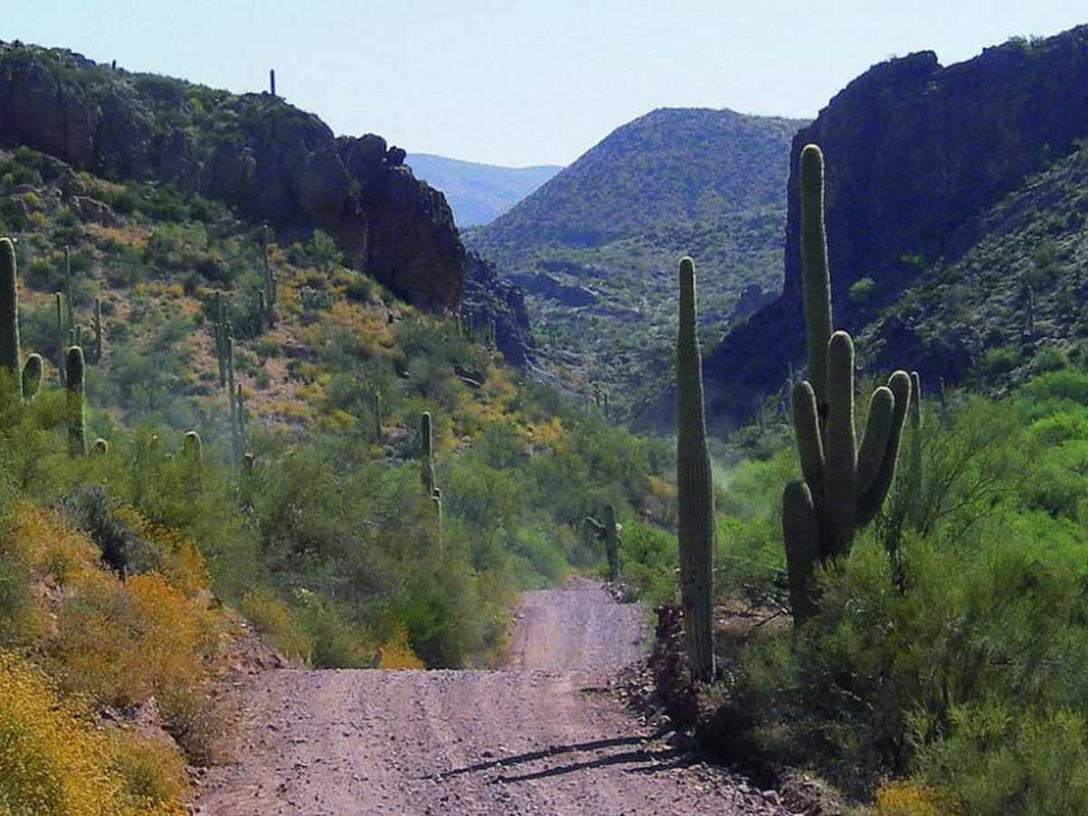
Trail is in pretty good shape and the views are amazing! Normal wear and it looked like parts may have been grated not to long ago. The only part to watch out for it the switchbacks. There are a few spots where it has started to wash out and the road is quite narrow for a moment. One more big rain and it might be impassible until its repaired. Took us around 4 hours with many stops, highly recommend
Austin Linderer
Apr 19, 2026
Open
Normal
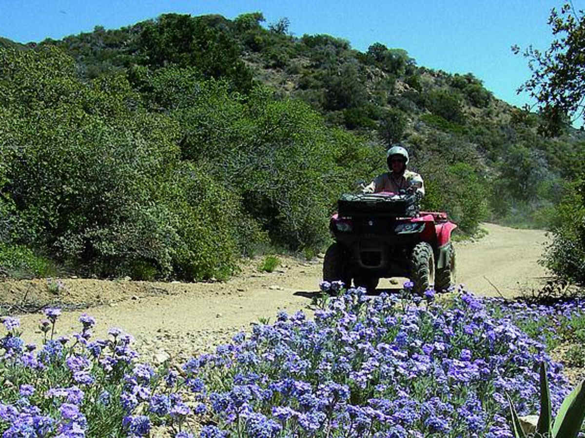
Took this trail on my big KTM 1190 which I've been riding pretty hard offroad for about 5 years. The trail was tough for a big bike and am happy I took it counter clockwise. The switchbacks uphill were the most challenging part for a big bike and I don't think I could have done them downhill. On a smaller bike I would say the rating is accurate pretty easy. On a big adv all the elevation was a struggle use lots of engine braking on the downhills to stop from sliding down the mountains. Couple side by sides and one jeep on the trail were kind and got out of the way so I could lug the big bike around them on the easiest paths.
Maryann Lopez
Mar 28, 2026
2013 Jeep Wrangler
Open
NormalDusty
I would rate this trail a 2/10, very easy with zero technical areas. We came from Tucson in a lifted JK and a stock Rubi JL. By the time we aired down and were on our way it was approx 10am. It was quite windy all day on trail, very hazy, super dusty, very little water only in the first wash crossing. It was a beautiful trail but it’s apparent the heat is taking an early toll. The climb up the mountain is narrow, with what feels like endless switchbacks, but we only came across one small SxS that saw us from a distance and waited in a corner for us to catch up and pass. After swinging around the forest looking part at the top, near the end of the stretch we came across 3 OHVs going faster than they should’ve been on a narrow mountain road. We found a nice spot with a couple shade trees for lunch once we started our climb down, just over halfway into the trail. I would love to do this trail again and explore more of the side roads.
Jennifer & Kevin c
Mar 15, 2026
2020 Jeep Gladiator
Open
the trail was great easy to navigate also so beautiful. Big climb up, nothing technical take your time watch for oncoming traffic when you reach the summit stop at the camp spot and enjoy the view and on the way down watch your speed on the switchbacks and 1 area where some rocks spilled out still room to pass but watch speed and oncoming traffic narrow steep switch backs. would recommend stunning that this on the outskirts of Phoenix.
Jayson Uptain
Mar 15, 2026
2021 Toyota Tacoma
Open
NormalDusty
Ran Montana Mountain and it was an excellent trip! The trail is mostly hard-packed dirt mixed with loose shale and embedded rock. The shelf road sections offer incredible panoramic views, but definitely keep an eye on those steep drop-offs. There are a few tight switchbacks along the climb; my Tacoma navigated them perfectly, though longer wheelbases might need to take it slow.
Tips: Definitely air down your tires—it helps tremendously with traction on the loose rock and smooths out the washboards. There is absolutely no natural shade at the top, so deploy your awning if you plan to stop for lunch at the overlooks. Overall, an awesome, scenic run!
Rafe Fillmore
Feb 28, 2026
2023 Toyota Tacoma
Open
NormalDusty
Ran the east side of the trail as an out and back. Easily manageable in Tacoma and 4runner. Most passes SS with a few other trucks on the trail.
Trevor Hansen
Feb 28, 2026
2026 Toyota 4Runner
Open
DustyMuddy/Wet
Trail was dusty with a few place having running or standing water. A few places where erosion is cutting away at the trail. We only did from the Superior side to the summit and then turned around.
Jim Rohde
Feb 03, 2026
2018 can-am maverick max dps
Open
NormalDusty
Trail was great, weather was beautiful we ran across a couple of jeeps, and 2 groups of SXS. There were some washed out spots from rain you have to watch out for.
Joe Zhou
Jan 04, 2026
Open
Normal
The whole trail is in good condition. Only the cattle guard about a mile from the Hewitt station entrance has the surrounding washed out. We turned around and went back couple hundred yards, used the side trail to continue with no issues. After that point, easy drive, thanks to the grading last year!
Brian Carmicheal
Dec 21, 2025
Open
Normal
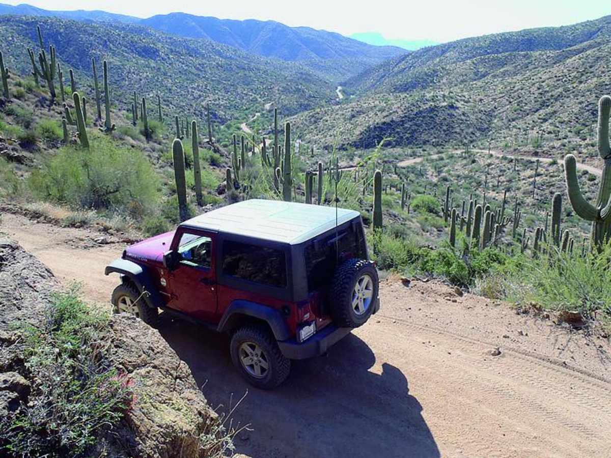
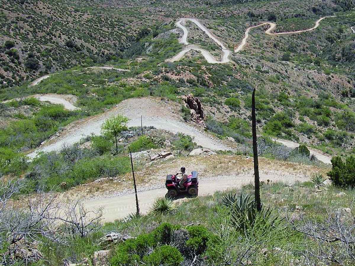
First time here. Went counter clockwise to hit the switchbacks uphill in the big truck. There are a few trucks and trailers at the staging area right off the 60 where I aired down. Ran across a group of 5SXS as I went through the lower washes. Had two small Jeeps coming clockwise as well that I passed. Fortunately, absolutely no traffic on the climb, Top, or most of the way down. Ran into a couple of hikersthat I ended up giving a lift back down to their truck and two other trucks that were out there hunting on the west end. absolutely beautiful drive. As soon as you start to make your way up the switchbacks, you retreated with an amazing view of the valley and some great photos that show you miles and miles and miles of trail. You just did. The top gets a little tighter and has fuse of the backside. Eventually, when you start back down, there’s some very very slightly technical rock decents. Easy trail. Averaged 9.9mph with lots of stopping for photos.
Steve B
Dec 02, 2025
2024 Toyota 4Runner
Open
Rough/Deteriorated
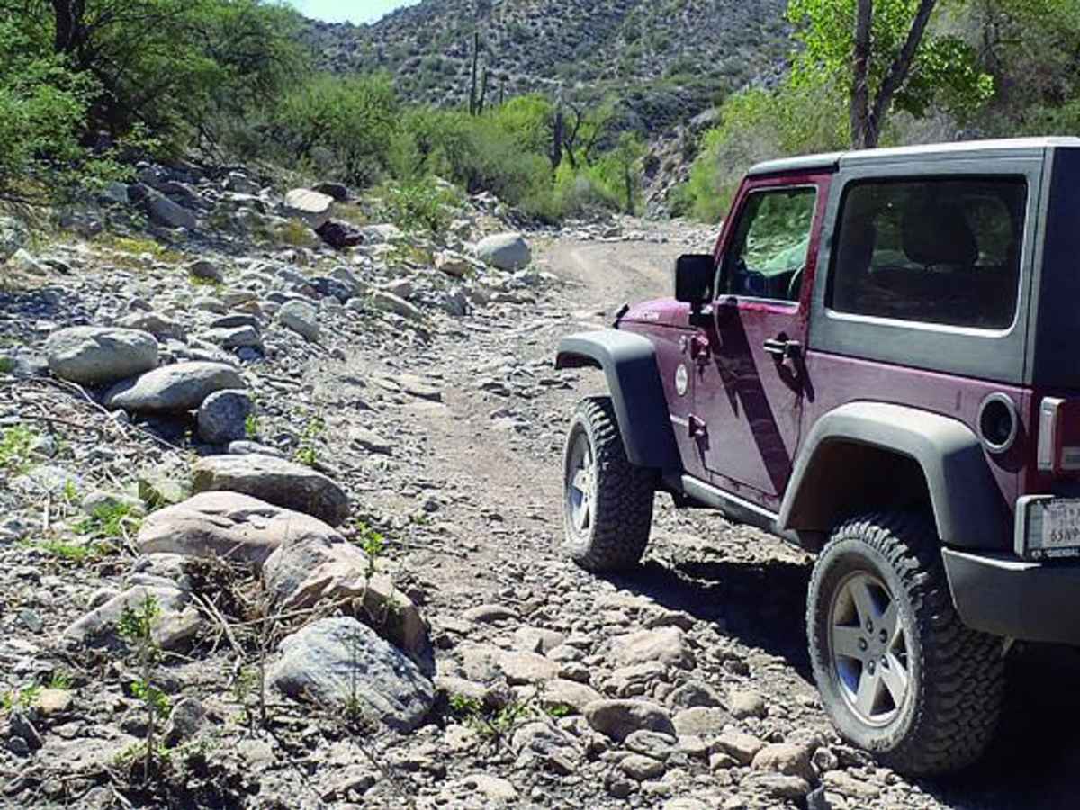
Wante stop give a trial report 157 about 2.67 miles in take the wash instead of veering right on the trail. The 157 is washed out at the cattle guard. I failed at maneuvering it because I was solo. Glad I got to on sliders. I probably could have made it but chose to just back track a few hundred feet. This trail is one of the most scenic trails I’ve ever been on. I could tell it was deteriorating from the last rains we had. Other than that it’s very easy and worth the 5-6 hour trip! Wow that was a long day!
Jenna Garcia
Nov 11, 2025
2008 Jeep Wrangler
Open
Muddy/WetRough/DeterioratedWashboard
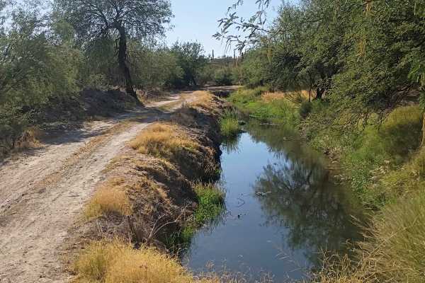
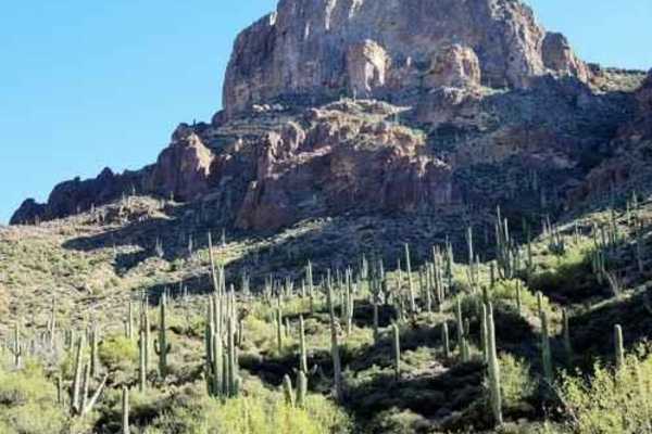
This is a beautiful trail up the mountain. Lots of washboard at the beginning with a rockier trail beginning later. Recent rain has eroded some of the road causing erosion on some steep turns. Larger vehicles like Gladiators had to make a 3 point turn in order to avoid these. Even in a JKU we had to back up and reposition at a particularly crappy switchback with erosion. It’s amazing to go from desert to pines and back climbing 5100 feet. There is a cool woodsman’s cottage to check out towards the end of the loop. I noted muddy bc there are several places where you cross fairly minor running water and then back to rocks making them slick. Def don’t take this trial after a recent heavy rain as it looks like areas become impassible bc of water. Overall a beautiful ride and well worth the time.
Chuck Reynolds
Oct 11, 2025
Open
Muddy/WetWashboard
Following all the rains it wasn’t as muddy as I anticipated but few areas were slick - just power through NBD. Just stuck to the west side this ride but be out there again in a week.
Dylan Tussey
Oct 03, 2025
2015 Jeep Wrangler
Open
NormalMuddy/Wet
Russ TGN
May 18, 2025
Open
Did this trail with Valley Jeepsters today. Amazing views, and definitely a lot more challenging than it was 2 years ago. Deep ruts, washouts, a few large rocks here and there, plus a few off-camber spots next to a steep drop off. Technically, the trail is easily passable with a stock Jeep Wrangler Rubicon, but it is a mental challenge for those not used to off-roading, steep drops and high elevations. This is a very remote trail, and it doesn’t matter how good your rig is, DO NOT GO ALONE!