
Dirt Bike Trails
Near Finger, Tennessee
Explore All Dirt Bike Trails Near Finger, Tennessee
Dirt Bike Trails Near Finger, Tennessee
Discover the best dirt bike trails near you. Browse trail maps, check difficulty ratings, and find your next adventure — whether you're looking for a quick ride or an all-day expedition.

Woods
Woods Trail is a narrow gravel route characterized by large, chunky rocks that create a noticeably loose driving surface. Traction can vary throughout the trail due to the size and depth of the gravel, requiring steady throttle control and attention to steering input. The road narrows to a single la...
Learn more about Woods
Thorn
Thorn Trail is a mixed gravel and dirt route that offers a scenic and slightly more engaging drive for those exploring the area. The surface varies between compacted gravel and dirt, with sections that can become soft depending on recent weather. A large open expanse along the trail provides an exce...
Learn more about Thorn
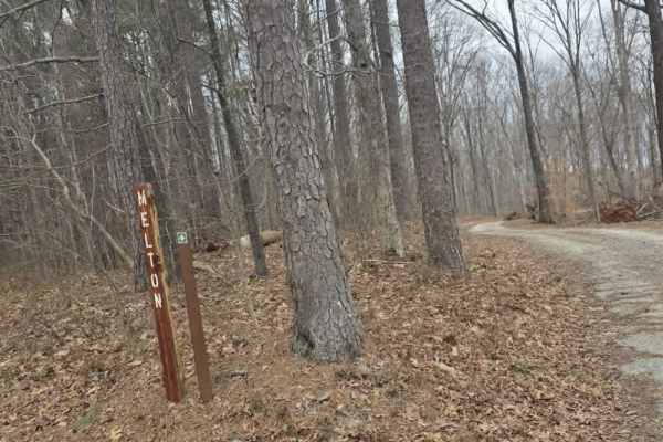
Melton
Melton Trail is an easy mixed-surface route featuring gravel and dirt with a solid, well-maintained base. Recent grading has introduced sections of larger gravel and fresh dirt, providing consistent traction under normal conditions. The trail experiences moderate elevation changes, gaining approxima...
Learn more about Melton
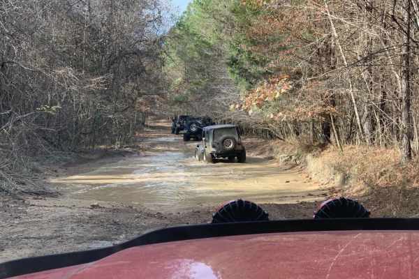
Austin Hollow
Austin Hollow is an exciting, short spur trail designed for intermediate offroaders looking to test their vehicles against wet, muddy terrain on their way to a beautiful waterfall. Branching off Hitchcock Lane near the Rainbow Falls Loop, this route spans just over a half-mile and descends roughly 4...
Learn more about Austin Hollow

Shiloh Trail
Shiloh Trail is an easy mixed-surface route located within Natchez Trace State Park, offering a quiet drive through wooded terrain with gentle elevation changes. The surface consists of dirt, gravel, and occasional sandy stretches, creating a varied but approachable experience for most drivers. Larg...
Learn more about Shiloh Trail
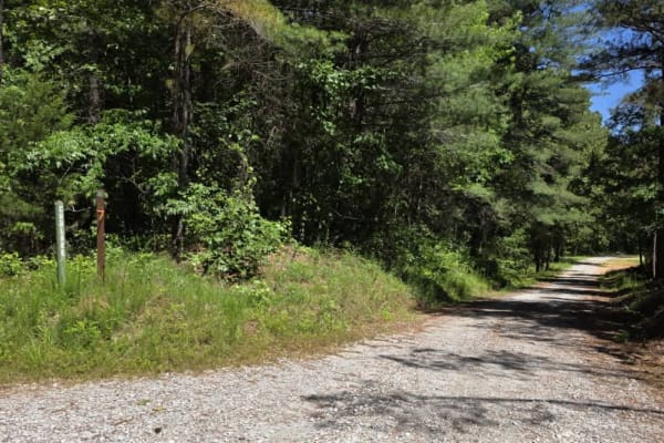
Cub Lake Trail
Tucked within the serene expanse of Natchez State Forest, this off-road trail offers a peaceful drive ideal for beginners and those looking for a more relaxed adventure. The road is well-graded with dirt and gravel, making for smooth travel without technical obstacles. Towering mature trees line the...
Learn more about Cub Lake Trail

Rainbow Falls Loop
Rainbow Falls Loop is a moderately challenging, 6.9-mile off-road trail in northwest Alabama's Lauderdale Wildlife Management Area. The route starts with approximately one mile of maintained gravel road before transitioning to rugged dirt paths with deep ruts, mud, and seasonal water pooling.
The t...
Learn more about Rainbow Falls Loop
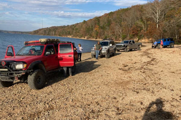
Pebble Beach
Pebble Beach is an exciting, moderately challenging trail perfect for drivers of capable four-wheel-drive vehicles and SxSs looking to test their skills and rigs on a mix of rugged terrain and water obstacles. Spanning approximately 6.2 miles, this route begins with a technical, high-clearance secti...
Learn more about Pebble Beach

Road 105
Road 105 is an ideal scenic route for novice off-roaders and those seeking a low-stress dirt road drive through the dense forests of northwest Alabama near Pickwick Lake. The route provides a perfect training ground for inexperienced drivers to build confidence behind the wheel while navigating a mo...
Learn more about Road 105
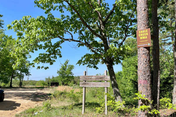
Copeland Ridge Road–Eagle Creek WMA
Access to Eagle Creek Wildlife Management Area requires a valid Tennessee hunting or fishing license and is limited to one-half hour before sunrise through one-half hour after sunset. Street-legal vehicles may use WMA roads with this license, while UTVs and other off-highway vehicles require a High ...
Learn more about Copeland Ridge Road–Eagle Creek WMA
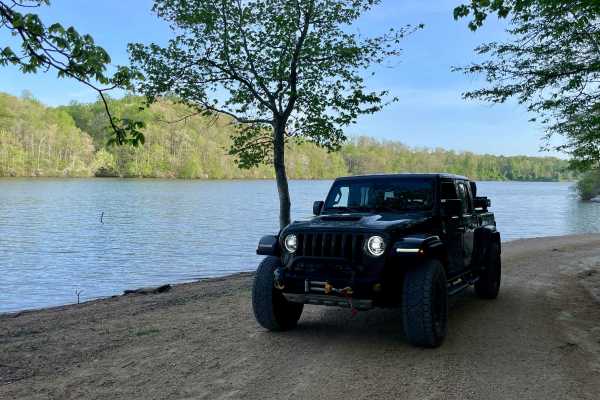
Peter Cave Road
Part of the Laurel Hill Wildlife Management Area Trail System. Drivers must possess a valid annual Hunt/Fish license, available online. Access is open year-round and restricted to daylight hours only (closed dusk to dawn). -- Peter Cave Rd. is a short access spur that provides direct entry to the we...
Learn more about Peter Cave Road
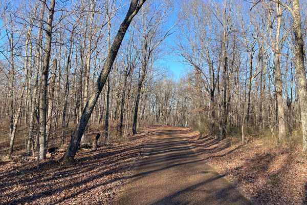
Laurel Hill Road
Laurel Hill Road is a scenic east–west traverse across the northern end of the Laurel Hill Wildlife Management Area, connecting Natchez Trace Parkway on the west to CC Road on the east. While both termini begin on pavement, the route quickly transitions to well-maintained gravel once inside the WMA,...
Learn more about Laurel Hill Road
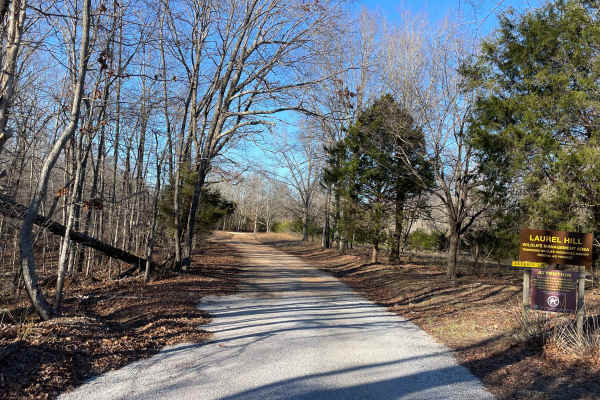
Artemis Lane
Artemis Lane is a primary interior access route within Laurel Hill Wildlife Management Area and one of the longest drivable tracks in the system at approximately six miles. Drivers must possess a valid annual Hunt/Fish license, available at GoOutdoorsTennessee.com. Tennessee resident licenses are $3...
Learn more about Artemis Lane
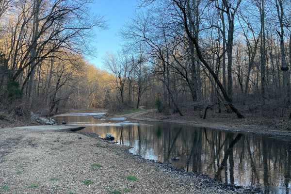
CC Road
CC Road is a short but important connector route within the Laurel Hill Wildlife Management Area, serving as one of the primary eastern access points into the WMA. The road links Laurel Hill Road on the east with Artemis Lane to the west, transitioning from pavement at the entrance to gravel once in...
Learn more about CC Road
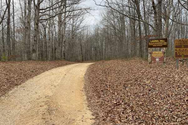
Finnie Road
Finnie Road is a gravel access route within Laurel Hill Wildlife Management Area, providing vehicle access through mixed hardwood forest and connecting interior management roads. Drivers must possess a valid annual Hunt/Fish license, available at GoOutdoorsTennessee.com. Tennessee resident licenses ...
Learn more about Finnie Road

VFW Road
Part of the Laurel Hill Wildlife Management Area trail system. A permit is not required to access this lake trail, only to fish. Access is open year-round and restricted to daylight hours only (closed dusk to dawn).
The VFW Lake Track is a short gravel access route that follows the shoreline of VFW...
Learn more about VFW Road
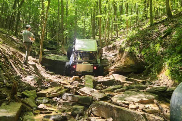
#115 Commandments
Trail #115 Commandments is a rocky climb from the north end of the park all the way back to the power lines. It has a lot of off-camber areas and tight trees to contend with. The trail also features large rock ledges 5 or 6 feet tall to contend with.
Learn more about #115 Commandments
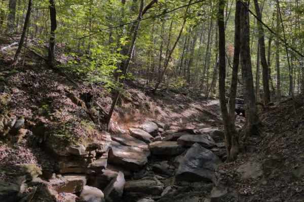
#136 - Fatty's Crack
Fatty's Crack is another popular and talked-about trail at Hawk Pride. It’s a very rough and rocky route characterized by large boulders, steep undercut ledges, and a couple of off-camber sections that challenge even experienced drivers. Fatty's Way runs parallel and offers a safe vantage point to w...
Learn more about #136 - Fatty's Crack
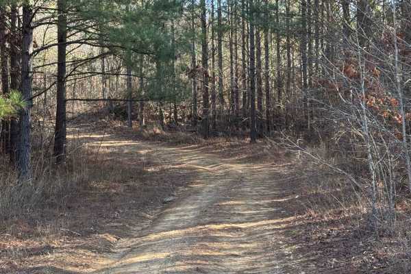
#21 Maynard's Trail
Maynard's trail is one of the longest trails in the park. This trail does a loop and dumps you out where it starts. This trail is all heavily wooded until you reach the end of the trail and then there is a big clearing. There are no major obstacles on this trail.
Learn more about #21 Maynard's Trail
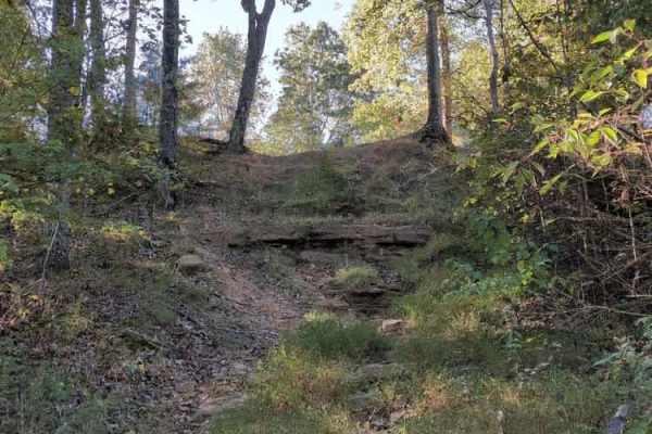
#103 Vertical Limit
Trail #103 – Vertical Limit is an extremely steep and hazardous hill climb located on the north end of the park. About halfway up, the trail splits into three separate lines, each presenting near-vertical ascents with loose rock and deep ruts. These climbs are among the most difficult in the park — ...
Learn more about #103 Vertical Limit
ATV trails near Finger, Tennessee
Explore ATV-friendly trails near you. These trails are accessible for vehicles up to 50 inches wide, perfect for ATVs and smaller off-road machines.
Woods
Woods Trail is a narrow gravel route characterized by large, chunky rocks that create a noticeably loose driving surface. Traction can vary throughout the trail due to the size and depth of the gravel, requiring steady throttle control and attention to steering input. The road narrows to a single la...
Learn more about Woods
Thorn
Thorn Trail is a mixed gravel and dirt route that offers a scenic and slightly more engaging drive for those exploring the area. The surface varies between compacted gravel and dirt, with sections that can become soft depending on recent weather. A large open expanse along the trail provides an exce...
Learn more about Thorn
Melton
Melton Trail is an easy mixed-surface route featuring gravel and dirt with a solid, well-maintained base. Recent grading has introduced sections of larger gravel and fresh dirt, providing consistent traction under normal conditions. The trail experiences moderate elevation changes, gaining approxima...
Learn more about Melton
Austin Hollow
Austin Hollow is an exciting, short spur trail designed for intermediate offroaders looking to test their vehicles against wet, muddy terrain on their way to a beautiful waterfall. Branching off Hitchcock Lane near the Rainbow Falls Loop, this route spans just over a half-mile and descends roughly 4...
Learn more about Austin Hollow
UTV/side-by-side trails near Finger, Tennessee
Find UTV and side-by-side trails near you. These trails accommodate vehicles up to 60 inches wide, ideal for UTVs, side-by-sides, and wider off-road rigs.
Woods
Woods Trail is a narrow gravel route characterized by large, chunky rocks that create a noticeably loose driving surface. Traction can vary throughout the trail due to the size and depth of the gravel, requiring steady throttle control and attention to steering input. The road narrows to a single la...
Learn more about Woods
Thorn
Thorn Trail is a mixed gravel and dirt route that offers a scenic and slightly more engaging drive for those exploring the area. The surface varies between compacted gravel and dirt, with sections that can become soft depending on recent weather. A large open expanse along the trail provides an exce...
Learn more about Thorn
Melton
Melton Trail is an easy mixed-surface route featuring gravel and dirt with a solid, well-maintained base. Recent grading has introduced sections of larger gravel and fresh dirt, providing consistent traction under normal conditions. The trail experiences moderate elevation changes, gaining approxima...
Learn more about Melton
Shiloh Trail
Shiloh Trail is an easy mixed-surface route located within Natchez Trace State Park, offering a quiet drive through wooded terrain with gentle elevation changes. The surface consists of dirt, gravel, and occasional sandy stretches, creating a varied but approachable experience for most drivers. Larg...
Learn more about Shiloh Trail
The onX Offroad Difference
onX Offroad combines trail photos, descriptions, difficulty ratings, width restrictions, seasonality, and more in a user-friendly interface. Available on all devices, with offline access and full compatibility with CarPlay and Android Auto. Discover what you're missing today!
Open Trail Map