
Dirt Bike Trails
Near El Macero, California
Explore All Dirt Bike Trails Near El Macero, California
Dirt Bike Trails Near El Macero, California
Discover the best dirt bike trails near you. Browse trail maps, check difficulty ratings, and find your next adventure — whether you're looking for a quick ride or an all-day expedition.
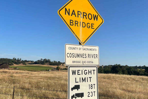
Latrobe Road
Latrobe Road is a scenic dirt road that passes through the rolling foothills outside the Sacramento Valley and provides ample views of the surrounding area. The trail passes through agricultural land, cattle grazing areas, and the 4000 acre Deer Creek Preserve, which is owned/managed by the Sacramen...
Learn more about Latrobe Road

Dunnigan Hill
Dunnigan Hill is an ideal route for offroaders of all skill levels, serving as the main scenic corridor connecting the north and south entrances of the Knoxville Off-Highway Vehicle (OHV) Area. Stretching approximately 7.8 miles through the rugged inner Coast Range, this point-to-point route reaches...
Learn more about Dunnigan Hill
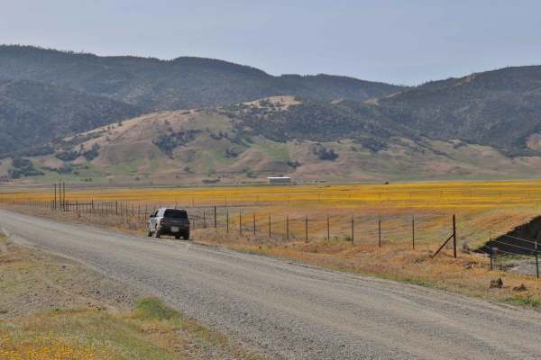
Bear Valley Road Trail
Easy dirt trail with connections to the Berryessa Snow Mountain Monument area Trails with wildflower sights in Spring and the main road to The Wilbur Hot Springs. Beautiful scenery of the Bear Valley in Lake and Colusa Counties in Spring with Bear Creek passing next to the trail. Near the end of the...
Learn more about Bear Valley Road Trail
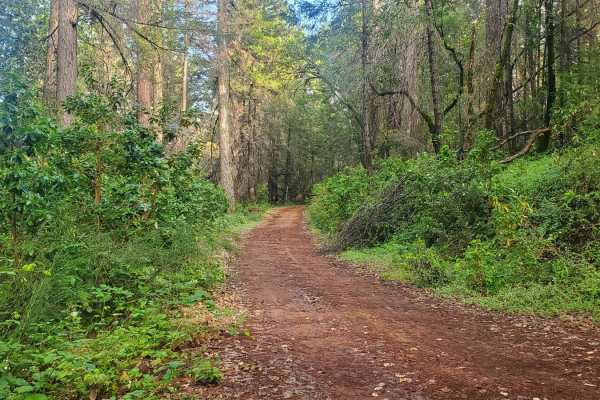
Bottle Hill
Bottle Hill is a good trail to learn how your vehicle feels on dirt, rock, and mud;or to check the off-road capability of your vehicle after making modifications or repairs. It is also a nice, relaxing trail to run for more experienced off-roaders. There is a cellular signal from multiple carriers t...
Learn more about Bottle Hill

Walker Ridge Road to Indian Valley Reservoir Road
Walker Ridge Road to Indian Valley Reservoir Road is a 9.7-mile scenic gravel connector route providing direct access to the Indian Valley Reservoir and Walker Ridge Recreation Area. The route climbs to a maximum elevation of 2,813 feet, offering expansive views of the chaparral-covered hills and se...
Learn more about Walker Ridge Road to Indian Valley Reservoir Road
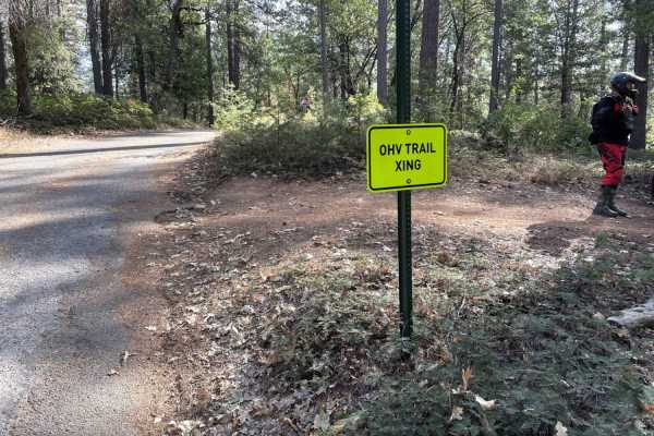
Trail 1 Georgetown OHV
This starts on Trail 1 off of Darlington Ridge Road and continues to Trail 6 over the bridge and through Slate Mountain. From Slate Mountain, you're presented with more trail options. Lots of single tracks are to be found from beginner to difficult trails.
Learn more about Trail 1 Georgetown OHV
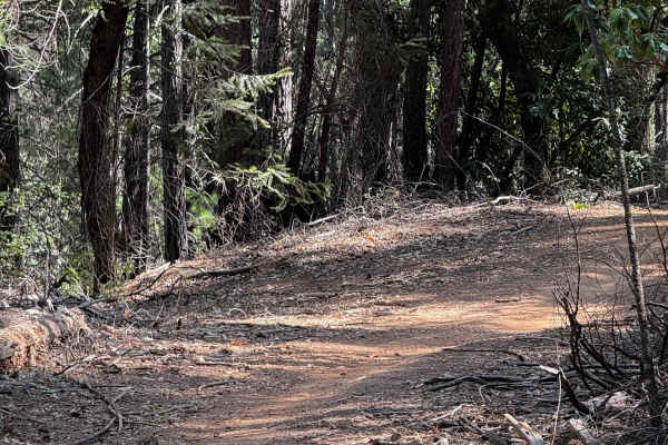
Trail 1-2 (11E36)
This is a seasonal ATV loop, open to motorized use from May 11 to November 9. The trail looks mostly ridden by dirt bikes, as it doesn’t connect to any other ATV trails in the area. The trail is a 1.5-mile-long loop off a road portion of the Rock Creek Loop. It’s mostly flat, with long straight sect...
Learn more about Trail 1-2 (11E36)
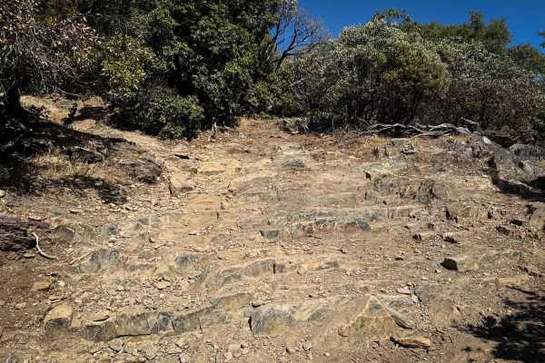
Trail 1 (Advanced) (11E23)
This is an advanced section of the Rock Creek Loop. From its west entrance, the trail starts off with some deep ruts as it starts steeply climbing into the forest from a forest road on a semi-steep grade. It goes through a corridor of manzanita trees forming a tunnel-like canopy where you have to wa...
Learn more about Trail 1 (Advanced) (11E23)

Trail 6-1 (11E28)
The north end of Trail 6-1 starts from an intersection with Trail 1, and goes through a tree corridor of curving Big Manzanita trees, on dry dusty dirt, with lots of loose rock. It curves through the trees, with some root bands across the trail creating small drop-offs. There are a couple of moderat...
Learn more about Trail 6-1 (11E28)
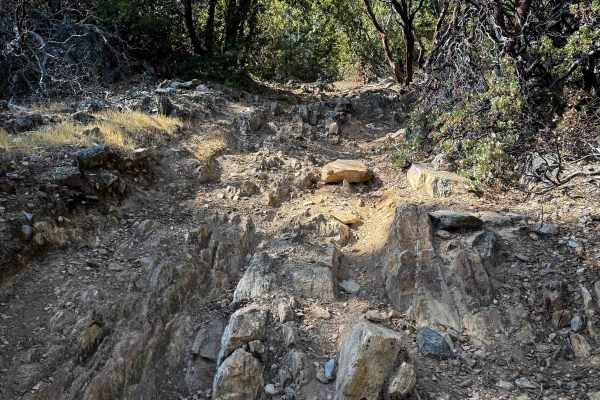
Trail 5-3 (11E54)
This is a 0.7-mile-long dead-end spur that branches off the Rock Creek Loop. It goes up to a shelfy section overlooking the mountains with a really scenic view. The first tenth of a mile climbs up to the viewpoint, then it descends down for the rest of the route on a steep slope covered in loose roc...
Learn more about Trail 5-3 (11E54)
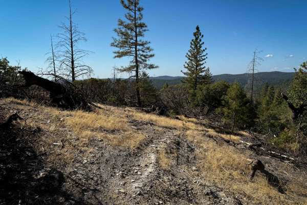
Trail 1-5 (11E51)
This is a short loop trail off of the Rock Creek Loop that is unmarked at both entrances and is kind of hidden due to forestry work along the Rock Creek Loop. The west end starts out on a dry, exposed hilltop, then goes through low tunnels of California black oak trees and manzanita trees. The trail...
Learn more about Trail 1-5 (11E51)
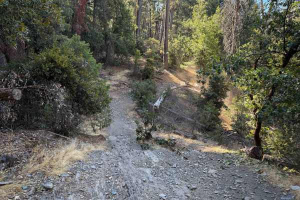
Trail 3 ATV (11E18)
This 6.2-mile-long ATV loop winds through a dry and sparse forest, on a wide path, with sharp corners through the trees. Lining the path are widely spaced pine and oak trees, plus manzanita bushes, sometimes with low-hanging branches. Most of the loop is pretty easy, fast, and flowy, but a few spots...
Learn more about Trail 3 ATV (11E18)
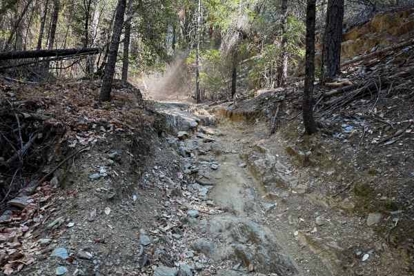
Trail 3-1 ATV (11E16)
This is a 1-mile intermediate ATV trail through the Eldorado National Forest near the Mace Mill Staging Area. From the intersection with Trail 3, this trail descends down the edge of the hillside, steadily descending a semi-steep grade with waterbars, sharp corners, and ruts. It drops about 500 feet...
Learn more about Trail 3-1 ATV (11E16)
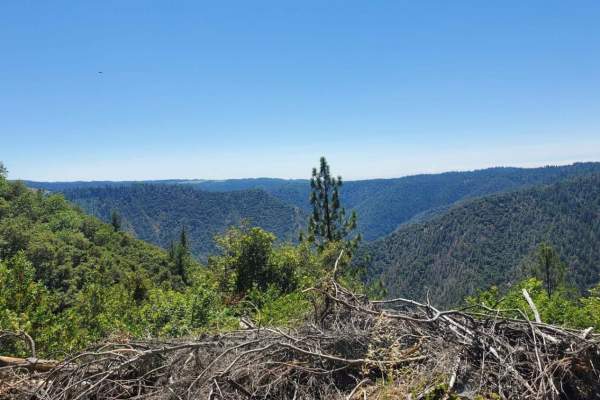
Volcanoville
Volcanoville is a good beginner trail that can be completed by most stock 4x4 SUVs, as well as many AWD vehicles with AT tires and at least 8 inches of clearance. The trail does get progressively more difficult, with plenty of opportunities to turn around safely. Private parcels are well marked and ...
Learn more about Volcanoville
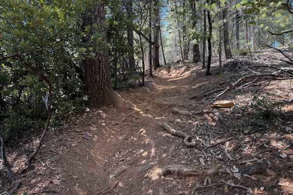
Trail 5-2 (11E29)
This trail is 1.1 miles of fun and easy winding single track through a dry and dusty forest of firs and pines. The trail has lots of big roots present, with tight twisty turns, and silty banked corners. Expect some deeper ruts as well, and natural drop-offs from the roots and ruts. The roots are dry...
Learn more about Trail 5-2 (11E29)
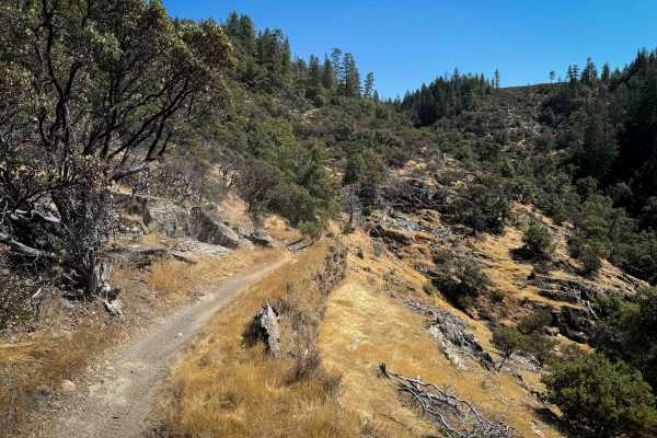
Trail 1-4 (11E42)
This is a really unique and fun dirt bike trail that goes through a mix of terrain, including through low tree canopies, and out onto an exposed hillside lined with embedded rock. Overall, the trail is pretty easy, but there are sections with moderate exposure, so it isn’t ideal for brand-new riders...
Learn more about Trail 1-4 (11E42)
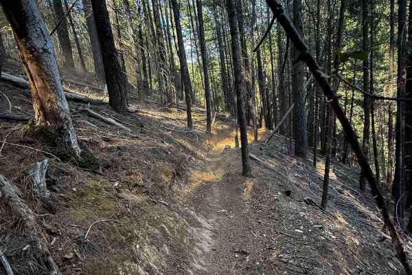
Trail 5-1 (11E32)
This is a short cutoff trail that bails you out from Trail 5, back to the road portion of Rock Creek Loop, and out to Rock Creek Road. The trail is 1.2 miles long, and mostly gradually ascends from south to north, gaining about 450 feet in elevation. The trail is shelfy, but not overly narrow, as it...
Learn more about Trail 5-1 (11E32)
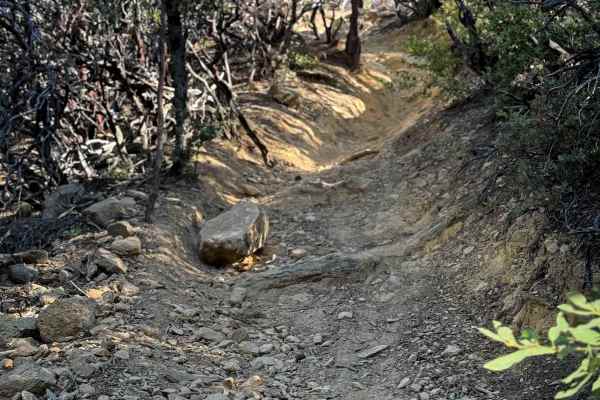
Trail 4-2 (11E25)
4-2 is a moderate dirt bike trail in the Rock Creek Trail System. The southern end starts out as a shaded wide path climbing up from the south entrance, in between scraggly manzanita trees. Watch for root bands across the trail, small loose rocks, dips, bumps, and a bit of embedded rock. The trail w...
Learn more about Trail 4-2 (11E25)
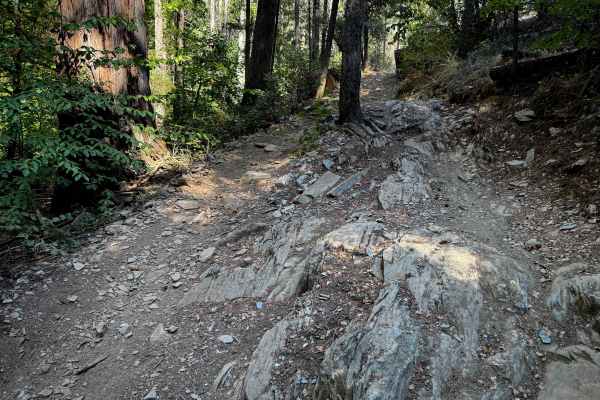
Trail 9 ATV (11E13)
The ATV portion of Trail 9 starts at its east end at a marked entrance on Rock Creek Road, and starts winding through the manzanita bushes on a smooth and curvy path that would be quite narrow for ATVs in some spots between the trees. The trail descends down and cuts across the hillside, with sharp ...
Learn more about Trail 9 ATV (11E13)
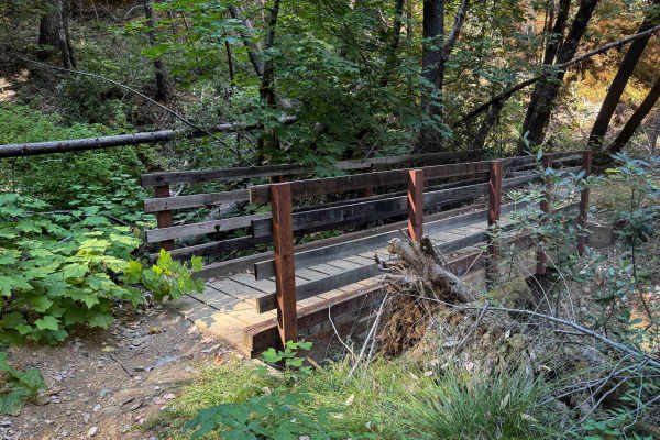
Trail 5 (11E31)
This single track is over 3 miles in length, full of scenic and moderately easy riding through the Eldorado National Forest. The trail is mostly fast and flowy, but is shelfy in sections, as it winds down the edge of a forested hillside, along mossy rock walls, through some tight tree gaps, with a b...
Learn more about Trail 5 (11E31)
ATV trails near El Macero, California
Explore ATV-friendly trails near you. These trails are accessible for vehicles up to 50 inches wide, perfect for ATVs and smaller off-road machines.
Dunnigan Hill
Dunnigan Hill is an ideal route for offroaders of all skill levels, serving as the main scenic corridor connecting the north and south entrances of the Knoxville Off-Highway Vehicle (OHV) Area. Stretching approximately 7.8 miles through the rugged inner Coast Range, this point-to-point route reaches...
Learn more about Dunnigan Hill
Bear Valley Road Trail
Easy dirt trail with connections to the Berryessa Snow Mountain Monument area Trails with wildflower sights in Spring and the main road to The Wilbur Hot Springs. Beautiful scenery of the Bear Valley in Lake and Colusa Counties in Spring with Bear Creek passing next to the trail. Near the end of the...
Learn more about Bear Valley Road Trail
Bottle Hill
Bottle Hill is a good trail to learn how your vehicle feels on dirt, rock, and mud;or to check the off-road capability of your vehicle after making modifications or repairs. It is also a nice, relaxing trail to run for more experienced off-roaders. There is a cellular signal from multiple carriers t...
Learn more about Bottle Hill
Walker Ridge Road to Indian Valley Reservoir Road
Walker Ridge Road to Indian Valley Reservoir Road is a 9.7-mile scenic gravel connector route providing direct access to the Indian Valley Reservoir and Walker Ridge Recreation Area. The route climbs to a maximum elevation of 2,813 feet, offering expansive views of the chaparral-covered hills and se...
Learn more about Walker Ridge Road to Indian Valley Reservoir Road
UTV/side-by-side trails near El Macero, California
Find UTV and side-by-side trails near you. These trails accommodate vehicles up to 60 inches wide, ideal for UTVs, side-by-sides, and wider off-road rigs.
Dunnigan Hill
Dunnigan Hill is an ideal route for offroaders of all skill levels, serving as the main scenic corridor connecting the north and south entrances of the Knoxville Off-Highway Vehicle (OHV) Area. Stretching approximately 7.8 miles through the rugged inner Coast Range, this point-to-point route reaches...
Learn more about Dunnigan Hill
Bear Valley Road Trail
Easy dirt trail with connections to the Berryessa Snow Mountain Monument area Trails with wildflower sights in Spring and the main road to The Wilbur Hot Springs. Beautiful scenery of the Bear Valley in Lake and Colusa Counties in Spring with Bear Creek passing next to the trail. Near the end of the...
Learn more about Bear Valley Road Trail
Bottle Hill
Bottle Hill is a good trail to learn how your vehicle feels on dirt, rock, and mud;or to check the off-road capability of your vehicle after making modifications or repairs. It is also a nice, relaxing trail to run for more experienced off-roaders. There is a cellular signal from multiple carriers t...
Learn more about Bottle Hill
Walker Ridge Road to Indian Valley Reservoir Road
Walker Ridge Road to Indian Valley Reservoir Road is a 9.7-mile scenic gravel connector route providing direct access to the Indian Valley Reservoir and Walker Ridge Recreation Area. The route climbs to a maximum elevation of 2,813 feet, offering expansive views of the chaparral-covered hills and se...
Learn more about Walker Ridge Road to Indian Valley Reservoir Road
The onX Offroad Difference
onX Offroad combines trail photos, descriptions, difficulty ratings, width restrictions, seasonality, and more in a user-friendly interface. Available on all devices, with offline access and full compatibility with CarPlay and Android Auto. Discover what you're missing today!
Open Trail Map