
Dirt Bike Trails
Near Duchesne, Utah
Explore All Dirt Bike Trails Near Duchesne, Utah
Dirt Bike Trails Near Duchesne, Utah
Discover the best dirt bike trails near you. Browse trail maps, check difficulty ratings, and find your next adventure — whether you're looking for a quick ride or an all-day expedition.
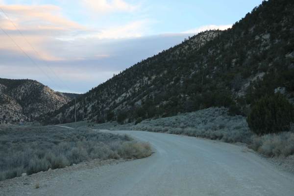
Lake Canyon Road - 10700S
This trail is an easy cruise through the Wilderness Management Area. There are several oil pumpers along this trail as well. The trail passes by Lake Canyon Lake which offers some good fishing. Past the lake, a bit of the trail crosses into National Forest Land, and there are plenty of places to cam...
Learn more about Lake Canyon Road - 10700S
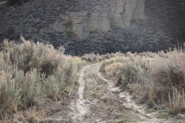
Bear Gulch - FS 10329
This trail is not well-traveled, and it shows. The trail is only one vehicle wide but not particularly difficult. There is one section where the trail has slightly washed away, but it is crossable. The trail does sort of fade away towards the end and becomes harder to follow. The huge benefit of a t...
Learn more about Bear Gulch - FS 10329
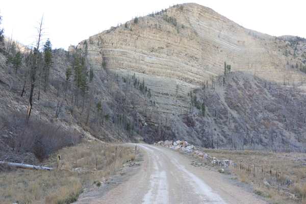
Strawberry River Road
This trail branches off of Timber Canyon Trail and follows along the Strawberry River. It is an easy cruise through some absolutely beautiful scenery. The trail ends at a locked gate where only authorized vehicles are allowed to proceed. There is a beautiful lake at the end as well. Be on the lookou...
Learn more about Strawberry River Road
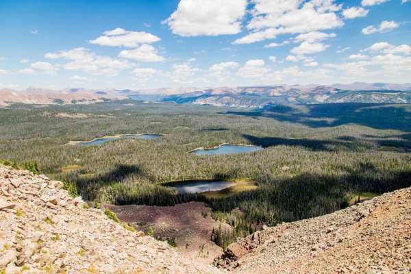
Dry Ridge Road
The Dry Ridge Road is a very pretty and relatively unknown place. The road takes you over 11,400 feet to some of the most spectacular views you can find anywhere, but the ride in can be pretty miserable. It is not particularly difficult, but it is so rocky that even on an ATV it is slow going. The r...
Learn more about Dry Ridge Road
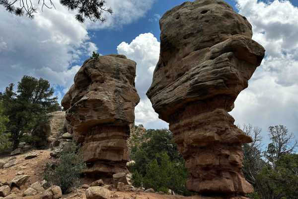
Tabby Mountain Loop
This is a very enjoyable trail above the Tabiona and Hanna Valleys that will take you through multiple ecosystems and incredible views. The trail is occasionally technical with some boulder crawls (nothing that necessitates a spotter) but also gets very tight at times. If you go in a full-size SUV, ...
Learn more about Tabby Mountain Loop
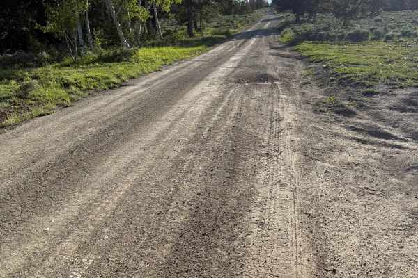
Reservation Ridge - FS 10147
Reservation Ridge is a well-maintained, well-traveled Forest Service road that runs on the borders of the Uinta and Ashley National Forests. Outside of the occasional rut, it is a smooth ride. Nothing your stock Subaru can’t handle. On the east end, there is a large paid campground, first-come, firs...
Learn more about Reservation Ridge - FS 10147
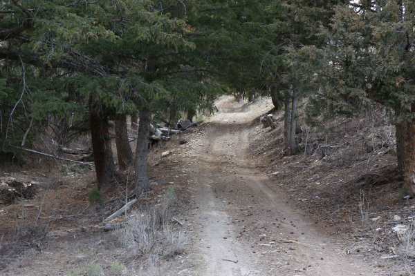
Pine Hollow - FS 10655
This trail may be short on mileage, but it's a technical trail that travels through some beautiful scenery. The trail travels through a section of the mountain that has seen some wildfire, and the burnt trees tell the tale. There are a few sections where the trail is washed out. Travel is possible, ...
Learn more about Pine Hollow - FS 10655
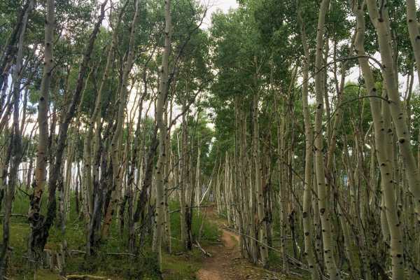
Yellowstone ATV Trail
The Yellowstone ATV Trail is a unique ride in the southern side of the Uinta Mountains. It is located just north of Mountain Home and Altamont, Utah. Much of the trail is restricted to machines 50" wide or less. There is riding you can do on a UTV, but it may not be worth the trip. On ATVs its a lot...
Learn more about Yellowstone ATV Trail
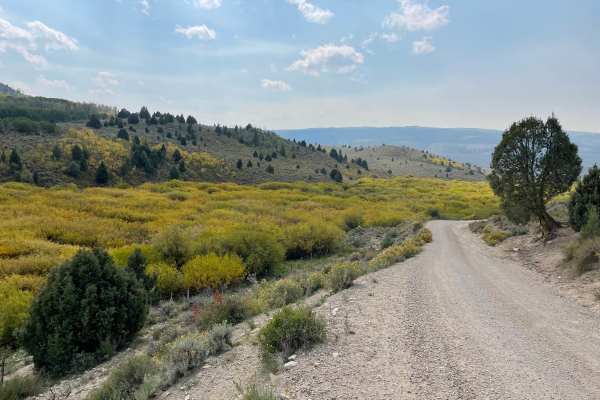
Timber Canyon Trail
Timber Canyon Trail is an easy, highly scenic 18-mile point-to-point route ideal for beginners, families, and seasoned offroaders looking for a relaxing cruise through Utah's stunning high country. Connecting Highway 6 near Soldier Summit to Highway 40 near Duchesne, this dirt and gravel trail serve...
Learn more about Timber Canyon Trail
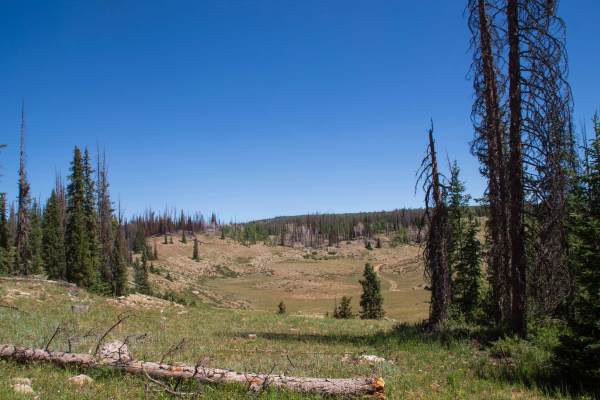
Rhodes Canyon
This trail starts at Highway 35 just outside of Hanna and heads up Rhodes Canyon up into the Soapstone Basin area, where the trail opens up out of the trees and travels through meadows before ending at Soapstone where you can continue onto Soapstone Pass. The majority of this trail is smooth and mai...
Learn more about Rhodes Canyon
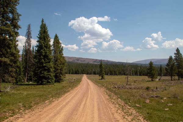
Elkhorn Loop - FS 10117
Elkhorn Loop is a 26-mile point-to-point trail that runs up into the Uintas before turning back and heading down a different canyon and back down and out of the Uintas. This trail is well maintained, with the east half better maintained than the west half. The west half has a few small rocks in the ...
Learn more about Elkhorn Loop - FS 10117
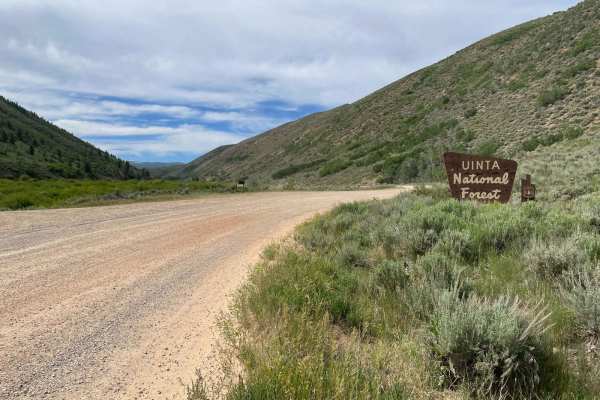
West Side Currant Cr (FR 70471)
Providing access to the Uinta National Forest from Currant Cr Road, West Side Currant Cr (Forest Road 70471) mostly follows the shoreline of the Currant Creek Reservoir. The Currant Creek campground and a boat ramp are on the west end of this road. However, beach and picnic areas can be found alon...
Learn more about West Side Currant Cr (FR 70471)
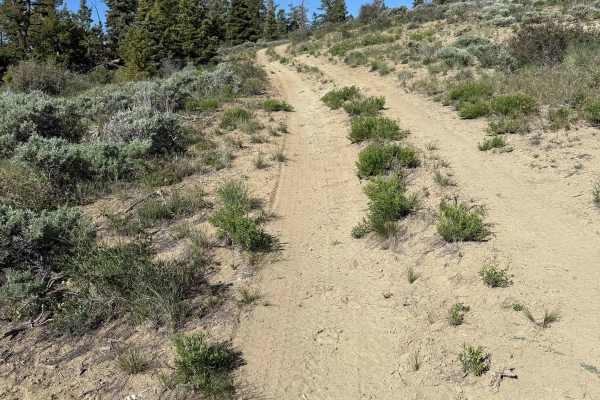
Trail Ridge - FS 10070
Trail Ridge is a very short out-and-back trail that ends at an incredible view of Ashley National Forest. There is space for maybe one tent or car camp at the end. The trail itself is hilly with a few slopes of around 20-24 degrees. There are a few drainage ruts that you straddle on your way. There ...
Learn more about Trail Ridge - FS 10070
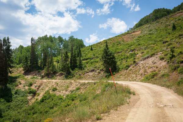
Devil’s Notch - FS 70090
Devil’s Notch (FS 70090) is a nine-mile forest road running southwest to northeast just south of Strawberry Reservoir. On the north end, it connects to Stinking Springs on the southeast shore. The route offers wide views of the reservoir and surrounding mountains while winding through pine and aspen...
Learn more about Devil’s Notch - FS 70090
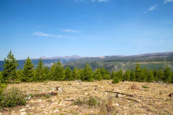
Harmston Overlook
Harmston Overlook is a short out-and-back trail that branches off of Elkhorn Loop and heads West to where it ends at a parking lot right next to a large overlook of the canyon below. This trail is rough as it heads to the overlook, with some small ruts and sections with small rocks throughout. This ...
Learn more about Harmston Overlook
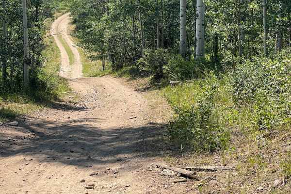
Racetrack (FR 70514)
Racetrack is a short, relatively easy trail that provides access to and connects with a network of other trails in the area. Expect a reasonably easy grade for most of the trail, some rocks, camping at the trail's north end, cattle, and even some wildlife such as deer. Even a gentle flowing brook ...
Learn more about Racetrack (FR 70514)
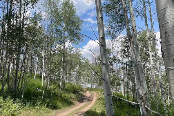
Racetrack Cutoff (FR 70203)
Racetrack Cutoff is a short fun route with a few varying challenges to overcome. There are deep ruts and deep potholes, short and steep inclines with loose rock, and early in the season, or during a wet season, there may be some mud holes to traverse. Overall, the trail is narrow with a few spots ...
Learn more about Racetrack Cutoff (FR 70203)
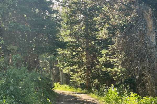
Alvies Bench (FR 70192)
Alvies Bench cuts through a shady aspen and pine forest. There is little camping right off the trail. However, an unnamed spur trail on the east side of Alvies Bench will head north and may have some available primitive camping. At the time of this writing, there is no cell service in the area - e...
Learn more about Alvies Bench (FR 70192)
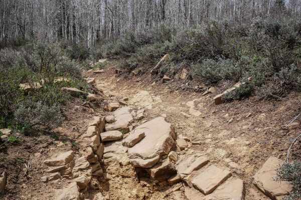
French Hollow #027
French Hollow is a 5.4-mile-long single track that crosses the Willow Creek Single Track in the Uinta National Forest. It's a fun and narrow trail along a small creek through a drainage the whole way. The west end starts through sagebrush in a flat, wide-open valley. It has several big river crossin...
Learn more about French Hollow #027
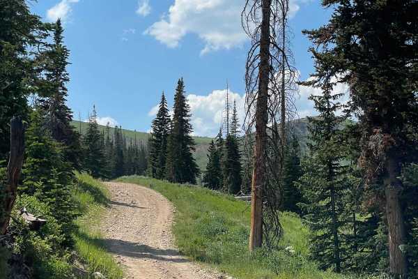
Trout Cr (FR 70084)
Trout Cr goes from navigating valleys in the south to hugging the sides of green alpine mountains. On the southern end of this trail, Trout Creek follows the road but quickly dries out the higher up you go. And the further north you are, the fewer campsites you'll find. Be careful navigating the ...
Learn more about Trout Cr (FR 70084)
ATV trails near Duchesne, Utah
Explore ATV-friendly trails near you. These trails are accessible for vehicles up to 50 inches wide, perfect for ATVs and smaller off-road machines.
Lake Canyon Road - 10700S
This trail is an easy cruise through the Wilderness Management Area. There are several oil pumpers along this trail as well. The trail passes by Lake Canyon Lake which offers some good fishing. Past the lake, a bit of the trail crosses into National Forest Land, and there are plenty of places to cam...
Learn more about Lake Canyon Road - 10700S
Bear Gulch - FS 10329
This trail is not well-traveled, and it shows. The trail is only one vehicle wide but not particularly difficult. There is one section where the trail has slightly washed away, but it is crossable. The trail does sort of fade away towards the end and becomes harder to follow. The huge benefit of a t...
Learn more about Bear Gulch - FS 10329
Strawberry River Road
This trail branches off of Timber Canyon Trail and follows along the Strawberry River. It is an easy cruise through some absolutely beautiful scenery. The trail ends at a locked gate where only authorized vehicles are allowed to proceed. There is a beautiful lake at the end as well. Be on the lookou...
Learn more about Strawberry River Road
Dry Ridge Road
The Dry Ridge Road is a very pretty and relatively unknown place. The road takes you over 11,400 feet to some of the most spectacular views you can find anywhere, but the ride in can be pretty miserable. It is not particularly difficult, but it is so rocky that even on an ATV it is slow going. The r...
Learn more about Dry Ridge Road
UTV/side-by-side trails near Duchesne, Utah
Find UTV and side-by-side trails near you. These trails accommodate vehicles up to 60 inches wide, ideal for UTVs, side-by-sides, and wider off-road rigs.
Lake Canyon Road - 10700S
This trail is an easy cruise through the Wilderness Management Area. There are several oil pumpers along this trail as well. The trail passes by Lake Canyon Lake which offers some good fishing. Past the lake, a bit of the trail crosses into National Forest Land, and there are plenty of places to cam...
Learn more about Lake Canyon Road - 10700S
Bear Gulch - FS 10329
This trail is not well-traveled, and it shows. The trail is only one vehicle wide but not particularly difficult. There is one section where the trail has slightly washed away, but it is crossable. The trail does sort of fade away towards the end and becomes harder to follow. The huge benefit of a t...
Learn more about Bear Gulch - FS 10329
Strawberry River Road
This trail branches off of Timber Canyon Trail and follows along the Strawberry River. It is an easy cruise through some absolutely beautiful scenery. The trail ends at a locked gate where only authorized vehicles are allowed to proceed. There is a beautiful lake at the end as well. Be on the lookou...
Learn more about Strawberry River Road
Dry Ridge Road
The Dry Ridge Road is a very pretty and relatively unknown place. The road takes you over 11,400 feet to some of the most spectacular views you can find anywhere, but the ride in can be pretty miserable. It is not particularly difficult, but it is so rocky that even on an ATV it is slow going. The r...
Learn more about Dry Ridge Road
The onX Offroad Difference
onX Offroad combines trail photos, descriptions, difficulty ratings, width restrictions, seasonality, and more in a user-friendly interface. Available on all devices, with offline access and full compatibility with CarPlay and Android Auto. Discover what you're missing today!
Open Trail Map