
Dirt Bike Trails
Near Dorrington, California
Explore All Dirt Bike Trails Near Dorrington, California
Dirt Bike Trails Near Dorrington, California
Discover the best dirt bike trails near you. Browse trail maps, check difficulty ratings, and find your next adventure — whether you're looking for a quick ride or an all-day expedition.
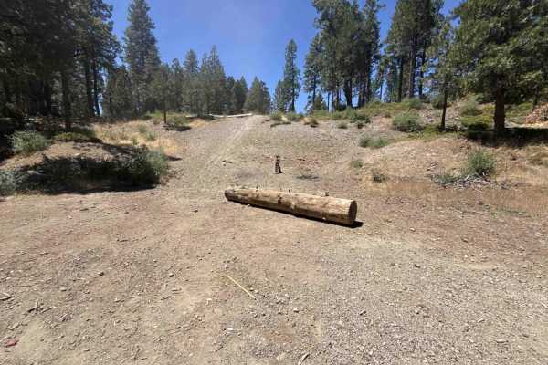
White Pines Lake - FS 7N08
Connecting Summit Level Road to the White Pines Lake recreation basin, Forest Service Road 7N08 serves as a primary forest thoroughfare within the Stanislaus National Forest. The corridor winds through a mixed-conifer woodland defined by towering ponderosa pines, fragrant incense cedars, and sunny t...
Learn more about White Pines Lake - FS 7N08
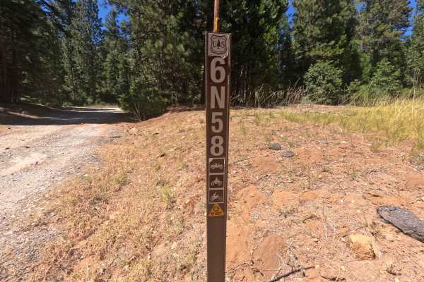
FS 6N58
Forest Service Road 6N58 is an inviting out-and-back spur branching directly off Highway 4 and winding through the scenic Stanislaus National Forest. The route climbs gradually through a dense canopy of towering pines and cedars, intermittently opening up to sweeping views of mountain ridgelines to ...
Learn more about FS 6N58
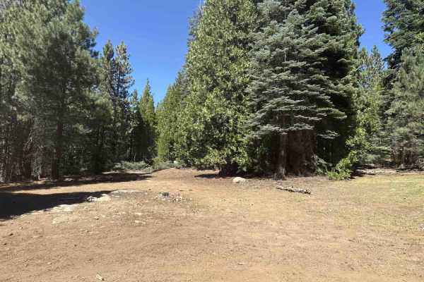
FS 6N11
Connecting from Forest Service Road 6N58 and weaving through the backcountry to an old locked gate near FS 6N69, Forest Service Road 6N11 is an engaging woodland route in the Stanislaus National Forest. The trail traverses an expansive mixed-conifer landscape characterized by tall pine and fir canop...
Learn more about FS 6N11
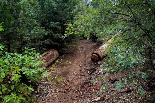
15EV64B
This is a half mile long ATV trail that leaves from the Interface staging area, and accesses more of the trail system. It will likely be the trail that many rider’s start their ride on. It goes through a tight corridor of fir trees and maples, and between scrub oak and manzanita shrubs. It descends ...
Learn more about 15EV64B
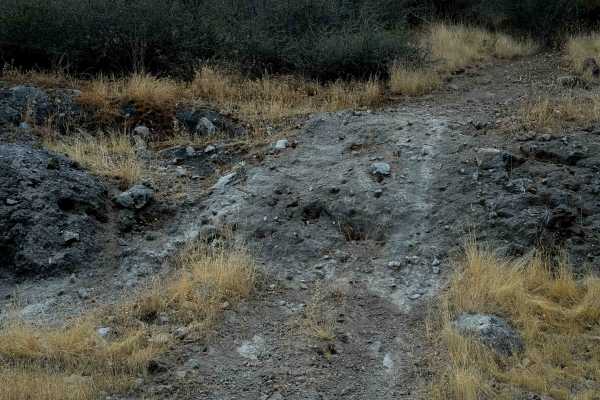
15EV64
15EV64 is about 1 mile long with several technical features. The trail has lots of big loose rocks, deep ruts and steep technical rocky sections. There’s a big rock obstacle that’s a steep and several-foot-tall ledge, plus an extreme hill climb on the east end that goes straight up the hill. It’s so...
Learn more about 15EV64
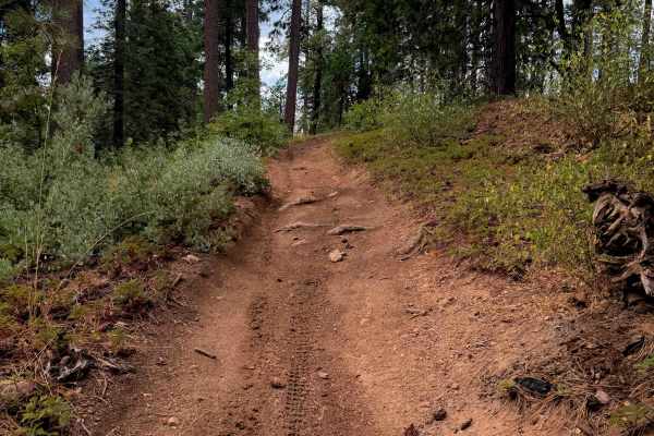
15EV26
15EV26 is a wide dirt ATV trail that starts from the north end with a steep descent into the tall sugar pine trees. There are bits of loose rock in the trail, and a couple narrow spots between logs that have been cut, but no major obstacles. The grade mellows out after the initial descent, and it gr...
Learn more about 15EV26
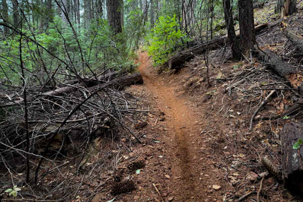
15EV69
15EV69 is a short and moderately easy dirt bike trail that connects the ATV trail 15EV105, to the 4 way intersection with 15EV70, 15EV109, and 15EV68. It weaves through towering trees typical of northern California including ponderosa and sugar pines, and white cedars, on a simple dirt single track ...
Learn more about 15EV69
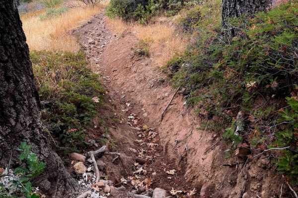
15EV72
This is one of the more difficult dirt bike trails in the Interface Trail System. The entrance from the north end is rutted, with overgrown grass, a few rocks, and embedded root bands across the trail creating small drop-offs. It starts descending down a rutted slope, with lots of loose rock filling...
Learn more about 15EV72
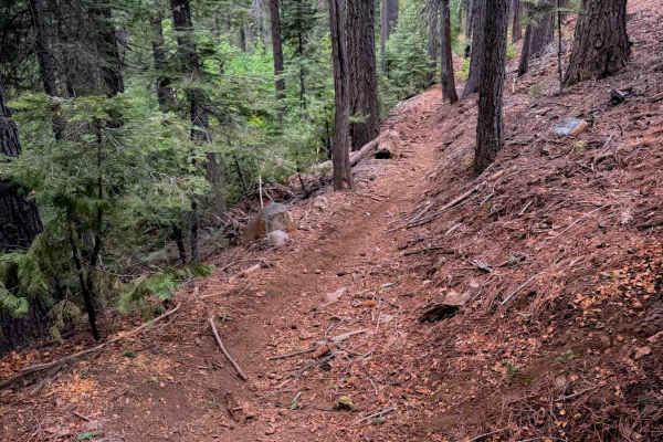
15EV56
This ATV trail starts out on the west end between the bushes, creating a tighter feeling path for ATVs, although still wide for dirt bikes. It winds down through the tall pine trees, cutting across the side of the hill, on a narrower path with big whoops. It goes underneath a canopy of bigleaf maple...
Learn more about 15EV56
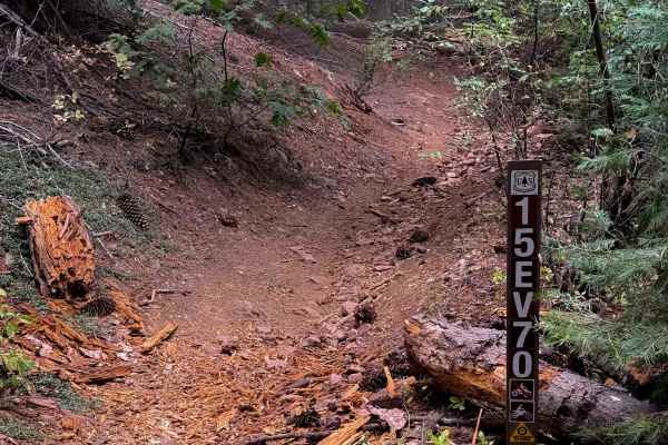
15EV70
This is a quarter-mile-long singletrack connector trail between the 4 way intersection of 15EV69, 15EV109, and 15EV68 on the south end, and the ATV trail 15EV105 on the north end. From south to north, it leaves the O’Neil Creek bottom, and climbs straight up a steep hill with lots of roots and loose...
Learn more about 15EV70
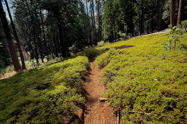
15EV67
This is a short dirt bike trail – less than half a mile long – but easy and ideal for riders of all skill levels. The south end of this trail starts out with some loose rocks on a wide surface, between oak trees and dry grass, going past a big slash pile. The trail is smooth for much of the rest of ...
Learn more about 15EV67
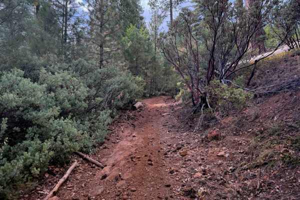
15EV109
This is a short and easy ATV trail that doesn’t have any major obstacles, but is a bit tighter in the trees. From the east end, it goes through a narrow tree corridor tightly lined with fir trees. The trail itself is smooth dirt, with a few shallow ruts and loose sticks and loose rocks, but nothing ...
Learn more about 15EV109
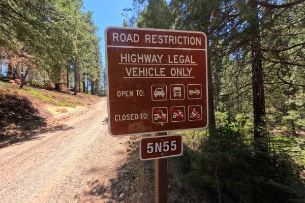
Mandel Rd - FS 5N55
Mandel Road - FS Road 5N55 serves as a smooth connector link bridging Forest Road 5N56 and Forest Road 7N08 near the White Lake area. Set within the Stanislaus National Forest, the corridor travels through a shaded, verdant mixed-conifer woodland framed by towering pines, incense cedars, and lush gr...
Learn more about Mandel Rd - FS 5N55
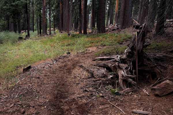
15EV68
15EV68 is a short and easy dirt bike trail that mostly just curves through the forest on a narrow single track on smooth dirt for .7 miles. The trail goes through several previously cut logs, and looks like it gets maintained for any downfall. It goes up and down small hills and meanders through the...
Learn more about 15EV68
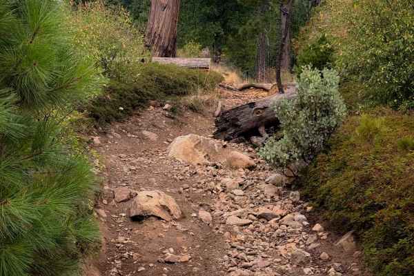
15EV71
15EV71 is a .6 mile long ATV trail, gaining almost 500 feet elevation from south to north. It starts out as a wide dirt path between young pine trees, curving up the hillside. It goes through a lot of previously cut logs, and goes through segments that are more rutted and narrow and covered in a lay...
Learn more about 15EV71
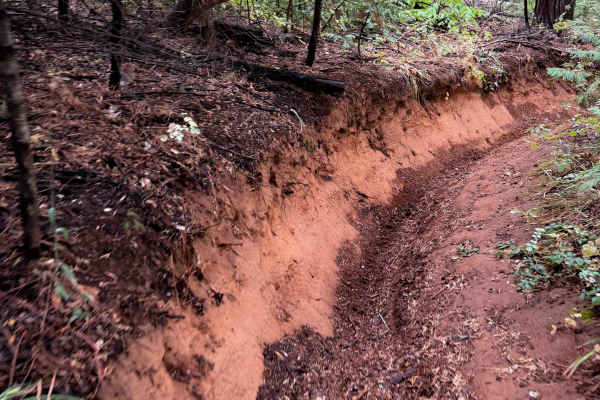
15EV63
This is a short and easy trail in the Interface Trail System that winds through the forest. Its east entrance starts on FS 5N41Y and it zig zags west for 1.2 miles. The beginning has some deeper ruts and troughed out sections, sometimes dug out a foot below the forest floor. There are a few embedded...
Learn more about 15EV63
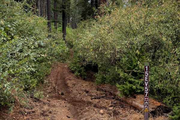
15EV57
This is a 1.2-mile-long easy ATV loop in the northern area of the Interface Trail System. It’s quite narrow for an ATV trail, with a lot of segments between the bushes that feel more like a dirt bike trail. It’s fast and flowy with some big whoops, meandering through flat grassy meadows, and gradual...
Learn more about 15EV57
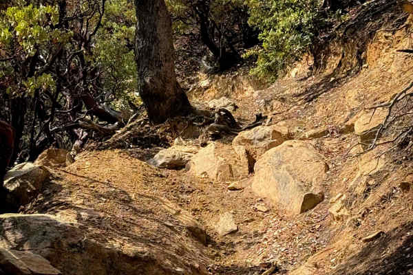
15EV62
This single track starts at the end of 15EV109, and keeps going west for about a half mile. It’s a relatively easy dirt bike trail, but with a few more embedded rock sections that make it somewhat more technical. It’s a narrow trail cut into a shelf and following the curvature of the hillside, with ...
Learn more about 15EV62
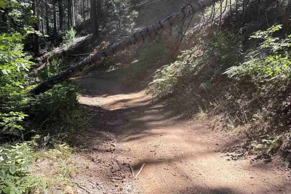
FS 5N41Y
Branching off Forest Service Road 5N52 at the staging area, FS 5N41Y serves as a backcountry connector linking into the surrounding motorized trail network within the Stanislaus National Forest. The route winds through a shaded mixed-conifer woodland characterized by towering pines, fragrant cedars,...
Learn more about FS 5N41Y
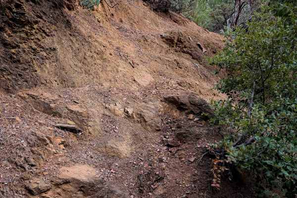
15EV60
This is one of the longer and more difficult trails within the Interface Trail System. The east entrance spurs off of 15EV62, and it starts steeply descending down a deeply rutted path with small loose rocks. Some of the ruts are at least a foot deep, and it side-hills down an exposed hillside lined...
Learn more about 15EV60
ATV trails near Dorrington, California
Explore ATV-friendly trails near you. These trails are accessible for vehicles up to 50 inches wide, perfect for ATVs and smaller off-road machines.
FS 6N58
Forest Service Road 6N58 is an inviting out-and-back spur branching directly off Highway 4 and winding through the scenic Stanislaus National Forest. The route climbs gradually through a dense canopy of towering pines and cedars, intermittently opening up to sweeping views of mountain ridgelines to ...
Learn more about FS 6N58
FS 6N11
Connecting from Forest Service Road 6N58 and weaving through the backcountry to an old locked gate near FS 6N69, Forest Service Road 6N11 is an engaging woodland route in the Stanislaus National Forest. The trail traverses an expansive mixed-conifer landscape characterized by tall pine and fir canop...
Learn more about FS 6N11
15EV64B
This is a half mile long ATV trail that leaves from the Interface staging area, and accesses more of the trail system. It will likely be the trail that many rider’s start their ride on. It goes through a tight corridor of fir trees and maples, and between scrub oak and manzanita shrubs. It descends ...
Learn more about 15EV64B
15EV26
15EV26 is a wide dirt ATV trail that starts from the north end with a steep descent into the tall sugar pine trees. There are bits of loose rock in the trail, and a couple narrow spots between logs that have been cut, but no major obstacles. The grade mellows out after the initial descent, and it gr...
Learn more about 15EV26
UTV/side-by-side trails near Dorrington, California
Find UTV and side-by-side trails near you. These trails accommodate vehicles up to 60 inches wide, ideal for UTVs, side-by-sides, and wider off-road rigs.
FS 6N58
Forest Service Road 6N58 is an inviting out-and-back spur branching directly off Highway 4 and winding through the scenic Stanislaus National Forest. The route climbs gradually through a dense canopy of towering pines and cedars, intermittently opening up to sweeping views of mountain ridgelines to ...
Learn more about FS 6N58
FS 6N11
Connecting from Forest Service Road 6N58 and weaving through the backcountry to an old locked gate near FS 6N69, Forest Service Road 6N11 is an engaging woodland route in the Stanislaus National Forest. The trail traverses an expansive mixed-conifer landscape characterized by tall pine and fir canop...
Learn more about FS 6N11
FS 5N41Y
Branching off Forest Service Road 5N52 at the staging area, FS 5N41Y serves as a backcountry connector linking into the surrounding motorized trail network within the Stanislaus National Forest. The route winds through a shaded mixed-conifer woodland characterized by towering pines, fragrant cedars,...
Learn more about FS 5N41Y
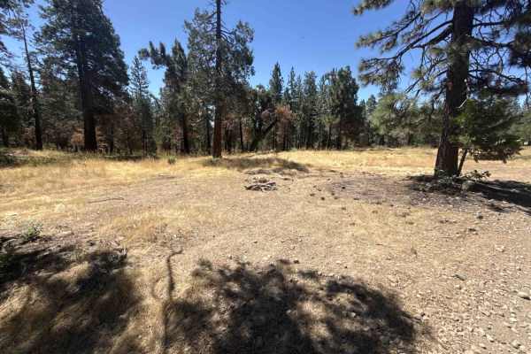
FS 5N52
Forest Service Road 5N52 serves as an essential backcountry connector linking recreational staging areas, camping clearings, and branching motorized routes within the Stanislaus National Forest. The route winds through a mixed-conifer woodland characterized by towering ponderosa pines, mature incens...
Learn more about FS 5N52
The onX Offroad Difference
onX Offroad combines trail photos, descriptions, difficulty ratings, width restrictions, seasonality, and more in a user-friendly interface. Available on all devices, with offline access and full compatibility with CarPlay and Android Auto. Discover what you're missing today!
Open Trail Map