
Dirt Bike Trails
Near Cane Beds, Arizona
Explore All Dirt Bike Trails Near Cane Beds, Arizona
Dirt Bike Trails Near Cane Beds, Arizona
Discover the best dirt bike trails near you. Browse trail maps, check difficulty ratings, and find your next adventure — whether you're looking for a quick ride or an all-day expedition.
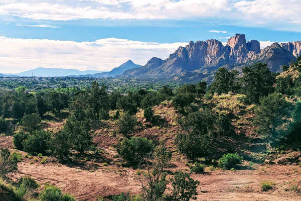
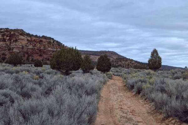
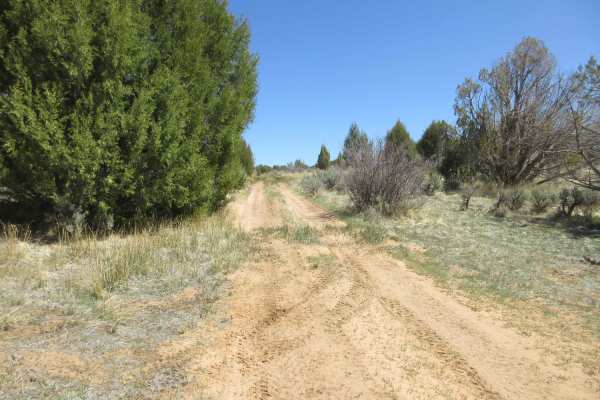
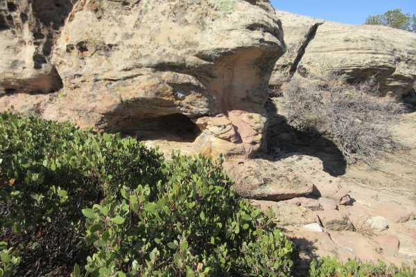
Cottonwood Point
This beautiful trail winds through the trees, and offers wonderful views of the red rock faces of Cottonwood Point above. There are many options throughout this BLM area, ranging from fairly packed dirt to deep loose sand. The area allows you to connect the town of Colorado City to the Coral Pink Sa...
Learn more about Cottonwood Point
BLM M0000-M4186
This red dirt road is a great entry point into a much larger trail system. Starting right off the highway, it's a fun, sandy route with gentle curves and a few small dips. As you work your way in, you'll find numerous side trails branching off, offering plenty of opportunities for further exploratio...
Learn more about BLM M0000-M4186
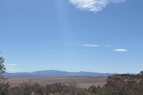
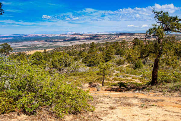
Yellowstone Mesa
Yellowstone Mesa is a remote volcanic mesa located on the Arizona Strip north of the Grand Canyon, within the rugged high-desert landscape between the Uinkaret Mountains and the Toroweap Valley. Formed from ancient lava flows associated with the Uinkaret volcanic field, the mesa rises above surround...
Learn more about Yellowstone Mesa
Lost Spring Mesa BLM 2100
Lost Spring Mesa BLM 2100 is a 16.3-mile (one-way) out-and-back trail across the mesa to Lost Spring Mountain at 5,700 feet. This is a 3 of 10 rated dirt and rock trail that consists of flat plains dirt track and a single wide rocky shelf road climb to the top of the mesa, with a sand and dirt flat ...
Learn more about Lost Spring Mesa BLM 2100
Rose Canyon - BLM M4156
Rose Canyon (also known as Rosy Canyon) is a destination trail located along the northernmost border of Arizona, in Mohave County. BLM M4156- Rose Canyon is a 1.9-mile point-to-point sand and dirt trail rated 3 of 10. This dirt trail runs along the edge of BLM managed land between two points on the ...
Learn more about Rose Canyon - BLM M4156
BLM M4187
This scenic BLM trail in Arizona offers a fun and sandy loop with ever-changing terrain. Expect soft sections that can challenge traction, plus a few banked corners that add to the ride. Along the way, you'll pass through two gates- be sure to close them if they are found open- and may encounter gra...
Learn more about BLM M4187
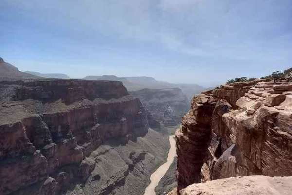
County Highway 5
This trail is class 2 sand, dirt, and gravel trail traveling south from Colorado City, AZ to Grand Canyon, Toroweap Overlook. A two-dollar permit is required to enter the last six miles of the trail. The last six miles will be a class 3. Tuweep campground is at the end of the trail with ten primitiv...
Learn more about County Highway 5
Dinosaur Tracks Loop
This is a fun excursion that will depart from the Elephant Cove Trailhead near Coral Pink Sand Dunes State Park. It starts with a short climb up a slick rock face. From there you will follow some very sandy trails with two relatively steep, deep sand drops that will add a little spice to the adventu...
Learn more about Dinosaur Tracks Loop
Elephant Gap - Poverty Gulch Overlook
This is a sandy but somewhat easy trail with great views of the surrounding area. You will see mountains, rocky valleys, and large areas of sand-based flats. There are also interesting small areas with grass and a nearby spring. If you want a ride to get to know your vehicle or to train a newer driv...
Learn more about Elephant Gap - Poverty Gulch Overlook
BLM 15
Marked clearly at its southern entrance by a weathered brown Carsonite Forest Service post indicating the junction with BLM 20, BLM 15 is a highly enjoyable, 2.3-mile point-to-point connector trail. This beautifully scenic backcountry route offers off-road explorers a wonderfully fun, distinctly twi...
Learn more about BLM 15
Little Creek
This trail is a back way from Apple Valley to the Lost Spring lookout area. It will pass through the desert and then begin the climb up the mesa, passing white rocks and beautiful scenery. The trail up the switchbacks is steep and, depending on trail conditions, can be challenging. The rest of the ...
Learn more about Little Creek
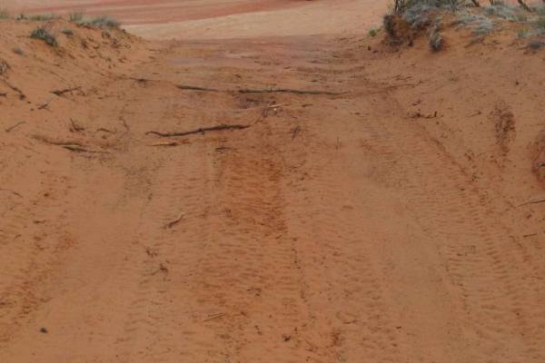
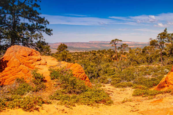
BLM 33
BLM 33 is a highly rewarding, 3.2-mile out-and-back backcountry two-track that seamlessly escorts explorers through a beautifully vibrant high-desert landscape. The distinctly soft, vivid red sand path playfully meanders past an old, rustic wooden fence line before safely winding its way through a c...
Learn more about BLM 33
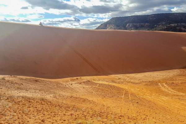
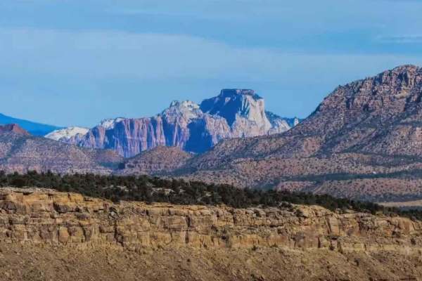
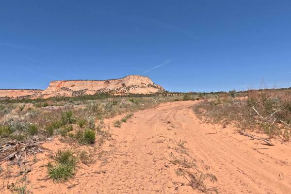
Coral Pink Sand Dunes
Coral Pink is a nice state park in far southern Utah, close to the Arizona border. There is camping available at or around the dunes or hotels located in Kanab. These dunes are open to OHV vehicles and hiking. There are sections of the dunes closed to vehicles, so please obey these laws as it is par...
Learn more about Coral Pink Sand Dunes
Upper Barracks Trail-BLM20
Upper Barracks Trail-BLM20 is an 8.6 miles section of the Barracks Trail which goes from the vicinity of the Coral Pink Sand Dunes State Park to Mt. Carmel Junction (Hwy 89). The Upper Barracks Trail-BLM20 is the middle of three sections that make up the entire Barracks Trail. This trail is typicall...
Learn more about Upper Barracks Trail-BLM20
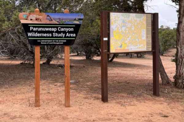
Harris Mountain-BLM28-KC1400
Harris Mountain-BLM28-KC1400 is a 4.4-mile point-to-point trail within the Parunuweap Canyon Wilderness Study Area rated 3 out of 10 due to the potential for deep sand. Whether traveling east or west on this trail, it will rise to the midpoint which is Harris Mountain. Along the way, there are vista...
Learn more about Harris Mountain-BLM28-KC1400
The Smithsonian Butte Backcountry Byway
The Smithsonian Butte Backcountry Byway is a main artery connecting Highway 59 to a local Rockville street. This street will take you to Route 9 which leads to the west entrance to Zion National Park. For those coming from the east on 59, this will cut almost an hour off your trip to Zion. A couple ...
Learn more about The Smithsonian Butte Backcountry Byway
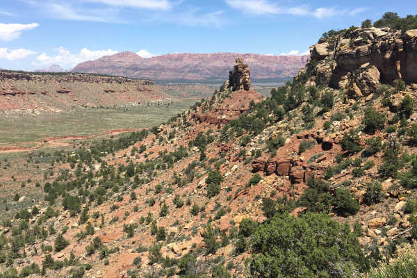
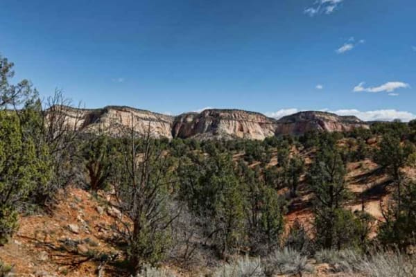
Little Creek Mesa
Little Creek Mesa is a hidden gem for anyone looking for fantastic views, widely varying terrain, history or something for the entire family. There are large areas of flat, slick rock that people use for biking, numerous areas with historic pit houses and other remnants from the early culture and pe...
Learn more about Little Creek Mesa
Water Canyon-Hell Dive Canyon Road (BLM052)
Water Canyon-Hell Dive Canyon Road-BLM052 is a 1.9-mile sand and slick rock trail with steep descents and climbs through several washes and is rated 4 of 10. This short but moderately difficult trail provides a shortcut to the Hell Dive Pictograph site at the end of BLM051. Recent storms have caused...
Learn more about Water Canyon-Hell Dive Canyon Road (BLM052)
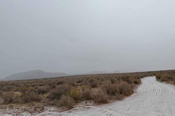
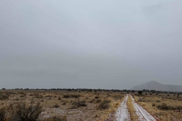
County Hwy 109/Mt. Trumbull Road
The road sign says Antelope Valley. It is a wide dirt, gravel, and sand trail that is rated at class 2. The trail is five miles east of Pipe Springs, AZ, and the South side of Highway 389 in AZ. The trail winds down south towards the Toroweap Ranger Station in The Grand Canyon National Park. There i...
Learn more about County Hwy 109/Mt. Trumbull Road
Sand/Lamb Point Loop Road (BLM05)
Sand/Lamb Point Loop Road-BLM051 is an 8.4-mile sand and slick rock trail rated 4 of 10. The last 2.2-miles of this trail which remains BLM052 is also known as Hell Dive Canyon Trail. This trail leads to a short destination hike to observe ancient native pictographs. The Hell Dive Canyon Pictographs...
Learn more about Sand/Lamb Point Loop Road (BLM05)
ATV trails near Cane Beds, Arizona
Explore ATV-friendly trails near you. These trails are accessible for vehicles up to 50 inches wide, perfect for ATVs and smaller off-road machines.
Cottonwood Point
This beautiful trail winds through the trees, and offers wonderful views of the red rock faces of Cottonwood Point above. There are many options throughout this BLM area, ranging from fairly packed dirt to deep loose sand. The area allows you to connect the town of Colorado City to the Coral Pink Sa...
Learn more about Cottonwood Point
BLM M0000-M4186
This red dirt road is a great entry point into a much larger trail system. Starting right off the highway, it's a fun, sandy route with gentle curves and a few small dips. As you work your way in, you'll find numerous side trails branching off, offering plenty of opportunities for further exploratio...
Learn more about BLM M0000-M4186
Yellowstone Mesa
Yellowstone Mesa is a remote volcanic mesa located on the Arizona Strip north of the Grand Canyon, within the rugged high-desert landscape between the Uinkaret Mountains and the Toroweap Valley. Formed from ancient lava flows associated with the Uinkaret volcanic field, the mesa rises above surround...
Learn more about Yellowstone Mesa
Lost Spring Mesa BLM 2100
Lost Spring Mesa BLM 2100 is a 16.3-mile (one-way) out-and-back trail across the mesa to Lost Spring Mountain at 5,700 feet. This is a 3 of 10 rated dirt and rock trail that consists of flat plains dirt track and a single wide rocky shelf road climb to the top of the mesa, with a sand and dirt flat ...
Learn more about Lost Spring Mesa BLM 2100
UTV/side-by-side trails near Cane Beds, Arizona
Find UTV and side-by-side trails near you. These trails accommodate vehicles up to 60 inches wide, ideal for UTVs, side-by-sides, and wider off-road rigs.
Cottonwood Point
This beautiful trail winds through the trees, and offers wonderful views of the red rock faces of Cottonwood Point above. There are many options throughout this BLM area, ranging from fairly packed dirt to deep loose sand. The area allows you to connect the town of Colorado City to the Coral Pink Sa...
Learn more about Cottonwood Point
BLM M0000-M4186
This red dirt road is a great entry point into a much larger trail system. Starting right off the highway, it's a fun, sandy route with gentle curves and a few small dips. As you work your way in, you'll find numerous side trails branching off, offering plenty of opportunities for further exploratio...
Learn more about BLM M0000-M4186
Yellowstone Mesa
Yellowstone Mesa is a remote volcanic mesa located on the Arizona Strip north of the Grand Canyon, within the rugged high-desert landscape between the Uinkaret Mountains and the Toroweap Valley. Formed from ancient lava flows associated with the Uinkaret volcanic field, the mesa rises above surround...
Learn more about Yellowstone Mesa
Lost Spring Mesa BLM 2100
Lost Spring Mesa BLM 2100 is a 16.3-mile (one-way) out-and-back trail across the mesa to Lost Spring Mountain at 5,700 feet. This is a 3 of 10 rated dirt and rock trail that consists of flat plains dirt track and a single wide rocky shelf road climb to the top of the mesa, with a sand and dirt flat ...
Learn more about Lost Spring Mesa BLM 2100
The onX Offroad Difference
onX Offroad combines trail photos, descriptions, difficulty ratings, width restrictions, seasonality, and more in a user-friendly interface. Available on all devices, with offline access and full compatibility with CarPlay and Android Auto. Discover what you're missing today!
Open Trail Map