
Dirt Bike Trails
Near California City, California
Explore All Dirt Bike Trails Near California City, California
Dirt Bike Trails Near California City, California
Discover the best dirt bike trails near you. Browse trail maps, check difficulty ratings, and find your next adventure — whether you're looking for a quick ride or an all-day expedition.
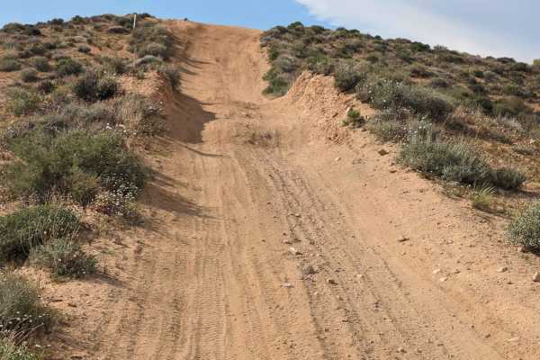
SC176 Gold Canyon Road
This 6-mile sandy road starts at Jawbone Canyon Road. It travels north through sandy washes. Off-camber, deep sand, and ruts are the main obstacles. Then it is a steep climb on an uneven and winding trail to the top. At that point, SC176 continues to the northeast. There is also a split-off to the ...
Learn more about SC176 Gold Canyon Road
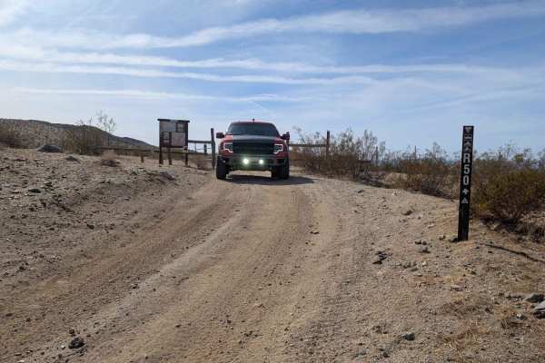
R50
This is a long, meandering trail along the base of the Rand Mountains on the Garlock side. There are a lot of loose rocks, some sand washes, and a few larger ruts. Watch for flash floods, the washes can fill up fast in thunderstorms. The cell signal is weak.
Learn more about R50
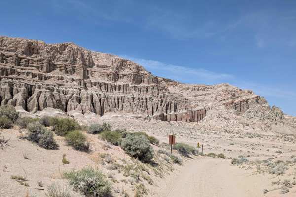
Tuft Point Road
Starting off Highway 14 within Red Rock Canyon State Park's restricted area, requiring staying on established trails, this sand and pumice route immediately starts climbing a sandy hill from the start. Surrounded by hills, desert brush, and Joshua trees throughout the journey. Part of the trail pass...
Learn more about Tuft Point Road
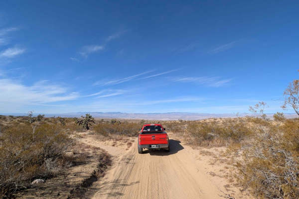
R43 Willis Well Road
This trail connects Redrock Randsburg Road to Randsburg Mojave Road by going over the Rand mountain range. There is cell coverage throughout most of the trail, may get a drop put or 2 in the mountain. There are very deep UTV ruts and "Razor chop". Any high clearance vehicle should be able to make it...
Learn more about R43 Willis Well Road
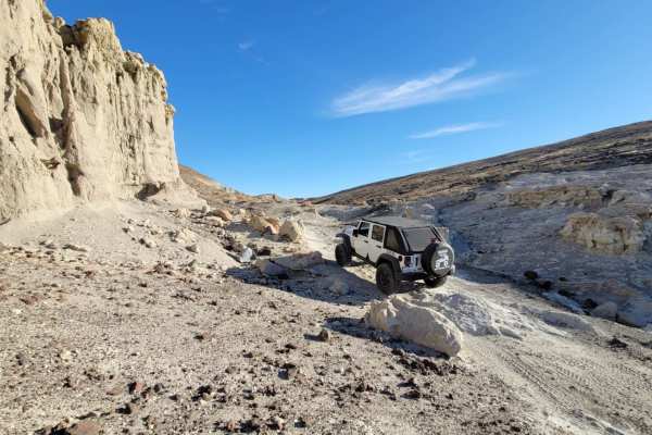
Black Rock Canyon Trail
Black Rock Canyon is a moderate trail that starts off on soft sand and quickly becomes a compact dirt trail with rocks. You are welcomed with gorgeous vistas of the red rock cliffs and even drive right beside volcanic rocks that you can explore. As you reach the middle of the trail, your view opens ...
Learn more about Black Rock Canyon Trail
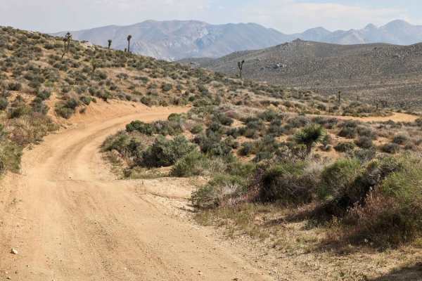
SC251 Jawbone Road to Gold Canyon Road
This 4-mile trail is primarily sandy. It's just wide enough for one vehicle and drops almost 1,200 feet. Consider low gear at times to save your brakes. A 4x4 with high clearance is recommended;a trailer is not. The obstacles include various off-camber sections, a few washed-out edges (due to rain r...
Learn more about SC251 Jawbone Road to Gold Canyon Road
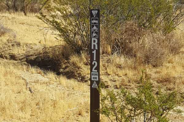
R22
This is an easy, scenic point-to-point trail on the east side of the Rand Mountains. The trail surface is primarily packed dirt and generally flat with occasional small embedded rocks. There are also shallow ruts in places, but 2WD vehicles with moderate clearance should be able to complete it witho...
Learn more about R22
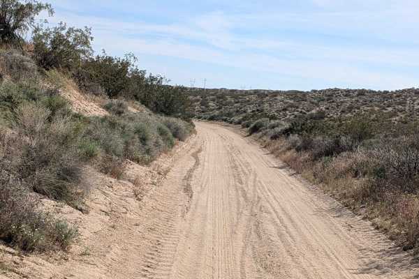
BLM SC94
This sandy route alternating between packed and loose sand winds through the Dove Springs OHV area as one of the main trails accessing other unnamed trails in the region. High traffic area demands watching for other vehicles constantly given the heavy use. The trail serves as an arterial connector t...
Learn more about BLM SC94
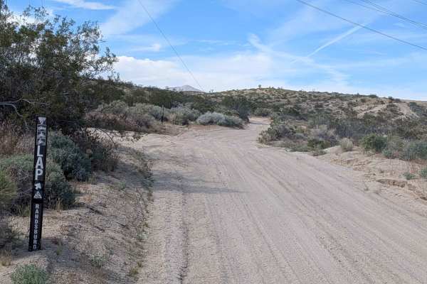
BLM LAP Dove Springs OHV
This route alternates between hard-packed and loose sand while winding up and down through hills, following large power lines for reliable navigation reference. At times, it runs along a shelf road perched high above canyons below, creating dramatic exposure. Ruts, off-camber sections, and whoop sec...
Learn more about BLM LAP Dove Springs OHV
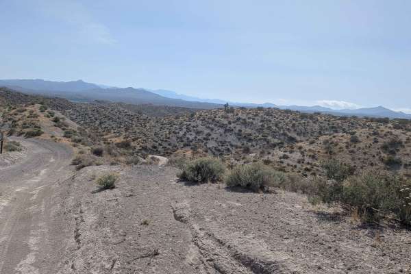
Opal Trail
This sandy trail starting off Opal Canyon Road can feature deeper sand at times, where airing down, great tires, and four wheel drive become highly recommended. Climbing almost 300 feet in just under 2 miles creates sustained grades offering nice views of the Eastern Sierras at higher elevations. Th...
Learn more about Opal Trail
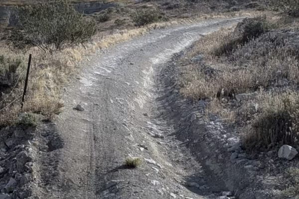
Joshua East
Joshua East Trail immediately starts up a hill from the north, climbing over 430 feet in just under 2 miles. The trail meanders through a series of small, rather beautiful hills, with a surface made up of loose pumice-like sand with some loose and embedded rocks. As you climb out of the small canyon...
Learn more about Joshua East
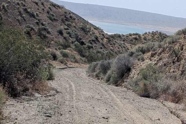
El Paseo Road
El Paseo Road trail climbs almost 400 feet and drops over 1700 feet in just over 5 miles. It is arguably one of the most beautiful trails in the state park, offering stunning views of colorful rock formations, valleys, and the Eastern Sierras and Red Rocks Canyon State Park Mountains. A few sections...
Learn more about El Paseo Road
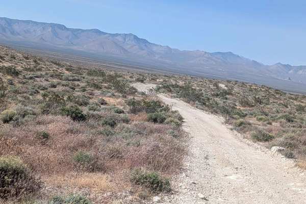
Roaring Ridge Road
The Roaring Ridge Road trail starts off Opal Trail, climbing 270 feet and dropping 115 feet over just under 2.5 miles. The terrain is primarily hard-packed pumice and fine sand with some embedded rocks, and is lined with small desert brush and grasses. Drivers can enjoy views of the Eastern Sierra m...
Learn more about Roaring Ridge Road
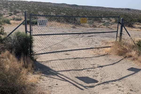
Josuha West
Joshua West Trail is located just off Highway 14, across from the Springs OHV area, and is part of the Red Rocks Canyon State Park. OHVs must have a green sticker and adhere to other requirements, and users should ensure they close the gate after entering. Starting parallel to Highway 14, the trail ...
Learn more about Josuha West
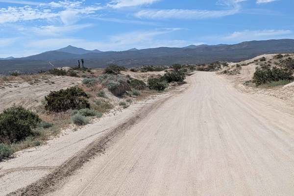
McIvers South Trailhead
Starting on Highway 14 as one of the main entrances to Dove Springs OHV Open Riding Area, this route transitions from hard pack dirt and gravel to sand as you progress. The 15 mph speed limit controls traffic flow on this very busy road, especially on weekends when you need to watch for traffic comi...
Learn more about McIvers South Trailhead
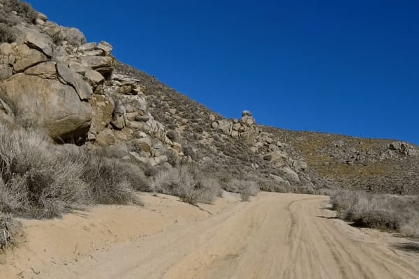
Alphie Springs Wash
This is a fun winding trail that starts right off of SC173 and quickly drops down into a soft wide sand wash. The trail narrows with a tight s-turn between large boulders then opens up into a double-wide trail that winds past the Yucca trees. After a few miles it dead ends into SC103, a left turn he...
Learn more about Alphie Springs Wash
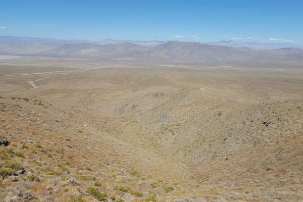
Trail 53
This single-track trail, which is restricted to dirt bike use only, climbs/descends about 850 ft in 0.9 miles. The trail is comprised of loose soil and shale with occasional larger embedded rocks as it follows a ridgeline down from the top of the Rand Mountains to the valley floor. There are a coupl...
Learn more about Trail 53
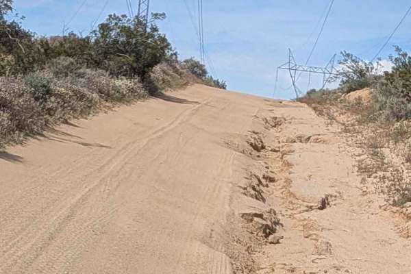
BLM LAP Indian Wells Canyon
This 1.5 vehicle-wide route combines hard-packed and loose sand while following dual power lines for navigation reference. Red Rock Canyon State Park Mountains rise to your east while the Eastern Sierra Mountains tower to your west, creating dramatic corridor scenery. The trail winds up and down var...
Learn more about BLM LAP Indian Wells Canyon
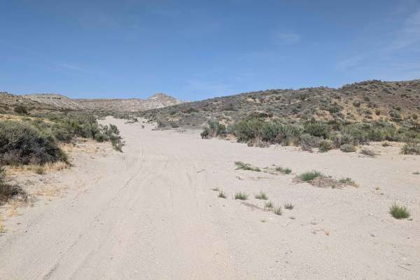
Opal Canyon
Opal Canyon Road trail offers a unique desert run within the scenic Red Rock Canyon State Park. This route is a fine sand trail, generally about one vehicle wide. It begins just off Sierra View Road near Highway 14 and makes its way south toward Ransburg, traversing a desert area full of lots of bru...
Learn more about Opal Canyon
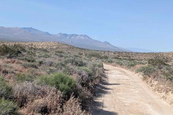
Roaring Ridge Cut Off
Roaring Ridge Cut Off is a great trail to get you back from the Roaring Ridge Trail to Red Rock InyoKern Road. The trail surface is composed of hard-packed pumice embedded with rock as well as soft sand, and it is seasonally graded. The route is lined with a mix of desert bushes, including creosote ...
Learn more about Roaring Ridge Cut Off
ATV trails near California City, California
Explore ATV-friendly trails near you. These trails are accessible for vehicles up to 50 inches wide, perfect for ATVs and smaller off-road machines.
R50
This is a long, meandering trail along the base of the Rand Mountains on the Garlock side. There are a lot of loose rocks, some sand washes, and a few larger ruts. Watch for flash floods, the washes can fill up fast in thunderstorms. The cell signal is weak.
Learn more about R50
Tuft Point Road
Starting off Highway 14 within Red Rock Canyon State Park's restricted area, requiring staying on established trails, this sand and pumice route immediately starts climbing a sandy hill from the start. Surrounded by hills, desert brush, and Joshua trees throughout the journey. Part of the trail pass...
Learn more about Tuft Point Road
R43 Willis Well Road
This trail connects Redrock Randsburg Road to Randsburg Mojave Road by going over the Rand mountain range. There is cell coverage throughout most of the trail, may get a drop put or 2 in the mountain. There are very deep UTV ruts and "Razor chop". Any high clearance vehicle should be able to make it...
Learn more about R43 Willis Well Road
R22
This is an easy, scenic point-to-point trail on the east side of the Rand Mountains. The trail surface is primarily packed dirt and generally flat with occasional small embedded rocks. There are also shallow ruts in places, but 2WD vehicles with moderate clearance should be able to complete it witho...
Learn more about R22
UTV/side-by-side trails near California City, California
Find UTV and side-by-side trails near you. These trails accommodate vehicles up to 60 inches wide, ideal for UTVs, side-by-sides, and wider off-road rigs.
R50
This is a long, meandering trail along the base of the Rand Mountains on the Garlock side. There are a lot of loose rocks, some sand washes, and a few larger ruts. Watch for flash floods, the washes can fill up fast in thunderstorms. The cell signal is weak.
Learn more about R50
Tuft Point Road
Starting off Highway 14 within Red Rock Canyon State Park's restricted area, requiring staying on established trails, this sand and pumice route immediately starts climbing a sandy hill from the start. Surrounded by hills, desert brush, and Joshua trees throughout the journey. Part of the trail pass...
Learn more about Tuft Point Road
R43 Willis Well Road
This trail connects Redrock Randsburg Road to Randsburg Mojave Road by going over the Rand mountain range. There is cell coverage throughout most of the trail, may get a drop put or 2 in the mountain. There are very deep UTV ruts and "Razor chop". Any high clearance vehicle should be able to make it...
Learn more about R43 Willis Well Road
R22
This is an easy, scenic point-to-point trail on the east side of the Rand Mountains. The trail surface is primarily packed dirt and generally flat with occasional small embedded rocks. There are also shallow ruts in places, but 2WD vehicles with moderate clearance should be able to complete it witho...
Learn more about R22
The onX Offroad Difference
onX Offroad combines trail photos, descriptions, difficulty ratings, width restrictions, seasonality, and more in a user-friendly interface. Available on all devices, with offline access and full compatibility with CarPlay and Android Auto. Discover what you're missing today!
Open Trail Map