
Dirt Bike Trails
Near Alma, Colorado
Explore All Dirt Bike Trails Near Alma, Colorado
Dirt Bike Trails Near Alma, Colorado
Discover the best dirt bike trails near you. Browse trail maps, check difficulty ratings, and find your next adventure — whether you're looking for a quick ride or an all-day expedition.
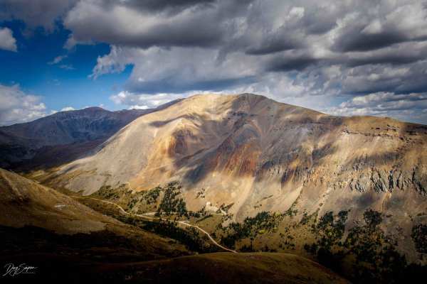
Loveland Road - FS 192/450
Starting from the Buckskin Road side is easy but will require 4-wheel drive. The road travels up through Pine Forest where the road is gravel turning into a more rocky road as you reach timberline, with a few steeper sections with loose rock. You can also reach Loveland Road from the Mosquito Pass R...
Learn more about Loveland Road - FS 192/450
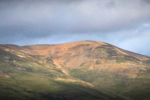
Switchback/ Privateer Road
As per the name, the first part of the trail is a series of switchbacks as you climb up the side of Mount Bross. As you reach the upper part the road turns into a shelf road. This trail is a great companion route to the Dolly Varden trail. Go up one trail and go down the other. This route is also go...
Learn more about Switchback/ Privateer Road
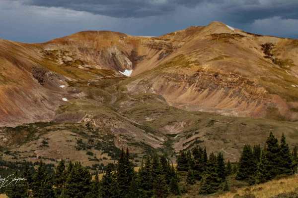
Mt. Lincoln Road
The start of the trail is through private land. Once you come out of private land, about 0.5 miles, there is a rutted section then a rock obstacle. After that, the trail steadily climbs towards the top, with a lot of loose rock. About 0.25 miles from the top, the road turns into a shelf road, and at...
Learn more about Mt. Lincoln Road
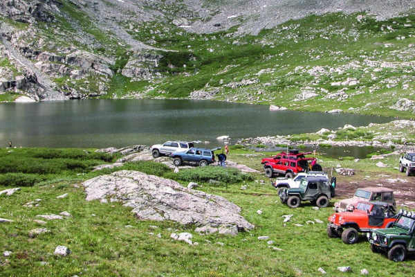
Wheeler Lake
Be sure to bring your camera on this beautiful climb through a valley and to an alpine lake with a waterfall. Enjoy the wildflowers and some great fishing. This trail will also take you directly under Magnolia Mill.
Learn more about Wheeler Lake
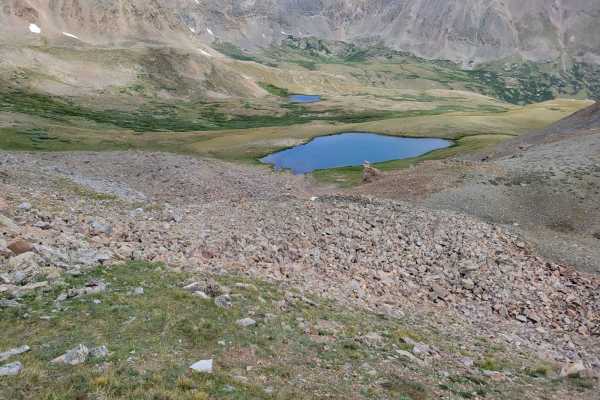
Oliver Twist Lake
Trail is an offshoot of the popular Mosquito Pass trail. It takes you past Oliver Twist Lake. It's a natural glacier lake that you can actually catch some trout at if you're lucky. The trail can definitely hold snow late into the year, most likely will be covered in snow until June. The trail itself...
Learn more about Oliver Twist Lake
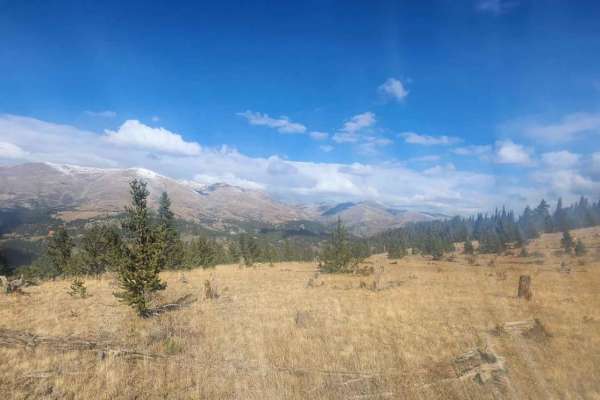
West Beaver Creek Road
A gentle but scenic maintained dirt/gravel road underneath Mount Silver Heels ending just before the Iron Mine across Beaver Creek. There are spectacular views of Quandary to the West and Silverheels to the East. Along the way are several historic cabins as well as the remnants of a mining dredge, c...
Learn more about West Beaver Creek Road
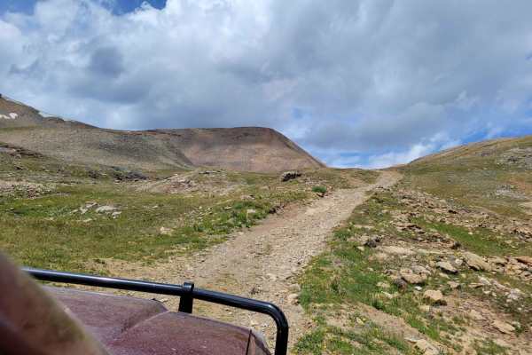
Baltic Mine Trail
This is an easy offshoot of the popular Mosquito Pass Trail. It takes you up to an old mine up on the hill. Make sure to mind the old mine equipment. There's also a small glacier pond near the top. No fish can be found in this pond, but it's fun to check out. Up on the hill, you can also spot an old...
Learn more about Baltic Mine Trail
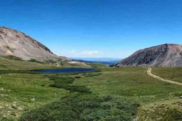
South Mosquito Road FS 696
South Mosquito Road is the other route below Mosquito Pass to the London Mine, versus the New London Mine on the better-known Mosquito Pass. Numerous other named mines are in the basin. The road is open only one day per year (the last Sunday in July) for spectators to view the Fairplay Burro Days ...
Learn more about South Mosquito Road FS 696
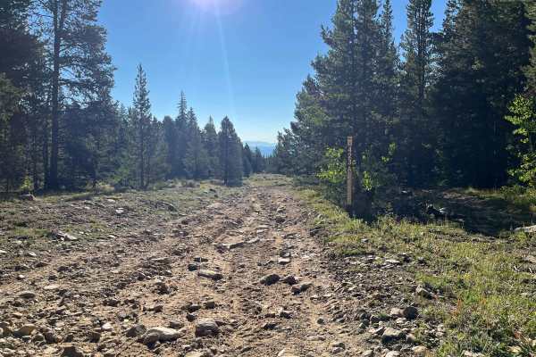
Dog Hair Road
This short, low-traffic route provides an easy entry into the National Forest with minimal elevation change. A parking and meeting area sits at the eastern end, making access convenient. The trail is mostly smooth dirt with a few rough sections of exposed rock, but nothing difficult. Along the way, ...
Learn more about Dog Hair Road
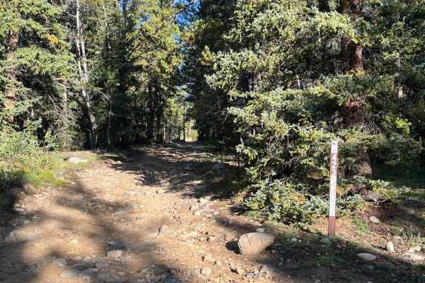
Thompson Park Road
This out-and-back route runs mostly through forest and can develop washouts after heavy rain. Campsites are available in a few spots, but are limited. Near the end, the trail sees little use, and vegetation may brush against the sides of standard vehicles. The route finishes at a locked gate, visibl...
Learn more about Thompson Park Road
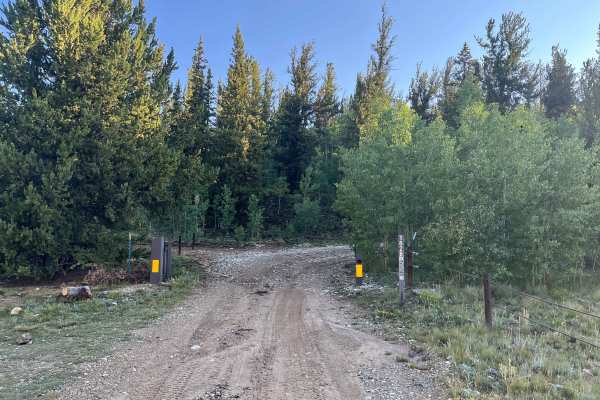
Horseshoe Road
This short connector trail has gentle elevation changes and is lined with aspen on the western end, making it especially scenic in the fall. A few shallow mud holes are present in autumn, but can hold more water during spring snowmelt. Campsites are available at a couple spots along the route.
Learn more about Horseshoe Road
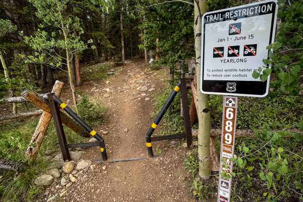
Almgren Trail #689
Almgren is a 1.7-mile-long trail within the Sheep Mountain trail network near Fairplay, Colorado. The north end of the trail starts from the Horseshoe Campground at a pinch point. The majority of the route is a wider trail through pine trees with small embedded rocks and roots, but it remains pretty...
Learn more about Almgren Trail #689
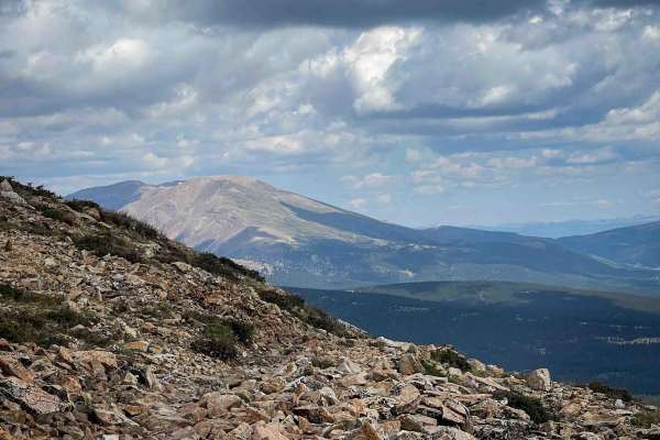
Sheep Mountain Trail #691
This is a really great singletrack near Fairplay, Colorado, that is 4.8 miles through the Pike National Forest. The north end starts off of the Almgren Trail, south of the Horseshoe Campground. It winds into the forest on a singletrack with embedded rocks and roots, and climbs up to high elevation t...
Learn more about Sheep Mountain Trail #691
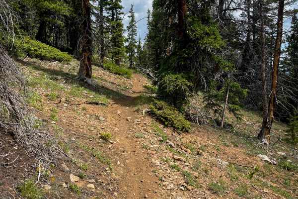
Sheep Mountain Interconnect Trail #740
This is a 2.1-mile-long single track through the Pike National Forest that mostly gradually descends from north to south off of the Sheep Mountain Trail down to the Almgren Trail. It’s a bit shelfy on the north end with mild exposure as it drops down the mountain, and continues on a narrow single tr...
Learn more about Sheep Mountain Interconnect Trail #740
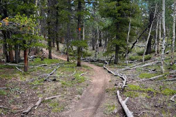
Louie’s Loop #660
Louie’s Loop is very similar to Almgren and the Sheep Mountain Interconnect trail, being a moderately easy forested single track with small loose and embedded rocks, but no major obstacles. It has small roots and sticks in the trail, and goes through tall, skinny lodgepole pine. It’s mostly a gradua...
Learn more about Louie’s Loop #660

Peerless Mine
Peerless Mine is a scenic and highly accessible off-road route near Fairplay, Colorado, ideal for off-roaders looking for high-alpine views and historic mining remains. Starting just south of Fairplay off US Highway 285, the route begins on Fourmile Creek Road (County Road 18), a wide, graded county...
Learn more about Peerless Mine

#178
This is a 1.2-mile-long easy dirt bike trail in the Sheep Mountain trail system near Fairplay, Colorado. It starts and ends off of Forest Road 178, and creates a fun loop with Louie’s Loop and Almgren Trail, ideal for newer riders. It’s mostly an easy single track, with a smooth dirt surface with sm...
Learn more about #178
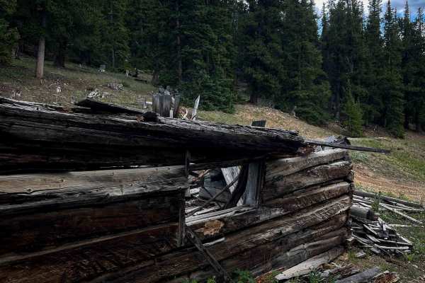
Browns Pass Trail #739
This is a 0.7-mile-long single track at the south end of Sheep Mountain Trail, starting off of Browns & Breakneck Road at a pinch point. It’s mostly dirt, intermittently covered in small rocks and roots, as it winds through the pine forest. The trail weaves tightly through the trees, but remains pre...
Learn more about Browns Pass Trail #739
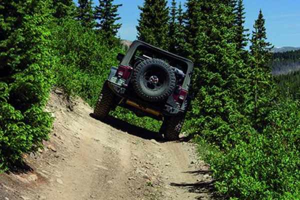
Birdseye Gulch
Birdseye Gulch is a side trip of Mosquito Pass with a reputation for a section of unruly mud bogs. The bogs used to be impassable, but recent repairs by the local 4WD community have made them driveable, but still very challenging. Wave to the tourist train that comes through occasionally. There is a...
Learn more about Birdseye Gulch
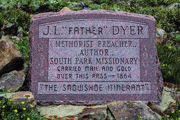
Mosquito Pass
Mosquito Pass is an iconic, moderately challenging high-altitude trail perfect for intermediate offroaders looking to traverse the highest continuous pass in the United States. Climbing to an elevation of 13,185 feet, this 10.7-mile point-to-point route connects Leadville and Alma, offering stunning...
Learn more about Mosquito Pass
ATV trails near Alma, Colorado
Explore ATV-friendly trails near you. These trails are accessible for vehicles up to 50 inches wide, perfect for ATVs and smaller off-road machines.
Loveland Road - FS 192/450
Starting from the Buckskin Road side is easy but will require 4-wheel drive. The road travels up through Pine Forest where the road is gravel turning into a more rocky road as you reach timberline, with a few steeper sections with loose rock. You can also reach Loveland Road from the Mosquito Pass R...
Learn more about Loveland Road - FS 192/450
Switchback/ Privateer Road
As per the name, the first part of the trail is a series of switchbacks as you climb up the side of Mount Bross. As you reach the upper part the road turns into a shelf road. This trail is a great companion route to the Dolly Varden trail. Go up one trail and go down the other. This route is also go...
Learn more about Switchback/ Privateer Road
Mt. Lincoln Road
The start of the trail is through private land. Once you come out of private land, about 0.5 miles, there is a rutted section then a rock obstacle. After that, the trail steadily climbs towards the top, with a lot of loose rock. About 0.25 miles from the top, the road turns into a shelf road, and at...
Learn more about Mt. Lincoln Road
Wheeler Lake
Be sure to bring your camera on this beautiful climb through a valley and to an alpine lake with a waterfall. Enjoy the wildflowers and some great fishing. This trail will also take you directly under Magnolia Mill.
Learn more about Wheeler Lake
UTV/side-by-side trails near Alma, Colorado
Find UTV and side-by-side trails near you. These trails accommodate vehicles up to 60 inches wide, ideal for UTVs, side-by-sides, and wider off-road rigs.
Loveland Road - FS 192/450
Starting from the Buckskin Road side is easy but will require 4-wheel drive. The road travels up through Pine Forest where the road is gravel turning into a more rocky road as you reach timberline, with a few steeper sections with loose rock. You can also reach Loveland Road from the Mosquito Pass R...
Learn more about Loveland Road - FS 192/450
Switchback/ Privateer Road
As per the name, the first part of the trail is a series of switchbacks as you climb up the side of Mount Bross. As you reach the upper part the road turns into a shelf road. This trail is a great companion route to the Dolly Varden trail. Go up one trail and go down the other. This route is also go...
Learn more about Switchback/ Privateer Road
Mt. Lincoln Road
The start of the trail is through private land. Once you come out of private land, about 0.5 miles, there is a rutted section then a rock obstacle. After that, the trail steadily climbs towards the top, with a lot of loose rock. About 0.25 miles from the top, the road turns into a shelf road, and at...
Learn more about Mt. Lincoln Road
Wheeler Lake
Be sure to bring your camera on this beautiful climb through a valley and to an alpine lake with a waterfall. Enjoy the wildflowers and some great fishing. This trail will also take you directly under Magnolia Mill.
Learn more about Wheeler Lake
The onX Offroad Difference
onX Offroad combines trail photos, descriptions, difficulty ratings, width restrictions, seasonality, and more in a user-friendly interface. Available on all devices, with offline access and full compatibility with CarPlay and Android Auto. Discover what you're missing today!
Open Trail Map