
Dirt Bike Trails
Near Agua Prieta, Sonora
Explore All Dirt Bike Trails Near Agua Prieta, Sonora
Dirt Bike Trails Near Agua Prieta, Sonora
Discover the best dirt bike trails near you. Browse trail maps, check difficulty ratings, and find your next adventure — whether you're looking for a quick ride or an all-day expedition.

Tex Canyon Road
Tex Canyon Road begins as a well-maintained route before entering forested foothills at the base of the mountains. Several spurs and side trails offer opportunities for exploration. As the road climbs, it becomes moderately rocky but remains navigable. Upon exiting Coronado National Forest, the road...
Learn more about Tex Canyon Road
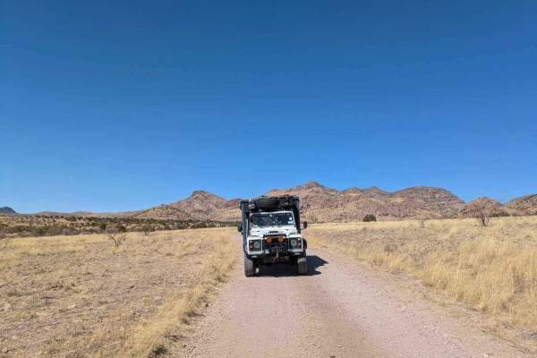
Tex Canyon Road
Tex Canyon Road begins as a well-maintained route before entering forested foothills at the base of the mountains. Several spurs and side trails offer opportunities for exploration. As the road climbs, it becomes moderately rocky but remains navigable. Upon exiting Coronado National Forest, the road...
Learn more about Tex Canyon Road
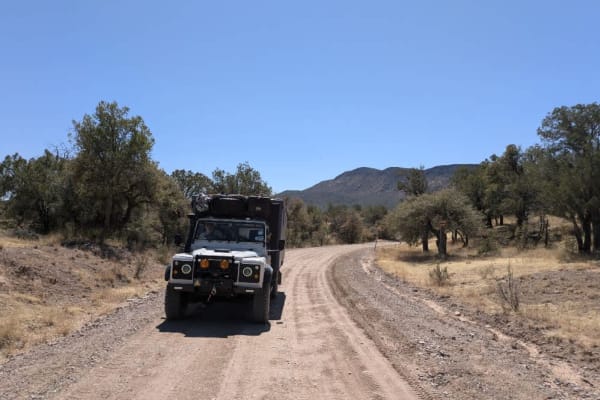
Rucker Canyon
The trail begins at the tidy and well-kept Walnut Grove Campground and starts out on a well-maintained path. Grasslands stretch out to the left and across the valley, gradually giving way to pine forests as you leave the mesquite lowlands behind. The route winds through the hills and becomes moderat...
Learn more about Rucker Canyon
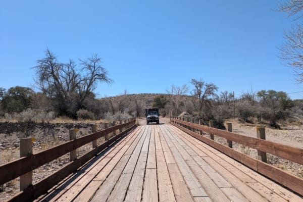
Rucker Canyon Road
This well-maintained and graded access road leads into the Chiricahua Wilderness which forms part of the Coronado National Forest, winding gently through a landscape of scenic ranches and rolling turns--drivers should adjust speed accordingly. The route follows a fenced boundary and offers sweeping ...
Learn more about Rucker Canyon Road
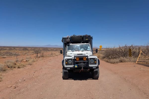
Kuykendall Cut Off
This access road is generally well-maintained but features frequent corrugation, with a series of dips and rises that can create a bumpy ride--airing down is recommended for comfort. The route follows the edge of the Chiricahua foothills, offering sweeping views of rolling grassland hills and rugged...
Learn more about Kuykendall Cut Off
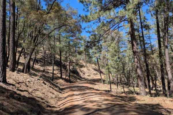
Turkey Creek
The road is graded and well-maintained as it approaches Morse Canyon, where it begins to narrow. Charming cottages dot the route, and there are numerous dispersed campsites along a stream. The road becomes rocky and uneven in places, but there's no off-camber driving. The trail winds through pine ne...
Learn more about Turkey Creek
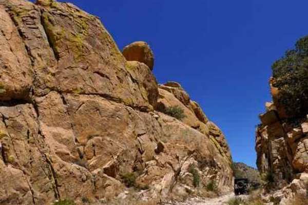
China Peak
China Peak is an exciting four-wheel-drive trail tailored for intermediate to experienced offroaders seeking a challenging climb with panoramic summit views in Arizona’s Dragoon Mountains. Spanning approximately 4 miles, this route begins off Middlemarch Road near the historic Abril Mine, ascending ...
Learn more about China Peak
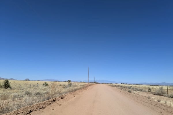
North Wilcox Road
This north-south access road begins as a wide, maintained ranch road, though it is often corrugated. Numerous private properties connect to the route in its early stretches. As it continues, the road narrows and passes alongside open fields before eventually re-entering private land. Camping is not ...
Learn more about North Wilcox Road
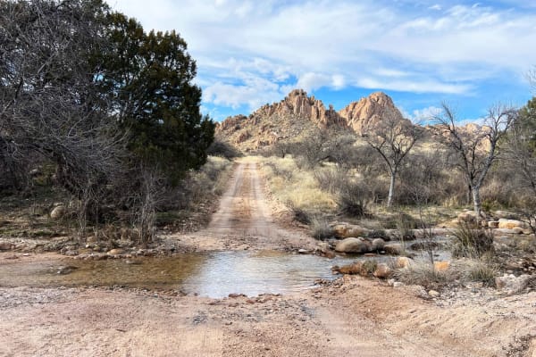
Slavin to West Stronghold
Slavin Forest Road 687 lies within Coronado National Forest. Most of the trail is smooth sandy gravel with incredible views of Council Rocks. Once reaching the gate at Corazon Ranch and turning onto West Stronghold FR 688 the road becomes more technical and narrow with washouts and many creek crossi...
Learn more about Slavin to West Stronghold
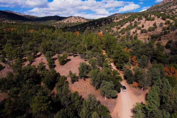
Chiricahua Byway
The Chiricahua Byway is an easy forest trail that takes you across the highest "Sky Island" district in Arizona. This trail provides incredible views of the Sonoran Desert, Mexico, New Mexico, and southern Arizona. There are ample camping spots all along this route from paid sites with toilets to pr...
Learn more about Chiricahua Byway
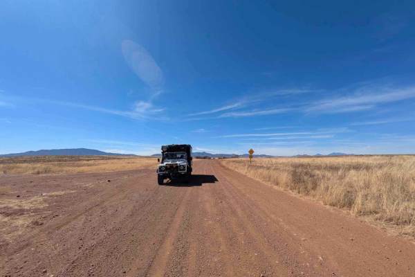
Montezuma Pass
Montezuma Pass is a heavily corrugated service road that provides access to Parker Canyon Lake. The route is a double-lane mountain pass with winding curves and rolling elevation changes, making for a scenic but bumpy drive. On Sundays, the road is a popular destination for motorcyclists looking to ...
Learn more about Montezuma Pass
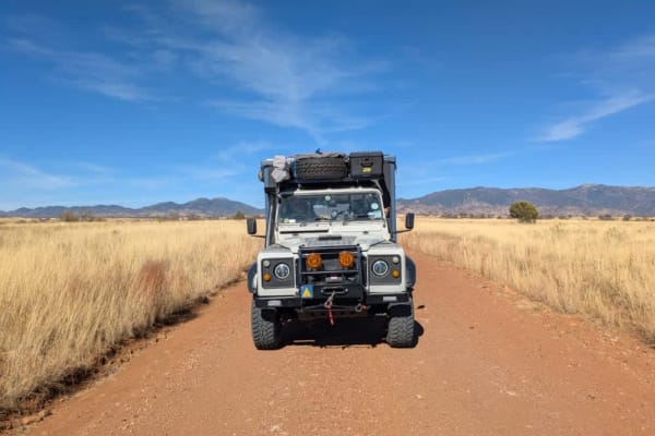
Sunnyside Canyon
Sunnyside Canyon is a narrow, single-track dirt road with numerous spurs and offshoots that invite exploration. The trail is unmaintained and rocky, stretching long and flat with certain sections that require slow, careful navigation due to rough terrain. Following the boundary of a fenced area, the...
Learn more about Sunnyside Canyon
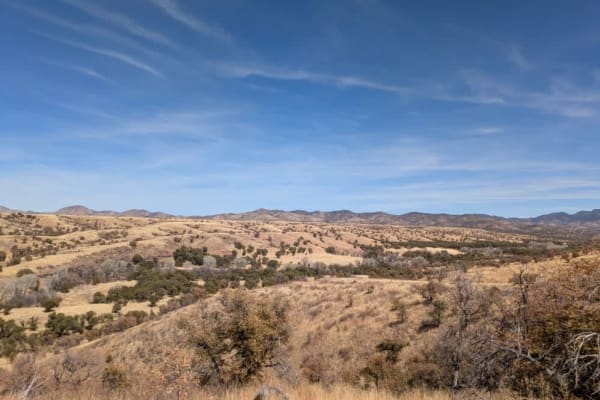
Parker Canyon
Parker Canyon is a rugged off-road trail characterized by rocky and bumpy terrain, though it remains mostly level throughout. The route follows a ridge line, offering dispersed camping opportunities along the way. The trail initially runs alongside a fence line before opening up to stunning panorami...
Learn more about Parker Canyon
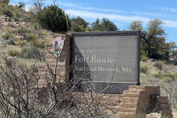
Fort Bowie Trail
This is a back road into Fort Bowie. It has a few overlook locations of the Fort and travels in from Highway 186. This is a historic fort that stood for years during a conflict between the US Government and the Apache tribe. To get to the fort is a short hike but worth it.
Learn more about Fort Bowie Trail
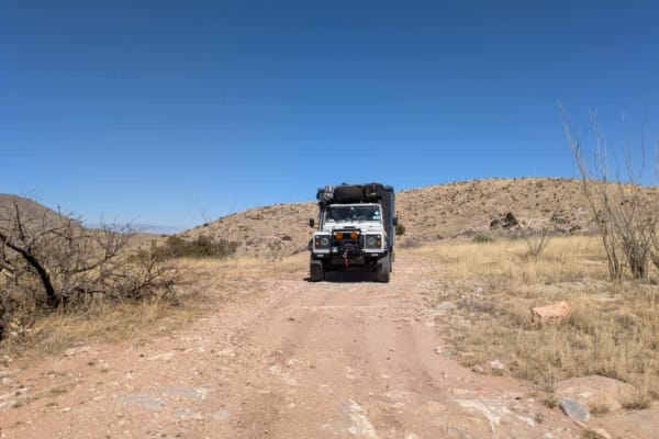
Blacktail Hill
As soon as you pass through the gate onto BLM land, the road improves significantly. Although there are a few washes and mildly off-camber sections, the trail is easy to drive and generally not challenging. It offers sweeping views of the valleys and salt flats, with dispersed camping available alon...
Learn more about Blacktail Hill
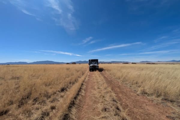
Parker Montezuma
Parker Montezuma is a narrow single-track trail that serves as a shortcut from Parker Canyon Trail to Montezuma Pass, winding through open grasslands along the way. The route eventually connects with Parker Canyon Road, which leads to the lake and its nearby campground. The trail has a rugged and re...
Learn more about Parker Montezuma
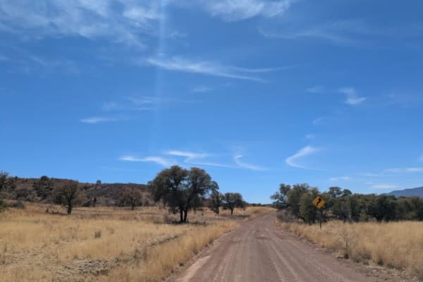
Parker Road
Parker Road is a scenic single-track trail that connects to Montezuma Pass, which then links up with the Patagonia Loop. As it winds through the landscape, the trail passes by several ranches and navigates a series of washes, featuring gentle ascents and descents along the way. In some areas, the te...
Learn more about Parker Road
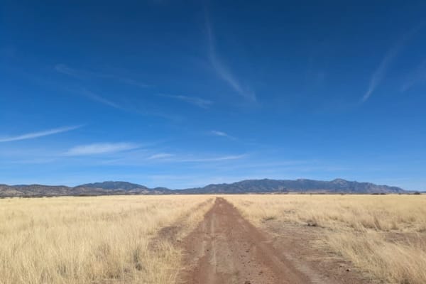
Max Tank Road
Max Tank Road branches off to the right from the Patagonia Loop, welcoming travelers with sightings of deer herds near its entrance. The trail winds through open grasslands, where signs of cattle are evident, though few are typically seen along the route. As the journey unfolds, the road splits, req...
Learn more about Max Tank Road
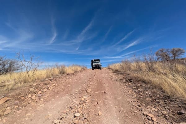
Chuparosa Road
Chuparosa is a narrow, rocky, single-track trail that winds through open grasslands, offering a rugged yet scenic off-road experience. As the route follows the ridge, drivers will encounter several gates along the way, adding to the sense of adventure. The trail eventually leads to a steep and rocky...
Learn more about Chuparosa Road
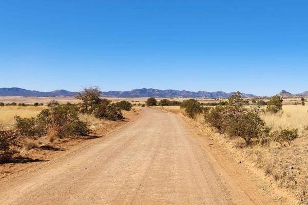
Patagonia Loop
This trail will take you through the Sonoita area's 4,970-foot elevation, featuring high-rolling grasslands surrounded by spectacular mountains and canyons. This region offers some of Arizona's most beautiful weather and landscapes. Mount Wrightson, one of the tallest peaks in Arizona, dominates the...
Learn more about Patagonia Loop
ATV trails near Agua Prieta, Sonora
Explore ATV-friendly trails near you. These trails are accessible for vehicles up to 50 inches wide, perfect for ATVs and smaller off-road machines.
Tex Canyon Road
Tex Canyon Road begins as a well-maintained route before entering forested foothills at the base of the mountains. Several spurs and side trails offer opportunities for exploration. As the road climbs, it becomes moderately rocky but remains navigable. Upon exiting Coronado National Forest, the road...
Learn more about Tex Canyon Road
Tex Canyon Road
Tex Canyon Road begins as a well-maintained route before entering forested foothills at the base of the mountains. Several spurs and side trails offer opportunities for exploration. As the road climbs, it becomes moderately rocky but remains navigable. Upon exiting Coronado National Forest, the road...
Learn more about Tex Canyon Road
Rucker Canyon
The trail begins at the tidy and well-kept Walnut Grove Campground and starts out on a well-maintained path. Grasslands stretch out to the left and across the valley, gradually giving way to pine forests as you leave the mesquite lowlands behind. The route winds through the hills and becomes moderat...
Learn more about Rucker Canyon
Rucker Canyon Road
This well-maintained and graded access road leads into the Chiricahua Wilderness which forms part of the Coronado National Forest, winding gently through a landscape of scenic ranches and rolling turns--drivers should adjust speed accordingly. The route follows a fenced boundary and offers sweeping ...
Learn more about Rucker Canyon Road
UTV/side-by-side trails near Agua Prieta, Sonora
Find UTV and side-by-side trails near you. These trails accommodate vehicles up to 60 inches wide, ideal for UTVs, side-by-sides, and wider off-road rigs.
Tex Canyon Road
Tex Canyon Road begins as a well-maintained route before entering forested foothills at the base of the mountains. Several spurs and side trails offer opportunities for exploration. As the road climbs, it becomes moderately rocky but remains navigable. Upon exiting Coronado National Forest, the road...
Learn more about Tex Canyon Road
Tex Canyon Road
Tex Canyon Road begins as a well-maintained route before entering forested foothills at the base of the mountains. Several spurs and side trails offer opportunities for exploration. As the road climbs, it becomes moderately rocky but remains navigable. Upon exiting Coronado National Forest, the road...
Learn more about Tex Canyon Road
Rucker Canyon
The trail begins at the tidy and well-kept Walnut Grove Campground and starts out on a well-maintained path. Grasslands stretch out to the left and across the valley, gradually giving way to pine forests as you leave the mesquite lowlands behind. The route winds through the hills and becomes moderat...
Learn more about Rucker Canyon
Rucker Canyon Road
This well-maintained and graded access road leads into the Chiricahua Wilderness which forms part of the Coronado National Forest, winding gently through a landscape of scenic ranches and rolling turns--drivers should adjust speed accordingly. The route follows a fenced boundary and offers sweeping ...
Learn more about Rucker Canyon Road
The onX Offroad Difference
onX Offroad combines trail photos, descriptions, difficulty ratings, width restrictions, seasonality, and more in a user-friendly interface. Available on all devices, with offline access and full compatibility with CarPlay and Android Auto. Discover what you're missing today!
Open Trail Map