
Beginner Off-Road Trails
Near Top-of-the-World, Arizona
Explore All Beginner Trails Near Top-of-the-World, Arizona
Beginner Off-Road Trails Near Top-of-the-World, Arizona
Discover the best beginner-friendly off-road trails near you. These easier, lower-rated trails are a great place to start — browse trail maps, check difficulty ratings, and find your next adventure.
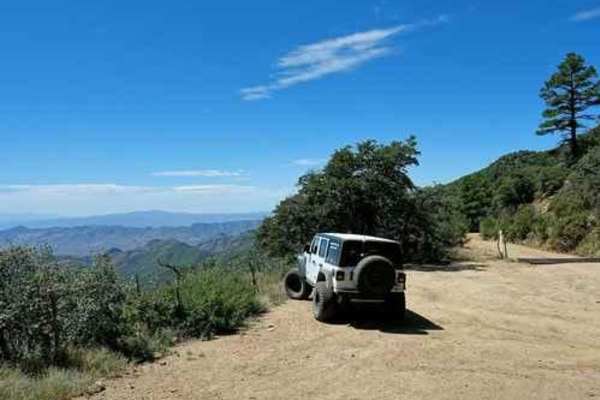
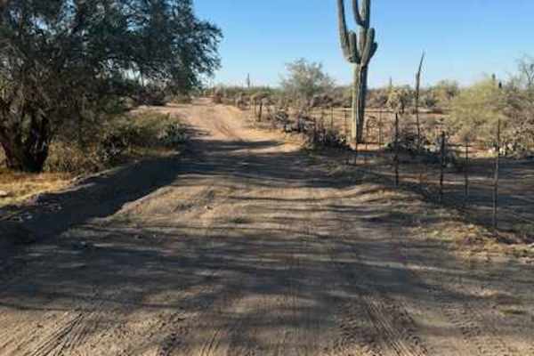
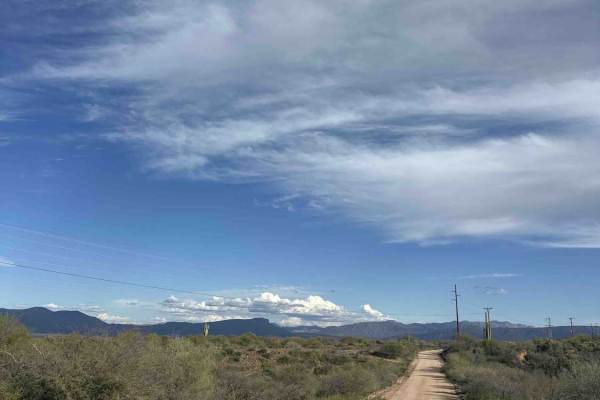
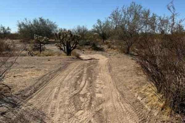
Pinto to Pinal
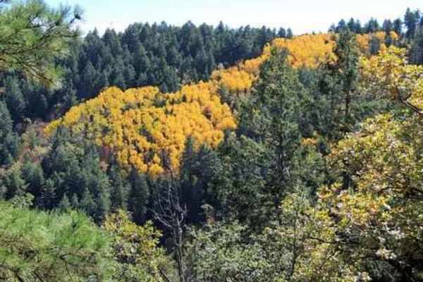
This Jeep trail is 50 miles, including the road up to and down from Pinal Peak and the one out to Madera Peak.This series of easy, scenic roads will take you from Pinto Mine Road on US 60 to the summit of Pinal Peak, out to Madera Peak for some nice overlooks then down into Globe. The very southwest...
Learn more about Pinto to Pinal
Putz Cemetery and Superior View
A trail to some historical graves and a fantastic viewpoint. A pretty drive even if you don't care for the history, but we recommend checking the history section below. From US 60, go directly across the road to Silver King Road. You will pass Imerys Perlite USA. They mine and process perlite. Th...
Learn more about Putz Cemetery and Superior View
Wagon Tracks, Apache Tears, and Arnett Canyon
Begin at the east end of the airport and follow the trail to the Wagon Tracks. Head south across Queen Creek. The creek can have a natural flow of water after heavy rain, but it is usually only the outflow from the Superior wastewater treatment plant. Do not worry--no odor. Look east of Superior to ...
Learn more about Wagon Tracks, Apache Tears, and Arnett Canyon

Pucker Ridge Bat Cave
A short distance after the Mini Grand Canyon you have a chance to hike to the Bat Cave. This will probably take an hour and involve a small bit of rock scrambling. Drive to the end of the road "Ridgeline Bat Cave" (included in the Minor Trails file) then hike down the small wash to a big wash. Hi...
Learn more about Pucker Ridge Bat Cave
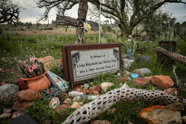
Historic Pinal Cemetery Trail
Just outside of Superior, Arizona, you can experience some Wild West, Wyatt Earp lore. The legendary cowboy was involved in the famous gunfight at the O.K. Corral. Multiple movies have been made about him, but I bet you have not heard of Mattie Earp. This trail will take you to the gravesite of Matt...
Learn more about Historic Pinal Cemetery Trail
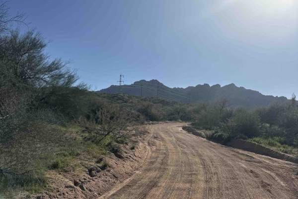
Pioneer Pass
Pioneer Pass starts near the center of Globe, circles the south side of Pinal Peak, and ends on Forest Service Road 651 leading to Pinal Peak. Climb to Pioneer Pass at 6,000' elevation, drop into Pioneer and Bobtail Basins at 5,000' then climb back up to 6,000' on the Pinal Peak Road. An enjoyable...
Learn more about Pioneer Pass
Reymert Ovens
The Reymert Mine Ovens Trail offers a scenic and moderately adventurous experience, lined with stunning cacti that characterize the Arizona desert landscape. As you navigate through washes, adding some natural variation to the trail. The route provides excellent views of the surrounding mountains, g...
Learn more about Reymert Ovens
J/K Trail
This bypass branches directly off the popular Montana Mountain Loop, providing a scenic and engaging connector route to the backside of Queen Valley within the Tonto National Forest. This trail is an exceptional training ground for novice off-roaders looking to advance their technical driving skills...
Learn more about J/K Trail
FS 1457
This road connects Forest Service Road 83 to a network of other trails that are a little more difficult. There are some gates you will have to go through, and since this is near a working ranch, be sure to close them after going through. You will get pin striping on this trail as it is narrow with a...
Learn more about FS 1457
Nw2030
This trail consists of dirt and rock. It is on the BLM side and borders Arizona State Trust Land. It connects the main East and West arteries to a small wash. When guided, travelling West in the wash will bring you to an open gate to Arizoa State Trust Land. Note: Arizona State Trust Land requires a...
Learn more about Nw2030
Nw2077a
This is a small wash consisting of dirt and rock. There are a few low-hanging trees and a landslide from the adjacent cliff partially blocking the wash. Mid-size and full-size vehicles can still pass, with pinstriping being inevitable. Traveling East will keep you on BLM and bring you to a well-grad...
Learn more about Nw2077a
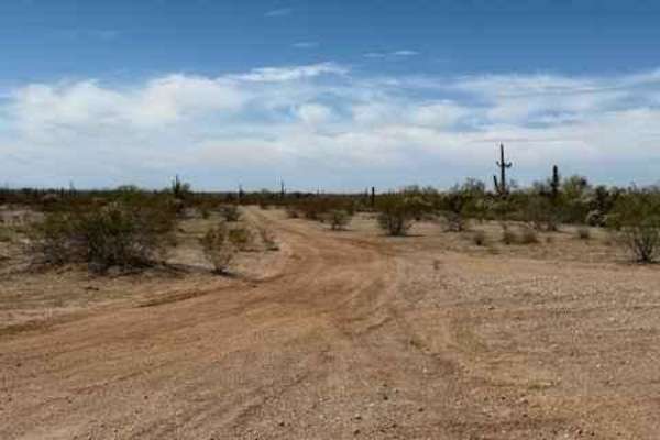
Side Quest
Side Quest offers one of the most scenic and geologically striking off-road experiences in the Sonoran Desert. This iconic route winds through narrow, rock-walled canyons and broad desert washes, framed by rugged mountains, towering cliffs, and an abundance of desert flora and fauna. It's a favorite...
Learn more about Side Quest

Braddock Creek - FS 9
This sandy and rocky trail winds its way down a wash, offering a fun and scenic alternative to Cherry Creek Road, which runs parallel nearby. The route is mostly easy to navigate, with some overgrown vegetation in places, but nothing too restrictive. It’s an enjoyable drive as the trail meanders thr...
Learn more about Braddock Creek - FS 9

Apache Trail
The historic Apache Trail, also known as Highway 88, now reopened after years of closure due to rockslides, is a must-drive route rich in Arizona history and stunning desert scenery. Over 100 years old, this scenic byway offers a more direct and visually rewarding path to Apache Lake, bypassing the ...
Learn more about Apache Trail
FS 1738
FS 1738 is a fun little trail with a few washouts that leads to a network of other trails. The majority of this trail goes in and out of a wash that is full of cattle, so be very aware of your speed. This trail will change with rain as the sides of the wash get washed out. When turning off Highway 1...
Learn more about FS 1738
FS 83
The trail turns south off Highway 188 near Roosevelt Lake. This route is a smooth and wide road that leads to a ranch at the end. Please be aware of animals. There are signs up towards the end of the trail stating no camping due to a watering hole nearby. When looking south, you do get great views o...
Learn more about FS 83
Nw2233
Nw2233 is located to the East of Arizona State Route 79 and South of the Box Canyon trail. This side trail connects Nw2006 to Nw2014 and consists of dirt and small rocks. It is a single track with places to pass. Pinstriping is possible for full-size vehicles. One bar of Verizon LTE service was avai...
Learn more about Nw2233
79C
This is a fun little trail off of Apache Trail that takes you to the Apache Lake Marina. The road is narrow and goes through a sandy wash. Watch out for wild animals, as there are deer, big horn sheep, and javalina in the area. There are a lot of blind corners, so be cautious. Fun alternative way to...
Learn more about 79C
Nw2006a
Nw2006a is located to the East of Arizona State Route 79 and South of the Box Canyon trail. This is a side trail to the main North/South Nw2006 trail. The trail consists of dirt and small rocks. It is wide and suitable for full-size vehicles. One bar of Verizon LTE service was available.
Learn more about Nw2006a
Nw2230
Nw2230 is located to the East of AZ State Route 79 and North of the Box Canyon trail. Coming from Box Canyon, it is a little difficult to find at first because of the dirt bike play area. The trail is a mix of single track and wash. Not suitable for full-size vehicles. Pinstriping is imminent and lo...
Learn more about Nw2230
Beginner ATV trails near Top-of-the-World, Arizona
Explore ATV-friendly trails near you. These trails are accessible for vehicles up to 50 inches wide, perfect for ATVs and smaller off-road machines.
Pinto to Pinal
This Jeep trail is 50 miles, including the road up to and down from Pinal Peak and the one out to Madera Peak.This series of easy, scenic roads will take you from Pinto Mine Road on US 60 to the summit of Pinal Peak, out to Madera Peak for some nice overlooks then down into Globe. The very southwest...
Learn more about Pinto to Pinal
Putz Cemetery and Superior View
A trail to some historical graves and a fantastic viewpoint. A pretty drive even if you don't care for the history, but we recommend checking the history section below. From US 60, go directly across the road to Silver King Road. You will pass Imerys Perlite USA. They mine and process perlite. Th...
Learn more about Putz Cemetery and Superior View
Wagon Tracks, Apache Tears, and Arnett Canyon
Begin at the east end of the airport and follow the trail to the Wagon Tracks. Head south across Queen Creek. The creek can have a natural flow of water after heavy rain, but it is usually only the outflow from the Superior wastewater treatment plant. Do not worry--no odor. Look east of Superior to ...
Learn more about Wagon Tracks, Apache Tears, and Arnett Canyon
Pucker Ridge Bat Cave
A short distance after the Mini Grand Canyon you have a chance to hike to the Bat Cave. This will probably take an hour and involve a small bit of rock scrambling. Drive to the end of the road "Ridgeline Bat Cave" (included in the Minor Trails file) then hike down the small wash to a big wash. Hi...
Learn more about Pucker Ridge Bat Cave
Beginner UTV/side-by-side trails near Top-of-the-World, Arizona
Find UTV and side-by-side trails near you. These trails accommodate vehicles up to 60 inches wide, ideal for UTVs, side-by-sides, and wider off-road rigs.
Pinto to Pinal
This Jeep trail is 50 miles, including the road up to and down from Pinal Peak and the one out to Madera Peak.This series of easy, scenic roads will take you from Pinto Mine Road on US 60 to the summit of Pinal Peak, out to Madera Peak for some nice overlooks then down into Globe. The very southwest...
Learn more about Pinto to Pinal
Putz Cemetery and Superior View
A trail to some historical graves and a fantastic viewpoint. A pretty drive even if you don't care for the history, but we recommend checking the history section below. From US 60, go directly across the road to Silver King Road. You will pass Imerys Perlite USA. They mine and process perlite. Th...
Learn more about Putz Cemetery and Superior View
Wagon Tracks, Apache Tears, and Arnett Canyon
Begin at the east end of the airport and follow the trail to the Wagon Tracks. Head south across Queen Creek. The creek can have a natural flow of water after heavy rain, but it is usually only the outflow from the Superior wastewater treatment plant. Do not worry--no odor. Look east of Superior to ...
Learn more about Wagon Tracks, Apache Tears, and Arnett Canyon
Pucker Ridge Bat Cave
A short distance after the Mini Grand Canyon you have a chance to hike to the Bat Cave. This will probably take an hour and involve a small bit of rock scrambling. Drive to the end of the road "Ridgeline Bat Cave" (included in the Minor Trails file) then hike down the small wash to a big wash. Hi...
Learn more about Pucker Ridge Bat Cave
The onX Offroad Difference
onX Offroad combines trail photos, descriptions, difficulty ratings, width restrictions, seasonality, and more in a user-friendly interface. Available on all devices, with offline access and full compatibility with CarPlay and Android Auto. Discover what you're missing today!
Open Trail Map