
Beginner Off-Road Trails
Near Tillamook, Oregon
Explore All Beginner Trails Near Tillamook, Oregon
Beginner Off-Road Trails Near Tillamook, Oregon
Discover the best beginner-friendly off-road trails near you. These easier, lower-rated trails are a great place to start — browse trail maps, check difficulty ratings, and find your next adventure.
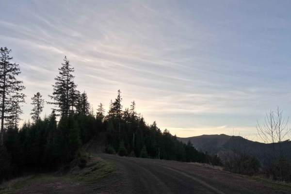
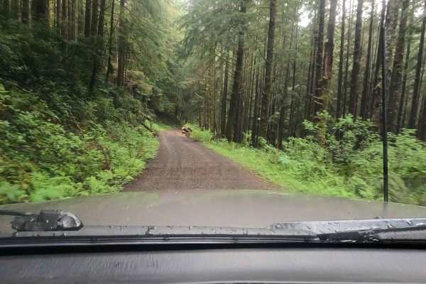
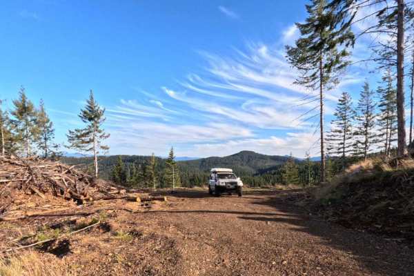
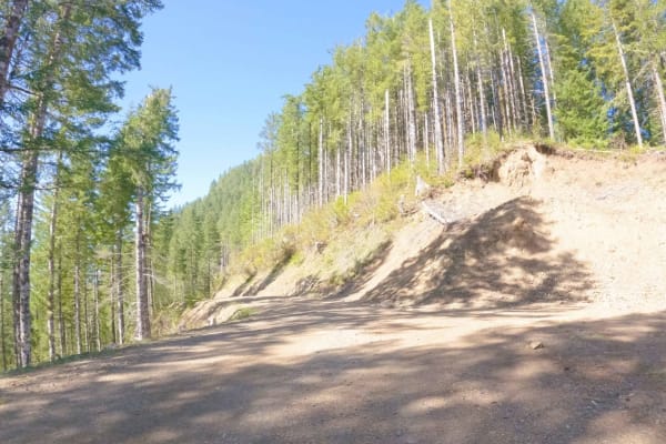
Andy Creek
Gravel Forest Service road accessing Buzzard Butte from Sand Lake Road in the hills just off the beach along the Oregon Coast. These roads are rarely traveled and offer an alternate to the paved roads nearby filled with tourists. There are a few dispersed camping spots along the spur roads in this a...
Learn more about Andy Creek
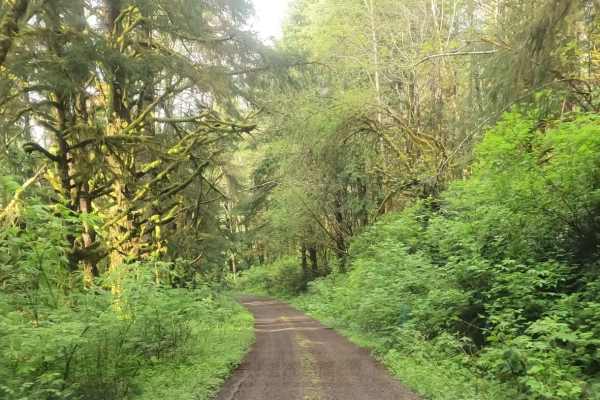
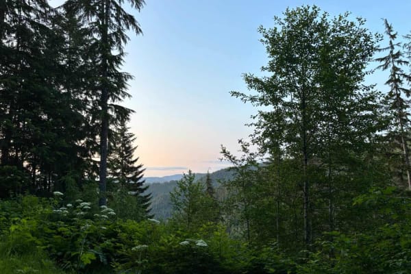
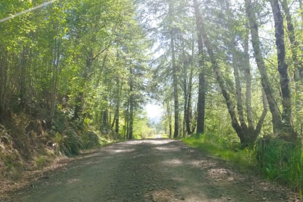
Simmons Ridge Road
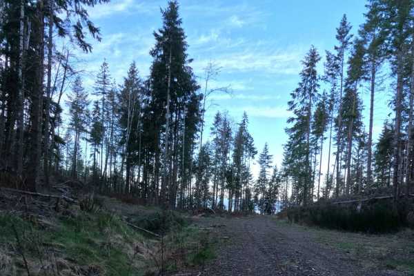
Stretching out for eight impeccably smooth miles, Simmons Ridge Road is a scenic, highly accessible, and effortless transit route through the lush, emerald corridors of the coastal forest. The drive is exceptionally straightforward, sweeping elegantly along the ridge under a dense, moss-draped canop...
Learn more about Simmons Ridge Road
Miami River Forest Road
Miami River Forest Road and Frank Crane Road are a 4–6 mile gravel route through Tillamook State Forest's second-growth Douglas-fir, along the Miami River, offering year-round access for hiking, fishing, and OHV, but expect variable conditions due to over 100 inches of annual rainfall: summer/fall b...
Learn more about Miami River Forest Road
North Fork Trask River Road
This is one of the main arteries leading deep into the Tillamook State Forest from the Trask River Road. Follow it up the North Fork Trask River and on to Yamhill if you wish, passing Barney Reservoir along the way. As you leave the pavement behind, you'll soon be traveling along the riverbank where...
Learn more about North Fork Trask River Road
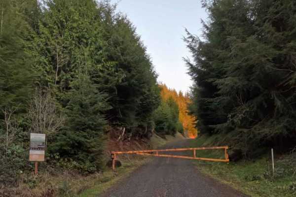
BSM Road
Brace yourself for an intense climb. BSM Road is a grueling, 4.1-mile gravel forest service route that immediately demands your absolute attention and respect. Cutting deeply through the dense, working timberlands, this severely steep, single-lane track functions as an active, heavy-duty commercial ...
Learn more about BSM Road
South Fork Trask River Road
South Fork Trask Road is a beautifully smooth, highly accessible 6.5-mile gravel forest service route that serves as a vital and picturesque artery through the lush Tillamook State Forest. Tracing the winding, scenic path of the South Fork Trask River, this uncomplicated, single-lane track is deeply...
Learn more about South Fork Trask River Road
Kilchis Lookout Road
Kilchis Lookout Road starts at Muesial Creek Road to the east and heads up to Kilchis Mountain to the west. From Kilchis Mountain spur you can head back and to the west. It intersects with Sam Downs Road and then to Kilchis Forest Road. Heading further west will bring you to the Tillamook area. Kilc...
Learn more about Kilchis Lookout Road
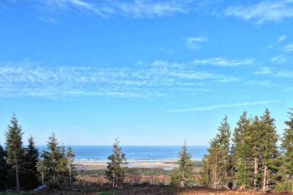
Farmer Creek
Prepare to get your rally on! The Farmer Creek trail is a fast and furious, adrenaline-pumping descent that serves as the perfect, high-spirited conclusion to your Buzzard Butte adventures. Starting just below the summit, this smooth and well-graded gravel forest service road meanders nearly eight m...
Learn more about Farmer Creek
Bun Creek - NF1004
Gravel Forest Service Road climbing up over Buzzard Butte on the Oregon Coast. This is a segment of a longer 'City to Coast' route that traverses the Tillamook Range with the most off-pavement milage possible between the Portland Metro and the Oregon Coast. This route ends at the Sand Lake OHV Recre...
Learn more about Bun Creek - NF1004
Shiffman Road
Shiffman Road begins at Miami Foley Road in the west and ends at Miami Forest River Road. It peaks at about 1,500 feet near Foley Peak and dips to its lowest point at the Miami River. An optional spur leads past Craig Mountain (2,008 feet) and Foley Peak (2,260 feet). The gravel road has occasional ...
Learn more about Shiffman Road
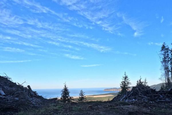
Kart - FS 1004158
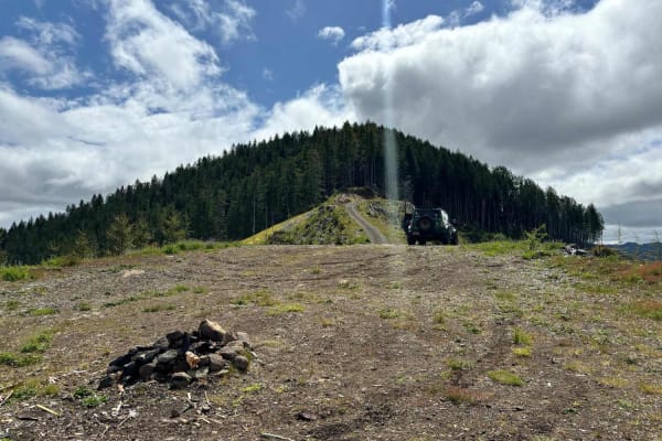
The Kart Road spur offers a 0.8-mile scenic climb to one of the premier camping locations in the area. The route ascends steadily through a working coastal forest, transitioning from enclosed timber into recently harvested zones lined with prominent slash piles. According to the GPS data, the trail ...
Learn more about Kart - FS 1004158
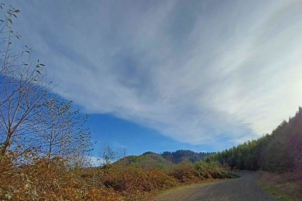
Foland Creek
Foland Creek road is an easy gravel road with sections that turn into a more natural surface. A couple of spots clear out for a pretty view of the valleys. The road runs through the Siuslaw National Forest, with a few sections of private property, so be mindful. There are a couple of small spots you...
Learn more about Foland Creek
FS 1004147
Branching off the main coastal forest network, trail 1004147 is a brief, 0.6-mile rocky spur that delivers an incredibly high return on investment for overlanders seeking a picturesque basecamp. The route winds through a dynamic coastal landscape, transitioning from dense, moss-draped evergreen cano...
Learn more about FS 1004147
Bohom - FS 1004155
Nestled just east of the bustling Sand Lake OHV Recreation Area, the Bohom forest service road offers a tranquil, secluded escape into the lush canopy of the Oregon Coast Range. Branching directly off the central spine of Bun Creek road as it climbs the flanks of Buzzard Butte, this short 0.9-mile s...
Learn more about Bohom - FS 1004155
Wolf Point to Jones Creek
This trail connects Cedar Butte Road with Jones Creek Road with an optional stop at Wolf Point. An open area just below Wolf Point offers great views to the north of Triangulation Point along with views of the Cedar Creek Valley below. The top of Wolf Point is accessible via a single track trail, al...
Learn more about Wolf Point to Jones Creek
Bobcat Cutoff Road
Plunging off the lofty elevations of Hembre Ridge, Bobcat Cutoff Road is a thrilling, gravity-fed 2.9-mile gravel descent that serves as a rapid shortcut down to the North Fork Trask River Road. This precipitous, single-lane forest service track weaves tightly through the rugged coastal mountains, c...
Learn more about Bobcat Cutoff Road
Cedar Butte Road
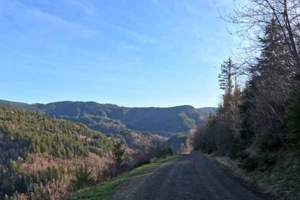
Cedar Butte Road crosses the Wilson River as it begins at Highway 6 and climbs over 2,500' over 6.5 miles up into the Tillamook Range to a saddle just below Cedar Butte where it meets up with Cedar Creek Road, Kilchis River Road, and Wolf Point Road. It is one of the main access roads into this sect...
Learn more about Cedar Butte Road
Muesial Creek Road
Start by turning off Highway 6 onto Cedar Butte Road, then take a left onto Wolf Creek Road, which eventually becomes Muesial Creek Road. You can also reach the opposite end of Muesial Creek Road by heading about 2 miles up Cedar Butte Road. Stretching roughly 4 miles, Muesial Creek Road crosses pat...
Learn more about Muesial Creek Road
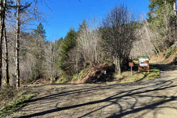
Jordan Creek Road
Jordan Creek Road is a five-mile gravel FS road that follows along Jordan Creek before connecting to Hembre Ridge Road and then eventually ending at the Jordan Creek 003 Moto/ATV trail. It accesses numerous other OHV trails and the Jordan Creek OHV Staging Area so there is often a good amount of mix...
Learn more about Jordan Creek Road
Shuttle Camp - FS 1004150
Branching off the main Bun Creek spine, the Shuttle Camp spur is a very brief but incredibly rewarding 0.5-mile track that serves up the ultimate coastal dispersed basecamp. The route navigates upward through a recovering coastal forest, characterized by towering, moss-draped evergreens and recently...
Learn more about Shuttle Camp - FS 1004150
Beginner ATV trails near Tillamook, Oregon
Explore ATV-friendly trails near you. These trails are accessible for vehicles up to 50 inches wide, perfect for ATVs and smaller off-road machines.
North Fork Trask River Road
This is one of the main arteries leading deep into the Tillamook State Forest from the Trask River Road. Follow it up the North Fork Trask River and on to Yamhill if you wish, passing Barney Reservoir along the way. As you leave the pavement behind, you'll soon be traveling along the riverbank where...
Learn more about North Fork Trask River Road
Foland Creek
Foland Creek road is an easy gravel road with sections that turn into a more natural surface. A couple of spots clear out for a pretty view of the valleys. The road runs through the Siuslaw National Forest, with a few sections of private property, so be mindful. There are a couple of small spots you...
Learn more about Foland Creek
Wolf Point to Jones Creek
This trail connects Cedar Butte Road with Jones Creek Road with an optional stop at Wolf Point. An open area just below Wolf Point offers great views to the north of Triangulation Point along with views of the Cedar Creek Valley below. The top of Wolf Point is accessible via a single track trail, al...
Learn more about Wolf Point to Jones Creek
Cedar Butte Road
Cedar Butte Road crosses the Wilson River as it begins at Highway 6 and climbs over 2,500' over 6.5 miles up into the Tillamook Range to a saddle just below Cedar Butte where it meets up with Cedar Creek Road, Kilchis River Road, and Wolf Point Road. It is one of the main access roads into this sect...
Learn more about Cedar Butte Road
Beginner UTV/side-by-side trails near Tillamook, Oregon
Find UTV and side-by-side trails near you. These trails accommodate vehicles up to 60 inches wide, ideal for UTVs, side-by-sides, and wider off-road rigs.
North Fork Trask River Road
This is one of the main arteries leading deep into the Tillamook State Forest from the Trask River Road. Follow it up the North Fork Trask River and on to Yamhill if you wish, passing Barney Reservoir along the way. As you leave the pavement behind, you'll soon be traveling along the riverbank where...
Learn more about North Fork Trask River Road
Foland Creek
Foland Creek road is an easy gravel road with sections that turn into a more natural surface. A couple of spots clear out for a pretty view of the valleys. The road runs through the Siuslaw National Forest, with a few sections of private property, so be mindful. There are a couple of small spots you...
Learn more about Foland Creek
Wolf Point to Jones Creek
This trail connects Cedar Butte Road with Jones Creek Road with an optional stop at Wolf Point. An open area just below Wolf Point offers great views to the north of Triangulation Point along with views of the Cedar Creek Valley below. The top of Wolf Point is accessible via a single track trail, al...
Learn more about Wolf Point to Jones Creek
Cedar Butte Road
Cedar Butte Road crosses the Wilson River as it begins at Highway 6 and climbs over 2,500' over 6.5 miles up into the Tillamook Range to a saddle just below Cedar Butte where it meets up with Cedar Creek Road, Kilchis River Road, and Wolf Point Road. It is one of the main access roads into this sect...
Learn more about Cedar Butte Road
The onX Offroad Difference
onX Offroad combines trail photos, descriptions, difficulty ratings, width restrictions, seasonality, and more in a user-friendly interface. Available on all devices, with offline access and full compatibility with CarPlay and Android Auto. Discover what you're missing today!
Open Trail Map