
Beginner Off-Road Trails
Near St. Regis, Montana
Explore All Beginner Trails Near St. Regis, Montana
Beginner Off-Road Trails Near St. Regis, Montana
Discover the best beginner-friendly off-road trails near you. These easier, lower-rated trails are a great place to start — browse trail maps, check difficulty ratings, and find your next adventure.
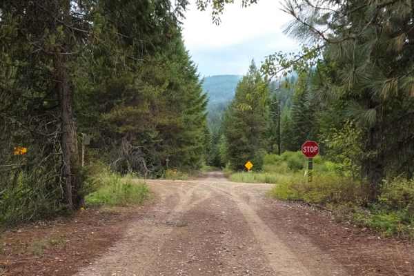
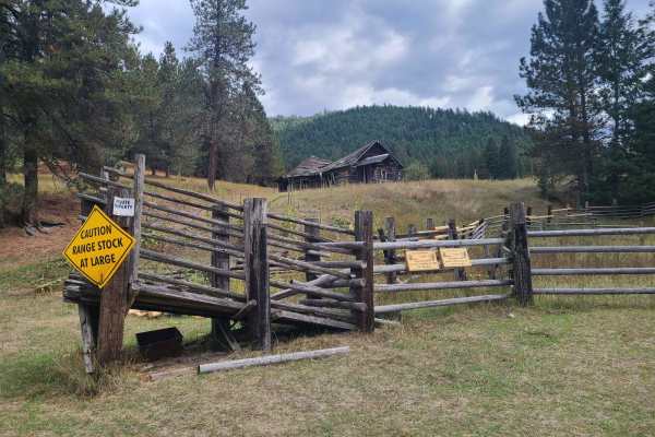
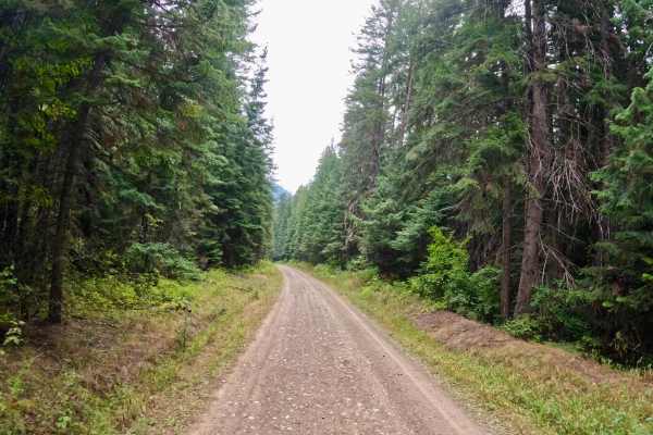
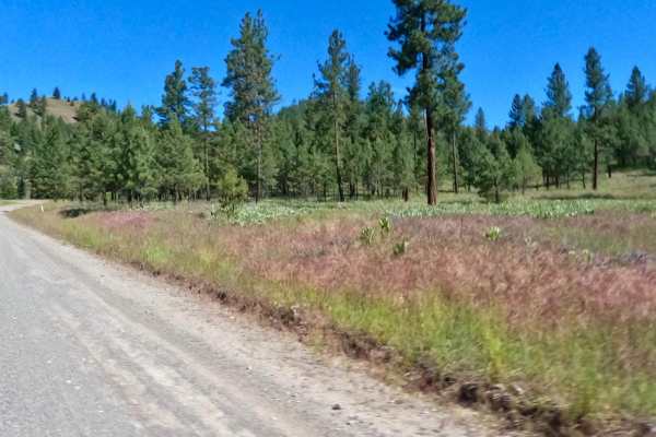
Little Joe Road
The trail is a wide flat gravel route that has gradual curves and short side embankments. The majority of the route parallels the St. Regis River with many areas to stop to fish or have a lunch break. Cell service is available through all of the route. The route can be very dusty when dry, but great...
Learn more about Little Joe Road
Mayo Gulch
Turn off I-90 and go north on 135 through Saint Regis, Montana. FS 4227 road will be on the West side and begin in the state of Montana land and quickly enter Lolo National Forest. Stay on the main road. There are some pull-outs but no notable spurs. The road will continue a bit past the quarry to ...
Learn more about Mayo Gulch
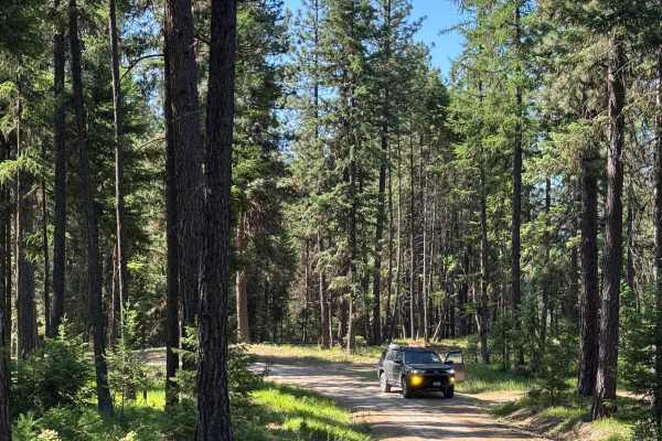
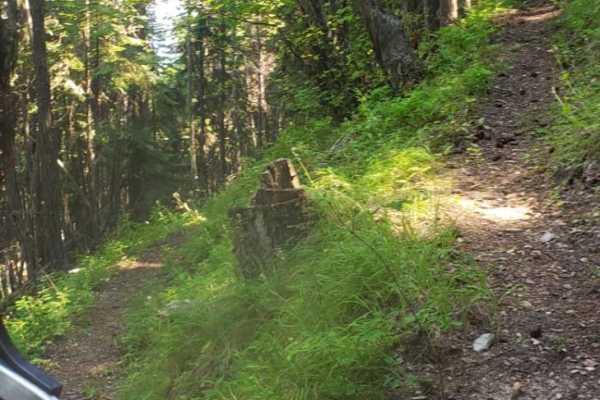
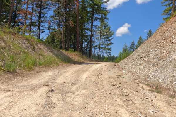
Little Joe Creek FS 282
This is a direct route to the St. Joe River corridor when coming from Montana via St. Regis. The route has established and dispersed camping as well as both hiking and OHV trails branching off. The road is in excellent condition except for a few sections of washboard. It is also extremely wide with ...
Learn more about Little Joe Creek FS 282
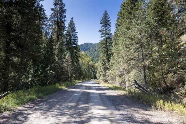
Cold Peak Trail (FSR 3803)
The Route Starts at an elevation of 2980 feet and climbs to 3200 feet along a mostly gravel and loose rock roadbed. It has many curves with steep embankments that you need to be aware of. The route can be pretty dusty in dry weather. Places to pass other vehicles are along the route. The route sees ...
Learn more about Cold Peak Trail (FSR 3803)
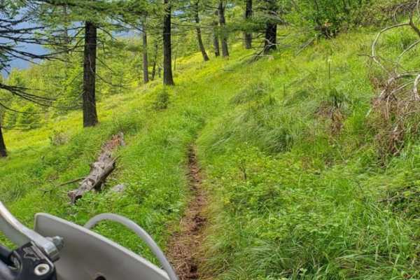
Boyd Mountain
Boyd Mountain is an outstanding destination for dirt bike riders looking for a scenic, flowy singletrack climb with moderate technical challenges. Beginning near Old Mullan Road in Mullan Gulch, this route offers a gentle introduction to singletrack riding as it snakes its way up the forested mounta...
Learn more about Boyd Mountain
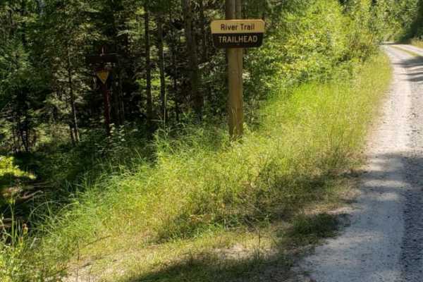
River Trail
This is a fun, well-maintained singletrack that follows the Clark Fork River. There are some technical rock/root features, very small water crossings and a few switchbacks. The trail is shared, trail so you may encounter the occasional hiker/biker. You'll end at the Ferry Landing Fishing Access whic...
Learn more about River Trail
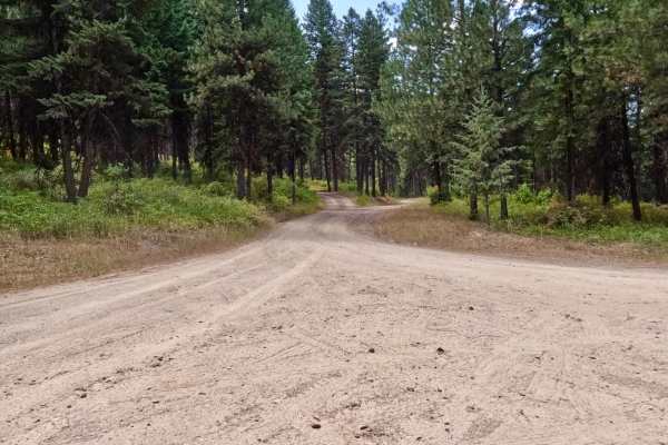
Bemish Ridge - FS 7583
Bemish Ridge- USFS 7583 is a moderately traveled gravel road through Lolo National Forest north of St. Regis, Montana. There is significant deadfall from a recent fire in the area. Take a saw with you to be prepared. It is easily traveled by all vehicles except when snow or ice covered. The roadway ...
Learn more about Bemish Ridge - FS 7583
Ward Creek Trail
The trail begins from the Two Mile Creek (431) road heading northwest. The area the trail passes through is being logged at this time. Sunday-only passage is recommended. The trail is mostly two-lane gravel, but you can encounter single lanes in spots. Steep embankments with wide curves are encounte...
Learn more about Ward Creek Trail
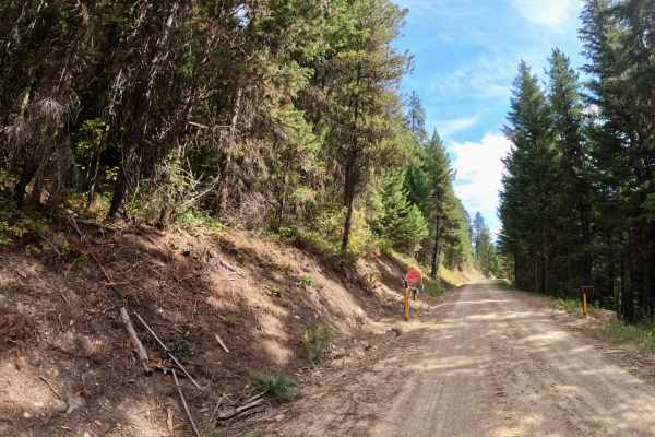
Tamarack Creek - FS 284
Tamarack Creek is USFS road 284, a moderately traveled gravel road through Lolo National Forest north of St. Regis, Montana. The road has heavier use near Highway 135, which decreases as you ascend toward Camel's Hump Lookout. It is easily traveled by all vehicles except when snow or ice covered. Th...
Learn more about Tamarack Creek - FS 284
Camels Hump - FS 3800
Camels Hump Lookout is USFS road 3800, a lightly traveled gravel road through Lolo National Forest east of Henderson, Montana. The road is moderately traveled and has a mild incline never exceeding a 6% grade. It is easily traveled by all vehicles except when snow or ice covered. The roadway is subj...
Learn more about Camels Hump - FS 3800
Cabin City
The route is mainly two-lane, made up of dirt and gravel. Long straight aways and sharp corners make up the route. There are spots with deep drops right next to the side of the route. The route runs next to Twelve Mile Creek with several narrow bridges running over the creek. No cell service was fou...
Learn more about Cabin City
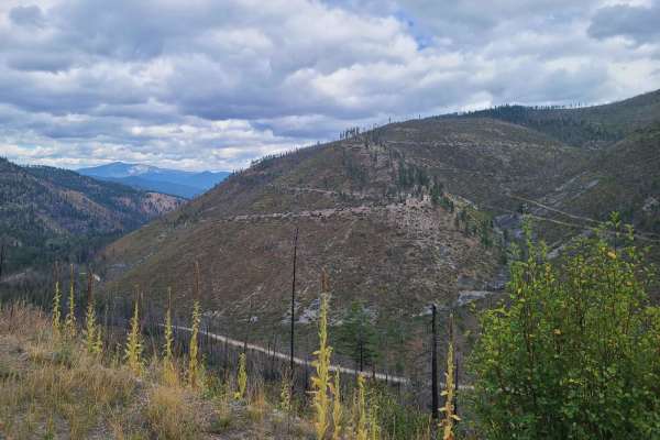
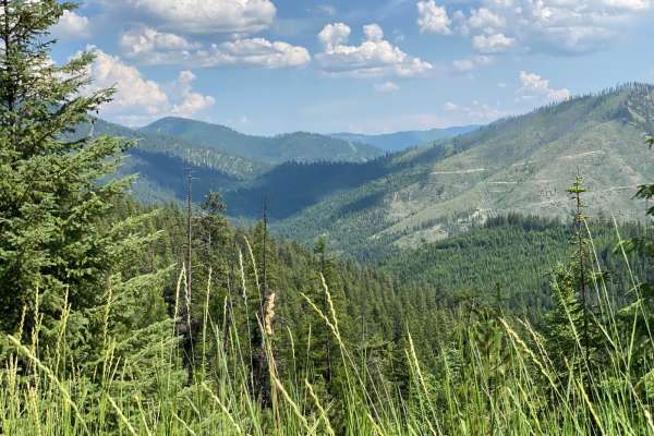
Canyon Creek (3816)-Cromie Creek (236)
The route is mainly made up of gravel and dirt that can be dusty in dry conditions. The route is mainly two-lane with some narrow sections. The route will take you from 3300'-5500' at its highest point. Gentle curves with some steep embankments will be found along the route. Cell service is very spo...
Learn more about Canyon Creek (3816)-Cromie Creek (236)
Olson Peak Singletrack
This is a singletrack, two-way trail that is slightly overgrown. It is fairly easy, but there are a few log hops and side hills, and there may be blown down trees blocking your way. The trail is mostly marked with colored tape and trail signs. The Olson Peak Trail connects with the CC Divide Trail ...
Learn more about Olson Peak Singletrack
Newman Ridge Road (1185) - Canyon Creek Road (3816)
The trail is mainly made up of gravel with a few potholes filled with water from a few springs in the area. Some rocky sections will be encountered along the route as steep rock ledges dot the sides of the trail in places. The trail is mostly wide enough to get past another vehicle. You will be desc...
Learn more about Newman Ridge Road (1185) - Canyon Creek Road (3816)
Sloway Gulch Road-Keystone Peak
The route is mainly two-lane gravel, but there are narrow parts where it would be hard to pass another vehicle. The route is a gradual climb from 2,600 to 5,800 feet. There are sharp blind curves along the route with steep embankments. Cell service is limited in parts of the route, and traffic along...
Learn more about Sloway Gulch Road-Keystone Peak
South Fork Little Joe Creek - FS 221
The route begins at the turn to Moore Lake (FS9121) and ends at Little Joe Creek Road (FS282). The route is made up of smooth gravel and dirt with long straight aways. The route in most parts is two lanes wide with very gentle turns. Cell Service is iffy along the route. The route begins at an altit...
Learn more about South Fork Little Joe Creek - FS 221
Pardee Cr. Rd-Ninemile Rd (97)
The route begins at the W. end of Mullan Rd. just outside Superior, MT. The route begins as a gradual climb from 2800'' through winding gravel and dirt roads. Sharp turns and steep embankments will be encountered along the route. The route is wide enough for two vehicles to pass, but there are areas...
Learn more about Pardee Cr. Rd-Ninemile Rd (97)
Flat Creek Road - Pardee Creek Road
The route is mainly gravel and loose rock passing thru government lands. There are sharp corners with steep embankments along part of the route. Ponderosa Pine & Tamarack line most of the route. Offline Maps will be needed to navigate parts of the route. You will pass through openings where you can ...
Learn more about Flat Creek Road - Pardee Creek Road
West Side Pardee Creek Road - Old Hwy 10
The route is made up of gravel and loose rock. The route climbs from 2600'-5800' along the Lolo Forest and some private land. There are many sharp turns with steep embankments along the route. Offline Maps will be needed to navigate some parts of the route. The route has both single and two-lane par...
Learn more about West Side Pardee Creek Road - Old Hwy 10

West Fork of Swamp Creek
West Fork of Swamp Creek- FS 217 is a lightly traveled gravel road through Lolo National Forest west of Plains, Montana. Lower sections of the road have many ATV and motorcycle pathways from the main road. Be aware of private or prohibited activities and do not trespass. The road has received little...
Learn more about West Fork of Swamp Creek
Beginner ATV trails near St. Regis, Montana
Explore ATV-friendly trails near you. These trails are accessible for vehicles up to 50 inches wide, perfect for ATVs and smaller off-road machines.
Little Joe Road
The trail is a wide flat gravel route that has gradual curves and short side embankments. The majority of the route parallels the St. Regis River with many areas to stop to fish or have a lunch break. Cell service is available through all of the route. The route can be very dusty when dry, but great...
Learn more about Little Joe Road
Little Joe Creek FS 282
This is a direct route to the St. Joe River corridor when coming from Montana via St. Regis. The route has established and dispersed camping as well as both hiking and OHV trails branching off. The road is in excellent condition except for a few sections of washboard. It is also extremely wide with ...
Learn more about Little Joe Creek FS 282
Cold Peak Trail (FSR 3803)
The Route Starts at an elevation of 2980 feet and climbs to 3200 feet along a mostly gravel and loose rock roadbed. It has many curves with steep embankments that you need to be aware of. The route can be pretty dusty in dry weather. Places to pass other vehicles are along the route. The route sees ...
Learn more about Cold Peak Trail (FSR 3803)
Bemish Ridge - FS 7583
Bemish Ridge- USFS 7583 is a moderately traveled gravel road through Lolo National Forest north of St. Regis, Montana. There is significant deadfall from a recent fire in the area. Take a saw with you to be prepared. It is easily traveled by all vehicles except when snow or ice covered. The roadway ...
Learn more about Bemish Ridge - FS 7583
Beginner UTV/side-by-side trails near St. Regis, Montana
Find UTV and side-by-side trails near you. These trails accommodate vehicles up to 60 inches wide, ideal for UTVs, side-by-sides, and wider off-road rigs.
Little Joe Road
The trail is a wide flat gravel route that has gradual curves and short side embankments. The majority of the route parallels the St. Regis River with many areas to stop to fish or have a lunch break. Cell service is available through all of the route. The route can be very dusty when dry, but great...
Learn more about Little Joe Road
Little Joe Creek FS 282
This is a direct route to the St. Joe River corridor when coming from Montana via St. Regis. The route has established and dispersed camping as well as both hiking and OHV trails branching off. The road is in excellent condition except for a few sections of washboard. It is also extremely wide with ...
Learn more about Little Joe Creek FS 282
Cold Peak Trail (FSR 3803)
The Route Starts at an elevation of 2980 feet and climbs to 3200 feet along a mostly gravel and loose rock roadbed. It has many curves with steep embankments that you need to be aware of. The route can be pretty dusty in dry weather. Places to pass other vehicles are along the route. The route sees ...
Learn more about Cold Peak Trail (FSR 3803)
Bemish Ridge - FS 7583
Bemish Ridge- USFS 7583 is a moderately traveled gravel road through Lolo National Forest north of St. Regis, Montana. There is significant deadfall from a recent fire in the area. Take a saw with you to be prepared. It is easily traveled by all vehicles except when snow or ice covered. The roadway ...
Learn more about Bemish Ridge - FS 7583
The onX Offroad Difference
onX Offroad combines trail photos, descriptions, difficulty ratings, width restrictions, seasonality, and more in a user-friendly interface. Available on all devices, with offline access and full compatibility with CarPlay and Android Auto. Discover what you're missing today!
Open Trail Map