
Beginner Off-Road Trails
Near St. Pauls, North Carolina
Explore All Beginner Trails Near St. Pauls, North Carolina
Beginner Off-Road Trails Near St. Pauls, North Carolina
Discover the best beginner-friendly off-road trails near you. These easier, lower-rated trails are a great place to start — browse trail maps, check difficulty ratings, and find your next adventure.
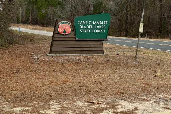
Camp Chamblee
This is a State Forest road that takes you directly to Camp Chamblee, a dispersed camping area within the State Forest. The road is a well-maintained dirt road suitable for any vehicle. Camping is free, however, you are required to call the ranger station to let them know you are camping. They can b...
Learn more about Camp Chamblee
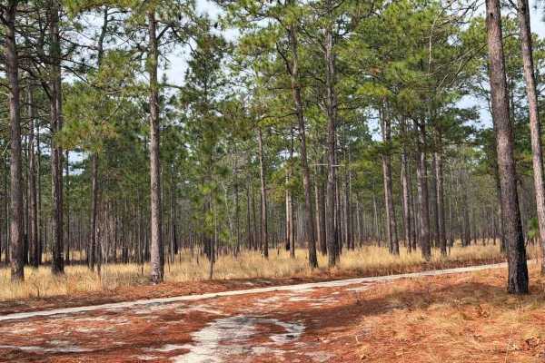
Carpenter Road
Carpenter Road is a short connector between State Route 15 and Strausburg Lane, providing access from pavement to the southeastern portion of the game lands. The road is predominantly a double-track trail, with some narrower sections consisting of loose sand and the potential for mud, while the west...
Learn more about Carpenter Road
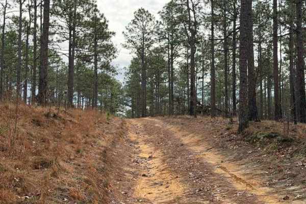
Strausburg Lane
Strausburg Lane is a poorly maintained forest road that has gradually deteriorated into an easy-to-moderate trail. Numerous puddles and small water crossings are scattered along the route, some of which may have soft bottoms. Depending on recent rainfall, these crossings can range from shallow puddl...
Learn more about Strausburg Lane
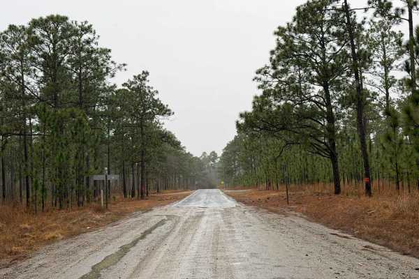
Hoffman Road
Hoffman Road is a large Forest Service road that provides access to a wide area of the southeastern portion of the Sandhills Game Lands. The road itself is wide and well-defined, with numerous trails branching off and a couple of key points of interest along the way. One of the most prominent featur...
Learn more about Hoffman Road
Scotland Lane
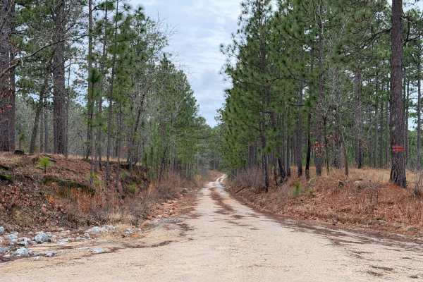
Scotland Lane is a smaller, less-maintained forest service road that runs east to west through the southern portion of the Sandhills Game Lands. The majority of the trail is generally easy; however, after rainfall, a few moderate-sized puddles can form toward the western end. Additional minor challe...
Learn more about Scotland Lane
Deaton Lane
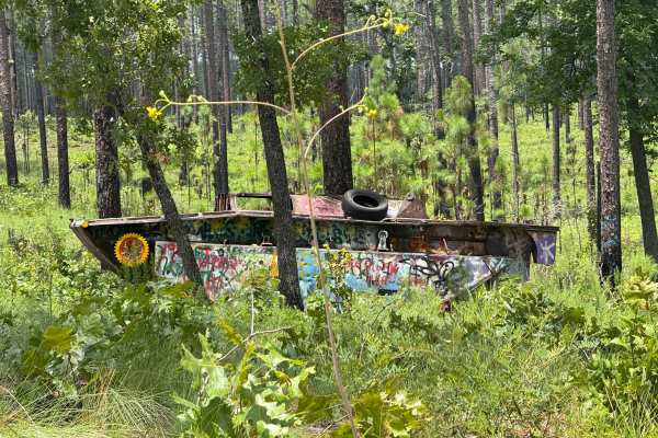
Deaton Lane is a sandy Forest Service road located on the eastern side of the Sandhills Game Lands. While many of the major roads in this area are fairly easy, this route presents a few minor challenges. At the end of the trail, drivers will find a small turnaround filled with medium-depth soft sand...
Learn more about Deaton Lane
Baggetts Lake Lane
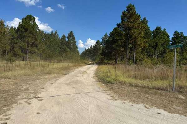
Baggetts Lake Lane is a longer Forest Service road that runs north to south, providing access to a large portion of the Sandhills Game Lands. In addition to general access, the midpoint of the trail leads to the field trial grounds center, a military memorial, and nearby horse stables. The central s...
Learn more about Baggetts Lake Lane
Field Trial Road
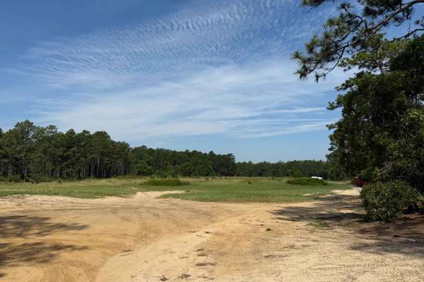
Field Trial Road is an access road running from the Northeast to Southwest in the Sandhills Game Land. The road is generally easy, consisting of a wide, sandy forest service route with minor ruts and areas of loose sand. After heavy rain, the ruts may worsen, though the forest service frequently mai...
Learn more about Field Trial Road
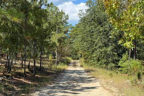
Naked Creek Lane
Naked Creek Lane is a major east–west road located in the northernmost portion of the Sandhills Game Lands. Of the primary named roads, it is arguably the least maintained, tending to be narrower and slightly rougher than others in the area. Despite this, there are a few significant obstacles, thoug...
Learn more about Naked Creek Lane
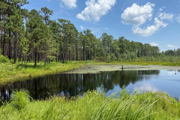
Thrower Lane
Thrower Lane is a shorter Forest Service road within the Sandhills Game Lands that provides views and access to the eastern end of Bones Fork, a flooded pond. This area frequently overflows, creating small water crossings of varying depths. While these crossings may present a minor challenge, they t...
Learn more about Thrower Lane
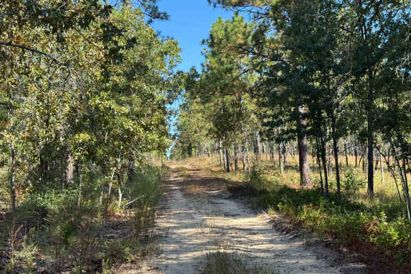
Telephone Ln
Telephone Lane is a smaller and more involved trail than others located within the Sandhills Game Lands. The route is primarily a sandy double-track, with the potential for deeper sand, standing water, ruts, and mud depending on the weather and time of year. Seasonal changes or recent prescribed bur...
Learn more about Telephone Ln
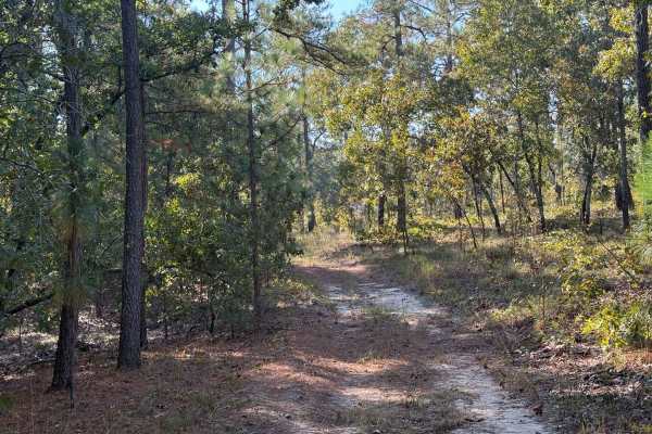
A-6 Lane
A-6 Lane is one of the primary Forest Service roads connecting the northern portions of the Sandhills Game Lands to the southern areas, while also serving as the boundary between the field trial grounds and the main game lands. The southern half of the road is generally wider and better maintained, ...
Learn more about A-6 Lane
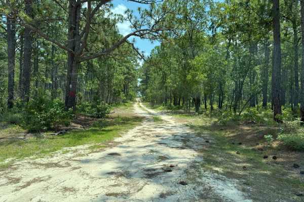
Nursery Lane
Nursery Lane is a longer Forest Service road within Sandhills Game Lands that offers a generally easy drive with only minimal challenges, most of which depend on weather conditions. A short section of the trail has been rutted out by recent rainfall, though the ruts are typically no deeper than 6 in...
Learn more about Nursery Lane
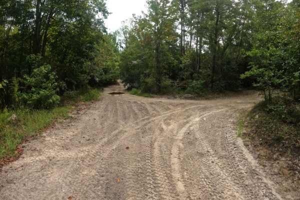
Oakley Road
This trail is accessible from the north side of the campground or from Cooke's Circle. Oakley Road is a nice and easy ride through the woods. It does have a few narrow blind corners so use caution. However, the trail is generally wide enough for two vehicles to pass. Be aware that the speed limit in...
Learn more about Oakley Road
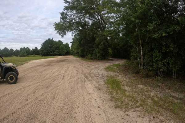
Trey's Trail
This is a great little trail that breaks off of Heritage Trail and runs parallel to it. It has a couple of blind corners and is mostly a single-lane trail with areas to pull off to allow traffic to pass. It feels a little slower-paced and avoids some of the mud holes that develop on its bigger broth...
Learn more about Trey's Trail
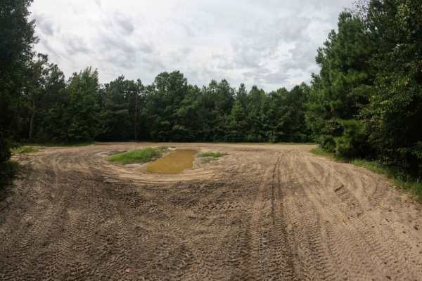
Beaten Path
The Beaten Path lives up to its namesake, the trail is hardpacked sand with multiple mud holes in the middle of the trail; however, they're easy to bypass under normal conditions. There is one large obstacle that comes shortly after the intersection with Blackdog's Boulevard, or before the intersect...
Learn more about Beaten Path
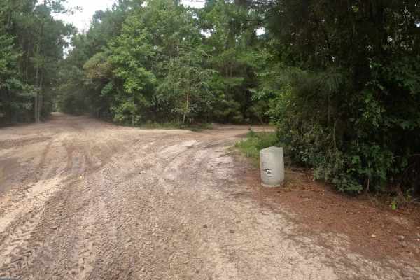
Cooke's Circle
This loop begins and ends at the Heritage Trail intersection. Most of the obstacles on the trail are a few small mudholes that are easily bypassed around the edges. Further down the trail is a larger mud hole with no visible bypass that may pose a more significant challenge after heavy rain. As the ...
Learn more about Cooke's Circle
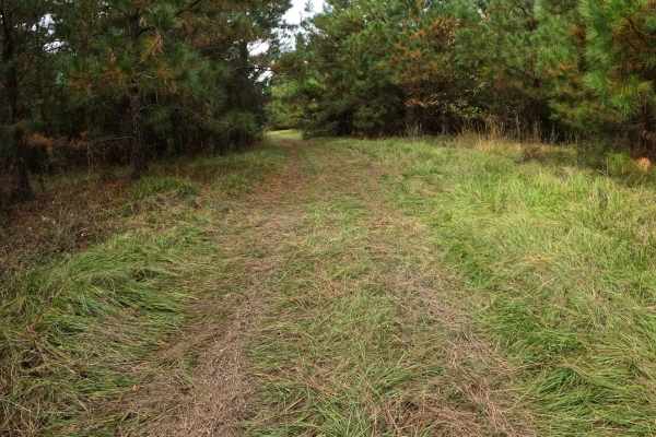
Strickland Drive
Strickland Road is a connector between Heritage Trail and Shelby Drive. The trail is mostly comprised of grass with compact sand underneath. Its wide;however, the trees tend to grow in near Shelby Drive, so the trail may narrow near this intersection. Use caution approaching Heritage Trail or Shelby...
Learn more about Strickland Drive
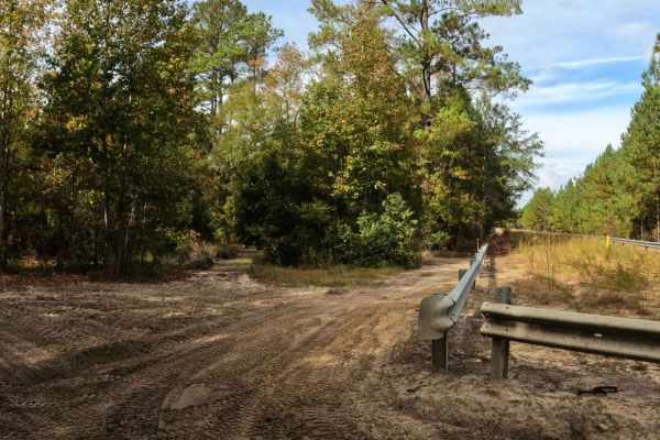
Sadie's Way
This trail is a great single-lane alternative to The Beaten Path. As Sadie's Way winds through the forest, it's comprised of mostly compact sand with some loose areas in between. There are several mud pits along the way as well; however, they all have a narrow bypass around them. Vehicles larger tha...
Learn more about Sadie's Way
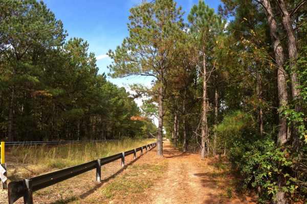
Adventure Alley
Adventure Alley follows the pipeline from Shelby Drive to Blackdog's Boulevard. The trail is single-lane and comprised of compact sand. The northern section of the trail has several sections of mud and ruts that may require a bypass if not equipped for it. The bypass through the trees can get tight ...
Learn more about Adventure Alley
Beginner ATV trails near St. Pauls, North Carolina
Explore ATV-friendly trails near you. These trails are accessible for vehicles up to 50 inches wide, perfect for ATVs and smaller off-road machines.
Oakley Road
This trail is accessible from the north side of the campground or from Cooke's Circle. Oakley Road is a nice and easy ride through the woods. It does have a few narrow blind corners so use caution. However, the trail is generally wide enough for two vehicles to pass. Be aware that the speed limit in...
Learn more about Oakley Road
Trey's Trail
This is a great little trail that breaks off of Heritage Trail and runs parallel to it. It has a couple of blind corners and is mostly a single-lane trail with areas to pull off to allow traffic to pass. It feels a little slower-paced and avoids some of the mud holes that develop on its bigger broth...
Learn more about Trey's Trail
Beaten Path
The Beaten Path lives up to its namesake, the trail is hardpacked sand with multiple mud holes in the middle of the trail; however, they're easy to bypass under normal conditions. There is one large obstacle that comes shortly after the intersection with Blackdog's Boulevard, or before the intersect...
Learn more about Beaten Path
Cooke's Circle
This loop begins and ends at the Heritage Trail intersection. Most of the obstacles on the trail are a few small mudholes that are easily bypassed around the edges. Further down the trail is a larger mud hole with no visible bypass that may pose a more significant challenge after heavy rain. As the ...
Learn more about Cooke's Circle
Beginner UTV/side-by-side trails near St. Pauls, North Carolina
Find UTV and side-by-side trails near you. These trails accommodate vehicles up to 60 inches wide, ideal for UTVs, side-by-sides, and wider off-road rigs.
Oakley Road
This trail is accessible from the north side of the campground or from Cooke's Circle. Oakley Road is a nice and easy ride through the woods. It does have a few narrow blind corners so use caution. However, the trail is generally wide enough for two vehicles to pass. Be aware that the speed limit in...
Learn more about Oakley Road
Trey's Trail
This is a great little trail that breaks off of Heritage Trail and runs parallel to it. It has a couple of blind corners and is mostly a single-lane trail with areas to pull off to allow traffic to pass. It feels a little slower-paced and avoids some of the mud holes that develop on its bigger broth...
Learn more about Trey's Trail
Beaten Path
The Beaten Path lives up to its namesake, the trail is hardpacked sand with multiple mud holes in the middle of the trail; however, they're easy to bypass under normal conditions. There is one large obstacle that comes shortly after the intersection with Blackdog's Boulevard, or before the intersect...
Learn more about Beaten Path
Cooke's Circle
This loop begins and ends at the Heritage Trail intersection. Most of the obstacles on the trail are a few small mudholes that are easily bypassed around the edges. Further down the trail is a larger mud hole with no visible bypass that may pose a more significant challenge after heavy rain. As the ...
Learn more about Cooke's Circle
The onX Offroad Difference
onX Offroad combines trail photos, descriptions, difficulty ratings, width restrictions, seasonality, and more in a user-friendly interface. Available on all devices, with offline access and full compatibility with CarPlay and Android Auto. Discover what you're missing today!
Open Trail Map