
Beginner Off-Road Trails
Near St. John, Washington
Explore All Beginner Trails Near St. John, Washington
Beginner Off-Road Trails Near St. John, Washington
Discover the best beginner-friendly off-road trails near you. These easier, lower-rated trails are a great place to start — browse trail maps, check difficulty ratings, and find your next adventure.
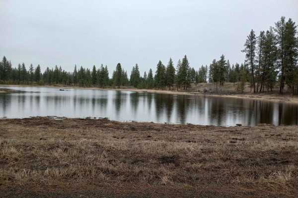
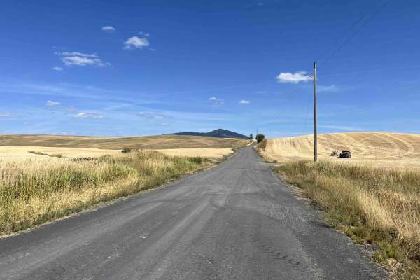
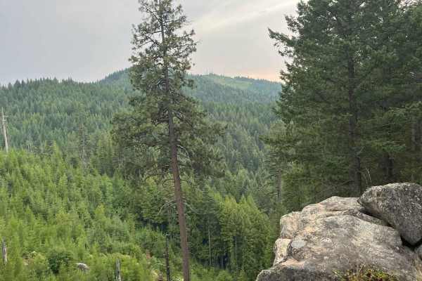
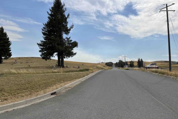
Turnbull's Pine Creek Auto Route
Pine Creek Auto Tour Route is a casual drive through Turnbull's National Wildlife Refuge. This is a well-maintained road that should be manageable in any vehicle. There is a small amount of pavement-less than 500 yards overall. What it's lacking in off-road challenges, it more than makes up for in b...
Learn more about Turnbull's Pine Creek Auto Route
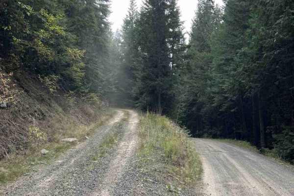
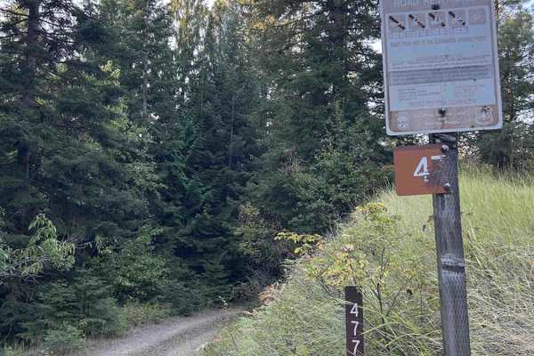
Korth Trail
The Korth trail is a 50" trail at McCroskey State Park. Both ends start out pretty wide like a logging road, but you'll drop into the timber where the trail narrows. This is where you'll find more winding and flow on the trail. There are a handful of creek crossings that would likely be pretty seaso...
Learn more about Korth Trail
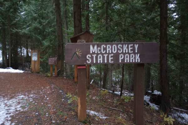
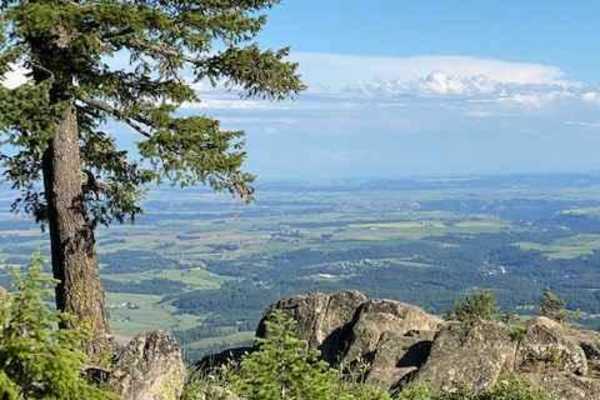
Skyline Drive
This route starts on Highway 95 near De Smet, Idaho and travels through McCroskey State Park. This is a well maintained road that any vehicle should be able to take on. Signs along the way will teach you some of the history of the area. Just over 6 miles in, you'll come across a day use area with a...
Learn more about Skyline Drive
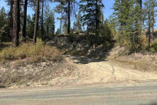
Crane Point/FS 1273
Crane Point is a 3.7-mile out-and-back gravel road that climbs from US95 to Crane Point. The gravel road is well maintained and ranges from one to two vehicles wide. Crane Point serves as the main access point to the Crane Point trail network. There is logging activity, so watch for logging trucks a...
Learn more about Crane Point/FS 1273
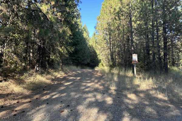
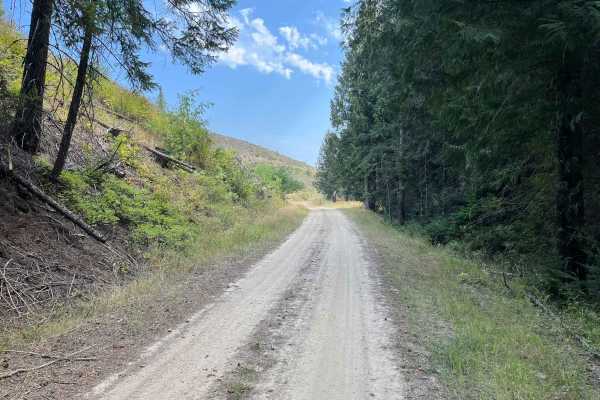
Gold Hill - FS 770
Gold Hill (FS 770) is a 5.6-mile, point-to-point trail that takes drivers from US Highway 95 up into the Gold Hill trail network. Gold Hill starts in rolling wheat fields and ends up in the hills at an intersection with Big Creek (FS 370). Coming from the west side, Gold Hill is a slow but steady cl...
Learn more about Gold Hill - FS 770
Treasure Gulch - FS 1418
1418 Treasure Gulch is a 3-mile out-and-back trail that breaks off from 770 Gold Hill. FS 1418 climbs up and along the west side of the geographical feature by the same name, Treasure Gulch, before cresting the ridge at an intersection with Waterhole Creek, a 50" and under trail. Before the intersec...
Learn more about Treasure Gulch - FS 1418
Waterhole Creek
Waterhole Creek Trail begins at Gold Hill - (Road 770) and climbs up through dense timber and along an open ridge to Prospect Peak, where it drops off onto Big Creek Road. The trailhead is designated by a blue marker. This is Trail 15 in the US Forest Service Palouse Trail System. On the Big Creek s...
Learn more about Waterhole Creek
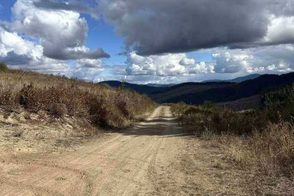
Palouse Divide West - FS 377
Palouse Divide West (FS 377) is a 15.3 point-to-point trail that, when starting from the west side, begins at the end of Big Creek Road. It winds down into the backside of Prospect Peak into a valley and continues along Meadow Creek for several miles before making a sharp left shown in the second pi...
Learn more about Palouse Divide West - FS 377
Carrico Mine - FS 4775
Carrico Mine is a 2.2-mile out-and-back single-lane trail that ends at an intersection with East Fork Gold Creek, a 50-inch and under trail. According to motor vehicle use maps (MVUMs), the trail continues for another 0.5 miles past East Fork Gold Creek. As of 9/15/25, there are large, essentially i...
Learn more about Carrico Mine - FS 4775
Gold Hill - FS 770-A
770-A Gold Hill is a 2-mile out-and-back trail that breaks off from 770 Gold Hill. It is gated at the bottom, and according to signs nearby, the gate may be closed at any time. 770-A is a good side trip from 770, with several short trails that break off from 770-A to explore. There are several pull-...
Learn more about Gold Hill - FS 770-A
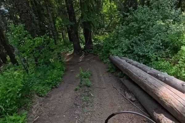
Hoteling Creek C - FS 73680
Hoteling Creek C is a 1-mile out-and-back trail that breaks off from Hoteling Creek. It continues north along the east side of Gold Hill before ending at an open area with space for several vehicles to camp or have lunch. FS 73680 is heavily overgrown in some spots; vehicles larger than quads will g...
Learn more about Hoteling Creek C - FS 73680
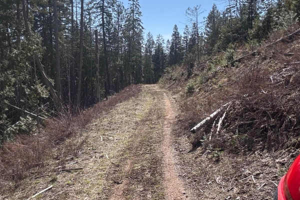
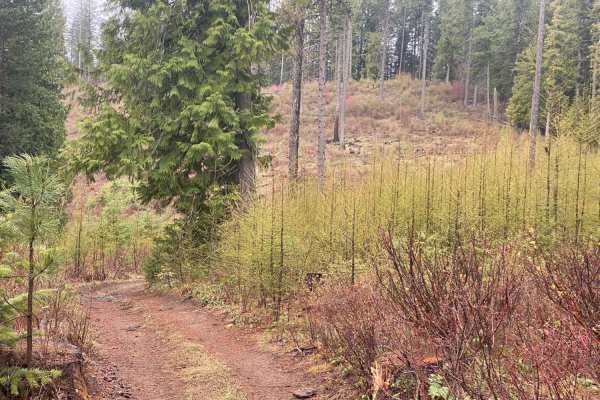
Chesley Creek Trail 19
This is one of the more enjoyable trails in the area, with lots of elevation changes, several banked corners, and switchbacks. It is smooth and flowy, which makes for a great ride. The trail winds through a mix of shady timber and open clear-cut areas. There has been some logging in the area, so the...
Learn more about Chesley Creek Trail 19
Moscow Mtn Road
This is a county road only open from June 1-November 7 to motorized traffic, with gates closed during winter. This route is from gate to gate over Moscow Mountain through the woods. There is parking just past the Moscow side gate. The road is nice but narrow in parts--lots of mountain biking, hiking...
Learn more about Moscow Mtn Road
Moscow Mountain Lookout
This is a short but fun ride up to the Moscow Mountain lookout, which resides on the East Summit of Moscow Mountain. This trail is mostly dirt, with the first several hundred yards made up of large 2" gravel rock. This trail is relatively wide for a good portion before turning to a narrow two-track ...
Learn more about Moscow Mountain Lookout
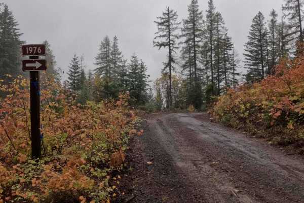
Hill Creek - FS 1976
1976 Hill Creek is a 1.9-mile out-and-back trail that starts at 377 Palouse Divide West, climbing around the west and north side of West Dennis, before ending at the border of PotlachDeltic timberland, where the trail becomes restricted to 50-inch and under OHVs. Hill Creek has recently had logging ...
Learn more about Hill Creek - FS 1976
Chelsey Creek - FS 1960
Chelsey Creek is a 6.4-mile point-to-point trail that breaks off of Big Creek Road into a small valley when starting from the lower east side. Through the valley, the road surface is a mix of dirt and thin silt. As the trail begins to climb, the surface turns to dirt with some smaller rocks. After t...
Learn more about Chelsey Creek - FS 1960
Rimrock Road
Rimrock Road is a point-to-point gravel road that skirts along the top of the Snake River Canyon. The trail is lined with private farmland on either side, so please be respectful when passing through. The road is well-maintained and two lanes wide for its entire length. Watch out for farm equipment ...
Learn more about Rimrock Road
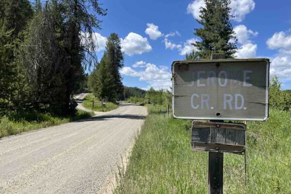
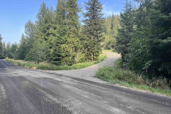
Jerome Creek - FS 788
Jerome Creek (FS 788) is a 10.4-mile, well-maintained gravel road loop that starts near Idaho Route 6 and climbs up the southeast side of Gold Hill before turning back down and reconnecting with itself. For the first 3 miles, Jerome Creek crosses several parcels of private property;fortunately, thes...
Learn more about Jerome Creek - FS 788
224A
This short connector trail starts at the Giant White Pine Campground and Trailhead and connects to the 4-way intersection with Three Tree Butte and East Fork Meadow Creek. This is an alternate way to start either of those trails or make a very short loop near the campground for beginner riders. Near...
Learn more about 224A
Palouse Divide East - FS 377
Palouse Divide West is a 15.3-mile point-to-point trail that, beginning from the west, starts at the terminus of Big Creek Road. The trail descends the northwest side of Prospect Peak, continuing through a valley along Meadow Creek for several miles before making a sharp left turn as shown in Pictur...
Learn more about Palouse Divide East - FS 377
Beginner ATV trails near St. John, Washington
Explore ATV-friendly trails near you. These trails are accessible for vehicles up to 50 inches wide, perfect for ATVs and smaller off-road machines.
Korth Trail
The Korth trail is a 50" trail at McCroskey State Park. Both ends start out pretty wide like a logging road, but you'll drop into the timber where the trail narrows. This is where you'll find more winding and flow on the trail. There are a handful of creek crossings that would likely be pretty seaso...
Learn more about Korth Trail
Skyline Drive
This route starts on Highway 95 near De Smet, Idaho and travels through McCroskey State Park. This is a well maintained road that any vehicle should be able to take on. Signs along the way will teach you some of the history of the area. Just over 6 miles in, you'll come across a day use area with a...
Learn more about Skyline Drive
Crane Point/FS 1273
Crane Point is a 3.7-mile out-and-back gravel road that climbs from US95 to Crane Point. The gravel road is well maintained and ranges from one to two vehicles wide. Crane Point serves as the main access point to the Crane Point trail network. There is logging activity, so watch for logging trucks a...
Learn more about Crane Point/FS 1273
Gold Hill - FS 770
Gold Hill (FS 770) is a 5.6-mile, point-to-point trail that takes drivers from US Highway 95 up into the Gold Hill trail network. Gold Hill starts in rolling wheat fields and ends up in the hills at an intersection with Big Creek (FS 370). Coming from the west side, Gold Hill is a slow but steady cl...
Learn more about Gold Hill - FS 770
Beginner UTV/side-by-side trails near St. John, Washington
Find UTV and side-by-side trails near you. These trails accommodate vehicles up to 60 inches wide, ideal for UTVs, side-by-sides, and wider off-road rigs.
Skyline Drive
This route starts on Highway 95 near De Smet, Idaho and travels through McCroskey State Park. This is a well maintained road that any vehicle should be able to take on. Signs along the way will teach you some of the history of the area. Just over 6 miles in, you'll come across a day use area with a...
Learn more about Skyline Drive
Crane Point/FS 1273
Crane Point is a 3.7-mile out-and-back gravel road that climbs from US95 to Crane Point. The gravel road is well maintained and ranges from one to two vehicles wide. Crane Point serves as the main access point to the Crane Point trail network. There is logging activity, so watch for logging trucks a...
Learn more about Crane Point/FS 1273
Gold Hill - FS 770
Gold Hill (FS 770) is a 5.6-mile, point-to-point trail that takes drivers from US Highway 95 up into the Gold Hill trail network. Gold Hill starts in rolling wheat fields and ends up in the hills at an intersection with Big Creek (FS 370). Coming from the west side, Gold Hill is a slow but steady cl...
Learn more about Gold Hill - FS 770
Treasure Gulch - FS 1418
1418 Treasure Gulch is a 3-mile out-and-back trail that breaks off from 770 Gold Hill. FS 1418 climbs up and along the west side of the geographical feature by the same name, Treasure Gulch, before cresting the ridge at an intersection with Waterhole Creek, a 50" and under trail. Before the intersec...
Learn more about Treasure Gulch - FS 1418
The onX Offroad Difference
onX Offroad combines trail photos, descriptions, difficulty ratings, width restrictions, seasonality, and more in a user-friendly interface. Available on all devices, with offline access and full compatibility with CarPlay and Android Auto. Discover what you're missing today!
Open Trail Map