
Beginner Off-Road Trails
Near Santa Rosa, Arizona
Explore All Beginner Trails Near Santa Rosa, Arizona
Beginner Off-Road Trails Near Santa Rosa, Arizona
Discover the best beginner-friendly off-road trails near you. These easier, lower-rated trails are a great place to start — browse trail maps, check difficulty ratings, and find your next adventure.
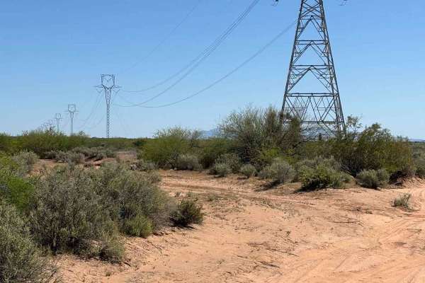
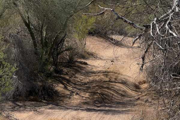
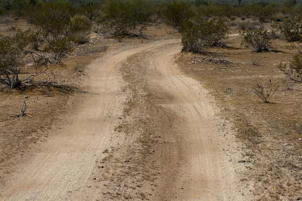
Sawtooth Powerline Trail
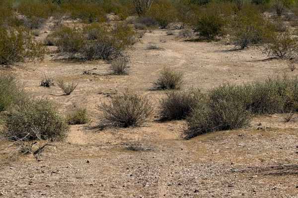
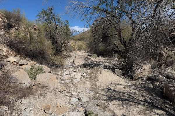
This powerline trail provides access to the West Silverbell Mountain Loop from the Sawtooth Mountain Loop. Other side trails give access to the Silverbell Sasco loop as well. This is a massive backcountry area with many unmapped trails, very few crowds, and an abundance of Sonoran desert flora and f...
Learn more about Sawtooth Powerline Trail
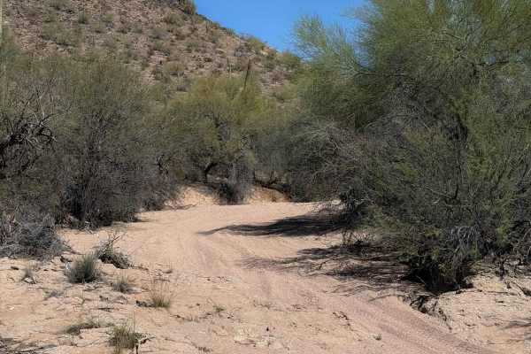
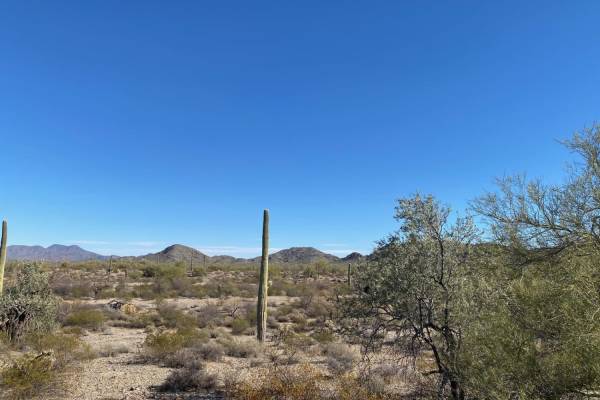
West Silverbell Mountain Loop
Explore a relatively easy trail meandering through quintessential Sonoran Desert landscapes. The trail is mostly smooth and has a good flow to it, with a handful of rockier sections. There are great views of the local mountains and unique rock outcrops. The southern end of West Silverbell Mountain f...
Learn more about West Silverbell Mountain Loop
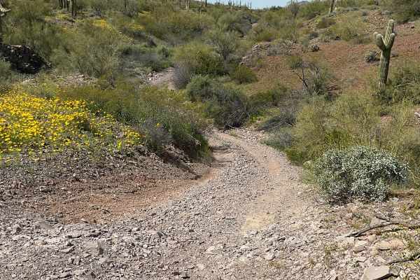
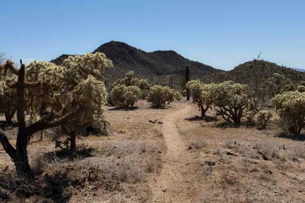
Sawtooth Mountain Loop
AZ State Trust permit required. This scenic trail circles around the Sawtooth Mountains. It is on BLM and AZ State Trust and skirts private land. You will experience forests of cholla, saguaro, and large pear cactus, which are extremely beautiful in their natural setting. After rains, the greenwash ...
Learn more about Sawtooth Mountain Loop
8042B
This is a short trail, 0.8 miles long, on the edge of the Table Top Wilderness and BLM land, easily accessible from the Sonoran Desert National Monument Staging Area. It’s mostly an easy desert trail on a mix of hard-packed dirt and sand, meandering through the creosote bushes with minimal elevation...
Learn more about 8042B
8042
BLM route 8042 starts on the north end as a narrower trail between a couple of paloverde trees, with branches sticking out into the trail. After the initial entrance, it opens up as it goes south, wider like a road. The route is a mix of sand washes and hard-packed dirt trails over the low rolling h...
Learn more about 8042
Javelina Mountain Trail
This trail is found in the Barry Goldwater Bombing Range, Sand Tank Mountain Area A. A permit is required and easily obtained for free at Luke.isportman.net. Check-in and check-out can easily be done on the same website. This trail takes off from Vekol Road and winds behind Maricopa Peak, Javelina M...
Learn more about Javelina Mountain Trail
Bh1270
This is a 2.2-mile-long desert trail through the BLM land north of the Table Top Wilderness and Interstate 8. The east end of the trail departs from a more major desert road (Bh1271), and it meanders west through a flat desert terrain on a mix of hard-packed dirt and sand. The trail enters a wide sa...
Learn more about Bh1270
Backway to Waterfall
This easy backway to the waterfall trail makes for a fun drive with plenty of stops throughout. Along the way, you will find small and large rock features that will be great for stops for groups as well as for picture taking. It is suggested to have 4WD and high clearance for some areas and the Wate...
Learn more about Backway to Waterfall
Hidden Valley
This is a 1.3-mile-long segment of primitive dirt bike trail through BLM land, accessed off of BLM Route 1273. The trail is lightly trafficked and faint at times, and will require some good navigation and a GPS track. It goes through a flat and barren desert terrain over hard-packed dirt and gravel,...
Learn more about Hidden Valley
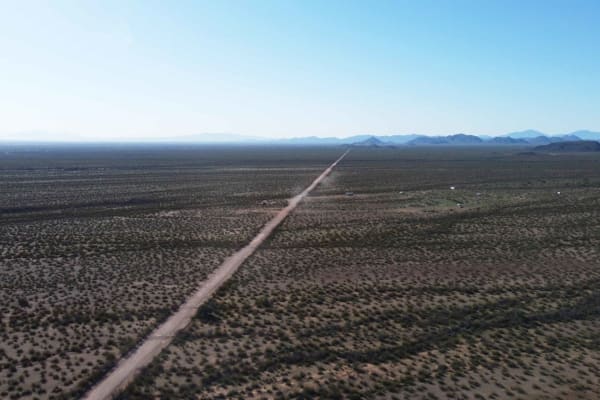
Sonoran Desert 8009
Take Freeman Road exit about 17 miles east of Gila Bend. BLM. Camping is available, but put some distance between yourself and the interstate. It is an easy drive, though clearance is necessary in some areas. Bring some loppers, as palo verde crowds the road in places. 8009 crosses Barry Goldwater R...
Learn more about Sonoran Desert 8009
Bh1278 Singletrack
This dirt bike trail is a true singletrack through the BLM land north of Interstate 8, compared to the many wide wash trails. It goes through a flat desert terrain for 0.8 miles, on a skinny trail through cholla gardens and next to towering saguaro cactus. The trail weaves through the cactus with ge...
Learn more about Bh1278 Singletrack
Side Route - BLM 8008
Easy off-road wash trail follows a flat sandy bottom, suitable for ATVs and 4x4s. Optional side routes present six to seven obstacles—boulder fields, narrow ledges, soft ruts, and washouts- for experienced drivers. A signed shortcut climbs steeply to an abandoned copper mine. Obstacles are bypassabl...
Learn more about Side Route - BLM 8008
Hidden Valley Wash
This is a fun dirt bike trail through BLM land near the Hawk Hills. Although less than a mile long, it has some fun rocky sections that make it more interesting for the average rider. The trail starts off in easy desert flats, but is primitive through the creosote bushes. At times, it is wide open l...
Learn more about Hidden Valley Wash
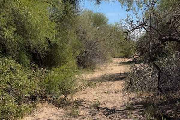
North Waterman Mountain Trail
North Waterman Mountain Trail is a narrow overgrown trail that passes through Ironwood National Monument BLM land and Arizona State Trust Land 5 miles south to West Avra Valley Road. This trail goes through many washes as it meanders through the dense saguaro and cholla valley. Expect pinstripes if ...
Learn more about North Waterman Mountain Trail
Bh1270 Wash
This is a 2-mile-long wash trail through BLM Land north of Interstate 8. The north end starts at the boundary of Arizona state trust land and BLM, accessed through a spur off the Vekol Wash. The entirety of the trail is a wide sandy wash with some grass growing through the sand. There are lots of tr...
Learn more about Bh1270 Wash
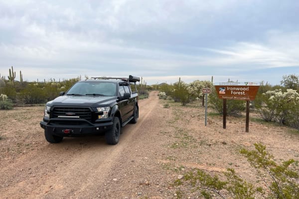
Gas Line Road
Gas Line Road offers a classic desert wheeling experience, winding through a stunning tapestry of protected landscapes, including the Ironwood Forest National Monument, BLM sections, and Arizona State Trust Land. This single-lane trek provides an intimate look at the rugged backcountry of the Southw...
Learn more about Gas Line Road
Hidden Valley Road
This is a road-width trail through BLM land that connects BLM route Bh1367 to private property. The trail is unmarked and looks like it gets used by full-width vehicles. It is a mix of sand and hard-packed dirt and a few loose rocks, traveling through wide open desert terrain for 1.3 miles. The trai...
Learn more about Hidden Valley Road
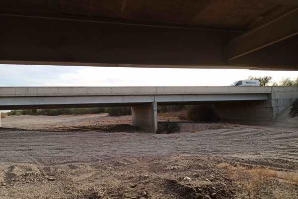
Vekol Wash I-8 Bridge Crossing
This is the leg of the Vekol Wash from Vekol Valley Road, Continuing South, crossing under the I-8 Bridge, and continuing into other trails leading further south; there is also a curve to the west that connects you to the I-8 onramp of Vekol Valley Road. Bridge clearance is approximately 12 feet but...
Learn more about Vekol Wash I-8 Bridge Crossing
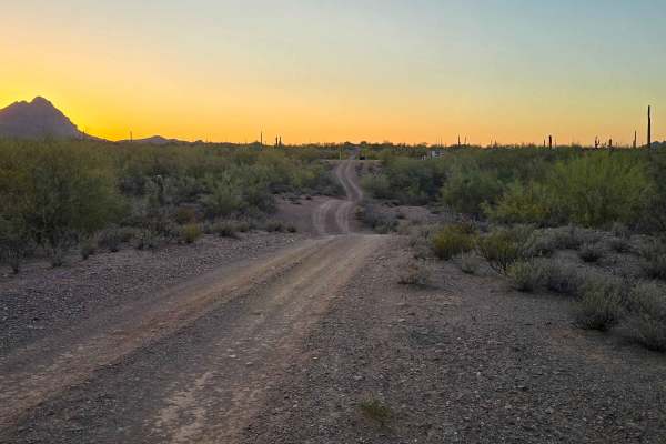
North Pump Station Road
North Pump Station Road is part of Ironwood Forest National Monument and Arizona State Trust Land. This road can be used to complete the long Silverbell Loop around the mountain. It is a smooth well graded dirt road with washboards in some areas and deep rolling washes. There are signs this area wil...
Learn more about North Pump Station Road
Barnes BLM Inlet
Barnes Rd Entrance to BLM Lands and Trails, Barnes Rd Staging area also here on the right and left side of the trail, lots of room for truck/trailer and unloading. There is a nice view from the top of Barnes Hill overlooking all directions that is a good spot for doing Panoramic Photos.
Learn more about Barnes BLM Inlet
Beginner ATV trails near Santa Rosa, Arizona
Explore ATV-friendly trails near you. These trails are accessible for vehicles up to 50 inches wide, perfect for ATVs and smaller off-road machines.
Sawtooth Powerline Trail
This powerline trail provides access to the West Silverbell Mountain Loop from the Sawtooth Mountain Loop. Other side trails give access to the Silverbell Sasco loop as well. This is a massive backcountry area with many unmapped trails, very few crowds, and an abundance of Sonoran desert flora and f...
Learn more about Sawtooth Powerline Trail
West Silverbell Mountain Loop
Explore a relatively easy trail meandering through quintessential Sonoran Desert landscapes. The trail is mostly smooth and has a good flow to it, with a handful of rockier sections. There are great views of the local mountains and unique rock outcrops. The southern end of West Silverbell Mountain f...
Learn more about West Silverbell Mountain Loop
Sawtooth Mountain Loop
AZ State Trust permit required. This scenic trail circles around the Sawtooth Mountains. It is on BLM and AZ State Trust and skirts private land. You will experience forests of cholla, saguaro, and large pear cactus, which are extremely beautiful in their natural setting. After rains, the greenwash ...
Learn more about Sawtooth Mountain Loop
8042B
This is a short trail, 0.8 miles long, on the edge of the Table Top Wilderness and BLM land, easily accessible from the Sonoran Desert National Monument Staging Area. It’s mostly an easy desert trail on a mix of hard-packed dirt and sand, meandering through the creosote bushes with minimal elevation...
Learn more about 8042B
Beginner UTV/side-by-side trails near Santa Rosa, Arizona
Find UTV and side-by-side trails near you. These trails accommodate vehicles up to 60 inches wide, ideal for UTVs, side-by-sides, and wider off-road rigs.
Sawtooth Powerline Trail
This powerline trail provides access to the West Silverbell Mountain Loop from the Sawtooth Mountain Loop. Other side trails give access to the Silverbell Sasco loop as well. This is a massive backcountry area with many unmapped trails, very few crowds, and an abundance of Sonoran desert flora and f...
Learn more about Sawtooth Powerline Trail
West Silverbell Mountain Loop
Explore a relatively easy trail meandering through quintessential Sonoran Desert landscapes. The trail is mostly smooth and has a good flow to it, with a handful of rockier sections. There are great views of the local mountains and unique rock outcrops. The southern end of West Silverbell Mountain f...
Learn more about West Silverbell Mountain Loop
Sawtooth Mountain Loop
AZ State Trust permit required. This scenic trail circles around the Sawtooth Mountains. It is on BLM and AZ State Trust and skirts private land. You will experience forests of cholla, saguaro, and large pear cactus, which are extremely beautiful in their natural setting. After rains, the greenwash ...
Learn more about Sawtooth Mountain Loop
Javelina Mountain Trail
This trail is found in the Barry Goldwater Bombing Range, Sand Tank Mountain Area A. A permit is required and easily obtained for free at Luke.isportman.net. Check-in and check-out can easily be done on the same website. This trail takes off from Vekol Road and winds behind Maricopa Peak, Javelina M...
Learn more about Javelina Mountain Trail
The onX Offroad Difference
onX Offroad combines trail photos, descriptions, difficulty ratings, width restrictions, seasonality, and more in a user-friendly interface. Available on all devices, with offline access and full compatibility with CarPlay and Android Auto. Discover what you're missing today!
Open Trail Map