
Beginner Off-Road Trails
Near Ruth, Nevada
Explore All Beginner Trails Near Ruth, Nevada
Beginner Off-Road Trails Near Ruth, Nevada
Discover the best beginner-friendly off-road trails near you. These easier, lower-rated trails are a great place to start — browse trail maps, check difficulty ratings, and find your next adventure.
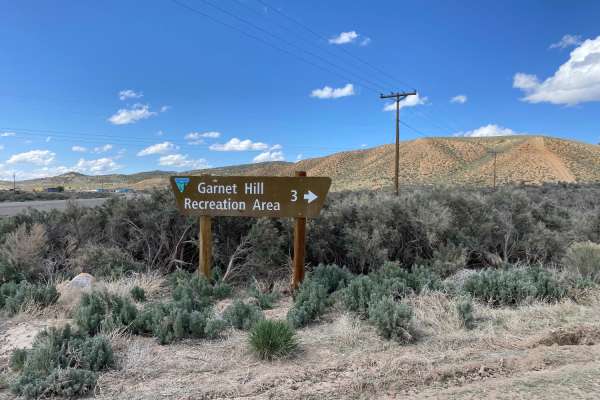
Garnet Hill
The Garnet Hill trail is just 10 miles northwest of Ely, Nevada. This public recreation area is managed by the BLM. The trail is maintained, and most passenger vehicles should be able to drive it in dry weather. The area was once a volcanic site that erupted 30 - 40 million years ago. One of the res...
Learn more about Garnet Hill
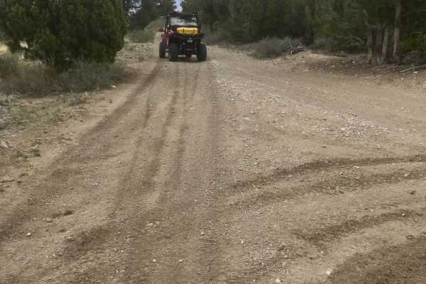
Ice Plant Road
This is an easy, fun ride through a small juniper and cedar tree stand. The tread is a single width composed of native dirt and gravel. The road rises to an elevation of about 7100 feet before intersecting with an ATV route open to vehicles of 50" or less in width. Panoramic views of the city of ...
Learn more about Ice Plant Road
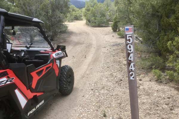
Ice Plant Springs Road
This is one of several roads that provide access to the Ice Plant ATV Loop. The road travels through a high desert environment with relatively dense juniper, pine trees, and sagebrush growth. The single-width tread comprises native gravels and soil with occasional rocks and ruts. This is a fairly ea...
Learn more about Ice Plant Springs Road
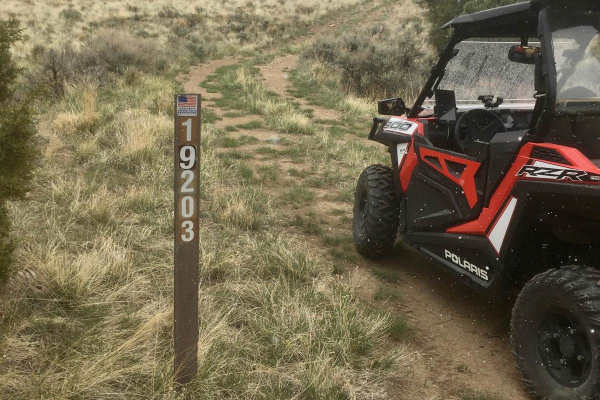
South Gallagher ATV Trail
This is a lightly traveled trail designated for ATVs (50" or less in width) and dirt bikes. The route travels through high desert terrain that alternates between open, lightly vegetated areas and dense stands of juniper and pine trees. The tread width is one line and can become narrow when winding t...
Learn more about South Gallagher ATV Trail
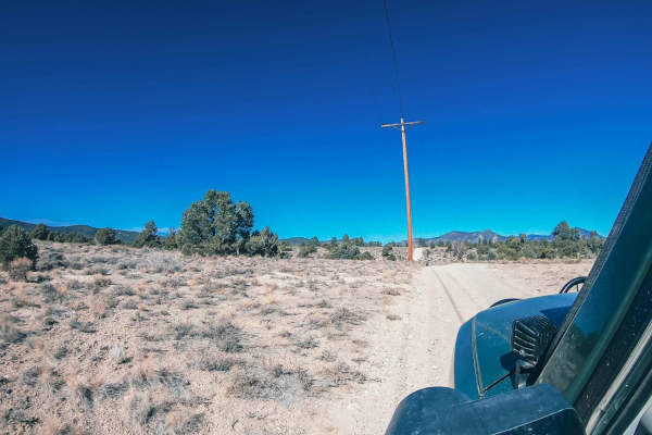
Powerline Road
Take a detour along the powerlines! There are hill climbs to test your vehicle and loose rock to slip around on. The road is easy, but the hill climbs and loose gravel make it more challenging for a 2WD vehicle. Please be mindful as this trail is behind private property, and the residents take these...
Learn more about Powerline Road
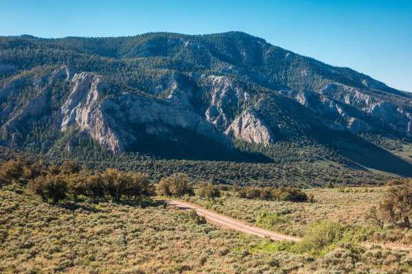
Success Loop
Success Loop is an exceptionally scenic mountain passage perfect for overlanders, stock four-wheel-drive vehicles, and SxSs looking to experience the breathtaking high-country landscapes of eastern Nevada’s Schell Creek Range. Spanning approximately 16.4 miles, this well-traveled dirt and gravel roa...
Learn more about Success Loop
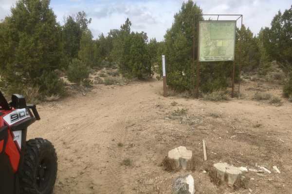
Legacy ATV Trail
This designated ATV (vehicles less than or equal to 50" in width) is part of the Ward Charcoal Ovens State Historical Park. The trail twists and turns through a dense stand of juniper and pine trees, with many short ascents and descents. The western limb of this trail traverses some steeper terrain ...
Learn more about Legacy ATV Trail
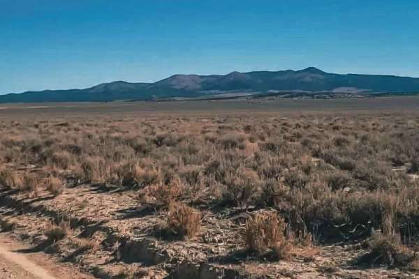
Farm View Road
Farm View Road offers an easy-going, 18.5-mile dirt route perfect for any skill level or vehicle type, running through the picturesque valley flanked by the Egan Range to the west and the Schell Creek Range to the east. With minimal elevation change—ranging between 6,689 and 6,921 feet—this flat and...
Learn more about Farm View Road
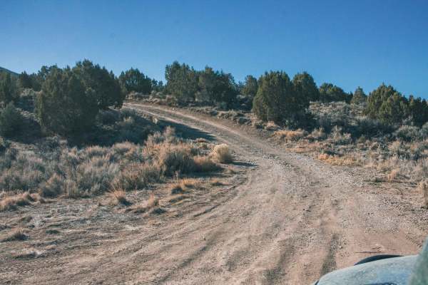
Valley View Road
Are you bored while driving on the freeway and wish there was a quick dirt road to get your mind off the drive? This road is perfect for you! Take a detour in the woods, find a camp spot to stay the night, enjoy beautiful views of the valley, and watch cars drive on the freeway while you're high up ...
Learn more about Valley View Road
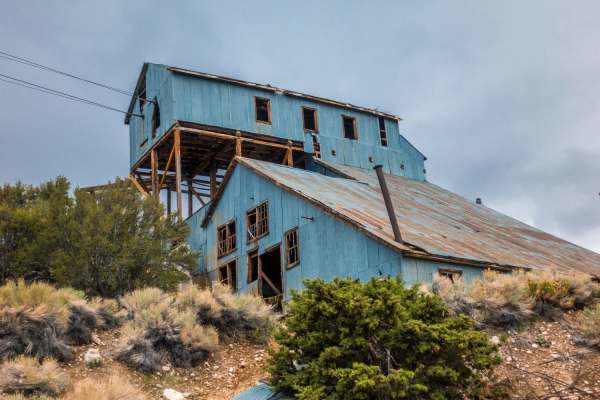
Belmont Mine
This easy route will reward travelers with scenic views and a trip back in history. Head deep into the hills of White Pine county to the remains of the historic Belmont Mill. The trail is not technical and is suitable for most high clearance vehicles. There is abundant wildlife in the area, be on th...
Learn more about Belmont Mine
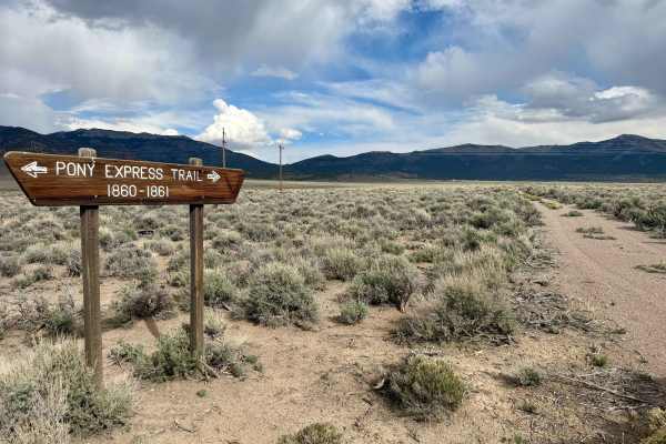
Pony Express Trail 1860 California Telegraph Route
Old Pony Express Trail -California Telegraph route that contains stumps of the telegraph poles along the route. The route is mostly smooth, with overgrown double track wide enough for a high-clearance vehicle. You may gain a couple of pinstripes from the trees and bushes along the trail. Easy, qui...
Learn more about Pony Express Trail 1860 California Telegraph Route
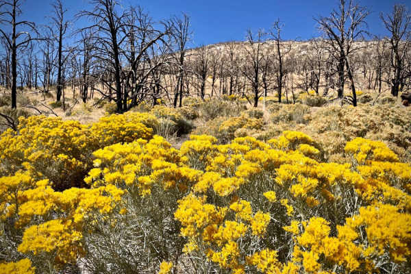
Strawberry Creek Road
Strawberry Creek Road is on the north end of Great Basin National Park and starts through private property off Nevada Highway 6/50. The road itself is no challenge, and the use of 4WD is probably not necessary. Though the drive is a short 5 miles (10 miles round-trip) it takes you through a dead for...
Learn more about Strawberry Creek Road
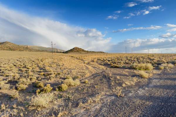
The Express Connector
East-west connector linking Old Highway 93 on the Steptoe Valley floor to the Pony Express National Historic Trail via Schellbourne Pass and surrounding BLM two-tracks. The route climbs from an open sagebrush basin through pinyon-juniper country and crosses the Schell Creek Range at Schellbourne Pas...
Learn more about The Express Connector
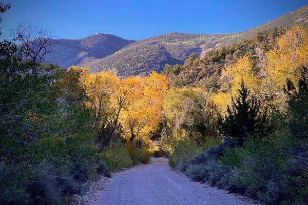
Snake Creek Road
Located south of Great Basin National Park, Snake Creek Road is a pleasant trip up into the mountains. There are two ways to get to the road;the first is off Nevada Highway 487/21 past Baker, while the second is at the intersection of Highways 487/21 and 159 in the town of Garrison. Both roads inter...
Learn more about Snake Creek Road
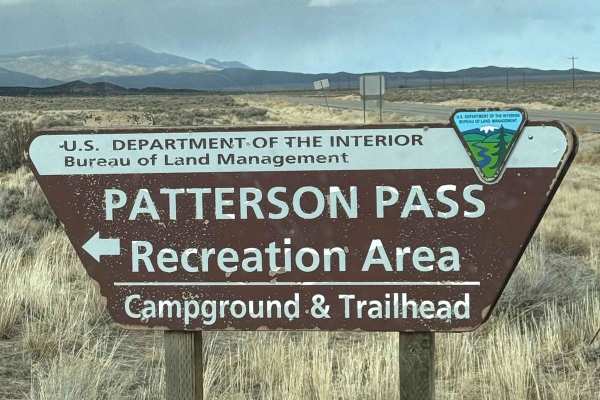
Patterson Pass
Traveling westward over Patterson Pass in Nevada from Highway 93 to State Road 318 is a journey through a rugged and remote landscape, where the vastness of the high desert unfolds in every direction. The road, a mix of gravel and dirt, winds through arid hills and rocky outcrops, with sparse vegeta...
Learn more about Patterson Pass
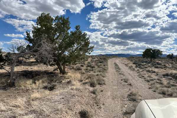
Lexington Trail
This trail is a tame trek through the Utah and Nevada desert near Garrison, Utah. This trail intersects with Lexington Creek and follows Lexington Creek Road to the trailhead for the Lexington Arch hike. The trail itself is fairly easy, with some washboard sections, with the most technical part bein...
Learn more about Lexington Trail
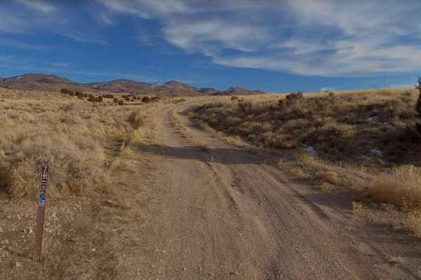
Burbank Hills Trail 7
Burbank Hills Trail 7 is a 23.4-mile loop trail rated 3 of 10 located in Millard County, Utah. This trail is a single-track with a dirt and rock base. Although this trail is open to all types of off-road vehicles it is probably best suited for ATV/UTVs. The Burbank Hills is a small northwest-southea...
Learn more about Burbank Hills Trail 7
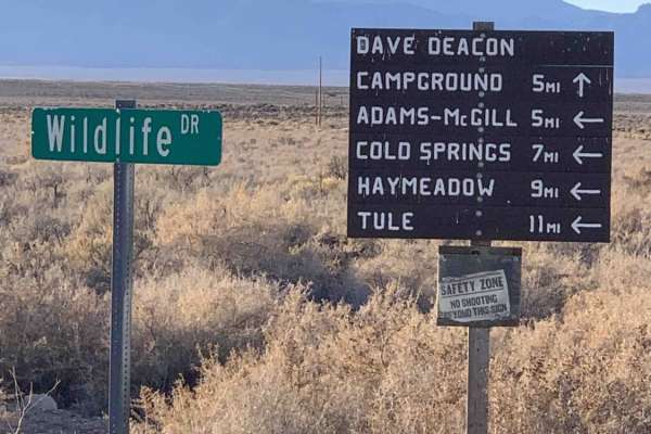
Dave Deacon Camp Dr. and Hot Creek
A nice graded main route into the area. This trail ends at the warm springs recreation area inside the Kirch Wildlife Management Area. It passes a nice established campground with large sites complete with shade structures, fire rings, and picnic tables. The campground has pit toilets and an RV dump...
Learn more about Dave Deacon Camp Dr. and Hot Creek
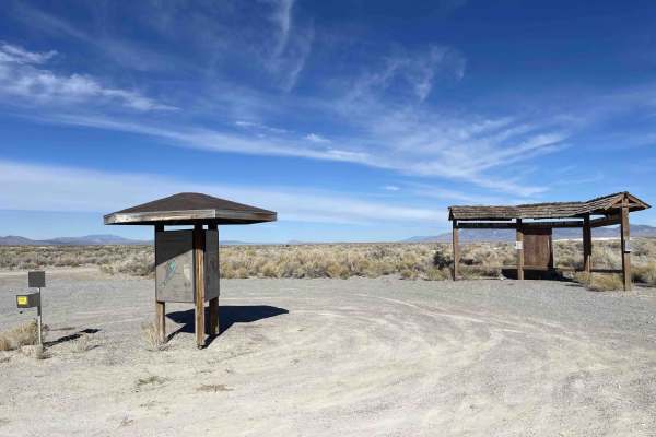
Adams McGill Reservoir Crossover Road
An easy two-lane washboard road to cross the reservoir. There is a nice established campground on the west side and access to highway 318 to the east. There are some clear dispersed camping trails outside of the wildlife refuges on the many trails in the area that crisscross the BLM land. There appe...
Learn more about Adams McGill Reservoir Crossover Road
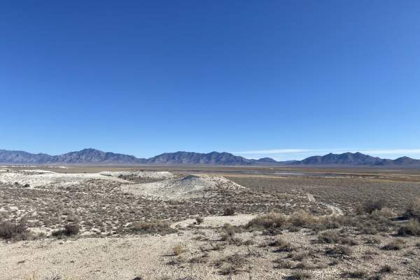
Moon River Viewpoint
Moon River Viewpoint is an easy, scenic 4.7-mile out-and-back trail ideal for beginners, overlanders, and high-clearance four-wheel-drive vehicles seeking panoramic views of Wayne E. Kirch Wildlife Management Area's reservoirs and surrounding desert peaks. Starting near Hay Meadow Reservoir and runn...
Learn more about Moon River Viewpoint
Beginner ATV trails near Ruth, Nevada
Explore ATV-friendly trails near you. These trails are accessible for vehicles up to 50 inches wide, perfect for ATVs and smaller off-road machines.
Ice Plant Road
This is an easy, fun ride through a small juniper and cedar tree stand. The tread is a single width composed of native dirt and gravel. The road rises to an elevation of about 7100 feet before intersecting with an ATV route open to vehicles of 50" or less in width. Panoramic views of the city of ...
Learn more about Ice Plant Road
Ice Plant Springs Road
This is one of several roads that provide access to the Ice Plant ATV Loop. The road travels through a high desert environment with relatively dense juniper, pine trees, and sagebrush growth. The single-width tread comprises native gravels and soil with occasional rocks and ruts. This is a fairly ea...
Learn more about Ice Plant Springs Road
South Gallagher ATV Trail
This is a lightly traveled trail designated for ATVs (50" or less in width) and dirt bikes. The route travels through high desert terrain that alternates between open, lightly vegetated areas and dense stands of juniper and pine trees. The tread width is one line and can become narrow when winding t...
Learn more about South Gallagher ATV Trail
Powerline Road
Take a detour along the powerlines! There are hill climbs to test your vehicle and loose rock to slip around on. The road is easy, but the hill climbs and loose gravel make it more challenging for a 2WD vehicle. Please be mindful as this trail is behind private property, and the residents take these...
Learn more about Powerline Road
Beginner UTV/side-by-side trails near Ruth, Nevada
Find UTV and side-by-side trails near you. These trails accommodate vehicles up to 60 inches wide, ideal for UTVs, side-by-sides, and wider off-road rigs.
Ice Plant Road
This is an easy, fun ride through a small juniper and cedar tree stand. The tread is a single width composed of native dirt and gravel. The road rises to an elevation of about 7100 feet before intersecting with an ATV route open to vehicles of 50" or less in width. Panoramic views of the city of ...
Learn more about Ice Plant Road
Ice Plant Springs Road
This is one of several roads that provide access to the Ice Plant ATV Loop. The road travels through a high desert environment with relatively dense juniper, pine trees, and sagebrush growth. The single-width tread comprises native gravels and soil with occasional rocks and ruts. This is a fairly ea...
Learn more about Ice Plant Springs Road
Powerline Road
Take a detour along the powerlines! There are hill climbs to test your vehicle and loose rock to slip around on. The road is easy, but the hill climbs and loose gravel make it more challenging for a 2WD vehicle. Please be mindful as this trail is behind private property, and the residents take these...
Learn more about Powerline Road
Success Loop
Success Loop is an exceptionally scenic mountain passage perfect for overlanders, stock four-wheel-drive vehicles, and SxSs looking to experience the breathtaking high-country landscapes of eastern Nevada’s Schell Creek Range. Spanning approximately 16.4 miles, this well-traveled dirt and gravel roa...
Learn more about Success Loop
The onX Offroad Difference
onX Offroad combines trail photos, descriptions, difficulty ratings, width restrictions, seasonality, and more in a user-friendly interface. Available on all devices, with offline access and full compatibility with CarPlay and Android Auto. Discover what you're missing today!
Open Trail Map