
Off-road trails in undefined

Beginner Off-Road TrailsUnited States of AmericaRodanthe, North Carolina

Beginner Off-Road Trails
Near Rodanthe, North Carolina

Explore All Beginner Trails Near Rodanthe, North Carolina

Trail Length
Technical Rating
Best Time of Year
Sort By

Beginner Off-Road Trails Near Rodanthe, North Carolina

Discover the best beginner-friendly off-road trails near you. These easier, lower-rated trails are a great place to start — browse trail maps, check difficulty ratings, and find your next adventure.
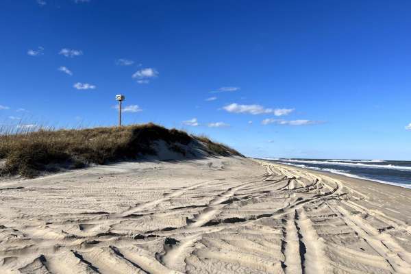
Learn more about Cape Hatteras Ramp 23 to 25
Cape Hatteras Ramp 23 to 25

Cape Hatteras Ramp 23 to 25

This is a beautiful sand beach that is a blast to ride on. Cape Hatteras has many access points you can drive on the beach. Ramp 23 is just south of the town of Rodanthe. 4x4 is required to be able to drive on the beach as well as airing down your tires to 20 psi or less. Recovery equipment is also ...
Learn more about Cape Hatteras Ramp 23 to 25
Total Miles
2.8
Tech Rating
3Easy
Best Time
Spring, Summer, Fall, Winter
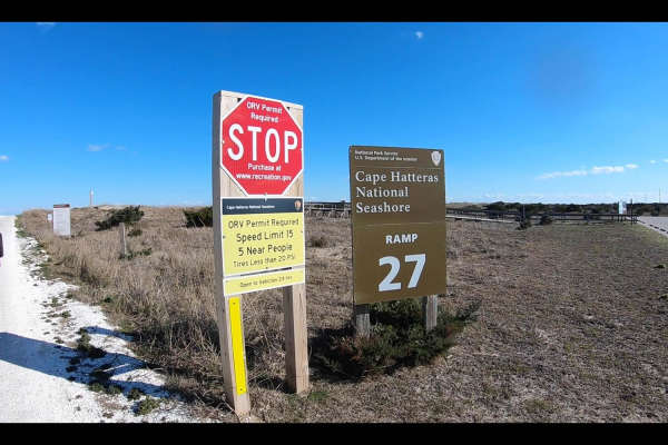
Learn more about Cape Hatteras Ramp 25 to 27
Cape Hatteras Ramp 25 to 27

Cape Hatteras Ramp 25 to 27

This is a beautiful sand beach. Cape Hatteras has many access points you can drive on the beach. Ramp 25 is just south of the town of Rodanthe. 4x4 is required to be able to drive on the beach as well as airing down your tires to 20 psi or less. Recovery equipment is also required along with an ORV ...
Learn more about Cape Hatteras Ramp 25 to 27
Total Miles
2.3
Tech Rating
3Easy
Best Time
Spring, Summer, Fall, Winter
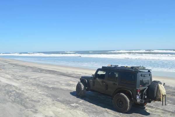
Learn more about Cape Hatteras Ramp 30 to 32
Cape Hatteras Ramp 30 to 32

Cape Hatteras Ramp 30 to 32

This is a beautiful beach that is a blast to ride on. Cape Hatteras has many access points you can drive on the beach. Ramp 30 to 32 is just north of Avon. 4x4 is required to be able to drive on the beach as well as airing down your tires to 20 psi or less. Recovery equipment is also required along ...
Learn more about Cape Hatteras Ramp 30 to 32
Total Miles
2.2
Tech Rating
3Easy
Best Time
Summer, Spring, Fall, Winter
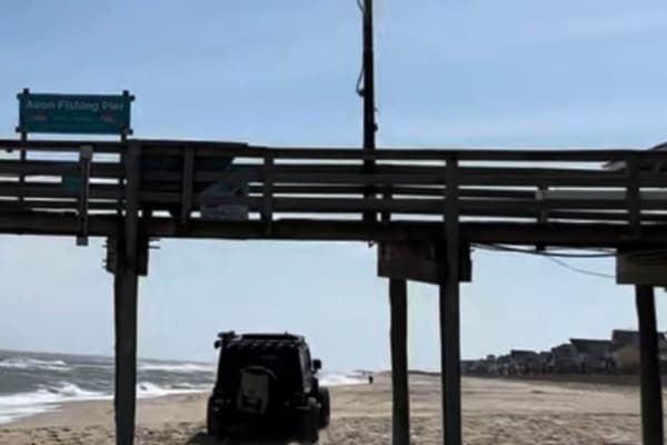
Learn more about Cape Hatteras 34 to 38 Avon Beach
Cape Hatteras 34 to 38 Avon Beach

Cape Hatteras 34 to 38 Avon Beach

This Beach access is only open from October 15- April 14. However, if you are there during this time it's a great way to access Avon Beach and have a front-row seat to an amazing beach. 4x4 is required to be able to drive on the beach as well as airing down your tires to 20 psi or less. Recovery equ...
Learn more about Cape Hatteras 34 to 38 Avon Beach
Total Miles
4.3
Tech Rating
3Easy
Best Time
Fall, Winter, Spring
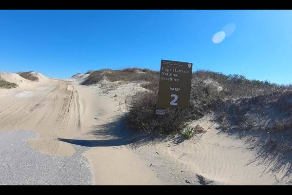
Learn more about Cape Hatteras Ramp 2 to 4
Cape Hatteras Ramp 2 to 4

Cape Hatteras Ramp 2 to 4

Cape Hatteras has many access points you can drive on the beach. Ramp 2 to 4 is just south of the town of Nag Head. 4x4 is required to be able to drive on the beach as well as airing down your tires to 20 psi or less. Recovery equipment is also required along with an ORV permit. The permits are sold...
Learn more about Cape Hatteras Ramp 2 to 4
Total Miles
2.6
Tech Rating
3Easy
Best Time
Spring, Summer, Fall, Winter
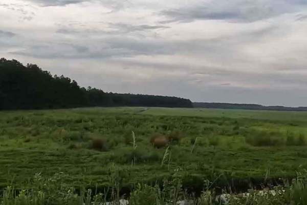
Learn more about Alligator River National Wildlife Refuge
Alligator River National Wildlife Refuge

Alligator River National Wildlife Refuge

Alligator River National Wildlife Refuge is a series of dirt and gravel roads located in Dare County, North Carolina, approximately 45 minutes west of Nags Head in the Outer Banks of North Carolina. The roads offer a relaxing view of the wildlife and surrounding forest and swampland. One can expect ...
Learn more about Alligator River National Wildlife Refuge
Total Miles
29.7
Tech Rating
1Easy
Best Time
Summer, Spring
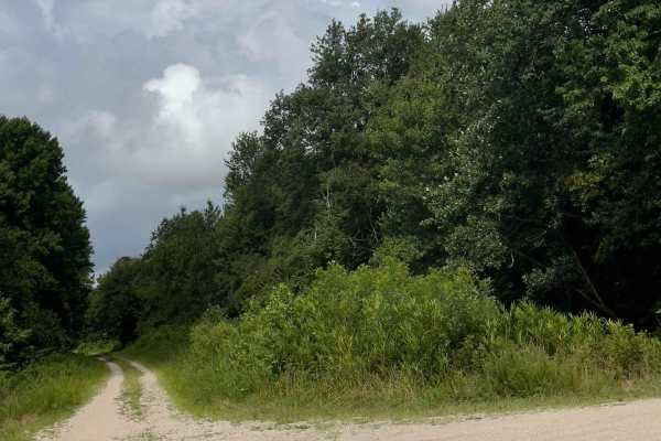
Learn more about Middle Road - Pocosin Lakes National Wildlife Refuge
Middle Road - Pocosin Lakes National Wildlife Refuge

Middle Road - Pocosin Lakes National Wildlife Refuge

This road within the Pocosin National Wildlife Refuge area starts very similar to other roads driving through farmland, with rivers, but eventually switches into a wetter forest road. The first half of the road is well-kept, and very easy to drive on, however, the second half of the road can get a l...
Learn more about Middle Road - Pocosin Lakes National Wildlife Refuge
Total Miles
4.2
Tech Rating
1Easy
Best Time
Summer, Fall, Spring
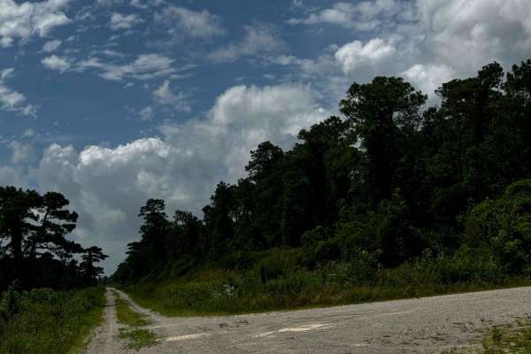
Learn more about Western Road Pocosin National Wildlife Refuge
Western Road Pocosin National Wildlife Refuge

Western Road Pocosin National Wildlife Refuge

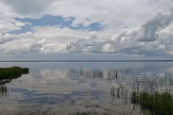
This road within the Pocosin National Wildlife Refuge area is rather similar to all the others however is very cool as it can connect to a lake within the refuge. With that being said, depending on the time of the year the connecting road was closed due to wildlife habitats. This connecting road is ...
Learn more about Western Road Pocosin National Wildlife Refuge
Total Miles
4.5
Tech Rating
1Easy
Best Time
Spring, Summer, Fall
Learn more about Pocosin Lakes National Wildlife Refuge
Pocosin Lakes National Wildlife Refuge

Pocosin Lakes National Wildlife Refuge

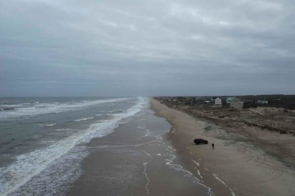
Pocosin Lakes National Wildlife Refuge is a series of scenic gravel roads in Tyrrell County, North Carolina. It's located west of Nags Head in the North Carolina Outer Banks. The Refuge offers amazing scenery and views of the local wildlife. One can expect to see alligators, black bears, red wolves,...
Learn more about Pocosin Lakes National Wildlife Refuge
Total Miles
32.4
Tech Rating
1Easy
Best Time
Spring, Summer
Learn more about NC12 - Carova 4x4 Beach
NC12 - Carova 4x4 Beach

NC12 - Carova 4x4 Beach

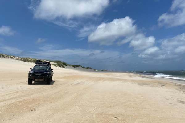
The Carova 4x4 Beach is the northernmost portion of NC-12, which runs along North Carolina's Outer Banks. The pavement ends in the town of Corolla, at which point a 4WD vehicle is mandatory to make the beach drive. Currituck County has an ordinance that makes airing down your vehicle's tires to a ma...
Learn more about NC12 - Carova 4x4 Beach
Total Miles
11
Tech Rating
2Easy
Best Time
Spring, Summer
Learn more about North Core Banks - Portsmouth Island
North Core Banks - Portsmouth Island

North Core Banks - Portsmouth Island

Portsmouth Island requires a private vehicle ferry from Morris Marina to access and reservation in advance is necessary. A permit is required to drive on the beach and can be obtained through the Cape Lookout National Seashore, National Parks website. Once you get to the island, you have 20 miles of...
Learn more about North Core Banks - Portsmouth Island

Total Miles
20
Tech Rating
3Easy
Best Time
Summer, Spring, Fall
Learn more about Lighthouse Access Ramp
Lighthouse Access Ramp

Lighthouse Access Ramp

This access leads to Cape Lookout Lighthouse and Soundside access, with parking that can be limited during the spring and Summer months. The ramp is to be driven with caution, as some corners do not provide enough visual clearance. Abide by the speed limit and pull off to the sides if possible, for ...
Learn more about Lighthouse Access Ramp

Total Miles
0.2
Tech Rating
2Easy
Best Time
Spring, Summer, Fall, Winter
Learn more about East Road
East Road

East Road

East road is accessible from the back road of Cape Lookout which connects to Cape Lookout road. It’s has an emergency storm shelter area that is located on this trail, that can be used during hurricane season. Packed down sand makes traveling this area easier but respect closed off areas.
Learn more about East Road

Total Miles
0.3
Tech Rating
2Easy
Best Time
Summer, Fall, Spring
Learn more about South Core Banks - Back Road
South Core Banks - Back Road

South Core Banks - Back Road

South Core Banks is only accessible by vehicle ferry. A reservation is required through Cape Lookout Cabins and Camps or the Davis Shore Ferry Service. A beach driving permit (ORV) is required and can be obtained through Rec.gov. The National Park Service recommends a low-pressure tire gauge, shovel...
Learn more about South Core Banks - Back Road

Total Miles
18.8
Tech Rating
3Easy
Best Time
Spring, Summer, Fall
Learn more about Ives Field - FS 182
Ives Field - FS 182

Ives Field - FS 182

This is a well-maintained gravel road. The whole road is mostly flat and is wide enough for passing vehicles to go around each other without stopping. No trees or debris blocking the road and no signs of washouts or ruts.
Learn more about Ives Field - FS 182

Total Miles
1.3
Tech Rating
1Easy
Best Time
Spring, Summer, Fall, Winter
Learn more about Pine Grove - FS 156
Pine Grove - FS 156

Pine Grove - FS 156

Coming up onto Pine Grove Road (FS 156), located off of Catfish Lake Road, you will be met with a gravel road that stretches 3.1 miles in the eastern section of the Croatan National Forest. It is smaller in width than most of the trails in the Croatan area, but you will still have room to pull to th...
Learn more about Pine Grove - FS 156

Total Miles
6.2
Tech Rating
1Easy
Best Time
Spring, Summer, Fall, Winter
Learn more about Brown Road - FS 121D
Brown Road - FS 121D

Brown Road - FS 121D

Can be accessed from Middle Little Road or Catfish Lake Road. This gravel road is fairly well maintained and has enough room for passing vehicles to get by. A gate is located in the middle of the trail off to the side that leads to private residence. A variety of different vehicles can travel this r...
Learn more about Brown Road - FS 121D

Total Miles
3.2
Tech Rating
1Easy
Best Time
Spring, Fall, Winter, Summer
Learn more about Mill Branch - FS 170
Mill Branch - FS 170

Mill Branch - FS 170

Located in the northern section of Croatan National Forest, Mill Branch (FS 170) stretches approximately 2.9 miles between County Line Road and Farrior Farm (FS 121A). Recent grading and bulldozing have significantly improved the road surface, eliminating rough patches and large rocks randomly scatt...
Learn more about Mill Branch - FS 170

Total Miles
2.9
Tech Rating
1Easy
Best Time
Spring, Summer, Fall, Winter
Learn more about Farrior Farm - FS 121A
Farrior Farm - FS 121A

Farrior Farm - FS 121A

Upon arrival at Farrior Farm Road, you will be greeted by the Croatan National Forest sign with a noticeably smooth gravel terrain. Approximately 0.5 mile on the left, the Southern New Bern Depot, which is managed by the NC Wildlife Resources Commission, will be located here. Going forward, the trai...
Learn more about Farrior Farm - FS 121A

Total Miles
1.3
Tech Rating
1Easy
Best Time
Spring, Summer, Fall, Winter
Learn more about Briery Branch - FS 122
Briery Branch - FS 122

Briery Branch - FS 122

Started off as a nice dirt road, then slowly transitions to small mud holes on both sides of the trail. Shortly after, you will come to the end that is gated and marked with numerous private property signs. There are no signs of dispersed camping located on this trail.
Learn more about Briery Branch - FS 122

Total Miles
2.1
Tech Rating
1Easy
Best Time
Spring, Summer, Fall, Winter

Beginner ATV trails near Rodanthe, North Carolina

Explore ATV-friendly trails near you. These trails are accessible for vehicles up to 50 inches wide, perfect for ATVs and smaller off-road machines.

Learn more about Lighthouse Access Ramp
Lighthouse Access Ramp

Lighthouse Access Ramp

This access leads to Cape Lookout Lighthouse and Soundside access, with parking that can be limited during the spring and Summer months. The ramp is to be driven with caution, as some corners do not provide enough visual clearance. Abide by the speed limit and pull off to the sides if possible, for ...
Learn more about Lighthouse Access Ramp

Total Miles
0.2
Tech Rating
2Easy
Best Time
Spring, Summer, Fall, Winter
Learn more about East Road
East Road

East Road

East road is accessible from the back road of Cape Lookout which connects to Cape Lookout road. It’s has an emergency storm shelter area that is located on this trail, that can be used during hurricane season. Packed down sand makes traveling this area easier but respect closed off areas.
Learn more about East Road

Total Miles
0.3
Tech Rating
2Easy
Best Time
Summer, Fall, Spring
Learn more about South Core Banks - Back Road
South Core Banks - Back Road

South Core Banks - Back Road

South Core Banks is only accessible by vehicle ferry. A reservation is required through Cape Lookout Cabins and Camps or the Davis Shore Ferry Service. A beach driving permit (ORV) is required and can be obtained through Rec.gov. The National Park Service recommends a low-pressure tire gauge, shovel...
Learn more about South Core Banks - Back Road

Total Miles
18.8
Tech Rating
3Easy
Best Time
Spring, Summer, Fall
Learn more about Brown Road - FS 121D
Brown Road - FS 121D

Brown Road - FS 121D

Can be accessed from Middle Little Road or Catfish Lake Road. This gravel road is fairly well maintained and has enough room for passing vehicles to get by. A gate is located in the middle of the trail off to the side that leads to private residence. A variety of different vehicles can travel this r...
Learn more about Brown Road - FS 121D

Total Miles
3.2
Tech Rating
1Easy
Best Time
Spring, Fall, Winter, Summer

Beginner UTV/side-by-side trails near Rodanthe, North Carolina

Find UTV and side-by-side trails near you. These trails accommodate vehicles up to 60 inches wide, ideal for UTVs, side-by-sides, and wider off-road rigs.

Learn more about Lighthouse Access Ramp
Lighthouse Access Ramp

Lighthouse Access Ramp

This access leads to Cape Lookout Lighthouse and Soundside access, with parking that can be limited during the spring and Summer months. The ramp is to be driven with caution, as some corners do not provide enough visual clearance. Abide by the speed limit and pull off to the sides if possible, for ...
Learn more about Lighthouse Access Ramp

Total Miles
0.2
Tech Rating
2Easy
Best Time
Spring, Summer, Fall, Winter
Learn more about East Road
East Road

East Road

East road is accessible from the back road of Cape Lookout which connects to Cape Lookout road. It’s has an emergency storm shelter area that is located on this trail, that can be used during hurricane season. Packed down sand makes traveling this area easier but respect closed off areas.
Learn more about East Road

Total Miles
0.3
Tech Rating
2Easy
Best Time
Summer, Fall, Spring
Learn more about Pine Grove - FS 156
Pine Grove - FS 156

Pine Grove - FS 156

Coming up onto Pine Grove Road (FS 156), located off of Catfish Lake Road, you will be met with a gravel road that stretches 3.1 miles in the eastern section of the Croatan National Forest. It is smaller in width than most of the trails in the Croatan area, but you will still have room to pull to th...
Learn more about Pine Grove - FS 156

Total Miles
6.2
Tech Rating
1Easy
Best Time
Spring, Summer, Fall, Winter
Learn more about Brown Road - FS 121D
Brown Road - FS 121D

Brown Road - FS 121D

Can be accessed from Middle Little Road or Catfish Lake Road. This gravel road is fairly well maintained and has enough room for passing vehicles to get by. A gate is located in the middle of the trail off to the side that leads to private residence. A variety of different vehicles can travel this r...
Learn more about Brown Road - FS 121D

Total Miles
3.2
Tech Rating
1Easy
Best Time
Spring, Fall, Winter, Summer

The onX Offroad Difference

onX Offroad combines trail photos, descriptions, difficulty ratings, width restrictions, seasonality, and more in a user-friendly interface. Available on all devices, with offline access and full compatibility with CarPlay and Android Auto. Discover what you're missing today!

Open Trail Map