
Beginner Off-Road Trails
Near Prescott, Arizona
Explore All Beginner Trails Near Prescott, Arizona
Beginner Off-Road Trails Near Prescott, Arizona
Discover the best beginner-friendly off-road trails near you. These easier, lower-rated trails are a great place to start — browse trail maps, check difficulty ratings, and find your next adventure.
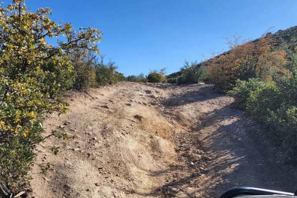
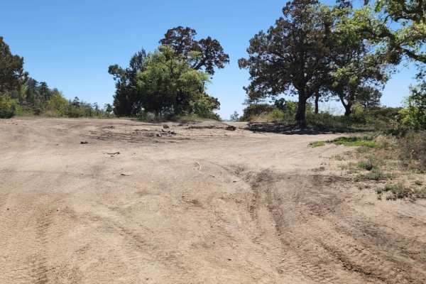
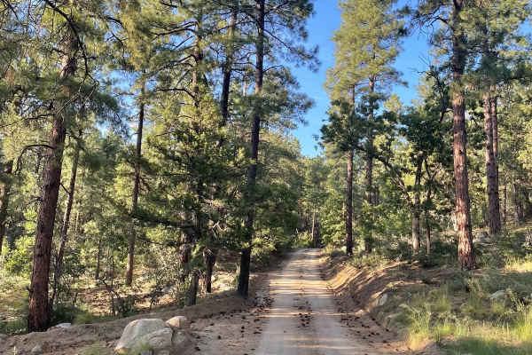
Jack Pine Road
This trail gives you access to hiking trails and provides great views of the valley down below. There is spotty cell phone service along the trail, better at the top. If you want a more challenging line, then choose the road to the right when you come to a "V". Unsure of camping regulations, but the...
Learn more about Jack Pine Road
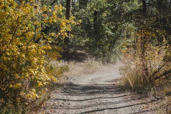
Schoolhouse Gulch
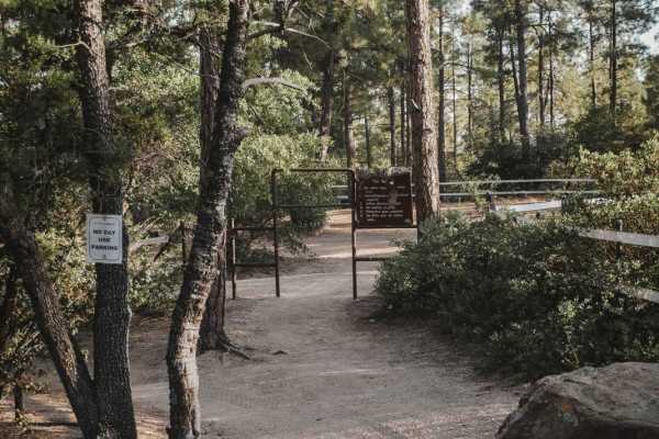
Schoolhouse Gulch is a multi-use trail in Prescott, Arizona, and is probably the easiest ATV trail in the area. It's a road-width trail that goes straight and flat through a forest floor. It starts at a staging area with parking for several vehicles right off Highway 89. There is a pinch point for 5...
Learn more about Schoolhouse Gulch
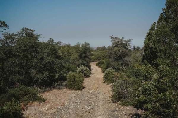
Ponderosa
Ponderosa is an easy ATV trail near Prescott, Arizona that starts at the Schoolhouse Gulch Trailhead on the north end and connects to Maripai Road on the south end. Going south to north, it starts out on top of the mountain on a ridge line, as a two-track full of rocks and gravel, in between lots of...
Learn more about Ponderosa
Thumb Butte Loop
The Thumb Butte Loop is arguably the most traveled off-road section in the Prescott National Forest. It's close to town, easy to access and offers sweeping views over Prescott, the Sierra Prieta, the Weaver Mountains and the Bradshaw Mountains as you wind along the drive. Camping is abundant along...
Learn more about Thumb Butte Loop
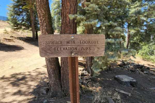
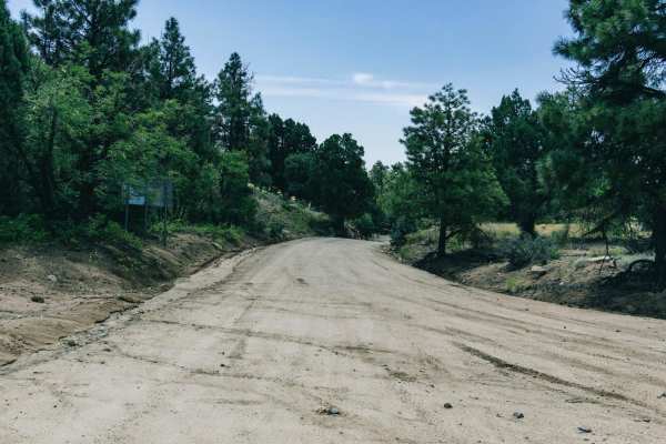
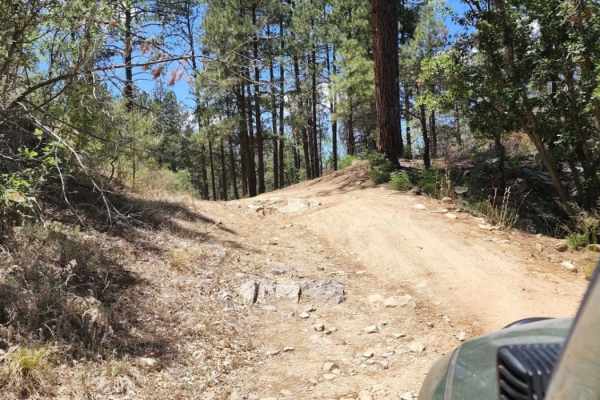
Spruce Mountain Lookout
This trail leads up to a fire lookout and a couple of awesome hikes. Picnic tables and a small restroom are at the top. There is a gate; it was open when this trail was run (June 2022), but may be closed. No camping on this road or at the lookout. This road is rocky with some dirt and gentle grades....
Learn more about Spruce Mountain Lookout
Ruins & Gold Pans
If you are looking for a short and easy dirt road with lots of outdoor activities, Ruins & Gold Pans offers just that. The start of this dirt road is just off of Walker Road and is before Lynx Lake. The road is a semi-maintained dirt road with washboards, small bumps, and little precipitation run-of...
Learn more about Ruins & Gold Pans
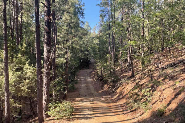
Wolf Creek to Senator Highway
This well-maintained dirt road connects Highway 89 to Senator Highway. The mileage of this trail is just over 6 miles long and snakes through the ponderosa-covered mountains of the Prescott National Forest. Several spots along this trail have potholes on the dirt road, so watch out. There are also s...
Learn more about Wolf Creek to Senator Highway
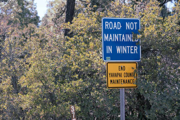
009402D
This trail is not maintained in the winter. It gets muddy when wet, and it is also rutted out in some places. There is no camping along the trail; however, there is dispersed camping at the entrance of the trail, and it's a large area big enough for RVs. Turning around at the end can be difficult. I...
Learn more about 009402D
Mount Francis
This trail is not maintained in the winter. It gets muddy when wet and it is rutted out. The road goes past private property. The road ends at a gate; however, the trail beyond the gate is accessible by foot traffic, bicycle and horseback. There is a nice spot at the top to turn around and a decent ...
Learn more about Mount Francis
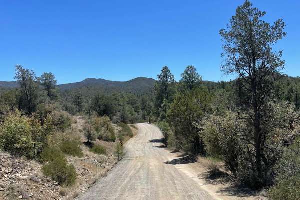
Copper Basin
The Copper Basin Road is a wide dirt road that has no obstacles on it. Along this road there is evidence of erosion and water damage from the monsoon rains that have swept across it, shaping this landscape. Still, you'll find hills and some bumps, but we've all been on driveways and highways that ar...
Learn more about Copper Basin
Exit Off Spruce Mountain Road
This dirt road is a route that branches off Spruce Mountain Lookout guided trail. The road starts off pretty mellow then starts to get steep and there are several sharp turns with loose rock scattered all over the surface of the trail. As you traverse down this trail, the road is very narrow so slow...
Learn more about Exit Off Spruce Mountain Road

Road 000047
This trail is typically unmaintained in the wintertime and offers access to biking, horseback riding, and hiking trails. There's spotty cellphone service. This is a residential area, so be respectful when driving as this is a very busy road, one to two car width. This road connects you to many other...
Learn more about Road 000047
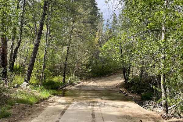
FS 79
Forest Road 79 is a maintained dirt road that is washboarded in areas. This is a short road just over 2 miles long. There is a water crossing over the Hassayampa River that any vehicle can pass. This road ends at a residential area. Along this road, there are many dispersed camping sites.
Learn more about FS 79
Trail 12 Beginners Loop
Trail 12 in the Alto Pit is a designated beginner's trail. This is a short and easy two-track loop where kids can practice their trail riding in a safe environment without the risk of getting run over by other riders. This loop is next to a fenced-in Beginner's Area and behind a sign saying 5 mph, t...
Learn more about Trail 12 Beginners Loop
Trail 1
Trail 1 starts as a very easy and wide two-track on soft gravel, on a well-packed surface. It starts near the entrance to the OHV area and goes around the east perimeter of the area. It curves through the bushes, past prickly pear cacti, and granite boulders, with some fun banked corners. There are ...
Learn more about Trail 1
Trail 2
Trail 2 in the Alto Pit OHV area is the first trail accessed from the day-use staging area that will lead you to all of the other trails. It drops down into the gravel OHV area and takes the first left turn. It continues as a curvy two-track on a gravel surface through the high desert forest, with s...
Learn more about Trail 2
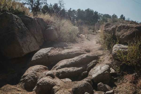
White Horse Tank
White Horse Tank is an easy 50-inch trail near Prescott, Arizona, that has some easy challenges such as loose rocks, loose dirt, and one long hill climb/descent that is full of chunky loose rock. This trail has fewer sections of rocks than the surrounding trails such as Nemo Spring, Salida, and Char...
Learn more about White Horse Tank
FR 80
Forest Road 80 is a well-maintained dirt road in the Prescott National Forest. This short, but scenic trail runs through the ponderosas and ends at a dead end with a great view of the mountains across the gulch. There are a handful of camping spots along the first half mile of this trail.
Learn more about FR 80
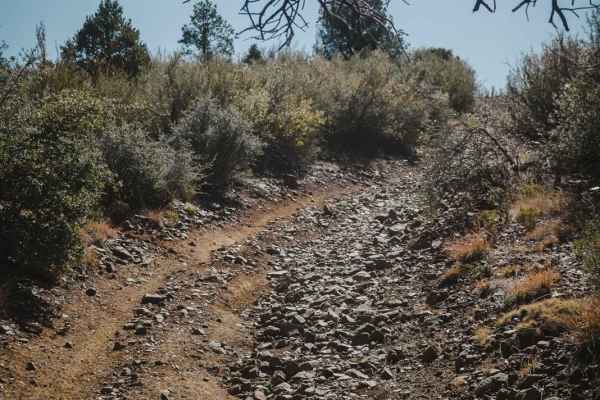
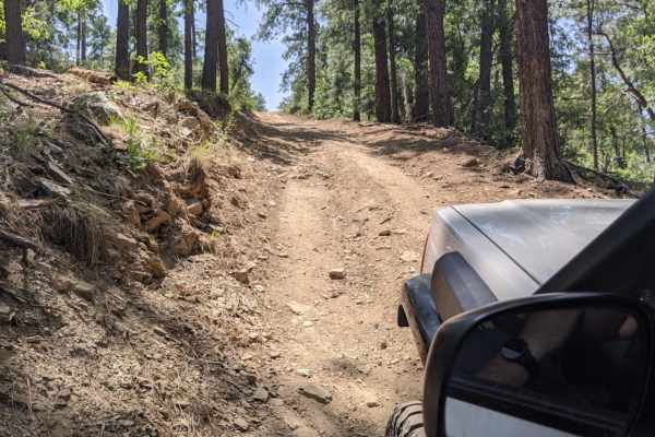
74A
This short road is rocky, sandy, muddy when wet, and tight with no turnarounds. It's a fun little road to enjoy in a 4WD; low clearance is possible with the right approach. Uneven, rutted trail with potential for loose rocks and sandy washes. Water crossings are less than a foot deep. Potential for ...
Learn more about 74A
Bannie and Amulet Mine
This drive through ponderosa pines leads to two historic mine remains. Drivers may miss Bannie Mine, as it has little evidence left, but Amulet Mine features historic foundations and metal materials just off the side of the trail. Most of the trail is easy-going, but there is one steep hill climb. T...
Learn more about Bannie and Amulet Mine
Beginner ATV trails near Prescott, Arizona
Explore ATV-friendly trails near you. These trails are accessible for vehicles up to 50 inches wide, perfect for ATVs and smaller off-road machines.
Jack Pine Road
This trail gives you access to hiking trails and provides great views of the valley down below. There is spotty cell phone service along the trail, better at the top. If you want a more challenging line, then choose the road to the right when you come to a "V". Unsure of camping regulations, but the...
Learn more about Jack Pine Road
Schoolhouse Gulch
Schoolhouse Gulch is a multi-use trail in Prescott, Arizona, and is probably the easiest ATV trail in the area. It's a road-width trail that goes straight and flat through a forest floor. It starts at a staging area with parking for several vehicles right off Highway 89. There is a pinch point for 5...
Learn more about Schoolhouse Gulch
Ponderosa
Ponderosa is an easy ATV trail near Prescott, Arizona that starts at the Schoolhouse Gulch Trailhead on the north end and connects to Maripai Road on the south end. Going south to north, it starts out on top of the mountain on a ridge line, as a two-track full of rocks and gravel, in between lots of...
Learn more about Ponderosa
Spruce Mountain Lookout
This trail leads up to a fire lookout and a couple of awesome hikes. Picnic tables and a small restroom are at the top. There is a gate; it was open when this trail was run (June 2022), but may be closed. No camping on this road or at the lookout. This road is rocky with some dirt and gentle grades....
Learn more about Spruce Mountain Lookout
Beginner UTV/side-by-side trails near Prescott, Arizona
Find UTV and side-by-side trails near you. These trails accommodate vehicles up to 60 inches wide, ideal for UTVs, side-by-sides, and wider off-road rigs.
Jack Pine Road
This trail gives you access to hiking trails and provides great views of the valley down below. There is spotty cell phone service along the trail, better at the top. If you want a more challenging line, then choose the road to the right when you come to a "V". Unsure of camping regulations, but the...
Learn more about Jack Pine Road
Spruce Mountain Lookout
This trail leads up to a fire lookout and a couple of awesome hikes. Picnic tables and a small restroom are at the top. There is a gate; it was open when this trail was run (June 2022), but may be closed. No camping on this road or at the lookout. This road is rocky with some dirt and gentle grades....
Learn more about Spruce Mountain Lookout
Ruins & Gold Pans
If you are looking for a short and easy dirt road with lots of outdoor activities, Ruins & Gold Pans offers just that. The start of this dirt road is just off of Walker Road and is before Lynx Lake. The road is a semi-maintained dirt road with washboards, small bumps, and little precipitation run-of...
Learn more about Ruins & Gold Pans
Wolf Creek to Senator Highway
This well-maintained dirt road connects Highway 89 to Senator Highway. The mileage of this trail is just over 6 miles long and snakes through the ponderosa-covered mountains of the Prescott National Forest. Several spots along this trail have potholes on the dirt road, so watch out. There are also s...
Learn more about Wolf Creek to Senator Highway
The onX Offroad Difference
onX Offroad combines trail photos, descriptions, difficulty ratings, width restrictions, seasonality, and more in a user-friendly interface. Available on all devices, with offline access and full compatibility with CarPlay and Android Auto. Discover what you're missing today!
Open Trail Map